Hazard in Earthquake Arizona
advertisement
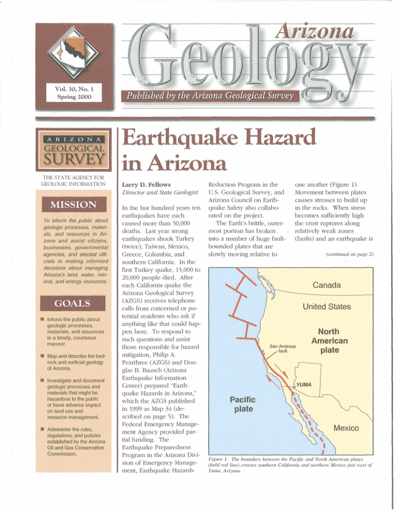
I Pz4blisbed bv the Arizona Geoloaicul Szlrvev kl SURVEY THE STATE AGENCY FOR GEOLOGIC INFORMATION the publhic a&x?Et /wm%sses,mat&&, atxi r e s w m in Asizona and assist dtizens, businesses, governmntal &g-pnciea, end M e d aficids in making informed dsdsions a h l f m a r a a m m m ' s liMd, wm, & To kr- eral, a d meqq i-eM?u17:.&ag. htam the WK) about S B O I ~ Cpw-, matwids, and r 8 S a U m in a timely, courtmanner. I ~ rrrawialsmt might tre b r W b ttse puMi ar have & e m imp& 0nlTMdwalwl TeSMII;Ce f?xxWqem. t Earthquake Hazard in Arizona Larry D. Fellows Director and State Geologist In the last hundred years ten earthquakes have each caused more than 50,000 deaths. Last year strong earthquakes shook Turkey (twice), Taiwan, Mexico, Greece, Columbia, and southern California. In the first Turkey quake, 15,000 to 20,000 people died. After each California quake the Arizona Geological Survey (AZGS) receives telephone calls from concerned or potential residents who ask if anything like that could happen here. To respond to such questions and assist those responsible for hazard mitigation, Philip A. Pearthree (AZGS) and Douglas B. Bausch (Arizona Earthquake Information e ~ ~ Center) prepared "Earthquake Hazards in Arizona," which the AZGS published in 1999 as Map 34 (described on page 5). The Federal Emergency Management Agency provided partial funding. The Eahquake Preparedness Program in the Arizona Division of Emergency Management, Earthquake Hazards Reduction Program in the U.S. Geological Survey, and Arizona Council on Earthquake Safety also collaborated on the project. The Earth's brittle, outermost portion has broken , into a number of huge faultbounded plates that are slowly moving relative to one another (Figure 1). Movement between plates causes stresses to build up in the rocks. When stress becomes sufficiently high the crust ruptures along relatively weak zones (faults) and an earthquake is (continued on page 2 ) Figure I . The boundary between the Pacific and Nwth American plates (bold red line) crosses southern California and northern Mexico just west of Yuma, Arizona.


