FORESHORE FREEWAY COMPLETION PROJECT Integrated Urban Design Study GAPP mma in association
GAPP and mma Architects in association DRAFT Foreshore Freeway Completion Project - Urban Design Report – May 2003
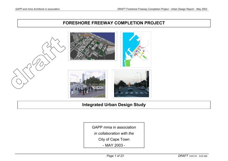
FORESHORE FREEWAY COMPLETION PROJECT
Integrated Urban Design Study
GAPP mma in association in collaboration with the
City of Cape Town
- MAY 2003 -
Page 1 of 23 DRAFT
13/01/31 9:03 AM
GAPP and mma Architects in association DRAFT Foreshore Freeway Completion Project - Urban Design Report – May 2003
1. TERMS OF REFERENCE
1.1 Freeway Completion Conceptual Design 2001
1.2 Participatory Planning
1.3 Brief & Scope of Work
1.4 Vision for the Inner City of Cape Town
C O N T E N T S
5. PRECEDENT STUDIES
Rio ( give full name )
Barcelona
Darling Harbour / Circular Quay ( Sydney, presumably?)
Boston
Shanghi ( Shanghai)
Subway Design (which city?)
2. CITY CONTEXT
2.1 Barriers
2.2 Space Structure
2.3 Pedestrian Movement
2.4 Public Transport
2.5 Qualitative Transformation
6. PREVIOUS WORK
8 options & physical model 2001
Gateway bridging structure 2001
Focus Group process 2002
I & AP – V&AW Convenco, Port City ( in full / tidy up)
7. URBAN DESIGN COMMENTS ON THE FILTERING
SYSTEM 3. CONTEXTURAL FRAMEWORK
3.1 Urban Spatial Structure
3.2 The Lively City : Activities and Public Buildings
3.3 Pedestrian Routes and Public Squares
3.4 Landscape Web
8. CONCLUSIONS & RECOMMENDATIONS
4. DETAIL STUDY AREAS
Phase 1 Report & Visual Impact
Phase 2 Report & Visual Impact
Phase 3 Report & Visual Impact
Phase 4 Report & Visual Impact
9. REFERENCE DOCUMENTS
Clive Richards Document
ICP Integrated Urban Design
GAPP Foreshore Framework
Focus Group Document
CCC Urban Design Framework Northern Foreshore
Contextual Framework CCC
CCC urban Design Principles
Wind Study – CSIR
Page 2 of 23 DRAFT
13/01/31 9:03 AM
GAPP and mma Architects in association
1. TERMS OF REFERENCE
The current Urban Design study carried out in the Foreshore
Freeway Precinct is an integral part of the Foreshore Freeway
Concept Design Report undertaken by the Foreshore Freeway
Consultants (FFC).
This study, commissioned in April 2003, entails the finalisation of the
Urban Design Evaluation of the Foreshore Freeway Precinct and shall include the compilation of work done to date by FFC. This study shall make reference to the previous studies mentioned below.
1.1 Freeway Completion Conceptual Design 2001
This Urban Design study therefore, should also be seen as the culmination of a process which started in 2001, when the Executive
Committee of City of Cape Town took a decision to appoint
Consultants (FFC), to embark on the conceptual design for the completion of the Foreshore Freeways (Freeway – we have agreed with the Client that there is only one Foreshore Freeway, hence no
"s" please.) from Table Bay Boulevard through to the Western
Boulevard/Buitengracht connection. This project had been initiated by the City of Cape Town in association with the Provincial
Administration of the Western Cape (PA:WC). The completion of the
Freeways was divided into four parts:
Phase 1 – Freeway Portion behind the new CTICC
Phase 2 – Western Boulevard/Buitengracht connection
Phase 3 – Table Bay Boulevard/Eastern Boulevard link
Phase 4 – Future proposed Buitengracht ramp
Due to the Public Participation Process (PPP) that accompanied the initial study, a decision was taken to broaden the process and the
Consultants to embark on a broader evaluation of other alternatives as well, including the “non-completion” of the Foreshore Freeway.
The initial Urban Design evaluation carried out in 2001 had identified that the completion of the Freeways cannot be seen in isolation from
Page 3 of 23
DRAFT Foreshore Freeway Completion Project - Urban Design Report – May 2003 the Urban Environment in the Foreshore Precinct, which is currently fragmented and needs to be improved.
1.2 Participatory Planning -
Focus Groups: 2002
As a result of the initial evaluation of the Integration of the Foreshore
Freeways with the Urban Environment in 2001, Minister Tasneem
Essop, of Public Works and Transport, Western Cape initiated a
Participatory Planning Process in March 2002.
The main objective of the initiative was to develop a vision for the
Foreshore Precinct based on a broader Freeway Evaluation process.
It was the view of the Minister that various stakeholders need to be mobilised in order to ensure an inclusive planning process that would assist the City and Provincial Authorities to take decisions on the
Foreshore Freeway Project.
To facilitate the Participatory Planning Process, 4 Focus Groups were formed, whose focus of evaluation would be the “evaluation of do minimum alternatives” in addition to previous options regarding the Foreshore Freeway Project. The 4 Focus Groups were:
1. Public Investment Priorities
– Chair: Ron Haiden & Ben
Veldman
2. Framework for City & Property Development – Chair:
Michael Farr
3. Transport and Traffic matters
– Chair: Frank Van Der Velde
4. Integrated Urban Design & Environmental Assessment –
Chair Luyanda Mpahlwa (Ivor Prinsloo†)
A Steering Committee chaired by City and Provincial Authorities was set up to coordinate the Process. The work of the Focus Groups was carried out on the basis of Focus Group meetings and inter-group workshops in order to ensure that the over-lapping inputs could be integrated into the respective Focus Group reports. The Focus Group
Report (s?) was submitted to the Steering Committee in April 2002.
DRAFT
13/01/31 9:03 AM
GAPP and mma Architects in association
1.3 Brief & Scope of Work :
Current Urban Design Study -
2003
The brief for the current study is an extension of the Urban Design scope of work and should be seen as the finalisation and completion of the studies that have been carried out in the above mentioned reports.
The scope of work for the Urban Design section of (Urban Design subconsultants to) FFC has been broadened to include the evaluation of the following proposals:
1.3.1 Prepare preferred Urban Design concept fro (sp) the
“Freeway Precinct”
1.3.2 Exploration of urban design implication from “build all” to
“build nothing” in relation to the Freeway.
1.3.3 Prepare an Urban Design Response to the various scenarios related to the implications explored above
1.3.4 Prepare proposals for “concept buildings” relating to the creation of “urban structure” in the Foreshore Precinct
1.3.5 Prepare proposals for the improvement of the Pedestrian
Environment and create a public space network in the
Foreshore Freeway Precinct.
The two City Departments dealing with Roads and Planning -
Transport, Roads and Stormwater (TR&S) & Planning and
Environmental Management(P&EM) agreed that the Urban Design section of FFC would consult and interact with the (consultants appointed to undertake the) broader Urban Design Framework commissioned by P&EM.
In addition to the above, the Urban Design section of the Foreshore
Freeway Consultants’ report would include the evaluation of the following Traffic/Freeway options:
1.3.6 The preferred Completion Option - 1c
DRAFT Foreshore Freeway Completion Project - Urban Design Report – May 2003
(You should include the modified Olympic proposal here)
1.3.7 Do Nothing to Freeway Option - Non-completion
1.3.8 Comments on the traffic Filtering System
1.3.9 Undertake detail Design Studies of specific areas in the
Foreshore Area
1.4 Vision for the Inner City of Cape Town
The context of an integrated planning Vision for the City of Cape
Town, The City released a Draft Document to FFC Urban Design
Consultants, outlining the Vision for the Inner City of Cape Town.
( grammar needs attention )
In the Preamble, the document addresses some concerns regarding the status of the Inner City. In summary, these are:
1.4.1 The grow th of “other” Centers around Cape Town
1.4.2 Existing under-utilisation of commercial and retail space
1.4.3 The dominance of vehicular traffic
1.4.4 Absence of a safe and reliable Public Transport system
1.4.5 Spatial fragmentation and poor integration between Central city, V&A Waterfront and Port
1.4.6 Lack of residential accommodation around the inner City.
1.4.7 Insufficient emphasis on Heritage, Culture and diversity
1.4.8 Pedestrian hostile environments within the inner City
It is in the context of the above, that the evaluation for the Foreshore
Freeway Precinct would be carried out. In terms of identifying opportunities for the realisation of a broader Urban Design
Framework, the vision for the Central City extracted from the document can be summarised as follows:
“The vision for the Central City is the establishment of a vibrant and sustainable mixed-use metropolitan centre that offers all of
Page 4 of 23 DRAFT
13/01/31 9:03 AM
GAPP and mma Architects in association its users, (both locals and visitors), safe and convenient access to a wide range of facilities, activities and opportunities.”
In the context of the above, the Central City should capitalise on and reinforce its inherent advantages , such as:
1.4.9 Its unique and majestic location between mountain and sea
1.4.10 Its historic and compact City structure that provides orientation, legibility and a potential for convenient pedestrian access to a variety of activities and experiences
1.4.11 The substantial public and private sector investment infrastructure and built fabric
1.4.12 The rich heritage, cultural and educational fabric, with the potential to reflect a true multi-cultural City
In conclusion, the Urban Design study for the Foreshore Freeway
Precinct was driven by the objective to contribute towards the Vision whose main intent is to encourage the “regeneration of the urban environment” in line with the Urban Design principles described above. The ultimate goal being, to enhance the urban quality based on a holistic, integrated approach.
It has been documented elsewhere, that from an Urban Design point of view, the Completion of the Freeways should not be biased towards vehicular traffic only, but should regard the urban environment and integrate the various modes of movement as a whole. This multi-modal approach includes:
Improvement of Pedestrian movement routes
Public transport - Integration of Bus, Taxi, Light rail etc
Reduction of private Vehicles & improve flows in the City
Integration of Parking facilities and Transport interchange
DRAFT Foreshore Freeway Completion Project - Urban Design Report – May 2003
Page 5 of 23 DRAFT
13/01/31 9:03 AM
GAPP and mma Architects in association
2. CITY CONTEXT
The problems of the physical environment on the Foreshore stem primarily from the fact that the City is sandwiched between Table
Mountain and the sea and that it is located eccentrically in relation to the rest of the Metropolitan area. Also the planning of the Foreshore and building of Duncan Dock which took place in the 1940s and
1950s is based on the ideas of central planning, and a scale which responds more to the car and the ship than the pedestrian. The large sites encourage a large-scale architecture, which is in many cases free standing and does not provide the shelter, scale and public spaces enjoyed in the older section of the City.
2.1 Barriers
The contextual framework plan indicates the primary access routes into the City which include the rail links, the freeway system and the at-grade road system. This plan indicates the areas, which were reclaimed during and after WW2, which cut the City off from the sea.
The expanded railway system, the Foreshore freeway and new harbour were all placed on this land creating an impenetrable barrier over a number of kilometers cutting the City off from its coastline.
(Comment: Including the Foreshore Freeway, presumably the elevated viaducts, with the expanded railway system and the harbour, as creating an impenetrable barrier seems inappropriate.
Whereas there can be little doubt that the expanded railway system, the harbour configuration and access thereto, as well as the at-grade
N1 and Table Bay Boulevard create impenetrable barriers, this cannot be said of the elevated viaducts. Its elevated nature provides opportunities for pedestrians, commercial activities, gt-grade transport routes, including canals.)
2.2 Space Structure
The contextual framework plan proposes a (??) the primary spatial structure, and in terms of the Freeway where the City can be reconnected to the sea, both physically and visually.
Page 6 of 23
DRAFT Foreshore Freeway Completion Project - Urban Design Report – May 2003
These view corridors provide linkage from the City to the mountain and to the sea and are connected to a number of the important existing and proposed spaces in the City. One of the most important aspects of the Foreshore Framework plan is for all stakeholders to agree this urban structure and to manage the implementation of this vision. This framework plan should be robust enough to ensure a high quality of urban space with or without the Freeway. (What is meant by "without the Freeway"? Is demolition intended? If the intention is to ensure high quality of urban space without further completion of the Freeway, or its partial or full completion, then tis should be stated as such. For consistency, one may choose the wording similar to that in 1.3.2.)
2.3 Pedestrian Movement
At the City scale significant pedestrian systems exist only in limited part of the City. The coastal promenade, which extends from Camps
Bay, Sea Point and Greenpoint extends through to the V&AW. The link with the coast is then broken by the Port until access to the coast is regained at the mouth of the Milnerton Lagoon. The Foreshore
Framework should respond to this major pedestrian promenade and incorporate it into the City network. In addition the pedestrian route from the Company Gardens extends seawards through St Georges
Mall and Adderley Street. This major route should likewise be extended to the sea.
There is urgent need to create urban spaces, which are connected by a “legible well structured pedestrian movement network”. This system should offer pedestrians various possibilities and should be diversified to link major routes and spaces with minor ones and viceversa. Most world-class cities like Paris, London, Berlin and
Barcelona are characterised by successful pedestrian movement systems within an integrated urban spatial network.
2.4 Public Transport
The other factor which has been identified, and which contributes to the breakdown and poor performance of the urban environment and
DRAFT
13/01/31 9:03 AM
GAPP and mma Architects in association infrastructure in this part of the City, is the fact that rail-based public transportation has deteriorated and is in a state of crisis. This has led to the “privatisation” of public transport, which leaves questions of answerability and accountability open to market forces.
The deterioration of Rail-based (no caps) transport has therefore encouraged the increase in vehicular-based movement, which is carried largely on a limited number of routes connecting the City with the metropolitan region. These routes are inadequate and tend to clash with the finer grained fabric of the Foreshore and the City, causing spatial severance and environmental imbalance.
2.5 Qualitative transformation
In order to contribute towards resolving some of the problems identified above, it is suggested, that an integrated approach that promotes the idea of mutually supportive movement systems and modes needs to be adopted. The broader understanding of wider issues that affect the City as a whole, and the specific measures that can be applied at local level would assist to improve existing urban conditions. This applies not only in The Foreshore, but also with reference to the need to transform and improve the relationship between the Central city and th e metropolitan region from a “spatial perspective”.
With regard to the Foreshore area, the challenge therefore, is to
“qualitatively transform” this part of the City into an “urban place” which links and unites all the significant urban spaces and urban c onditions into a “cohesive”, well defined and legible “urban structure”. The Urban Design team proposes the development of a system of “urban spaces linked by legible pedestrian movement routes” as one of the means to enhance the urban environment in the
Foreshore Area. All the various modes of movement should form part of an integrated spatial framework:
Public Transport – Integrate Bus, Taxi, Metrorail, Light Rail and
U-Ground (in full please)
DRAFT Foreshore Freeway Completion Project - Urban Design Report – May 2003
Motor vehicles – Filter traffic and reduce flows into City (and through the City).
Introduce traffic management systems
Consider integration of Parking facilities
Improve Pedestrian movement
Water taxi linkage between the V&AW and the City (Why state separately? Include with first bullet.) (Comment 1: The
Integrated Spatial Framework should also provide the means for through-traffic to circumvent the City.) (Comment 2: In the light of the findings of the HHO Africa traffic assessment, one should try to reduce the filtering of traffic through the City.)
3. FORESHORE CONTEXTUAL FRAMEWORK
The Foreshore Precinct has strategic significance to the City of Cape
Town. It is situated between the historic City and the Water’s edge.
However, the link to the Water has been severely curtailed by fragmented planning which is a result of a number of factors, among them the elevated viaducts – and partly unfinished Freeways - which run along the East-West axis across the face of the City. The other factor is the fact that the central planning of this part of the City is characterized by the dominance of the private vehicle as the main means of movement.
As a result, the urban grid is structured and scaled to the car, rather than to pedestrians and public transport. Public spatial qualities are lacking and the large erven are dominated by “monumental signature buildings” which undermine the human scale. It has been already been documented elsewhere, that the urban environment of the
Foreshore performs very poorly and has an “open and unprotected pedestrian environment”, (Urban Design Philosophy, CCT 1995).
3.1 Urban Spatial Structure
Page 7 of 23 DRAFT
13/01/31 9:03 AM
GAPP and mma Architects in association
The proposed Urban Spatial structure indicated in the Framework
Plan is therefore important to implement. This will provide a vision to the development of the Foreshore and to ensure that an environment is created which has the impact and scale of a world class city while at the same time provides a comfortable, convivial and enriching experience for the pedestrian.
The principal elements which make up this structure is the historic street pattern which run down from the mountain to the sea. The
Heerengracht is identified as the most important of these. In the
East-West direction, the City road grid is generally of a narrower nature and this structure also forms the basis of the grid. A set of major new spaces has been defined in this framework which include the new Civic Centre Square, Artscape Park, Convention Square and
Harbour Square. The appropriate design of these new public places within the City and the pedestrian linkages between them provide an exciting new Urban Spatial structure for the Foreshore.
3.2 The Lively City: Activities and Public Buildings
The Foreshore Framework seeks to promote the idea of a lively vibrant City, which is active 24 hours a day. To achieve this the land use within the Foreshore area should not focus on offices as at present, but should promote the idea of mixed-use activities especially along the main pedestrian routes and around the public squares. In addition the major public buildings such as the Artscape
Complex, the Civic Centre, the City Hall, the Castle and the
Convention Centre should all be related to public space and new facilities should reinforce this belt of public amenity. It is however now clearly understood that the most important element in bringing life back into the city is to provide residential accommodation opportunity.
3.3 Pedestrian routes and Public Squares
The major pedestrian routes within the City radiate from the station at present and the urban structure of the foreshore (Foreshore is spelled with and without a capital interchangeably – consistency
DRAFT Foreshore Freeway Completion Project - Urban Design Report – May 2003 please) must respond to these desire lines. Some 3,000 dock workers stream from the station to the harbour each morning and evening and cross some of the busiest roads in Cape Town. Tourist pedestrian traffic is also increasing on this and other routes and with the opening of the CTICC (in the next sentence the name is given in full – consistency please.) these routes especially where they cross the Foreshore Freeway are now require critical resolution. The Cape
Town International Convention Centre will increase this movement with delegates seeking to walk to hotels in the City and to visit the
Victoria and Alfred Waterfront on foot. (elsewhere given as V&A and
V&A Waterfront) (Comment: It is anticipated that the harbour operations will soon be relocated. How will this change the desire lines of the dock workers?)
The main desire lines of these pedestrians have been determined and an opportunity exists now to respond to the need and provide a good pedestrian environment in these areas and to encourage mixed-use land development along these corridors. Shops, restaurants, performance venues and residential development will bring life back into the City and ensure sustainable and secure environments.
In terms of pedestrian movement, it appears that the only street crossing that is not of acceptable standard and is currently at a dangerous level, is the crossing of the inbound lane of Buitengracht at the intersection of Coen Steytler. A design has been developed to provide an underpass for pedestrians of a scale and nature which would ensure a safe environment day and night and provide a sense that pedestrians were at all times walking on an undulating natural ground level. All other pedestrian crossings in the Foreshore
Precinct are at grade and are adequately controlled by traffic lights.
The new squares identified in this precinct each have a unique character and scale and should be developed in response to the unique precinct in which they are located. These squares, parks and public places require to be carefully designed into the urban structure.
Page 8 of 23 DRAFT
13/01/31 9:03 AM
GAPP and mma Architects in association
3.4 Landscape Web
The landscape framework is an important element in the implementation of the Urban Design Concept. These landscape elements have been used historically in the structuring of the City and can be used effectively in the realization of this Urban Design
Concept. We list the key landscaping elements as follows:
Focus on the Central Axis
By linking areas of planting from the Company Gardens to the
Heerengracht and on to a new square on the waters edge, the link from the mountain to the sea can be formalised.
Define the Edge
Hard landscaping including retaining walls as well as paving and road edge design should be integrated with higher order tree lines to highlight the threshold into the Central City. (Is it Central City or central City
– see next sentence. The words Central City,
CBD, Inner City and the City are used almost interchangeably. If they are meant to have different meanings, could a definition for each please be provided, possibly as item 1.5) The edges of the central City are defined as Buitengracht in the West, Oswald
Pirow in the East, De Waal Drive to the South and Duncan Dock to the North. The Foreshore Freeway should therefore not be seen as an edge to the City and should be designed as a permiable (sp) structure.
The New Cross Axis
The landscaping of the east-west axis from Culemborg to the
Waterfront should also be a higher order tree line (please explain
– not fully understood) and should be designed to respond to the harsh environmental conditions on the Foreshore.
Green Spaces within the City
The seven major spaces (would be useful to list these) structuring the Foreshore are by and large, hard urban spaces. The new landscape framework should endeavour to provide consolidated
Page 9 of 23
DRAFT Foreshore Freeway Completion Project - Urban Design Report – May 2003 areas within these spaces, especially on the Foreshore. Spaces such as the Opera House (Sydney?) Gardens and the
Convention Square should be designed to have significant green elements.
Within this main framework, a finer landscape web is evident – in many cases part of the pedestrianized system of side streets, squares and widened sidewalks. As part of this development strategy for the CBD, Council has further defined eleven subdistricts each with its own palette of hard landscaping materials for precinct identity. Tree species, specific to different precincts of the City, (see CBD in previous sentence) would also help to reinforce this framework and provide a sense of place or landscape identity.
Public Space
Public city spaces comprise street, alleys, walkways, forecourts, squares and parks. Intertwined are the semi-public domains at grade, underground and above ground of arcades, malls, entrance foyers, roof terraces and sky bridges. The successful functioning of these spaces depends on many variables, most notably land uses and density, though not directly part of the space design, are intimately related to the vibrancy of physical space for people. Other variables include linkages (accessibility) pedestrian amenity and safety, shape and scale, visual appeal and micro climatic comfort.
A number of urban design studies for the City and Foreshore have been prepared in recent times by the City Council. Some principles formulated for livable streets and squares are worth noting :
The City Streets
Ensure that the width of the street is compatible with both pedestrian and vehicular movement, while achieving continuity of street wall, a sense of enclosure and intimacy without infringing important vistas.
DRAFT
13/01/31 9:03 AM
GAPP and mma Architects in association
Provide continuous protection from sun and rain by colonnades, canopies or trees.
Provide wider sidewalks on the sunny side of the street.
With protection from the wind/Southeaster
Waiting, meeting, shopping and eating outdoors can be accommodated
Adding a greater variety to the street ambience.
Widening of sidewalks at intersections allow waiting space while reducing the perceived distance to be crossed.
Minimize vehicular access to sites so as not to disrupt the continuity of the street / commercial edge.
Shaping the street wall requires careful design. Inviting entrances into buildings, lively shop-fronts and street seats along building plinths ensure visually interesting streetscapes.
The street corner provides a particularly good meeting place – its opportunities should be manifestly exploited.
Respond to existing patterns and shapes established by the surrounds. However modestly, this can be achieved by a building simply responding to its neighbour in a compatible and enriching manner.
(Most of the principles above would reduce the capacity of the
City for filtering of traffic.)
The City Squares
The basic functional and focal role of the square in the public space network of the city should strategically balance the existing distribution of public space. The square should therefore be highly accessible to the movement system, be an extension of it, integrated with it and complimentary to it.
The square should be a deliberate action to plan its position and size in relation to important views, contextual fixes, axes and routes which can orientate space in the structure of the
City and give it particular memorability.
Climatic principles of optimizing sun exposure, controlling wind and providing shade are important factors to consider. If
DRAFT Foreshore Freeway Completion Project - Urban Design Report – May 2003
Page 10 of 23 the micro-climate is well handled, outdoor life will proliferate – witness St George’s Mall
DRAFT
13/01/31 9:03 AM
GAPP and mma Architects in association
4. DETAIL STUDY AREAS
Phase 1
The Phase One of the freeway completion was identified for construction to be completed simultaneously with the CTICC. This is no longer possible as the Convention Centre is complete, this section of the freeway will still however be referred to as Phase One.
The Urban Design constraints in this area are defined as follows:
View Corridors
Upper level view corridor down Loop Street. Lower level view corridor down Long Street. Heerengracht view axis. (After the completion of the hotel now under construction and the Roggebaai
Canal buildings, there won't be any view corridors left down Loop St or Long St. Even now, standing at say Riebeek St near Long St or
Loop St provides limited view of the freeway and the sea.)
Public Squares
North Wharf and Site D Square, Convention Square, Harbour
Square. Heerengracht “circle” square, ferry turning basin.
Public Pedestrian Routes
Important pedestrian routes are indicated in this study area. The walkway down Long Street connects across Coen Steytler into
Convention Square where access to the CTICC and Arabella Hotel is provided. This public pedestrian route then continues into the
Roggebaai Canal where it follows each side of the canal until it connects back to Dock Road in the V&A Waterfront property. (It is no longer possible to walk comfortably down Loop St from say Riebeek
St to Coen Steytler.)
DRAFT Foreshore Freeway Completion Project - Urban Design Report – May 2003
Both Long Street and the Heerengracht view corridor connect through to the harbour and the possible cruise liner berth located at the proposed Harbour Square.
The Landscape Web
The CTICC has provided significant hard and soft landscaping in close proximity to the freeway. The use of tree lines, planting screens, water and paved areas have been designed to provide a high quality public environment. The photographic study indicates the relationship of urban space, built form and elevated freeway.
Impact of the Existing Freeway on the Public Environment
The spatial structure has been designed in response to the existing viaducts and they form high level edges to Convention Square, the ferry turning basin and the knuckle basin of the Roggebaai Canal precinct. With only local traffic at grade, a significantly pedestrianorientated environment has been created. The noise level of traffic from above is significant especially from the rising ramp, this could be ameliorated by sound attenuators however the activities at ground level might prove to mask the freeway sound.
Impact of the Option 1C and “Olympic” Option
These two options have been modeled on the 3-D computer and superimposed on the site photographs. The resultant visual impact is minimal when viewed from either side of the freeway as the inner viaducts are screeded behind the existing freeway. From the ferry turning basin however, the new inner viaducts for both options have considerable impact as shown in the photograph. This additional cover could be considered to provide shelter in the service yard of the CTICC and the ferry basin but would have to be carefully designed. The wind testing of the 1 C option indicated that the pedestrian environment was generally improved from a wind aspect with the addition of the inner viaducts.
Visual Impact Assessment
Page 11 of 23 DRAFT
13/01/31 9:03 AM
GAPP and mma Architects in association
We address the urban design issues in this precinct by defining the constraints then testing the impact by 3-D computer modeling and photographic montage.
DRAFT Foreshore Freeway Completion Project - Urban Design Report – May 2003
Page 12 of 23 DRAFT
13/01/31 9:03 AM
GAPP and mma Architects in association
Phase 2
(to follow)
DRAFT Foreshore Freeway Completion Project - Urban Design Report – May 2003
Page 13 of 23 DRAFT
13/01/31 9:03 AM
GAPP and mma Architects in association
Phase 3
This portion of the freeway extends from the Heerengracht towards the east to Oswald Pirow and connects to the existing road network to the east of Oswald Pirow.
The Urban Design constraints are set out on the Framework Plan and are defined as follows:
View Corridors
These include in level of importance:
The Heerengracht with the Gateway buildings providing containment of the space at Coen Steytler area.
D.F. Malan with an edge onto the Artscape Park.
Oswald Pirow providing an edge to the central City
Jan Smuts is not considered a major connector, and has a new harbour building blocking the view corridor.
Public Squares
The Artscape Park has been identified as an important new public square. This should be incorporated into the City’s fabric and be developed and managed as a major and important space in this long neglected part of the City. With the use of Artscape as an extension of the CITCC the park and the pedestrian routes to the CTICC and on to the Waterfront become an important new linkage that needs to be structured.
Impact of Proposed Freeway on this Section of the City
The visual impact of the proposed inner viaducts is minimal when viewed from a distance down the length of various view corridors.
However, when viewed from closer the open space between existing viaducts is in the 1C Option, almost continuously covered. The
Olympic Option provides less cover of the existing open space however where the Eastern Boulevard stubs come to ground, a major
Page 14 of 23
DRAFT Foreshore Freeway Completion Project - Urban Design Report – May 2003 new visual barrier is created on the Foreshore. This down ramp however blocks the Jan Smuts view corridor, which is the least important of the Phase 3 view corridors.
Parking Structures in Phase 3
Visual Impact Assessment
We address the urban design issues in this precinct by defining the constraints then testing the impact by 3-D computer modeling and photographic montage.
DRAFT
13/01/31 9:03 AM
GAPP and mma Architects in association
Phase 4
(to follow0
DRAFT Foreshore Freeway Completion Project - Urban Design Report – May 2003
Page 15 of 23 DRAFT
13/01/31 9:03 AM
GAPP and mma Architects in association
5. PRECEDENT STUDIES
(to follow)
(The Foreshore Freeway is essentially a traffic bypass scheme. It is essentially a scheme meant to keep the traffic out of the City.
Without the Foreshore Freeway, a vast amount of traffic would have run through the City streets and would probably have transformed the relative intimate feeling of the inner City into a more sterile environment, such as is currently experienced in Pretoria. [Pretoria is criss-crossed by 4-lane one-way streets, providing high mobility, easy access to parking garages, but a nightmare for pedestrians.]
Most large cities in the world have bypass schemes, often circular ones such as the London M5, the Paris Boulevard Périphérique, the ring roads around Kuala Lumpur and others. Even smaller towns with historic centres like Dijon have ring roads which function as bypass schemes to keep the traffic out of the inner cities so that these can then be pedestrianised.
Cape Town, due to its peculiar geographical location between the mountain and the sea, and being offcentric to its later development, does not lend itself to a circular ring road or bypass scheme and hence a linear form of bypass scheme has been adopted. The functioning of the bypass scheme has thus far been limited by the lack of completion of a crucial element, mainly the links from the existing elevated viaducts on the Foreshore to the Western
Boulevard.
The traffic analysis by HHO Africa has shown that, for all schemes, alternatives and options evaluated, the completion of these links is essential. The remaining debate is therefore around the following aspects:
The number of lanes and the shape and form of these links
The need for the inner viaducts from Coen Steytler through to
Eastern Boulevard and N1
The form of grade separation at Oswald Pirow
DRAFT Foreshore Freeway Completion Project - Urban Design Report – May 2003
The need for and extent of the Buitengragt link.)
Page 16 of 23 DRAFT
13/01/31 9:03 AM
GAPP and mma Architects in association
6. PREVIOUS WORK
8 options & physical model 2001
Gateway bridging structure 2001
Focus Group process 2002
I & AP – V&AW Convenco
DRAFT Foreshore Freeway Completion Project - Urban Design Report – May 2003
Page 17 of 23 DRAFT
13/01/31 9:03 AM
GAPP and mma Architects in association
7. URBAN DESIGN COMMENTS ON THE
FILTERING SYSTEM
(to follow)
DRAFT Foreshore Freeway Completion Project - Urban Design Report – May 2003
Page 18 of 23 DRAFT
13/01/31 9:03 AM
GAPP and mma Architects in association
8. CONCLUSIONS AND RECOMMENDATIONS
The conclusions and recommendations contained in this report include the assessment and evaluation that was carried out in previous work done in relation to the Completion of the Foreshore
Freeways. Comments and reference shall be made in particular to the 2001 Urban Design Report and the 2002 Focus Group report.
It is the view of the Urban Design section of the Foreshore Freeway
Consultants that the broadening of the scope of work for the study, beyond purely traffic matters, has made an invaluable contribution towards fulfilling one of the main tasks of the evaluation - the
“Integration of the Foreshore Freeways with the Urban Environment.”
8.1 Integrated Planning
The decision by the City of Cape Town to integrate the Transport
Planning and Urban Design portfolios towards the compilation of this report has helped introduce one of the most important ingredients for
Integrated Planning. This development must be welcomed and the
City must be encouraged to continue with this process .
In the Focus Group report, it was documented, that “the development of a meaningful, integrated Urban Design approach was n ecessary.”
It was also identified in that report, that “in order to understand the complexity of the Foreshore Freeway Project, the need to view the
City from a variety of scales was strongly expressed and advocated.
The report concluded that a broader perspective was required as a basis for “improving the performance of the Urban Environment in the
Foreshore.”
The Foreshore Area, being strategically located as the “Gateway and entry point” to the City of Cape Town, is well positioned to promote the integration of the Central City with the V+A Waterfront,
Harbour/Port and Culemborg Precincts.
Page 19 of 23
DRAFT Foreshore Freeway Completion Project - Urban Design Report – May 2003
8.2 Current Urban Design Study – May 2003
The main conclusion of the current study is that the evaluation of the
Completion of the Foreshore Freeway requires a balanced, integrated and multi-disciplinary approach that is biased towards improving the
“performance of the Urban Environment” in the Foreshore Freeway
Precinct”.
The importance of the study has been the development of integrated
Urban Design responses that could be implemented without the completion of the Freeways, but which do not exclude possible future completion.
It has emerged from this process that the “completion of the
Freeways” cannot be seen in isolation from the creation of an “urban structure and spatial framework” that would help improve all the movement systems and overcome the fragmentation and “underutilisation of land” currently prevailing in the Foreshore.
The detailed design studies that have been undertaken in this study have focussed on the consolidation and extension of the historical
City grid to encourage the integration of the Central City with the waters’ edge, and with its periphery along the East-West axis.
8.3 Freeway Completion
The current study has also established, through the evaluation of various options, that the “there are other viable options other than the total completion of the freeways as proposed”. The following conclusions can be made:
8.3.1 Whilst there is merit in considering the need to complete the
Freeways in order to improve the “traffic flows” in the City as proposed, there seems to be other effective “do minimum freeway options” worth considering.
DRAFT
13/01/31 9:03 AM
GAPP and mma Architects in association
8.3.2 The combination of the “Olympic-bid” option, linking the
Western Boulevard ramps only, and filtering traffic on the
Culemborg-side (Phase 3) into the City grid seems to reduce the impact of “total completion of the freeways”.
8.3.3 The proposed future Buitengracht ramp (Phase 4) poses quite a serious impact on the Urban Environment on the West City
Hub space, which is viewed as an important connection to the
V+A Waterfront.
8.3.4 The proposed Olympic-bid option, with down ramps over
Oswald Pirow Street, poses a serious impact on the Urban
Environment on the Culemborg side of the Foreshore due to the “barrier effect” created by the ramps. However, this part of the Foreshore is not regarded as having a “strategically important urban character”.
8.3.5 The “non-completion of the inner viaducts” (Phase 3) in the
Olympic-bid option is viewed as reducing the impact of
Freeways on the Urban En vironment”.
8.3.6 The under-utilised land in-between the viaducts could be made available for viable development opportunities and the extending the landscape web linking the CTICC with the
Heerengragt corridor, Artscape and the Culemborg precinct.
8.3.7 The linking of freeways to the Western Boulevard (Phase 2) poses a “psychological and visual barrier” in the eyes of the public, but could be considered in future, in order to improve traffic flows at grade, provided proposals for improving the
“performance of the Urban Environment” are implemented
8.3.8 The proposed improvement of the Urban Environment in the
West City hub space, including the “underpass crossing the in-bound Buitengracht, should be considered for immediate implementation independent of the Completion of the
Freeways.
DRAFT Foreshore Freeway Completion Project - Urban Design Report – May 2003
8.4 Summary and way forward
The Urban Design section of the Foreshore Freeway Consultants acknowledges that in order to preserve and promote the status of the
Central City as “the core of commercial enterprise, culture, learning and innovation, ” serious attention must be given to improve traffic flows within the City.
In the medium-to-long term, as the City grows, this (presumably increased traffic flows?) is not going to be avoidable. However, as already documented, the problem that has been identified is not in the first instance purely a traffic and transportation problem, it is primarily a planning and an environmental issue.
It is therefore important that the multi-disciplinary and integrated planning process which the City has embarked upon should continue, particularly with regard to the Foreshore Precinct. The planning should focus on short term
“do-able solutions”
(could we please replace the word "do-able" with "feasible" throughout) and a long-term vision .
The Vision driving the process should aim to locate Cape Town alongside other “World Class” cities with a view to ”unleash the potential for future renewal initiatives” based on a balanced developmental approach.
The Urban Design study carried out the analysis of the City at different scales. The findings of the analytical approach can be summarised as follows:
8.4.1 Central City scale
Reinforce and extend the street grid to reconnect the City with the water’s edge and encourage better integration of the Central
City and its periphery along the East-West axis.
Improving the public transport system by greater integration into street grid and linking to surrounding neighbourhoods, extending the link between the “southern suburbs” and the Atlantic
Seaboard” urban corridors
Page 20 of 23 DRAFT
13/01/31 9:03 AM
GAPP and mma Architects in association
Creating a spatial framework that provides legibility and accessibility of public spaces and places
Encourage a balanced approach to traffic reticulation and public transportation combining the “filtering of traffic” into the
City whilst alleviating build-up and congestion in the Central city. (The two requirements seem contradictory. Presumably no single solution will satisfy both, hence a solution for each requirement would be needed.)
8.4.2 Foreshore scale
Develop an urban structure to improve integration of the
Foreshore with the City, V+A Waterfront/Harbour and
Culemborg Precinct
Create new public places at strategic locations, linked to a
“legible well structured pedestrian movement network” to enrich
“informal urban life”.
Provide integrated public transport network ( linked to parking facilities on the periphery of ) the Foreshore and Central City
(no arguments with pros and cons regarding parking facilities on the periphery could be found in the document, hence the portion in brackets should be omitted.)
Maintain view corridors to water’s edge to allow future integration
Introduce human scale into foreshore and improve pedestrian environment and movement system
Promote on-going processes of upgrading towards greater mixed-use in the area
Residential component to be increased in this part of the City
8.4.3 West City hub scale
Create spatial linkage between positive urban spaces on City side of hub as well as on Waterfront side, e.g. connect North
Wharf square/Coen Steytler and Amsterdam Battery legible pedestrian movement system (more clarity needed)
DRAFT Foreshore Freeway Completion Project - Urban Design Report – May 2003
Hub to be declared “pedestrian friendly priority zone” by improving the pedestrian crossing, reducing traffic lanes and improving management of traffic signals
Design of pedestrian crossing to be based prima rily on “at grade solution”. Grade separation proposed where at grade crossing not feasible, e.g. 24 hour underpass crossing
Buitengracht
Infill buildings and landscaping to define edge of hub space as proposed in the detail study areas (Phase 2 + 3)
Re-landscape Buitengracht Green island with hard and soft landscaping. Hub space to be transformed to “celebrate arrival” through installation of urban elements, e.g. water features, innovative light masts, Flag masts and sculptural elements etc.
Widen pavements to enhance pedestrian movement, particularly along the link Coen Steytler/V+A Waterfront (R
8.5 The way forward
(Sentence structure needs attention)
It can be concluded that from the analysis and evaluation that has been undertaken by the Urban Design section of the Foreshore
Freeway Consultants,
Feasible “do minimum” completion option evaluated.
A balanced concept of the filtering or dispersal and integration of different transport modes would benefit and improve the
“performance of Urban Environment” in the City, in particular in the Foreshore Precinct and environs.
The integrated urban design, landscape, movement and landuse concepts illustrated here should form the basis for further discussions and negotiations between relevant parties and role players
The City should move towards an equitable and sustainable city, with more emphasis being placed on public transport and improving urban quality through improvement of all movement systems.
Page 21 of 23 DRAFT
13/01/31 9:03 AM
GAPP and mma Architects in association
(This analysis has not dealt with the Urban Design response to the completion of the links to the Western Boulevard (Phase 2) and a comparison of pros and cons from an Urban Design perspective of:
1. Completion of the revised Foreshore Freeway scheme, i.e. inner viaducts in Phase 3,
2. Completion of modified Olympic proposal, i.e. N1 and Eastern
Boulevard ramps coming down to Table Bay Boulevard over
Oswald Pirow, and
3. Do nothing, i.e. take the traffic anticipated in the HHO Africa report into the city with due consideration of the anticipated levels of service.)
The conclusions and recommendations of the Urban Design section of Foreshore Freeway Consultants can be summarised as follows:
An immediate programme for improving the poor performing urban environment in the Foreshore needs to be put in place
An integrated multi-nodal movement system must be developed
Even if a decision to complete the freeways might be taken in future, immediate measures towards an integrated spatial framework should be implemented urgently
The recommended landscaping principles should be considered for immediate implementation
The emphasis should be on do-able (feasible) solutions in the short term, driven by a long-term, integrated planning vision.
DRAFT Foreshore Freeway Completion Project - Urban Design Report – May 2003
Page 22 of 23 DRAFT
13/01/31 9:03 AM
GAPP and mma Architects in association
9. REFERENCE DOCUMENTS
Clive Richards Document
ICP Integrated Urban Design
GAPP Foreshore Framework
Focus Group Document
CCC Urban Design Framework Northern Foreshore
Contextual Framework CCC
CCC urban Design Principles
Wind Study – CSIR
DRAFT Foreshore Freeway Completion Project - Urban Design Report – May 2003
Page 23 of 23 DRAFT
13/01/31 9:03 AM
