Erf 18370, Khayelitsha
advertisement
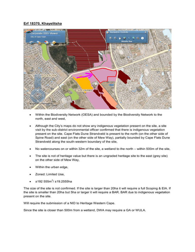
Erf 18370, Khayelitsha Within the Biodiversity Network (OESA) and bounded by the Biodiversity Network to the north, east and west, Although the City’s maps do not show any indigenous vegetation present on the site, a site visit by the sub-district environmental officer confirmed that there is indigenous vegetation present on the site. Cape Flats Dune Strandveld is present to the north (on the other side of Spine Road) and east (on the other side of Mew Way), partially bounded by Cape Flats Dune Strandveld along the south-western boundary of the site, No watercourses on or within 32m of the site, a wetland to the north – within 500m of the site, The site is not of heritage value but there is an ungraded heritage site to the east (grey site) on the other side of Mew Way, Within the urban edge, Zoned: Limited Use, ±192 555m / ±19.2555ha 2 The size of the site is not confirmed. If the site is larger than 20ha it will require a full Scoping & EIA. If the site is smaller than 20ha but 5ha or larger it will require a BAR. BAR due to indigenous vegetation present on the site. Will require the submission of a NID to Heritage Western Cape. Since the site is closer than 500m from a wetland, DWA may require a GA or WULA. EMF Areas of Potential Impact Map Other Ecological Support Area Conservation & Biodiversity Zone Other Ecological Support Area Coastal Protection Zone & Dunes Other Biodiversity Network Cultural & Recreational Resources Zone Area of Natural Heritage Natural Economic Resources Zone: Mining Sand & Building Sand Hydrological Zone Aquifer Productivity: High Urban Uses & Utility Zones Nothing New Development Areas The western part of the site is within a landfill buffer zone. Spatial Development Plan Spatial Development Plan & the western part of the site is within a landfill buffer zone. Urban Restructuring A portion of the site is designated: “Sites for Investigation”, the western part of the site is within a landfill buffer zone. Metro South-East CIP Not Part of the CIP Archaeologigy & Palaeontology comments: Erf 18370 is in an area which is indicated on the SAHRIS palaeontological map as moderately sensitive, but is interspersed with areas of high sensitivity. Therefore when the NID is completed for submission to Heritage Western Cape, it should be indicated that there is a possibility of palaeontological resources being impacted and a desk top study should be done. Not likely to find any in-situ archaeological material. Sub-district comment: There is some indigenous vegetation on site and the site is next to an old landfill site and the refuse transfer station. The site used to be the Amy Biehl golf driving range, but it is in disuse now.

