Earth’s Interior: Big Ideas
advertisement

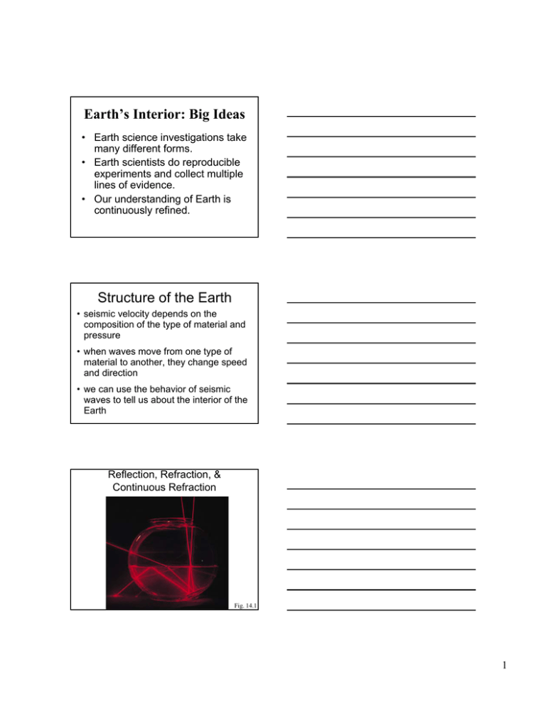
Earth’s Interior: Big Ideas • Earth science investigations take many different forms. • Earth scientists do reproducible experiments and collect multiple lines of evidence. • Our understanding of Earth is continuously refined. Structure of the Earth • seismic velocity depends on the composition of the type of material and pressure • when waves move from one type of material to another, they change speed and direction • we can use the behavior of seismic waves to tell us about the interior of the Earth Reflection, Refraction, & Continuous Refraction Fig. 14.1 1 How Do We Know the Earh’s Outer Core is a Liquid? P-Wave Bend at CoreMantle Boundary Fig. 14.2 How Do We Know the Earh’s Outer Core is a Liquid? S-Wave Stop at CoreMantle Boundary Fig. 14.2 Multiple Paths Give Much Information Fig. 14.3 2 Multiple Waves Give More Information Fig. 14.4 Can Distinguish Waves by Arrival Time and Type of Ground Motion Fig. 14.4 Distribution of Density, Velocity Fig. 14.5 3 Structure of the Earth The study of the behavior of seismic waves tells us about the shape and composition of the interior of the Earth: • crust: crust ~10–70 km thick, intermediate composition • mantle: mantle ~2800 km thick, mafic composition • outer core: core ~2200 km thick liquid iron • inner core: core ~1500 km thick solid iron Composition of the Earth Seismology also tells us about the density of rocks: • continental crust: crust ~2.8 g/cm3 • oceanic crust: crust ~3.2 g/cm3 • asthenosphere: asthenosphere ~3.3 g/cm3 S-Wave Velocity Versus Depth Fig. 14.6 4 Isostasy • buoyancy of low-density rock masses “floating on” high-density rocks; accounts for “roots” of mountain belts • first noted during a survey of India • Himalayas seemed to affect plumb Isostasy In order for continents to be higher they must also be thicker Glacial Rebound Box 14.1 5 Earth’s Internal Heat • original heat • subsequent radioactive decay • conduction • convection The Relationship Between the Age and Depth of the Sea Floor is Fundamentally a Function of Temperature. Fig. 14.7 Temperature Increases With Depth: The Geotherm Curve Fig. 14.8 6 Seismic Tomography Uses Travel Times to Create 3-D Images of Earth’s Interior Fig. 14.9 Tomographic Section Reveals Hot and Cold Rocks Fig. 14.9 Fig. 14.9 7 Paleomagnetism • use of the Earth's magnetic field to investigate past plate motions • permanent record of the direction of the Earth’s magnetic field at the time the rock was formed • may not be the same as the present magnetic field Acquiring a Magnetic Signature Fig. 14.14 Earth’s Magnetic Field 8 Earth's Magnetic Field declination: horizontal angle between magnetic north and true north inclination: angle made with horizontal What is Inclination at Equator? How Continents Grow: Accretion of Fragments Fig. 10.12a 9 How Continents Grow: Accretion of Island Arcs Fig. 10.12b How Continents Grow: Accretion Along Transform Fault Fig. 10.12c How Continents Grow: Accretion by Continental Collision/Rifting Fig. 10.12d 10 “Suspect Terranes” Terranes” of Western North America Multiple accretions of older island arcs, oceanic plateaus, oceanic crust, and marine sedimentary rocks. Fig. 10.11 Earth's Magnetic Field • It was first thought that the Earth's magnetic field was caused by a large, permanently magnetized material deep in the Earth's interior. • In 1900, Pierre Currie recognized that permanent magnetism is lost from magnetizable materials at temperatures from 500 to 700 °C (Currie point). Geodynamo: Self-exciting Dynamo A dynamo produces electric current by moving a conductor in a magnetic field and vise versa. (i.e., an electric current in a conductor produces a magnetic field) 11 Geodynamo: Self-exciting Dynamo • It is believed that the outer core is in convective motion (because it is liquid and in a temperature gradient). • A "stray" magnetic field (probably from the Sun) interacts with the moving iron in the core to produce an electric current that is moving about the Earth's spin axis yielding a magnetic field—a self-exciting dynamo! Geodynamo: Self-exciting Dynamo The theory is gaining popularity because: – it is plausible – it predicts that the magnetic and geographic poles should be nearly coincident – the polarity is arbitrary – the magnetic poles move slowly Magnetic Reversals • the polarity of the Earth's magnetic field has changed thousands of times in the Phanerozoic • The most recent reversal was about 30,000 years ago. However, the end of the last significant reversal was approximately 700,000 years ago. • These reversals appear to be abrupt, lasting approximately 1000 years. 12 More Recent Magnetic Reversal Magnetism and Dating We can now use the magnetic properties of a sequence of rocks to determine their age. The Geomagnetic Time Scale Based on determining the magnetic characteristics of rocks of known age (from both the oceans and the continents). We have a good record of geomagnetic reversals back to about 60 Ma. Fig. 14.15 13


