New Zealand - Off He Goes Around The Bend
advertisement
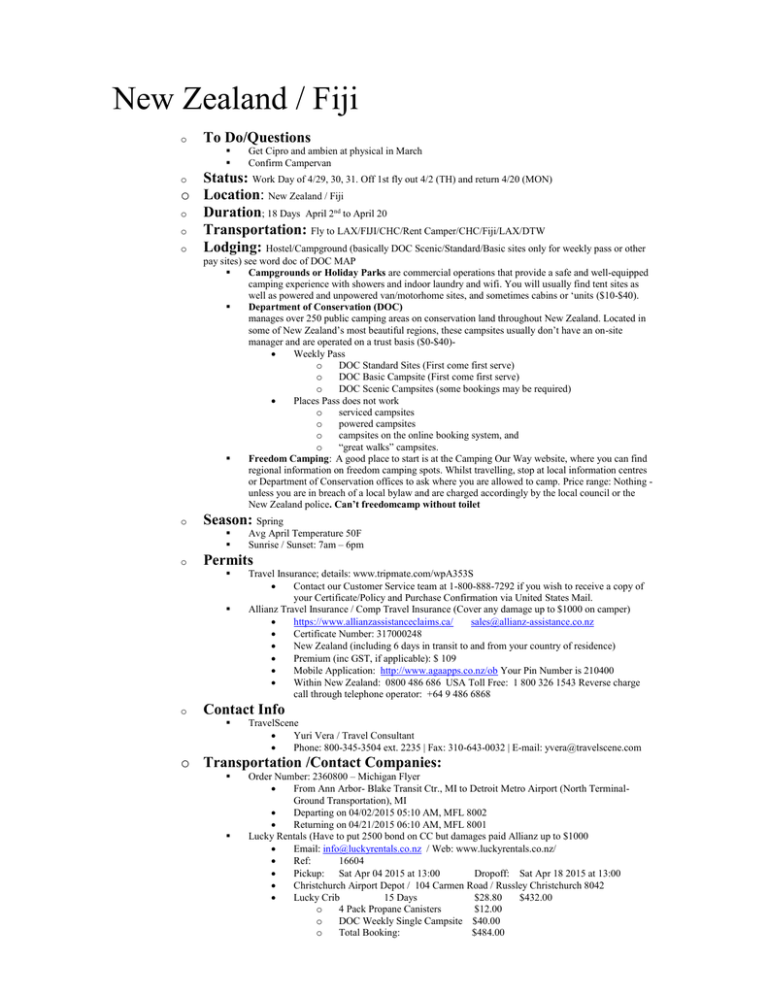
New Zealand / Fiji o To Do/Questions Get Cipro and ambien at physical in March Confirm Campervan Status: Work Day of 4/29, 30, 31. Off 1st fly out 4/2 (TH) and return 4/20 (MON) o Location: New Zealand / Fiji o Duration; 18 Days April 2nd to April 20 o Transportation: Fly to LAX/FIJI/CHC/Rent Camper/CHC/Fiji/LAX/DTW o Lodging: Hostel/Campground (basically DOC Scenic/Standard/Basic sites only for weekly pass or other o pay sites) see word doc of DOC MAP Campgrounds or Holiday Parks are commercial operations that provide a safe and well-equipped camping experience with showers and indoor laundry and wifi. You will usually find tent sites as well as powered and unpowered van/motorhome sites, and sometimes cabins or ‘units ($10-$40). Department of Conservation (DOC) manages over 250 public camping areas on conservation land throughout New Zealand. Located in some of New Zealand’s most beautiful regions, these campsites usually don’t have an on-site manager and are operated on a trust basis ($0-$40) Weekly Pass o DOC Standard Sites (First come first serve) o DOC Basic Campsite (First come first serve) o DOC Scenic Campsites (some bookings may be required) Places Pass does not work o serviced campsites o powered campsites o campsites on the online booking system, and o “great walks” campsites. Freedom Camping: A good place to start is at the Camping Our Way website, where you can find regional information on freedom camping spots. Whilst travelling, stop at local information centres or Department of Conservation offices to ask where you are allowed to camp. Price range: Nothing unless you are in breach of a local bylaw and are charged accordingly by the local council or the New Zealand police. Can’t freedomcamp without toilet o Season: Spring o Permits o Avg April Temperature 50F Sunrise / Sunset: 7am – 6pm Travel Insurance; details: www.tripmate.com/wpA353S Contact our Customer Service team at 1-800-888-7292 if you wish to receive a copy of your Certificate/Policy and Purchase Confirmation via United States Mail. Allianz Travel Insurance / Comp Travel Insurance (Cover any damage up to $1000 on camper) https://www.allianzassistanceclaims.ca/ sales@allianz-assistance.co.nz Certificate Number: 317000248 New Zealand (including 6 days in transit to and from your country of residence) Premium (inc GST, if applicable): $ 109 Mobile Application: http://www.agaapps.co.nz/ob Your Pin Number is 210400 Within New Zealand: 0800 486 686 USA Toll Free: 1 800 326 1543 Reverse charge call through telephone operator: +64 9 486 6868 Contact Info TravelScene Yuri Vera / Travel Consultant Phone: 800-345-3504 ext. 2235 | Fax: 310-643-0032 | E-mail: yvera@travelscene.com o Transportation /Contact Companies: Order Number: 2360800 – Michigan Flyer From Ann Arbor- Blake Transit Ctr., MI to Detroit Metro Airport (North TerminalGround Transportation), MI Departing on 04/02/2015 05:10 AM, MFL 8002 Returning on 04/21/2015 06:10 AM, MFL 8001 Lucky Rentals (Have to put 2500 bond on CC but damages paid Allianz up to $1000 Email: info@luckyrentals.co.nz / Web: www.luckyrentals.co.nz/ Ref: 16604 Pickup: Sat Apr 04 2015 at 13:00 Dropoff: Sat Apr 18 2015 at 13:00 Christchurch Airport Depot / 104 Carmen Road / Russley Christchurch 8042 Lucky Crib 15 Days $28.80 $432.00 o 4 Pack Propane Canisters $12.00 o DOC Weekly Single Campsite $40.00 o Total Booking: $484.00 o o Less Deposit: Balance Remaining: -$100.00 $391.68 o Special Items To Bring o power converter and USB? Carryon clothes and swim trunks for 2 days Book of CDs Larger towel Portable icebag? Dry bags for shower Flight Information Travelscene:583Q7W Spirit: EC6SMN THURSDAY 02 APRIL 2015 Airline:Spirit 939 Departing 7:30 DTW Arriving: 9:40 HOU (Change Plans) Airline: Spirit 217 Departing: 15:24 HOU Arriving 17:00 LAX AGENT WS/KP BOOKING REF 583Q7W RESERVATION NUMBER(S) FJ/583Q7W ETKT:FJ 260 7432126783 CALYPSO BOOKING NUMBER NM/070478 THURSDAY 02 APRIL 2015 Airline:Air Fiji FJ811 Departing 23:30pm LAX SATURDAY 04 APRIL 2015 Arriving 5:50am NADI (Fiji) Airline:Air Fiji FJFJ451 Departing 9:30am NADI Arriving 14:30pm CHC SATURDAY 18 APRIL 2015 Airline:Air Fiji FJ450 Departing 14:30pm CHC Arriving 18:25pm NADI MONDAY 20 APRIL 2015 Airline:Air Fiji FJ810 Departing 21:40pm NADI Arriving 13:30pm LAX Airline:Spirit 709 Departing 22:00 LAX Arriving 05:11 DTW Day 1 S 4/4 - South From Christchurch to Banks Peninsula. If bags get delayed stay on Akaroa night one and maybe raft night 2 and explore christchurch and Lyttelton Day 2 U 4/5 – Hike to Mueller Hut overnight or Tasman Kayak Day 3 M 4/6 – Descend Mueller Hut drive back through Omarama to coast city of Oamaru to try and catch penguins. Head South on rte 1 and stop at Moeraki Boulders and Dunedin Tunnel Beach and Mt Cargill Organ Pipes drive along Otago beach. Deunedin for beers and camp after town Day 4 T 4/7 - Day 5 H 4/8 - Hike the Kepler Trail 2 days Day 6 T 4/9 - Finish Trail. North on Milford HWY with stops along the way Possible Sound Cruise, Day 7 F 4/10 - Backtrack Milford Hwy towards Te Anau towards Queenstown. Hike Lemond Day 8 S 4/11 - Hike Day / Wanaka for day hike and town Day 9 U 4/12 - Continue Rte 6 Stop and Climb either Fox or Franz Josef Glacier in Okarita along coast Continue Continue down coast to Porpoise Bay for penguins, Invercargill for Southern tip and on to Tuatapere for Tuatapere Hump Ridge Track (Option) Further into Fjordland and town of Te Anau Glowworm Caves up coast. Before Greymouth head inland to Analanche overnight on rte 73 Day 10 M 4/13 - Day 11 T 4/14 - Day 12 W 4/15 – Day Hike Able Tasman or overnight near car at end Day 13 T 4/16 Day Loop Pelorus Track outside of Nelson if time Follow Rte 1 down to Kaikouri for city coast Past Greymouth stop at Punakaiki Rocks Possible offshoot to Lake Brunner for some hikes just East of Greymouth Continue to Paparoa NP and the 2 day Inland Pack trip or just hike tail end Take Rte 6 North to Nelson Lakes for possible alpine overnight or 5 hr Mt Roberts or St Arnaud Range Track. If not going to Nelson Lakes continue rt 6 on to Karamea (see arches around town) and do overnight beach hike to Heaphy Hut (4 Hrs). Continue on to Able Tasman Park (interesting short hikes near Takaka) and drive to edge of Golden Bay to see the parts of hike you skipped by doing an out and back) walks. Head inland to Hammer Springs. Option to head West from Christchurch to Cave Stream Scenic Reserve to Lyttelton and summit road out to Godley Beach Park and on to Ankora and Walk Day 14 F 4/17 -Extra Day Day 15 S 4/18 - Fly to Fiji Day 16 U 4/19 – Explore Day 17 M 4/20 – 1230 departure DETAILED ITINERARY DAY 1 – (14:30 Saturday 4/4) Make sure to pack carryon with swim trunks and clothes for 2 days with essentials in case bags lost. Arrive at airport. Turn off cellular data and roaming. Rent Campervan. Stop at Grocery Store once on Rte 1(Pita, Buns, Hummus, Fruit (Apples, ORanges, bananas, cucumber-hummus),Cheese bricks, Sauseges, mustard BBQ sauce, Onions Gpeper, Saurkraut, Vodka, Olives, Rice, Dehydrated Pasta mix, Milk ,Oatmeal packs, Rasins / walnuts, Teabags. May need Clif Bars. olive oil, couscus) . Drive out to 75S and Rt 1 Then south to Banks Peninsula and Okains Bay Beach Reserve Camping Ground via the north rim of the peninsula with a few view stops. After setting up spot go for short hike if possible (see Peninsula PDF) or head into town of Akaroa for city walks. Location Hikes/Activities o Grocery Shopping (Countdown) o Akaroa Okains Bay Beach Reserve Camping Ground $12 Timber Yard Lakeside Domain- Free Camping off the Peninsula on West end of Lake Ellesmere o Rangitata Rafts $200 10am 4 hours with lunch / dinner 9-5pm: 64 800 251 251 Once a booking has been confirmed you must provide Rangitata Rafts with 48 hours’ prior notice of cancellations or full payment will be charged. If you have the chance to come in January that is the time to come. The chances of warmer weather and better river flows are higher during that time of the year. The difficulty of the river depends very much on the water level but are challenging anyway since we have two grade 5 rapids that we rafts through on our trip. Christchurch South to Ashburton (3 Hrs). The traveling time is approx 2 hours from central Christchurch to us.Head south on ‘State Highway One’. After one hour you will travel through Ashburton.On the outskirts of Ashburton is Tinwald. On the left is ‘Claas’ a tractor sales shop. Turn RIGHT here which is signposted to ‘Mayfied/Arundel 37km' and you will now be on Maronan Road. Follow on this road following the signs to ‘Geraldine/Arundel’ When you get to the T junction turn LEFT (signposted Geraldine) and cross the Rangitata river. Turn first RIGHT at the end of the bridge and follow the signs to Peel Forest or Rangitata Gorge. Our local Peel Forest shop is your last opportunity to buy any extras for yourself eg beer or wine for the BBQ at the end of the day. We do not sell alcohol at our lodge. Rangitata Rafts is located 13km past the store on the same road, Rangitata Gorge Rd. This road is a sealed all the way to our lodge. If the road you are traveling on turns into a gravel/unsealed road you would have missed our driveway by 200m.Turn right down Waikari road (our driveway) it is signposted. We are the green lodge with the trees around it. http://www.rafts.co.nz/about/ Camping o Okains Bay DAY 2 – (Sunday 4/5) call Mt cook to see if can Hike to Mueller tomorrow and stay overnight without ice axe. Also ask if clear for hiking and if glaciers in Tasman Lake for kayaking. If so Drive up to Mt Cook. If not continue on Rte 1 (assume going up). Along Rt 8 stop at blue waters of Lake Tekapo and Lake Pukaki. Based on weather can either start day at Lake Tasman (If Glaciers, if not just drive to car park and lookout) for either Kayaking or Ball Pass Route (can I take car on Ball Rd). In Afternoon short hike to Hooker Valley and back and possible overnight Mueller Hut If doing overnight might also skip Lake Tasman hike/kayak). Location o Mt Cook. Follow Rt 1 out of CH then 79 Northwest at Geraldine then on to 8 west and 80 North Hikes/Activities o Lake Tekapo/Pukaki Along rt 8 halfway to Mt Cook o Hooker Valley Track 10K / 3 Hours o o Turn off State Highway at Lake Pukaki onto State Highway 80. Begin at the Visitor Centre, or White Horse Hill Campground and car park. This is one of the most popular walks in the park, leading up the Hooker Valley towards Aoraki Mount Cook. The track passes close to the Alpine Memorial which is a great viewpoint. Continue on to the Hooker River and cross twice on swing bridges before reaching Stocking Stream Shelter. From here, head up the valley crossing a third swing bridge that leads to the East Hooker and the source of the Hooker River. The track ends at the glacier lake where there are amazing views of Aoraki Mount Cook, the Hooker Glacier and the Southern Alps. Ball Pass Route 6 Hrs This track starts from the Blue Lakes car park Follow the line of the old Ball Hut Road alongside Tasman Glacier. Ball Flat is close to the historic Ball Hut site and offers superb views of the glacier and surrounding peaks. Mueller Hut hike 5.2 km uphill Camping o Mueller Hut The hut can sleep 28 people on platform bunks complete with mattresses. There is a separate kitchen and living area and self-contained wardens quarters. People staying overnight need to provide their own cooking and eating utensils. There are solar-powered lights and gas-operated stoves. A toilet is sited a short distance away from the hut, but can be inaccessible in winter. Booking $25/night http://www.doc.govt.nz/parks-and-recreation/book-online/?op=departme75&pid=7525 Resources o Aoraki / Mt Cook National Park Visitor Centre Phone +64 3 435 1186 o Mt Cook Kayaking (at Old Mountaineers Cafe, Bar & Restaurant) $150-3 hrs Lake Tasman (glaciers flowing?) 10 am departure Phone: 03 4351 890 / After Hours Phone: 0274 342 277 / mountcook@xtra.co.nz http://www.mtcook.com/glacier-sea-kayaking/ o Glentanner Park Centre (Mt Cook) $21 / 18 km before park State Highway 80 / P O Box 23 Mount Cook 7946 Phone: +64 3 435 1855 / info@glentanner.co.nz Resources o Aoraki / Mt Cook National Park Visitor Centre Phone +64 3 435 1186 Maps o Mt Cook hiking map DAY 3 – (Monday 4/6) Descend from Mueller Hut and Drive back to Omarama stopping at Clay Cliffs and on to coast town of Oamaru for Penguin visits. Continue South on rte 1 past boulders and on to Dunedin and Otago Peninsula Location o Oamaru (2 hrs) via rte 80 / 8 and 83. On to Dunedin in 1 Hr Hikes/Activities o Omarama Clay Cliffs: 3kms north of town and an additional 10km after that : $5 o Oamaru Buildings in Harbour-Tymne Historic Precinct Bushy Beach – Yellow-eyed Penguins on Graves Trail Blue Penguin colony – Waterfront Rd (Late afternoon) o Moeraki Boulders 30km south of Oamara o Dunedin City Walk Taieri Gorge Railway Tunnel Beach Walkway Mt Cargill Organ Pipes (option) Railway Station Drinks and Dinner at “Octagon” in center of town o Otago Peninsula See penguins and albatross Camping o Number of Free noncontained spots just north/South of Dunedin, Resources o Dunedin Walking Guides http://www.dunedinnz.com/visit/see-and-do/outdoor-sport/walks DAY 4 – (Tuesday 4/7) Continue from Dunedin to Balcutha where you get off rte 1 and onto coastal hwy. Invercargill and Tuatapere for Tuatapere Hump Ridge Loop Track (option to eliminate if Short on time). Up to Te Anau. Find lodging and do night Glowworm tour (option, kinda commercial) after confirming hiking for tomorrow on Kepler Trail (reserve boat, camping pass, and shuttle from Rainbow?) Location o Follow Rte 1 to Invercargill and then rte 99 to Tuatapere (3.5 Hours). 1 Hr further to Te Anau Hikes/Activities o Nugget Point Lighthouse with view o Cathedral Caves Worth a photo stop if low tide Tide Chart; http://www.cathedralcaves.co.nz/ o Porpoise Bay Possible Penguin spot o Slope Point 20 min walk to point o Invercargill Bluff Hill for View of Stewart Island Sterling Point Walk o Tuatapere Hump Ridge Track Page 310 Tramping Book 3 Days 2 Huts $45/each with no camping options. Steep climb to ridge. Rich in cultural history and timber town. Coastal views. Nice loop option. Purchase Pass at 31 Orawai Rd Tuatapere o Te Anau Doubtful Sound Cruise Sea Kayaking with Dolphins (is it 2 day minimum?) Gloworm Caves 2 Hours / $75 Real Journeys Visitor Centre , Lakefront Drive : +64 3 249 6000 or 0800 65 65 01 (within NZ) Departure Times: 2pm / 6pm / 7pm / 8pm https://www.realjourneys.co.nz/en/experiences/glowworm-caves/te-anau-glowwormcaves/ Scenic Route o Southern Scenic Route http://www.southernscenicroute.co.nz/ Camping o Te Anau Holiday Park $15 DAY 5 – (Wednesday 4/8) Hopefully able to Park in Holiday Park and catch water Taxi at 830 to Brod Bay and hike 9hrs to Iris Campground for Kepler Track. Location o Te Anau Hikes/Activities o Kepler Track 2/3 Days, 60km Alpine Crossing / Must ensure Open / End at Rainbow Reach or it will be 3 days Buy Great Walk Camping Pass for Iris Burn at Fjordland Visitors Center Need Topo Map / Confirm can do in 2 if camping not huts Possible Leave Car at Rainbow, get back into town and take taxi (830 and 930am)to Brod Bay in order to reach Iris night one Camping o Iris Burn Campground Maps http://www.doc.govt.nz/parks-and-recreation/tracks-and-walks/fiordland/eastern-fiordland/kepler-track/trackdescription/map-and-profile/ DAY 6 – (Thursday 4/9) Hike Remainder of Trail to Rainbow Reach (2 Hrs) and Hitchhike/Shuttle back to Marina/RV campsite. Drive toward Milford Sound (Fill Gas in Te Anau) Catch Late afternoon Cruise (until 5pm) Location o Milford Sound is 2 Hrs North of Te Anau on Rte 94. Hikes/Activities o Sound Cruises About 5 companies all for roughly $60 for 2 Hrs Try to go early/Late to avoid tourist rush from Te Anau at Noon. Camping o Anywhere along Hwy on way back towards Queenstown DAY 7 – (Friday 4/10) Head to Queenstown to explore downtown and Arrowtown after hiking Ben Lomond in afternoon. If not a clear day, can skip and just relax after finding camp spot. (Rafting or Jetboat Option) Location o Return down to Te Anau for 2 Hr Drive. And additional 2hrs East and North to Queenstown. Knock Hike at Summit Road early so can enjoy beers downtown after nabbing camping spot outside of town Hikes/Activities o Queenstown Shotover River Rafting option: http://www.queenstownrafting.co.nz/ Meet downtown $200, 5 hours (08:15 departure) Queenstown Rafting Booking Centre, 35 Shotover Street, Queenstown, New Zealand Shotover Jet: www.shotoverjet.com Can meet them at river 7km out of town $135 for 40 min (shorter than rafting) Leave every 15 minutes Shotover Jet, Shotover Jet Beach, Gorge Rd, Arthurs Point, Queenstown, New Zealand Gondola (Drive Up) BEN LOMOND SUMMIT VIA THE SKYLINE GONDOLA VIEWPOINT, QUEENSTOWN - 4-7 HOURS. You have several options, including paying to take the Gondola up, which cuts about 1 hour of walking. You can also take the Tiki Trail (not recommended as it's better to take down) or the Skyline Gondola Access Road. The latter is a wide open road and the fastest way to access the trail to Ben Lomond. After ascending the hill from Queenstown (either by foot or gondola) the track follows the ridge just below the top. Once you reach the saddle between Ben Lomond and Bowen Peak the track climbs the northeast ridge until it loops around and gains the summit from western side. Expect 4-6 hours round-trip from the top of the Gondola and 6-8 from Queenstown http://www.skyline.co.nz/queenstown/gondola/ Camping o Either outside of Arrowtown or Queenstown. Not many free sites seen. Resource o Queenstown Visitors site: http://www.queenstownnz.co.nz/ Maps o See LP Book DAY 8 – (Saturday 4/11) Further Explore Queenstown and either find a day hike at Routeburn (7Hrs), or do Rob Roy up in Wanaka (3 Hrs). another 3 Hours to Coast on rte 6 Location o 1 Hour North from Queenstown to Wanaka. Another 3 Hours to Fox Glacier Hikes/Activities o Routeburn Shelter Day Hike Ask in town if worth drive up to Glenorchy if not hiking route. If not skip 1 Hr from Queenstown. at Routeburn Shelter, the route meanders up and down to Routeburn Flats Hut for 6.5 kilometers, which is the halfway point to Harris Saddle.. From Routeburn Flats Hut, take a left and start the slow 2 kilometer slog up the mountain to the Routeburn Falls.last bit of the walk is where the views really open up. You have amazing alpine scenery in all directions and the terrain isn't actually that challenging.so 7.5 hours in all. OTHER OPTIONS try and not drive up to milford sound after Te Anue and hike Reutburn to divide, shuttle to Milford sound and back, then shuttle back to divide and hike back greenstone to queenstown. Another option is to skip greenstone and ride back to queenstone. Another 3rd option is to drive north from Invergall to Queenstown and follow option one. o Wanaka Rob Roy Glacier hike – 4 Hours Day hike highly recommended Camping o Spots along West Coast Near Fox Glacier Resources DAY 9 – (Sunday 4/12) Franz Glacier and possible guided hike or just walk on own as close to either/both as possible. Stop At Glowworms/Gorge in Hokitika. Day hike at Avalanche in Arthur’s Pass National Park. If not clear continue 3 Hours to Paparoa NP Location o From Franz Glacier it is 2.5 Hours drive up to Greymouth Hikes/Activities o Glaciers Visitors Page http://www.glaciercountry.co.nz/ o Franz Josef Glacier Guides Probably just drive to car park and hike short bits to lookouts Anything get on Glacier for cheaper than $300 http://www.franzjosefglacier.com/ o Hokitika glowworm dell is on the lefthand side of the road as you come into the town from the North (on the main route from Greymouth). It's opposite the Shining Star Beachfront Accommodation. Entry is free and the dell itself is a 2 minute walk from the roadside entrance, where there's an information board if you want to learn more about the insect and its lifecycle. Hokitika Gorge Near Stafford St just past Dairy factory. o Avalanche Pass 5 Hours. Only if clear Day his tramping track/route is steep and exposed to the weather, with sheer drops in some places. It should not be attempted in poor visibility or high winds. In winter and spring, the route to the peak is prone to avalanches. During heavy snow conditions, we advise visitors not to travel this route unless sufficiently equipped and experienced enough to assess the conditions and choose a safe path through avalanche terrain. rom Arthur's Pass Visitor Centre follow the bush edge northwards to pick up the start of the track, signposted behind the first house and before the bridge over Avalanche Creek (elevation 737 metres). The track, rocky and steep in parts, climbs through mountain beech/tawhairauriki on the south side of Avalanche Creek. The creek drops over steep bluffs, creating spectacular waterfalls which you can see from the main road and occasionally from the track. The track moves away from o the creek and emerges at the bush line (1200 metres) to give good views down the Bealey valley to Cora Lynn Station, Black Range and Mt Bealey. Punakaiki Rocks DAY 10 – (Monday 4/13) Hike the Inland Pack Trip or at least to Ballroom or do Charming Creek Walkway farther north, continue on to Karamea (Fill tank at Westport) for overnight at Heaphy Hut if available. Also option to visit Oparara Basin near town Location o 3 Hrs up coast from Paparoa NP to Karamea. Hikes/Activities o Paparoa NP Punakaiki: Pancake Rocks Fox River Cave Walk (Tail end of Inland Pack Trip) Time: 2 hr, Distance: 6 km, one way- dangerous in flood. Some of the park's finest limestone features can be seen in this area. The track follows the Fox River and continues up the gorge to a point where the river branches. The large limestone overhang, known as the Ballroom Overhang is about half an hour up the left or main branch of the river. Access: The Inland Pack Track, sign posted by the main road bridge at Fox River, 12 km north of Punakaiki. o Hector old slaughterhouse hostel Charming Creek Walkway (5 Hr) near hector by Charming Creek BandB in Ngakawau o Oparara Basin 10km north of Karamean turn off at Mccallums Mill Rd and follow 14km winding road. Hit all three car parks and hikes to arches and caves o Karamean to Heaphy Hut Buy overnight at Karamean Information and Resource center $25 / 4 Hours Or Can Day Hike it Camping o Heaphy Hut $30 http://www.doc.govt.nz/parks-and-recreation/tracks-and-walks/nelson-tasman/golden-bay/heaphytrack/plan-and-prepare/fees-and-bookings/ DAY 11 – (Tuesday 4/14) Hike Back from coast and drive east through Westport on Rte 6 then north up from Motueka to Takaka around Tip (Cape Farewell) then back south to Takaka/Able Tasman stopping to camp at Totaranui and Hike loop Location o South to Rte 6 then East to Rte 60 and through Motueka to cape Farewell (6 Hours). If short on time don’t drive all way to tip but stop at Totaranui Hikes/Activities o Road between Takaka and Motueka Canaan Downs Scenic Reserve Harwoods Hole – Caving spot only for lookover. If go up to Cape Farewell stop at Mussel Inn near Collingwood o Totaranui campground Hike out to Wainui Bay then return on Gibbs Hill Track tomorrow (5 Hours) DAY 12 – (Wednesday 4/15) Drive South back to Marahua and maybe take Water Taxi and day hike. Drive to Motueka then drive to Nelson via SH60 with stop off on Ruby Bay Scenic Route (Smokehouse seafood and Golden Bear Brewery) for beer and end up somewhere between there and Kaikoura for night. (If light out head straight East from Nelson to Havelock and Picton along Queen Charlotte Drive) Location o 4 hrs from Motueka to Kaikoura via rte 1 and through Nelson Hikes/Activities o Nelson Nelson Cathedral Founders Heritage Park and Brewery Free House Brewery o Able Tasman Taxi / Kayaking Multiple Options Hikes Ask Taxi operators for Day hike options based on time constraints. One option is to taxi to Tonga Bay via seal colony then hike 3 hours north to Torrent Beach and get taxi back to Marahua ($50) DAY 13 – (Thursday 4/16) Kaikouri for city coast walks. Down to Christchurch (Walk around Central area) Also can explore peninsula east of Christchurch where Taylors Mistake and Lyttelton are. Location o Christchurch is 2hrs south of Kaikoura on Rt 1 Hikes/Activities o Kaikouri Seal Swim $80 / 2 Hours; not too exciting. Mighty be pretty cold for this Kaikoura Peninsula Walkway 3 Hour Loop to Kean Point Seafood BBQ along way: cheap local food o Christchurch Central Cathedral Square Botanic Gardens and Hagley Park Canterbury Museum (Free) International Antarctic Center with Penguin Backstage Pass High Street and Tramway tour Gondola (on way to Lyttelton) Willowbank Wildlife Reserve (10 km north of town of Rt 1) Taylors Mistake Walk (Past Lyttleton on Summit Rd) Lyttelton (South of town on 74/76) DAY 14 – (Friday 4/17) Extra Day Location Hike/Activities o x DAY 15 – (Saturday 4/18) Be at airport by Noon at Latest. Land in Fiji at 1830. Take Cab to Hostel. Ask if Vuda Point Marina is worth checking out along with VISEISEI VILLAGE or else just relax along water and recon for tomorrow Location o Take shuttle or Cab to Hostel 10 minutes Hikes/Activities o Vuda Point Marina at Vuda Point is worth a visit for their Saturday night markets. It's next to First Landing Resort and close to Viseisei Village www.vudapointmarina.com/ Camping o Smugglers Cove Beach Resort / Bamboo Travellers Beach Resort / Aquarius on the Beach On Beach, close to Airport. 1 mile to bus. Any will do fine Resources o Fiji's larger islands have extensive and inexpensive bus networks. Local buses are cheap and regular and a great way to mix with the locals. While they can be fairly noisy and smoky they are perfect for the tropics, with unglazed windows and pull-down tarpaulins for when it rains. There are bus stops but you can often just hail buses, especially in rural areas. Air-conditioned express buses run on some major routes such as Nadi to Suva. o Sunbeam Transport and Pacific Transport are the main carriers on Viti Levu. Pacific Transport also operates services on Taveuni. Local companies operate buses on Vanua Levu. DAY 16 – (Sunday 4/19) Explore. May opt for bus to Navala, but it will be all day thing. If not Head to Nadi market in morning, then off to Denarau Marina for lunch. Maybe continue on bus to Natadola beach for afternoon. At this point can go up to Viseisei village and vida marina if not last night, or get on bus and follow around island to capital of Suva and walk coast. from here follow bus around north of island or can take one that cuts through mountains back to Nadi. Hikes/Activities o o o o o VISEISEI VILLAGE You can walk into the village at the north end for free or pay 5 Fijian dollars ($3) at the south end and have someone show you around, which is well worth it. Avoid wearing bikinis or other skimpy clothes, which are considered disrespectful in this setting. Navala Native Town -photographer’s delight, but you need to get permission and pay the $15 entrance fee before wandering around. If arriving independently, ask the first person you meet to take you to the turaga-ni-koro (the chief-appointed headman who collects the entrance fee). As the village charges a fee to enter, a traditional sevusevu is not required although all other village etiquette rules apply. If you arrive with Tui from Bulou’s Eco Lodge, he will take care of protocol. 2 Hours from Nadi Transport to Navala: You can catch the bus in Ba at noon or 5 PM and it will take you to Navala for about FJ$3. The buses that return to town are at 6 AM, 8 AM, and 2 PM. This is the best way to get there - it's cheap and the slow ride from town to the village is beautiful. From Nadi to Lautoka to Ba to Navala will cost about US$5 total. There is no need to rent a car. You can take mini-buses (minivans) or regular buses. Garden of Sleeping Giant Basic Garden, not that impressive Nadi Market Nadi’s open-air souvenir market, pick up traditional Fijian crafts such as wooden kava bowls, handpainted saris and scepter-like cannibal forks, the latter a nod to the region’s colorful past. Then explore the country’s Indian legacy at Sri Siva Subramaniya Swami Temple, an elaborately painted Hindu temple. Nearly half of Fiji’s population is of Southeast Asian heritage, descendants of the Indians and Bengalis who came to work the British sugar cane plantations in the late 1800s and decided to stay. Finish up your tour by tasting the melding of these cultures with an Indo-Fijian feast of fresh fish curry and spiced roti at the Curry House, a Nadi favorite for locals and visitors alike. Natadola Beach – Coral Coast o o o Fiji’s most beautiful beach, Natadola, is located 36 km south of Nadi. Take public Bus Denarau Marina – Nadi -this is where the boats to many of the Mamanuca and Yasawa Island groups depart. You can book day trips at the companies who have booths near the checkin point for the island groups. The Marina has more than just a departure point for island trips. There's a good choice of restaurants, a coffee shop and a hot bread kitchen all at differing prices to suit all budgets. Good spot to have lunch and watch the boats coming and going. Local buses stop there, and there's a taxi rank too. The Denarau Island "Bula" bus also stops there. SUVA WATERFRONT Like most urban areas in Fiji, Suva, the capital, has a dilapidated feel and doesn't immediately seem inviting. But the country's leaders have made a point in recent months of trying to improve the waterfront promenade, an effort that's showing positive results. The horseshoe-shaped walk extends from the city to the national stadium and has become a popular place to jog and stroll. There's a new picnic area and sometimes you'll see pickup games of rugby, Fiji's national sport. Koroyanitu National Heritage Park Abaca National Heritage park, Koroyanitu National Heritage Park, Nase Lodge and Mt Batilamu are all the same place, but known by different names. half an hour’s drive from Nadi airport, Koroyanitu National Heritage Park seems deep within Viti Levu’s interior. It’s very beautiful, with walks through native dakua (a tree of the Kauri family) forests and grasslands, birdwatching, archaeological sites and waterfalls, and gorgeous landscapes of peaks, clouds and sunshine. There are no buses to Abaca but you can contact George Prince (664 5431, 8605406, 991 6956; george_prasad@hotmail.com and abacaecopark@yahoo.com, who operates transfers from Lautoka to the Village ($30/60 one way/return) per person. And additional of $10.00 per person one way from Nadi and $15.00 per person from Denarau Island. Also Pick up can be from any Hotel around Viti Levu. DAY 17 – (Monday 4/20) Fly Home at 1230 PM RESOURCES Nine Great Walks: http://www.newzealand.com/travel/en/media/features/walkinghiking/walkinghiking_greatwalks_feature.cfm South Island Itineraries: http://www.newzealand.com/us/trips-and-driving-itineraries/south-island/ Hike South: http://hikesouth.com/ All South Island Hikes: http://nzwalksinfo.co.nz/ Lonely Plantet Preview: http://books.google.com/books?id=O9kxgh1WlZgC&printsec=frontcover#v=onepage&q&f=false Great Walks Reservations: http://doc.govt.nz/parks-and-recreation/tracks-and-walks/great-walks/ Lonely Planet Tramping: http://www.amazon.com/Lonely-Planet-Hiking-TrampingZealand/dp/1741790174/ref=pd_sim_b_5?ie=UTF8&refRID=1SW9EGM5RZ0YZR4XJZ88 Tramping Tracks: http://www.trampingtracks.co.nz/ South ISLAND HIKING Malborough Queen Charlotte Track 4 Days, 71km Picton, NE Islands Thoughts: This is the landing spot for North Island ferry. This is a less busy alternative to Able Taseman track. Nice water overlooks, but Able is more beach hiking. Can sleep each night in lodges and bars accessible. Can do in 2-3 days but must take 45 min boat ride out and hike back. Nydia Track 1 Day, 27km Picton, NE Islands Thoughts: Pretty tame hike through flat fields Pelorus Track 2 Days, 31km Nelson Thoughts: Deep green pools in lush forests. Looks Like I could loop a day hike from Swing bridge Nelson Region *Abel Tasman Coast Trek 4 Days, 51km Nelson Thoughts: Nelson is good spot to chill. Not to be missed. A Warm version of West Coast Trail, only requires light walking shoes for the 50km (31 miles) route lined with miles of golden beaches. Along the way, five huts and 21 campsites offer accommodation, but transport has to be arranged from one end or the other. Book at small campsites. If cant get permit for overnight camp can take a water taxi out and catch the last one back to Marahau for day trip. Ideally book a morning taxi all the way to Mutton Cove and hike back until want to take a taxi back when bored (probably too expensive). If that is not gunna work then watch to see if campsites get booked before leaving and then taxi to Totaranui and ideally get there by noon and hike Back to Bark Bay for night. Then hike rest of way back to Marahau the next day. It will be dictated by which campsites are available. *Heaphy Track 4 Days, 82km Collingwood and Karamea at end: Kahurangi NP Thoughts: South of Abel. Cannot loop it. Hike East/West. 9 camping spots. A nice hike but logistics of shuttle could make it expensive. Best part of hike is the last section that goes south along the coast. Day walks are popular on the Heaphy Track from both ends of the track. Karamea is a great place to experience the final coastal section of the track, walking along a coastline of palm tree groves with deserted, sandy beaches and no evidence of man's presence on the coastline other than the track.The walk to Scotts Beach and then over night at Heaphy Hut (5 hours) and return. Wangapeka Track 4 Days, 51km Southern end of Kahurangi NP Thoughts: Rugged and isolated. Nothing special Leslie-Karamea Track 5 Days, 87km Motueka Kahurangi NP Thoughts: Semi-wilderness tramp through K NP. Good volcanic scaring and trout fishing. Not loop, not worth it. Nelson Lakes Region 5 Days, 87km Motueka Kahurangi NP Thoughts: Mountain Alpine lakes and passes. Many loop opportunities for 2 day tramps. 2 tramp options Travers-Sabine Circuit: Looks cool. It lists as a 5 day, but could just hike to John Tait, overnight and come back down an alternate way D’urville Valley Track: not really a short loop opportunity: 5 days – 70km Mt Roberts Circuit Track 5 hour loop West Coast Inland Pack trip 1-2 Days 27km Greymouth, Paparoa National Park Thoughts: Caves and gorges on this inland route.If Heavy rains may need to skip as it has a river hike that is much like UT narrows. Check with Visitors Center before going. Try to shuttle to start and leave car at end. Spend night one on rock ballroom. Croesus Track 1 Days 18km Blackball, Paparoa National Park Thoughts: Old minimg tows hike. Not loop, not impressive. Welcome Flat 2 Days 48km Fox glacier, Aoraki / Mt Cook / Westland / tai Poutini National Park Thoughts: More of a Winter climbing area called Southern Alps This is an alternative to copland pass, but it requires hiking back across same path out so no dice. Mueller Hut 2 day 10 km Mt cook village, Aoraki / Mt Cook / Westland / tai Poutini National Park Thoughts: alpine hike up to hut. Difficult hike but a good snow experience option. May be too cold this time of year. Also may get snow on Routeburn Track instead. *Avalache Peak 5 Hrs 7 km Arthur Village Thoughts: Good Day hike option Goat Pass Track 1 Day 25km Arthur Village Thoughts: Not a loop. Might as well do Avalanche Waimakariri-Harman Pass Route 3 Day 40km Arthur Village Thoughts: Like above, not a loop an might as well do the day hike option. Harper Pass 4 Day 70km Arthur Village Thoughts: Not logistically inviting Cass-Lagoon Saddles 2 Days 30 km Arthur Village Thoughts: A possible option to loop it it with a short shuttle. Canterbury / Christchurch Banks Peninsula Track 2 Days, 37km Christchurch Thoughts: Coastal scenery. Looks cool. Not sure if camping possible. Not a complete loop but close. Sleep first night at Hut and start hike next day. Finish hike back at car in Akaroa. Private requires fee $200 Mt Somers Track 2 Days, 25km Christchurch Thoughts: Loop Trail that circles mountain like wonderland at Mt Ranier. Probably could do in one day but that would be rough. Park car at Sharplin falls and loop, but may have to shuttle from Staveley is cannot leave car overnight at car park. May be cold up in alpines. Not too impresive St James Walkway 4 Days, 65km Christchurch Thoughts: Loop with some Hwy walking at end or beginning. Not as tough as hikes in Nelson Lakes. A couple mountain passes, mat get cold. Hot Springs. Cant shorten and may be too long and not exciting enough to tackle. Better options *Kaikoura Coast Trek 2 Days, 37km Kaikoura Thoughts: Alpine, beach views and farm lodging. Private, requires fee. $150 a person. Fuck that. def go on to Kaikoura to see whales and/or dusky dolphins- water so clear they are easier to see than in a harbour. Then do the free walkway: http://www.doc.govt.nz/Documents/parks-and-recreation/tracks-and-walks/nelson-marlborough/kaikoura-peninsula-brochure.pdf Kaikoura whales and/or dusky dolphins- and Loop Peninsula free hike from town Fjordland /Mt Aspiring National Park *Routeburn Track 3 Days, 32 km Glenorchy Thoughts: a Great Walk. Rainforest and high divide. Option to loop in 3 days by starting in Glenorchy and coming back through Emily Pass . Most popular section is between Routeburn Falls and McKenzie. Park car at Divide and catch ride back to start. Greenstone And Caples Track 3 Days, 36 km Glenorchy Thoughts: beech forest along trout river. Nothing exciting. Can be combined Caples track to loop in 4 days. Mavora Walkway 2 Days, 51km Glenorchy Thoughts: less crowded option. Then above ones but nothing spectacular as far as scenery and not a loop. Rees-Dart Track 3 Days, 57 km Glenorchy Thoughts: Alpine scenery and wild rivers make this a good alternative to Routeburn if cannot get reservations, but it is longer. Cascade Saddle Route 3 Days, 61 km Wanaka Thoughts: Alpine scenery one of the best in the country if weather cooperates. Wilkin-Young Valley Circuit 3 Days, 58 km Makarora Thoughts: Alpine scenery Could loop this hike with some hwy hitchhiking. Good option to Routeburn *Milford Track 4 Days, 53 km Te Anau Thoughts: Best known Great Walk but costs$120 to hike and must stay in huts. Another $70 to get to trailhead. And $70 to get back. Look for a cheaper similar hike.but if really greatest hike in world then do it. SOLD OUT Hollyford Track 4Days, 59km Te Anau Thoughts: forest valley hike with no alpines to coastal bay. But one way hike and may need plane or boat to get back which can get expensive *Kepler Track 3 Days, 60km Te Anau Thoughts: Great Walk Great Alpine Crossing Loop hike that may be better alternative to Milford Track. Dusky Track 3 Days, 45km Manapouri Thoughts: isolated and scenic. Looks pretty remote and challenging.If can only get back from tramp by helicopter or plane money better spent on milford. And it may be too late in season for hike anyway. Tuatapere Hump Ridge Track 3 Days, 55km Tuatapere Thoughts: steep climb to ridge. Rich in cultural history and timber town. Coastal views. Is camping allowed. Nice loop option. Gillespie Pass Circuit 3 Days, 58 km Makarora Thoughts: excellent 58 km, 3-4 day circuit, with spectacular mountain scenery, alpine vegetation and river valleys filled with silver beech. NORTH ISLAND Itinerary Coming North on ferry East side from Wellington through Hastings and Napier. Continue on to Te Urewera (Whirinaki Track) and/or possible Kaimanawa Forest Park Follow coast along SH35 along coast as much as possible (see route and stops in LP) . Bay of Plentydrive along coast but nothing to crazy. Come North along Rte 2 to connect with rte 1 into town of Rotorua (page 320/328 tour). drive up East side of Rte 1. Hike the Kauaeranga Kauri Trail. Possible overnight, then up into Auckland. Renta bike and ride the city. With possible overnight in hostel or ferry to island with van and camp. The next day drive up East coast and snorkel at Goat Island (check season) then cut straight west to coast (or if nore time can hit some things listed above up north) and come down along black sands. Back towards Auckland and possible hike at Waitakere Ranges Loop and back down Coming South on Rte 1 can stop in Hamilton for stock up West to Beach town of Reglan and on to Waitomo caves. Possible stop at tongariro alpine crossing if weather agrees. And possible stop at Orakei Korako and city of Taupo and Turangi River walkway on way up or south Back to Rte 3 South to Taraniki maybe canoe Whanganui River (or at least drive road) towards Wellington stopping to hike either Totara Flats or Mt Holdsworth (or Atene Skyline Track ) return to ferry along rt 1 and Kapiti coast to Malbourough and North Island Far North ____________ Rangitoto Island Loop 4 Hours, 10 km, Island off coast of Auckland - ok Thoughts: No campgrounds, but walkway over to Motutapu Island has campsites. 30 min ferry ($20) from Auckland Pier at intersection of Albert and Quay st www.fullers.co.nz. runs daily leaving at 915, 1215, 3pm with last return at 330 Kinda volcanic and barren, worth trouble? maybe if Auckland is boring *Waitakere Ranges Loop 3 Hours, 7km. 30 minutes from Auckland. Thoughts: Most popular area in country but due to proximity to big city. Too crowded to be worth it. May be interesting though after scenic drive out of Auckland then on to coast of Whatipu and drive along west coast up north. Cape Reinga Walkway 3 Days, 41km Auckland Thoughts: Companies will shuttle your car for you $60 Cape Reinga Adventures Northern Tip of NZ, beaches but a long drive, not sure worth the trip. And too long if cannot be shortned Great Barrier Island 3 Days 30km / Day trip 6 Hours Island off coast of Auckland. More remote than Rangitoto island Thoughts: Can slim to a day hike from Windy Canyon to Port Fitzroy. Sealink Ferry $95/5 hours: www.sealink.com. Great Barrier Buses $40 RT from Tryphena: greatbarriertravel.co.nz Looks good but too expensive for short trip and no time for 3 days. *Kauaeranga Kauri Trail 2 Days 15km 2 hour SE of Auckland part of Coromandel Forest park/Peninsula Thoughts: Possible good hike for excuse to go up north to Auckland and hit this on way home AUCKLAND and Other areas Attractions Rent Bike or walk o Tamaki Drive and Cliff Road. o Bridge/ferry to north Auckland and lunch in Daevonport. o Parnell and Newmarket neighborhoods (new England charm). o Explore Walking tour in LP book o Auckland Domain and Museum- Nice botanical walk o Walk to top of One Tree Hill for views, but kinda away from city center. Could hit another hill like Mt Eden closer to town o Queen Elizabeth II Square - food carts o Auckland Harbour bridge o Queen Street - Main Drag Ferry to Waiheke Island or Rangitoto Island Loop Sky Tower – views $25 in a casino, probably skip. War Memorial Museum Titirangi: Artist area Waitakere Ranges Loop Other Cities North Leigh o Goat Island Reserve – perfect for snorkel, kayak, or glass bottom boat ride. Whangarei o Abbey Caves: smaller glow worm option with waterfall hike o Bream Head Walk and Parua Bay Tavern o Perfect Day Ocean Cruise Snorkel (top 10 diving in world at Poor Knights Islands) Waihi o Karangahake Gorge City Notes Lodge (In Order) Verandahs- In Mt Eden area (if cannot find place to park/sleep in van) Bars/Restaurants Autea Square – nightlife Ponsonby Kingsland Central North Island __________________ Lake Waikaremoana Great Walk Te Urewera NP 4 Days, 42 km Thoughts: Just walking around a lake? Whakatane -Waikari River Loop 5 Days, 65km Location? Thoughts: Pictures dont look that impressive Whirinaki Track 2 Days, 25km Adjoining to Te Urewera NP Thoughts: possible day hike. Very Easy hike focused on great trees. Glow worm cave? could see to avoid float one if good Can shorten to day hike by doing Waterfall Loop in 2 Hours Tongarinio Northern Walking Circuit 3 Days, 50 km Tongarinio NP Thoughts: Volcanic hikes to emerald pools. Not that impressive. Can be shortened to 1 Day 17km hike called the Tongariro Crossing Urchin-Umukarikari Circuit 2 Days 32 km Kaimanawa Forest Park East of Tongarinio NP Thoughts: Looks somewhat Interesting Southern North Island ______________________ Other Things to See/Do Canoe or Kayak the Whanganui River Mt taranaki high level circuit/Low Level Circuit 4 Days, 45 km, 20 Hrs/ 5Days 50 km Thoughts: not to impressive, one peak to hike around with little vegetation Pouakai Track 2 Days, 28 km Thoughts: Near Mt Taranaki, less cumbersome but not exciting Matemateaonga Track 4 Days, 42km Whanganui NP Thoughts: Not a loop and not that exciting Rangiwahia & Deadmans Loop 3 days. 25 km Thoughts: No too exciting Mt Holdsworth Circuit 3 Days, 22km Tararua Forest Park. North of Wellington Thoughts: exposed mountain hike. Interesting option. Can be done in 2 Totara Flats Track 3 Days, 37km Tararua Forest Park. North of Wellington Thoughts: exposed mountain hike. Interesting option Atene Skyline Track 1 Day 5 hours Whanganui River Thoughts: Interesting option for day hike if don’t do river overnight Wellington Attractions The Waterfront of Wellington Civic Square Te Papa interactive museum Museum of Wellington Zealandia Wildlife sanctuary Walking tour Cape Palliser lighthouse Cable Car for gardens and views above city Courtenay Place- nightlife Marine Drive - Can I do by bike? Kapiti coast drive Other Cities o Whanganui Intersting stop if canoing the river (Overnight river trip from Taumarunui to Ohinepane)
