GOEG P1 - kcse online
advertisement
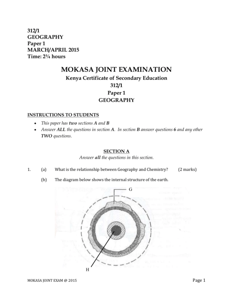
312/1 GEOGRAPHY Paper 1 MARCH/APRIL 2015 Time: 2¾ hours MOKASA JOINT EXAMINATION Kenya Certificate of Secondary Education 312/1 Paper 1 GEOGRAPHY INSTRUCTIONS TO STUDENTS This paper has two sections A and B Answer ALL the questions in section A. In section B answer questions 6 and any other TWO questions. SECTION A Answer all the questions in this section. 1. (a) What is the relationship between Geography and Chemistry? (b) The diagram below shows the internal structure of the earth. (2 marks) G H MOKASA JOINT EXAM @ 2015 Page 1 2. 3. (i) Name the parts marked G and H. (2 marks) (ii) Name the dominant mineral in the mantle. (1 mark) (a) Differentiate between absolute and relative humidity. (2 marks) (b) State the significance of humidity in the atmosphere. (3 marks) The diagram below shows some features formed by faulting. (2 marks) Y heave upthrow throw downthrow X 4. 5. (a) Name the parts marked X and Y. (2 marks) (b) State three effects of faulting on drainage of an area. (3 marks) (a) Identify two scales used to measure the intensity of an earthquake. (2 marks) (b) Give three major earthquake zones of the world. (3 marks) (a) State two ways in which plants cause weathering. (2 marks) (b) Describe the process of weathering through oxidation. (3 marks) SECTION B Answer question 6 and any other TWO questions from this section. 6. Study the map of Migwani 1:50,000 (sheet 151/1) provided and answer the following questions. (a) (i) What is the altitude of the lowest contour shown on the map? (1 mark) (ii) Give the six-figure grid reference of Mboni dam. MOKASA JOINT EXAM @ 2015 (2 marks) Page 2 (iii) (b) What is the length in Kilometres of the All Weather Road Bound Surface C94 from the junction with the Dry Weather Road D502 to Northing 84? (2 marks) Draw a rectangle measuring 10 cm by 8 cm to represent the area enclosed by Eastings 90 and 00 and Northings 62 and 70. (1 mark) On the rectangle, mark and name the following features: (i) (ii) (iii) Musengo school Road E742 Kitui Hills (3 marks) (c) 7. (i) Citing evidence from the map, identify four social services offered in Mutitu (Ndooa) township. (4 marks) (ii) Describe the relief of the area covered by the map. (d) Describe the characteristics of the long profile of river Ikoo. (a) (i) (ii) (b) (6 marks) (6 marks) Describe the following characteristics of minerals: Texture (1 mark) Tenacity (1 mark) Describe how extrusive igneous rocks are formed. (4 marks) For each of the following rocks, name the resultant rock that forms after metamorphism. (i) Sandstone (1 mark) (ii) Limestone (1 mark) (iii) Granite (1 mark) (c) Explain three economic significance of rocks in Kenya. (d) Students carried out a field study on rocks around their school. (3 marks) (i) State two importance of stating the objectives for their study. (2 marks) (ii) Give three reasons why they prepared a route map of the study area. (3 marks) MOKASA JOINT EXAM @ 2015 Page 3 8. (a) (b) (iii) Give three activities that the students where involved in during the field study. (3 marks) (i) What is an orogeny? (ii) Give two factors that influence the folding process of rocks. (2 marks) (2 marks) The diagram below shows some types of folds. Use it to answer the question (i) and (ii). F (c) (d) 9. (a) Nappe fold (i) Name the types of folds marked E and F. (2 marks) (ii) Describe how an overthrust fold is formed. (4 marks) Name the countries in which the following fold mountains are found. (i) Atlas (1 mark) (ii) Alps (1 mark) (iii) Himalayas (1 mark) (iv) Andes (1 mark) (i) Apart from fold mountains, name three other features resulting from folding. (3 marks) (ii) Explain four ways in which fold mountains influence climate. (8 marks) (i) Differentiate between a marine delta and a Lacustrine delta. (2 marks) MOKASA JOINT EXAM @ 2015 Page 4 (b) 10. (ii) Explain three conditions necessary for the formation of a delta. (6 marks) (iii) State three significance of deltas to man. (3 marks) (i) What is a braided channel? (2 marks) (ii) State four conditions necessary for the formation of a braided channel. (4 marks) (c) With the aid of well labelled diagrams, describe how an ox-bow lake is formed. (8 marks) (a) What is Karst scenery? (b) State four factors which influence the development of a karst landforms. (4 marks) (c) The diagram below shows a feature in a Karst landscape. Use it to answer question (i) and (ii). (2 marks) Y Z X (d) (i) Name the parts marked X, Y and Z. (3 marks) (ii) Describe how the features marked Y and Z are formed. (5 marks) (i) Define a lake. (2 marks) (ii) Name two types of lakes which are formed by volcanic activity. (2 marks) (iii) State three reasons why some lakes are salty. (iv) Explain four ways in which lakes are of significance to human activities. (4 marks) MOKASA JOINT EXAM @ 2015 (3 marks) Page 5


