Evidence for the Northward Drift of Britain

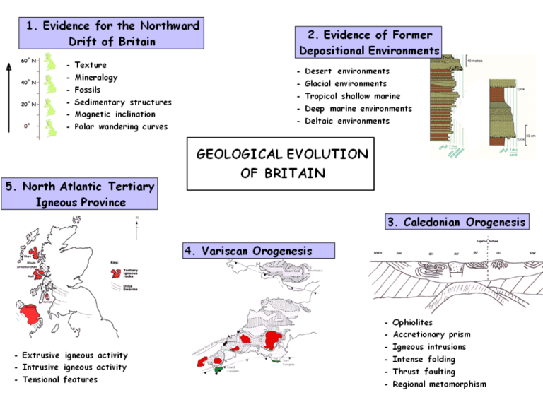
1. Evidence for the Northward Drift of Britain
Through the Phanerozoic
Rondinia
Supercontinent
Pre-Cambrian ~600 Ma
Cambrian ~550 Ma
Early Ordovician ~490 Ma
Late Ordovician-Early Silurian ~450-440 Ma
Old Red
Sandstone
Continent
Mid-Devonian ~400 Ma
Pangaea
Supercontinent
Triassic ~237 Ma
Jurassic ~195 Ma
Tertiary ~65 Ma
What is the rate (mm/year) Southern Britain has moved northwards over the last 500Ma?
•
60
°
S to 55
°
N
•
1 ° = 111km
Palaeomagnetism
Explain how magnetic inclination preserved in rocks and apparent polar wandering curves provide evidence of changes in palaeolatitude. (25)
1. Palaeomagnetism
2. Earth ’ s magnetic field
3. Magnetite in basalts
4. Erupt at surface & cool
5. Curie point
6. Align with magnetic field
7. Crystallisation
8. Magnetic inclination
9. Remnant magnetism
10. Palaeolatitude
Period Age
0
Rocks
Quaternary
Ice age deposits
Tertiary
Cretaceous
2
65
140
Crocodiles, lotus plant & laterites
Chalk – Chilterns,
North & South Downs
Oolitic Lst - Cotswolds
Jurassic
Triassic
Permian
Carboniferous tan I = 2 tan L
200
250
290
Desert sst - Eden
Valley
Desert sst - Eden
Valley
Carb lst – Pennines
Coal - Wakefield
I = angle of inclination
L = latitude
Magnetic
Inclination
69º
61º
57º
50º
50º
23º
0º tan I = tan L
2
Palaeolatitude
52º
42º
38º
31º
31º
12º
0º
“ Palaeomagnetic data is a reliable indicator of palaeolatitude.
”
Evaluate this statement.
• igneous rocks with magnetite needed (very rare in sedimentary rocks)
• doesn ’ t indicate which hemisphere
• assumes Earth ’ s magnetic field remained same over time (dipolar)
• doesn ’ t tell lines of longitude
• remanent magnetism very weak so need lots of readings for average
• re-melting/metamorphism destroys remanent magnetism
• inaccuracies caused by problems of radiometric dating of rocks
• very useful if backed up by study of sediments
Palaeomagnetic evidence suggests that during the Late
Palaeozoic (Devonian, Carboniferous and Permian), Britain drifted across the equator.
a). Describe the evidence from sedimentary rocks and fossils which suggests an equatorial climate in Britain in the Late
Palaeozoic.
b). Describe and evaluate the palaeomagnetic evidence. (25)
Define meanings & give figures. Say what you see!
Explain & give reasons for
With the aid of a labelled diagram, describe and account for the variation in heat flow across an ocean basin and an adjoining arc system.
(25)
How heat is transferred from inside the Earth to the outside
• Read & dissect the question (doing words & key words)
• Plan an outline & write out the essay question
• Use paragraphs as basic structuring unit in the essay
1. Introduction
2. Main Body
Say what you are going to do by defining your version of the title. Show you have understood every significant word of it. Define key words.
Theme of paragraph & should link with concluding sentence of paragraph above.
Topic sentence
•Paragraph 1
•Paragraph 2
• Presentation
Put the reader first.
Make it easy for them to read.
• supporting evidence
• supporting evidence
• supporting evidence
•Paragraph 3
•Paragraph 4
•Paragraph 5
•Paragraph 6
Each paragraph should be on a different aspect of the topic.
Clear & well presented.
Spelling & punctuation.
Concluding sentence 3. Conclusion
Briefly summarise the essay by referring to the title
Permo-Triassic 290 – 208 MYA
Permo-Triassic 290 – 208 MYA
Desert sst
• Grain size – medium (fine)
• Grain sorting – very well sorted
• Grain Shape – well rounded
• Grain surface - quartz frosting
• quartz (sand)
• haematite cement
• barchan sand dunes
• cross bedding
Breccio-conglomerate “ brockrams ”
•wadis
• alluvial fans
• poorly sorted/angular to sub-rounded
• Carboniferous lst clasts
Pangaea 20ºN – semi-arid/desert
Burrells Quarry,
Appleby, Vale of
Eden
Hoff Quarry, near
Appleby, Vale of
Eden
A facies (a group of rocks and structures that indicate a particular environment. e.g. cross bedded desert sst, brecioconglomerates, evaporites etc)
• evaporites/inter dune areas
• desiccation cracks
• playa lakes
• Zechstein Sea
Eden Shales,
Vale of Eden
Order of Precipitation
Calcite (CaCO
3
) – least soluble
Gypsum/Anhydrite (CaSO
4
)
Halite (NaCl)
Potassium salts
Magnesium salts – most soluble
Describe the evidence from sedimentary rocks which shows that semi-arid and desert conditions existed in the British area during the Permo-Triassic period. (25)
Introduction:
In Permo-Triassic times (~250 mya) Britain was about 20ºN of the equator in a latitude similar to that of present day North Africa.
Consequently, Britain experienced a hot arid climate, which was very different from that of today. In this essay I will show how sedimentary structures, textures, fossils and mineralogy can be used as evidence to prove this.
1. Geological background/context of essay/definitions/set the scene
2. In this essay I will …. How/what going to do in essay
3. Outline content to be covered in essay
Describe the evidence for the northward drift of the
British area from the beginning of the Carboniferous to the present day. (25)
Introduction:
In the Carboniferous period Britain was situated on the equator, and over the ensuing 300 million years has moved northwards to its present position of 50-60ºN of the equator. In this essay I will describe the evidence that proves this.
In the Carboniferous period Britain was situated on the equator, and over the ensuing 300 million years has moved northwards to its present position of 50-60ºN of the equator. In this essay I will describe how sedimentary and palaeomagnetic evidence can be used as evidence to proves this.
Paragraphs:
1,2 & 3. Sedimentary rocks – Carboniferous, Permo-Triassic, Jurassic,
Cretaceous, Tertiary & Quaternary
4. Palaeomagnetism
5. Fossils
Outline the evidence that Britain drifted north across the equator during the Late Palaeozoic. (25)
Introduction:
During Late Palaeozoic times Britain moved from a tropical equatorial region in the Carboniferous (~350 mya) to a arid desert environment 20ºN of the equator in the Permian (~290 mya). In this essay I will show how palaeomagnetism, sedimentary rocks and fossils can be used as evidence to prove this.
Paragraphs:
1. Palaeomagnetism
2. Sedimentary rocks – Carboniferous - limestones
3. Sedimentary rocks – Permian – desert sst, brecio-conglomerates & evaporites
4. Fossils
“ Sedimentary rocks and palaeomagnetic data are reliable indicators of palaeolatitude.
”
Evaluate this statement.
• Sedimentary rocks
• Palaeomagnetic data
• igneous rocks with magnetite needed (very rare in sedimentary rocks)
• doesn ’ t indicate which hemisphere
• assumes Earth ’ s magnetic field remained same over time (dipolar)
• doesn ’ t tell lines of longitude
• remanent magnetism very weak so need lots of readings for average
• re-melting/metamorphism destroys remanent magnetism
• inaccuracies caused by problems of radiometric dating of rocks
• very useful if backed up by study of sediments
2
.
1
.
3
.
5
.
4
.
Conclusion:
The rocks in Britain show evidence of climatic change throughout the Phanerozoic. Evaluate the evidence in the rock record for major climatic change in Great Britain from the Carboniferous to the present day. (25 marks)
Title:
Introduction:
Point ( Topic/first sentence) Evidence/Example/Extension Evaluation/Analysis of Evidence
Period/Age/Latitude
Carboniferous
0º Equator
Equatorial
300 Ma
Permo-Triassic
20º North
Desert
250 Ma
Jurassic &
Cretaceous
30º - 40º North
Tertiary
40º -60º North
Evidence Climate
Carboniferous lst – Pennines
Corals
Tropical shallow seas
Tropical forest/swamps
Fossil soil
Coal – Wakefield, Yorkshire
Plant fossils - Lepidodendron
Amphibians
Desert sst (well sorted, well rounded, fine sand, haematite cement, frosted grains, cross bedding) – Eden Valley
Hot desert with dunes
& wadis (flashflood canyons) leading out into alluvial fans.
Breccio-conglomerates
Mudcracks
Evaporites - Cheshire
Lack fossils
Hypersaline conditions with playa lakes, inland seas & salt pans.
Beaconites (burrows) – Kingsand,
Cornwall
Chalk – North & South Downs
Oolitic limestone – Cotswolds
Land fossils – reptiles, dinosaurs
Tropical shallow seas
Tropical forest/swamps
Plant remains – Lotus flowers in Skye
Red laterite soils
Humid & sub-tropical
Evaluation
Uniformitarianism
Coral species
Cold water lsts?
Indicates climate not latitude
Deciduous trees not evolved
Principle of
Uniformitarianism
Good evidence
Sedimentary facies – evidence needs to be taken as a whole
Implies high temp & tropical but mid latitude at time of high global temp
Implies sub-tropical but high latitude at time of high global temp
Why is it not possible to establish palaeo-longitude positions for Britain at different points through geological time?
• All places on same latitude will have similar climatic conditions
• One longitude could cross many climate types
• Rock types do not vary with longitude
• Magnetic inclination is the same along every line of latitude
• Earth ’ s magnetic field is dipolar – aligned north to south due to spin of Earth
Palaeomagnetic evidence suggests that during the Late
Palaeozoic (Devonian, Carboniferous and Permian),
Britain drifted across the equator. a). Describe the evidence from sedimentary rocks and fossils which suggests an equatorial climate in Britain in the Late Palaeozoic.
b). Describe and evaluate the palaeomagnetic evidence.
(25)


