es midterm study guide 2010
advertisement
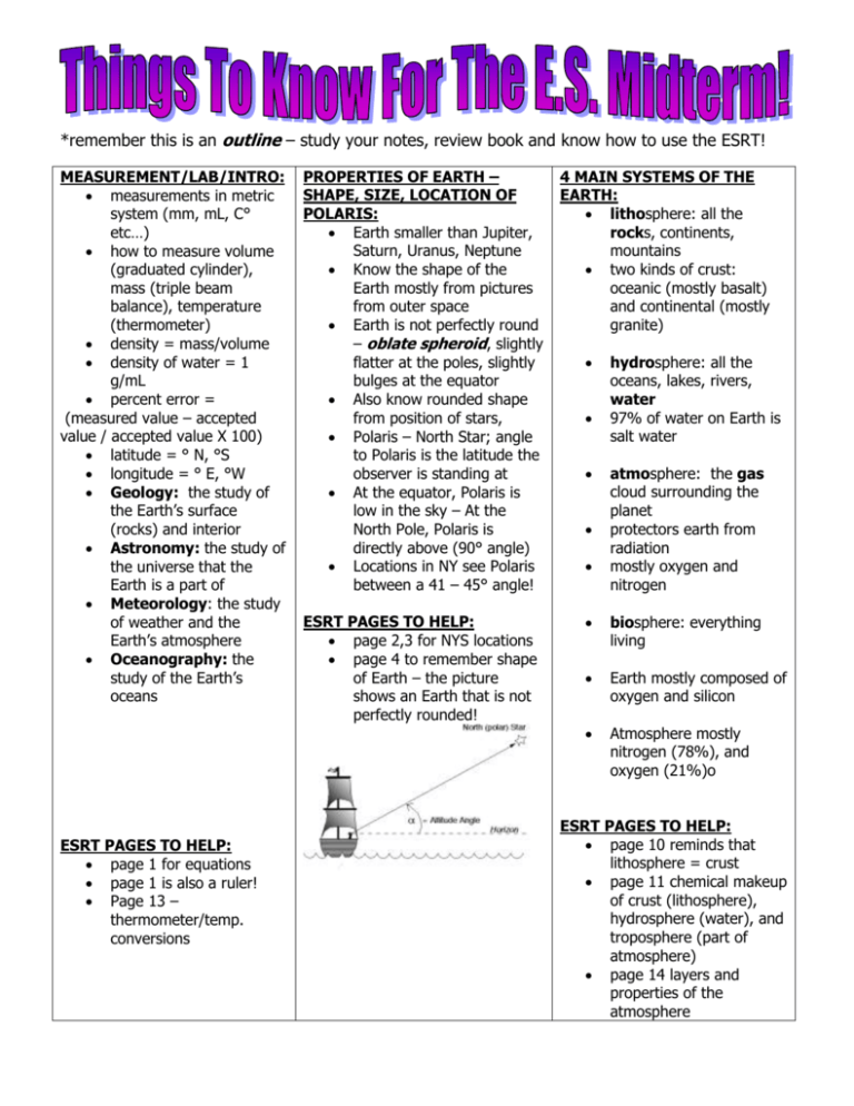
*remember this is an outline – study your notes, review book and know how to use the ESRT! MEASUREMENT/LAB/INTRO: measurements in metric system (mm, mL, C° etc…) how to measure volume (graduated cylinder), mass (triple beam balance), temperature (thermometer) density = mass/volume density of water = 1 g/mL percent error = (measured value – accepted value / accepted value X 100) latitude = ° N, °S longitude = ° E, °W Geology: the study of the Earth’s surface (rocks) and interior Astronomy: the study of the universe that the Earth is a part of Meteorology: the study of weather and the Earth’s atmosphere Oceanography: the study of the Earth’s oceans ESRT PAGES TO HELP: page 1 for equations page 1 is also a ruler! Page 13 – thermometer/temp. conversions PROPERTIES OF EARTH – SHAPE, SIZE, LOCATION OF POLARIS: Earth smaller than Jupiter, Saturn, Uranus, Neptune Know the shape of the Earth mostly from pictures from outer space Earth is not perfectly round – oblate spheroid, slightly flatter at the poles, slightly bulges at the equator Also know rounded shape from position of stars, Polaris – North Star; angle to Polaris is the latitude the observer is standing at At the equator, Polaris is low in the sky – At the North Pole, Polaris is directly above (90° angle) Locations in NY see Polaris between a 41 – 45° angle! ESRT PAGES TO HELP: page 2,3 for NYS locations page 4 to remember shape of Earth – the picture shows an Earth that is not perfectly rounded! 4 MAIN SYSTEMS OF THE EARTH: lithosphere: all the rocks, continents, mountains two kinds of crust: oceanic (mostly basalt) and continental (mostly granite) hydrosphere: all the oceans, lakes, rivers, water 97% of water on Earth is salt water atmosphere: the gas cloud surrounding the planet protectors earth from radiation mostly oxygen and nitrogen biosphere: everything living Earth mostly composed of oxygen and silicon Atmosphere mostly nitrogen (78%), and oxygen (21%)o ESRT PAGES TO HELP: page 10 reminds that lithosphere = crust page 11 chemical makeup of crust (lithosphere), hydrosphere (water), and troposphere (part of atmosphere) page 14 layers and properties of the atmosphere MAPPING THE EARTH: cartography = map making Latitude N°, S° 0° = equator, separates Earth into North and South hemispheres The North & South poles are at 90° N and S Longitude E°, W° 0° = prime meridian, runs through Greenwich, England, separates Earth into East and West hemispheres Solar time = the time determined by the sun / solar noon = when the sun is at the highest altitude In the western hemi its earlier than Greenwich, in the east its later, ex: if its noon where you live, and 5:00pm in Greenwich, you are 5 hours away, to the west! International dateline – when you cross going west (ex: from Hawaii to Australia) go a day ahead (Sunday in Hawaii Monday in Australia) if you’re moving east, (Australia Hawaii) go a day behind TOPOGRAPHIC MAPS: contour lines: show elevation differences contour intervals: the distance between each contour line gradient = change in elevation /distance isotherms = areas of same temperature connect areas of same value CONTOUR LINES NEVER SHOULD CROSS Lines going inward (hachures) show a depression (ex: volcano) Topographic profiles find the elevation of all the points that cross the line, then mark the dots on the graph lines and connect them! contour lines point up stream! MINERALS: atom = smallest part of matter (anything with size and volume) element = pure substance that can’t be broken down parts of an atom: nucleus = center, protons (+) and neutrons (0) in nucleus, electrons (-) orbit around minerals are made of natural materials, they occur naturally, have definite chemical composition, are solid, have atoms arranged in orderly patterns made inorganically meaning no plants/animals involved many form from melting material in the earth some occur when liquid containing dissolved ions evaporates, leaving the minerals behind ID Tests: color, streak, crystal shape, cleavage, fracture, Moh’s scale of hardness, acid test (for calcium carbonate), magnetism, taste, odor, specific gravity (light/heavy) Many minerals made of silicon & oxygen ESRT PAGES TO HELP: back page of reference tables! All about minerals! ROCKS: made up of minerals bound together the way they are formed determines the type of rock 3 types – igneous, sedimentary, metamorphic igneous: form from solidification of magma crystal size and texture; cooling slow crystals will grow intrusive (under ground), extrusive (above ground) mafic = dark, felsic = light Sedimentary: form from compaction and cementation of sediments may form in layers some have organic material (limestone may have shells or fossils) Metamorphic: rocks that have undergone change from heat and pressure Makes rocks more dense May show foliation (layers) and distortion Rock cycle: rocks can change through melting, heat, pressure etc… see reference tables! ESRT PAGES TO HELP: Page 6 – rock cycle Page 6 – igneous Page 6 – particle size Page 7 – sedimentary Page 7 - metamorphic EARTH’S LAYERS: inner core outer core mantle (asthenosphere) crust inner core = iron, nickel / solid outer core = probably iron, liquidy – known because S waves won’t go through mantle = plastic like, magma molten material crust = lithosphere Moho - boundary ESRT PAGES TO HELP: page 10 – all answers for the composition of the earth are on page 10!! EARTHQUAKES: happen along plate boundaries/faults point in earth where it occurs = focus point above focus = epicenter p waves = primary, first to arrive, compressional push pull, travel through everything s waves = side to side, secondary waves, second to arrive can’t travel through liquids or gases difference in arrival time of p and s waves = distance from earth quake magnitude = how damaging earthquake is, every earthquake gets 1 magnitude reading intensity = how you feel it, can be different, will be more intense closer to the epicenter ESRT PAGES TO HELP: Page 11 – travel time of P and S waves PLATE TECTONICS: Wegner’s theory – continents were all once together (Pangea) but are separating Evidence: Mesosaur fossils, rock formations, SONAR, radioactive dating Earth’s surface is composed of about a dozen large moving plates and many smaller ones Meet at boundaries / convergent – coming together / subduction zone – ocean plate goes under continental plate / transform – one slides past another / divergent – moving apart Mid Atlantic Ridge – rift zone, seafloor spreading – rocks closest to the center of the ridge are younger – they get older as you move further away (on either side – this is symmetrical) / show polarities in the rocks – “frozen in time”, normal polarity is NPole (+), SPole (-) , in times of reverse polarity NPole (–) and SPole was (+) Convection drives plate movement – magma in the asthenosphere Hot spot – movement of a plate over a constant source of magma – found central to a plate, not on a boundary, creates island chains (Hawaii), or natural phenomenon like geysers (Yellowstone) ESRT PAGES TO HELP: Page 5 – Tectonic Plates WEATHERING: chemical and physical processes that change the characteristics of rocks on the Earth’s surface environment of a rock must change / be exposed occurs when rocks are exposed to the hydrosphere (water) and atmosphere (air). Physical weathering occurs when rocks are broken in to smaller pieces without changing the chemical composition of the rock Frost action/ice wedging is the breakup of rock caused by the freezing and thawing (contracting and expansion) of water Plant action is break up of rock from plant roots Abrasion is the physical wearing down of rocks as they rub or bounce against each other Exfoliation is the peeling away of large sheets of loosened materials at the surface of a rock. Chemical weathering occurs when a rock is broken down by chemical action resulting in a change in the composition of a rock Oxidation occurs when oxygen Hydration occurs when water interacts Carbonation occurs when carbon dioxide interacts chemically with minerals. When carbon dioxide is dissolved in water, it forms weak carbonic acid. WEATHERING RATES AND SOIL: Rocks weather into sediments: boulders, cobbles, pebbles, sand, silt, clay, and colloids major products of weathering is soil soil is a combination of particles of rocks, minerals, and organic matter produced through weathering processes result of the weathering processes and biologic activity, soil horizons (layers) form climate effects weathering – heat and availability of water speed up chemical weathering chemical happens most rapidly in warm, moist climates / physical happens more in colder climates with varying temperatures harder minerals resist weathering (ex: quartz, feldspar) so they are found in sediments smaller particles weather faster – more surface area coming into contact with the weather ESRT PAGES TO HELP: page 6 – relationship of transpored particle size to water velocity remember – also gives range of particle sizes for each sediment! Vocabulary / Key Terms: Intro/Measures Earth Layers /Topo Maps Weathering density inference instrument mass measurement observation percent deviation prediction rate of change volume atmosphere contour line coordinate system crust depression elevation equator field gradient hachures hydrosphere isobars isoline isotherms latitude lithosphere longitude meridian model ozone layer pauses (atmosphere) prime meridian profile topographic map abrasion boulder carbonation chemical weathering cobble exfoliation frost wedging hydration Quakes/Tectonics asthenosphere continental crust convergent plate boundary divergent plate boundary earthquake epicenter fault focus hot spot lithosphere mantle mercali scale mid ocean ridge moho oceanic crust p waves plate tectonic theory richter scale s waves seismogram seismograph shadow zone tectonic plate transform boundary tsunami uplift volcano Rocks/Minerals banding bioclastic cementation clastic cleavage contact metamorphism crystal shape crystal structure crystalline extrusive foliation fossil fracture hardness igneous inorganic oxidation physical weathering plant action sediment soil soil horizons stream abrasion intrusive intrusive luster magma metamorphic metamorphism mineral mineral alignment organic precipitation (of minerals) regional metamorphism rock cycle sedimentary streak texture vesicular
