Levee Safety
advertisement
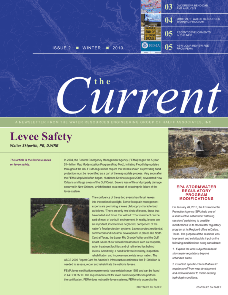
is s ue 2 WINTER 2010 03 Decordova bend dam pmf analysis 04 2010 halff water resources training program 05 recent developments in the nfiP 05 new lomr review fee from fema Current the a n e w s l e t t e r f r o m t h e w at e r r e s o u r c e s e n g i n e e r i n g g r o u p o f h a l f f a s s o c i at e s , i n c . Levee Safety Walter Skipwith, PE, D.WRE This article is the first in a series on levee safety. In 2004, the Federal Emergency Management Agency (FEMA) began the 5-year, $1+ billion Map Modernization Program (Map Mod), initiating Flood Map updates throughout the US. FEMA regulations require that levees shown as providing flood protection must be re-certified as a part of the map update process. Very soon after the FEMA Map Mod effort began, Hurricane Katrina (August 2005) devastated New Orleans and large areas of the Gulf Coast. Severe loss of life and property damage occurred in New Orleans, which flooded as a result of catastrophic failure of the levee system. The confluence of these two events has thrust levees into the national spotlight. Some floodplain management experts are promoting a levee philosophy characterized as follows, “There are only two kinds of levees, those that have failed and those that will fail.” That statement can be said of most of our built environment. In reality, levees are an important, if sometimes neglected, component of the nation’s flood protection systems. Levees protect residential, commercial and industrial development in places like North Central Texas, the Lower Rio Grande Valley and the Gulf Coast. Much of our critical infrastructure such as hospitals, water treatment facilities and oil refineries lies behind levees. Admittedly, a need for levee inventory, inspection, rehabilitation and improvement exists in our nation. The ASCE 2009 Report Card for America’s Infrastructure estimates that $100 billion is needed to assess, repair and rehabilitate the nation’s levees. FEMA levee certification requirements have existed since 1986 and can be found in 44 CFR 65.10. The requirements call for levee owners/operators to perform the certification. FEMA does not certify levee systems; FEMA only accredits the continued on page 2 EPA Stormwate r Regulatory program modifications On January 26, 2010, the Environmental Protection Agency (EPA) held one of a series of five nationwide “listening sessions” pertaining to possible modifications to its stormwater regulatory program at its Region 6 office in Dallas, Texas. The purpose of the sessions was to present and solicit public input on the following modifications being considered: 1. Expand the area subject to federal stormwater regulations beyond urbanized areas. 2. Establish specific criteria that would require runoff from new development and redevelopment to mimic existing hydrologic conditions. continued on page 2 continued from page 1 Levee Safety certification information, provided it meets 44 CFR 65.10. Otherwise, the area that the levee provides protection for would be mapped as floodplain (Zone AE). are being developed in such areas as failure resistant design, monitoring and flood warning/evacuation, to name a few. The National Levee Safety Act, part of the 2007 Water Resources Development Act, was passed by Congress, and directs the US Army Corps of Engineers (USACE) to prepare a national levee inventory and increase the levee inspection program. The USACE inspects about 2,000 levee systems (14,000 miles of levees) for federally built and well maintained, locally built projects that are a part of the federal Rehab and Inspection Program (RIP). In addition, it is estimated that perhaps another 80-90,000 miles of non-federal levee systems exists and will come into the inventory and inspection program in the future. The inventory and inspection has not been fully funded to date. This is a critical first step in addressing national levee issues. One significant result of the changes to the USACE levee inspection program is that, to date, approximately 240 levee systems across the country have received “Unacceptable” ratings as a result of USACE inspections. This can have a number of significant impacts to locals. The levee system is then in risk of being downgraded to Inactive in RIP. This can result in the system no longer being eligible for federally funded rehabilitation under PL 84-99. This can also trigger loss of FEMA accreditation of the current levee certification. Consequences of this include conversion of the area from “Protected by Levee” to Flood Hazard status which triggers mandatory flood insurance purchase and likely reduces property values potentially leading to business relocation and job loss. Efforts by locals to restore certification to these systems can be very expensive and time consuming. A number of initiatives are being developed across the nation in attempts to address the issues discussed above. The National Association of Flood and Stormwater Management Agencies (NAFSMA) is active on a number of fronts and has co-sponsored several conferences and summits aimed at the development of a meaningful and achievable national levee policy. The Levee Issues Alliance has recently formed and is working to “fashion legislation to instill appropriate flexibility and cost effectiveness into the levee inspection and certification process, while ensuring local sponsor compliance with national flood protection and public safety requirements.” One specific goal of the Alliance is to provide local levee system operators adequate time to correct deficiencies as they become known, prior to the issuance of flood maps showing the levee protected areas as flood hazard. The Association of State Floodplain Managers supports a higher design standard for levees and recommends them as a flood protection measure “of last resort.” The American Council of Engineering Companies is tackling the liability issues associated with the levee certification process. One positive outcome of the events mentioned above is the heightened awareness for levee safety and more effective communication of flood risk. In addition, the need for better hydrologic, hydraulic and geotechnical data associated with river and coastal levee systems has been recognized as essential to determining true flood risk in these areas. Also, research needs have been identified and improved safety measures Upcoming levee safety segments will include levee safety research and a case history regarding certification and rehabilitation efforts of a small district in Texas. Halff Associates continues to follow activities on all of these fronts. Halff has long been involved with levees throughout Texas from a design, operations, maintenance, permitting and certification standpoint. Since 2005, five levee systems have been certified by Halff. In our role as study contractor for FEMA Region VI, we also provided advice and assistance with the certification of numerous other levee systems both throughout Texas. u continued from page 1 EPA Stormwater regulatory program modifications 3. Develop a single set of consistent requirements for Phase I and Phase II MS4s. 4. Require MS4s to address stormwater discharges in areas of existing development through retrofitting of the storm sewer system, drainage area, or individual structures with improved stormwater control measures. 5. Include additional changes to the stormwater regulations in special sensitive areas (i.e Chesapeake Bay). The Dallas session was well attended by developers, contractors, municipalities, professional organizations, engineers, and consultants from across Texas and surrounding states. EPA staff began with an overview of the current stormwater program and a summary of the proposed modifications. Attendees were then allowed to make oral presentations, expressing concerns over a range of potential issues such as increased construction and maintenance costs, imbalanced focus on new development vs. existing development, and national “one size fits all” regulations without regard for regional climate, geology, and topography. Discussions regarding the EPA’s proposed modifications to the stormwater regulatory program are scheduled to continue through 2010 with final adoption of the modifications planned for late 2012. For additional information regarding EPA’s proposed rulemaking and options for providing the EPA with your comments, visit their website at http://www.epa.gov/npdes/stormwater/rulemaking. u DeCordova Bend Dam PMF Analysis Andrew Ickert, PE, CFM Halff recently completed a probable maximum flood (PMF) analysis at DeCordova Bend Dam (Lake Granbury) for the Brazos River Authority (BRA). DeCordova Bend Dam is located on the Brazos River mainstem near the city of Granbury, Texas, at river mile 542.5. Total drainage area to the dam is approximately 25,680 square miles, of which approximately 9,566 square miles are non-contributing. Morris Sheppard Dam (Possum Kingdom Lake), another BRA project, is located along the Brazos River mainstem approximately 145 river miles upstream of DeCordova Bend Dam. The PMF analysis was completed in accordance with the Texas Commission on Environmental Quality (TCEQ) Dam Safety Program guidelines as outlined in the Texas Administrative Code and the Hydrologic and Hydraulic Guidelines for Dams in Texas, published in January 2007. A HEC-HMS hydrologic model was developed for the 16,000 square mile contributing watershed with 86 sub-basins. An unsteady HEC-RAS model was developed for dynamic mainstem and major tributary routing, as well as routing through Possum Kingdom Lake and Lake Granbury. In total, more than 690 river miles were included in the unsteady HEC-RAS model. The HMR-52 computer program was used in conjunction with the HEC-HMS and HEC-RAS models to determine the critical PMF centering location, size, and storm orientation. One change from the traditional HMR-52 report methodology documented in the TCEQ Hydrologic and Hydraulic Guidelines for Dams in Texas is related to the temporal distribution of the total rainfall depths. The new TCEQ temporal distributions are front-end loaded with most of the rainfall occurring in the early portion of the storm. The traditional HMR-52 recommended temporal cumulative distribution is typically S-shaped with the highest intensity rainfall occurring near the middle of the storm duration. The new TCEQ temporal distribution was developed in an attempt to reduce the conservatism of the PMF by reducing the peak portion of the rainfall event. However, for large sub-basins and fairly high constant loss rates (sandy West Texas soils), the computed runoff volume and peak flows associated with the PMF event using the TCEQ distribution were significantly higher than the traditional HMR-52 S-shaped temporal rainfall distribution. Halff is currently working on a dam breach analysis and GIS-based inundation mapping task for BRA at and below DeCordova Bend Dam. u Didjaknow? The U.S. Army Corps of Engineers Hydrologic Engineering Center (HEC) has released the official versions of GeoHMS and GeoRAS for ArcGIS 9.2 and 9.3. The latest installs can be downloaded from the HEC site at http://www.hec.usace.army.mil. 2010 Training Progra Halff is currently making plans for our 2010 Water Resources Training Program—and we need your input. We are considering, if demand exists, one or more of the following courses: Basic HEC-RAS (3-day) Advanced HEC-RAS (3-day) Unsteady HEC-RAS (3-day) Basic HEC-HMS (3-day) Intro to HEC-ResSIM (3-day) HEC-GeoRAS (1-day) HEC-GeoHMS (1-day) Introduction to GIS (½ day) Introduction to Geoprocessing Tools within ArcGIS (½ day) Introduction to Terrain Building in ArcGIS (½ day) Stream Stability with Dr. Peter Allen (1 day) Detention Ponds SWAT Assessment Are you looking for something more customized for your organization or agency? In addition to our classes offered at Halff, in 2009 we hosted many “customized courses” for organizations and agencies. These courses include specific material tailored to your needs and course registration is limited to your staff. Please include your specialized training needs in your survey response. We would greatly appreciate your input regarding preferred classes, location and date. Please take this very short survey… Click Here! http://www.surveymonkey.com/s/NVKC89V These classes are intended primarily for government employees in cities, counties, local, state and federal agencies, river authorities, etc. and we try to provide a reduced course fee, compared to available courses by others. Please contact Jessica D. Baker, PE, CFM with any questions or training needs at (214) 217-6692 or jbaker@halff.com. hec-HMS Fast Tip Chris Riley, PE, CFM & Tips Tricks The US Army Corps of Engineers (USACE) Hydrologic Engineering Center has released an updated version of HEC-HMS. Version 3.4 now has the capability of using the USACE Fort Worth District Urbanization Curves also known as the “NUDALLAS” methodology. This option allows the user to directly input the parameters used for the Fort Worth method of determining the lag time for the Snyder’s unit hydrograph transform. This method uses percent sand derived from soil data, percent urbanization derived from land use data as well as some geometric characteristics of the sub basin and flow path. The regional equations are then used to calculate the basin lag time. The user is still responsible for assigning the peaking coefficient. This Fort Worth District method is preferred by the USACE for many of the projects being conducted in Central Texas. More information on this subject can be found in Chapter 7 of the HEC-HMS User’s Manual v3.4. u Recent Developments in the National Flood Insurance Program (NFIP) John Ivey, PE, CFM The NFIP has been authorized through February 28, 2010 so look for Congress to authorize another extension and possibly introduce a 2010 NFIP Reform Bill. The 2008 NFIP reform legislation was passed separately by the House and Senate in December 2008 but never finalized into law. Utilization of the new FEMA Elevation Certificate becomes mandatory April 1, 2010. Copies of the new Elevation Certificate and other FEMA forms can downloaded from the FEMA website at http://www.fema.gov/nfip/forms.shtm; • FEMA Form 81-31, Elevation Certificate and Instructions; • FEMA Form 81-65, Floodproofing Certificate • FEMA Form 81-92, MT-EZ, Application Form for Single Residential Lot or Structure Amendments to National Flood Insurance Program Maps; • FEMA Form 81-87, MT-1, Application Forms for Conditional and Final Letters of Map Amendment and Letters of Map Revision Based on Fill; • FEMA Form 81-89, MT-2, Application Forms for Conditional and Final Letters of Map Amendment and Letters of Map Revision Based on Fill; and • Standard Flood Hazard Determination form Excellent website sources exist for NFIP and Floodplain Management information including: Association of State Floodplain Managers . . . . www.floods.org Flood Smart . . . . . . . . . . . . . . . . . . . . . . . www.floodsmart.gov FEMA . . . . . . . . . . . . . . . . . . . . . . . . . . . . . . . . . www.fema.gov New LOMR Review Fee Cindy Mosier, PE, CFM On December 14, 2009, the Federal Emergency Management Agency (FEMA) published a notice in the Federal Register announcing that the fee schedules for processing certain types of requests for changes to National Flood Insurance Program (NFIP) maps, Flood Insurance Study (FIS) technical and administrative support data and NFIP map and insurance products are changing. The revised fee schedules are effective for all requests dated January 13, 2010 or later. Changes to the fee schedules will enable FEMA to more fully recover the costs associated with processing these requests. For more information regarding the new fees, please visit FEMA’s Flood Hazard Mapping website at http://www.fema.gov/plan/prevent/fhm/frm_fees.shtm, to view or download the Federal Register notice. u Dates check these impo rtant 3-5 March 2010 TWCA Annual Conference Dallas, Texas www.twca.org 15-19 March 2010 Flood safety week www.floodsafety.noaa.gov 30 March 2010 TFMA North texas 2nd event jbaker@halff.com 7 April 2010 TWDB Floodplain seminar Halff richardson office jbaker@halff.com 11-13 April 2010 ASCE Texas section spring meeting in Austin, texas www.texasce.org 29 April 2010 same dallas post—water resources intiaitives day www.same.org/dallas 16-21 May 2010 asfpm annual conference oklahoma city, oklahoma www.floods.org 7-10 June 2010 TFMA 2010 spring conference fort worth, texas www.tfma.org 9-11 June 2010 TWCA mid-year conference south padre island, texas www.twca.org 23-26 June 2010 tpwa annual conference grapevine, texas www.tpwa.org

