Agroforestry operational plan - Forestry Commission Scotland
advertisement
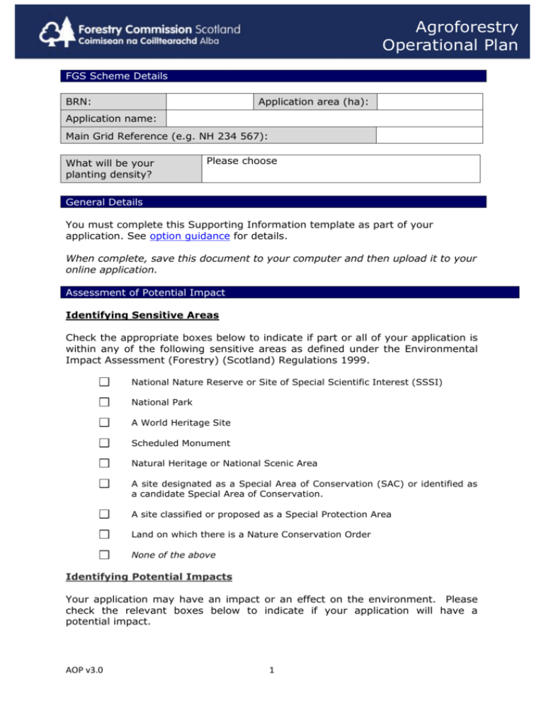
Agroforestry Operational Plan FGS Scheme Details BRN: Application area (ha): Application name: Main Grid Reference (e.g. NH 234 567): What will be your planting density? Please choose General Details You must complete this Supporting Information template as part of your application. See option guidance for details. When complete, save this document to your computer and then upload it to your online application. Assessment of Potential Impact Identifying Sensitive Areas Check the appropriate boxes below to indicate if part or all of your application is within any of the following sensitive areas as defined under the Environmental Impact Assessment (Forestry) (Scotland) Regulations 1999. National Nature Reserve or Site of Special Scientific Interest (SSSI) National Park A World Heritage Site Scheduled Monument Natural Heritage or National Scenic Area A site designated as a Special Area of Conservation (SAC) or identified as a candidate Special Area of Conservation. A site classified or proposed as a Special Protection Area Land on which there is a Nature Conservation Order None of the above Identifying Potential Impacts Your application may have an impact or an effect on the environment. Please check the relevant boxes below to indicate if your application will have a potential impact. AOP v3.0 1 Agroforestry Operational Plan People: Does your application have an impact or an effect on neighbouring properties or local communities? Archaeology: Does your application have an impact or an effect on a Scheduled or Unscheduled Monument? Soil: Does your application have an impact or an effect on the physical structure of soil or include deep peats (defined as peat greater than 50cm in depth)? Flora: Does your application have an impact or an effect on high value habitats such as those listed on the Scottish Biodiversity List? For example: Lowland Raised Bog. Landscape: Does your application have an impact or an effect on areas of national landscape importance such as National Parks, National Scenic Area, or Designed landscapes? Fauna: Does your application have an impact or an effect on wildlife. For example: European Protected Species such as Hen harrier? Access: Does your application have an impact or an effect on local transport networks such as public highways? Recreation: Does your application have an impact or an effect on any existing recreational facilities such as way-marked footpaths? Water: Does your application have an impact or an effect on any water bodies or water supplies? Land use Balance: No impact Does your application have an impact or an effect on prime agricultural land (defined as land use classes 1,2 and 3.1), or the local land use balance with agriculture? You should refer to the ‘Guidance About Woodland Creation on Agricultural Land’ located on Woodland Expansion Advisory Group (WEAG) web page for further details. There will be no effects or impacts on any of the above. Explaining the Potential Impacts If you have ticked any of the boxes in the section above (‘Identifying Potential Impacts’), then please explain below what impact or effect the work described in your application may have. Mitigating the Potential Impacts Having identified the factors that will have an impact or effect on the site give details of the actions you will take to mitigate these impacts or effects (refer to Annex 1). AOP v3.0 2 Agroforestry Operational Plan Site Assessment For each compartment that you intend to plant, please give a description of the site. Include soil types, topography, and indicate how the tree species you have chosen are silviculturally appropriate. Management Operations Describe any ground preparation method(s) you will use. Identify all existing watercourses on a map and detail any new drainage networks that are proposed. Provide any further details relating your application, for example, if the protection used will vary from that specified. Provide details of your planned maintenance schedule. Please complete the table. List each tree species to be planted and provide a breakdown of the area for each species. Map identifier Tree species to be planted Area by species Total Area (ha) Maps Required You must submit maps with your application. Please read the general mapping guidance prior to submitting your maps. Please include a map(s) that shows: AOP v3.0 3 Agroforestry Operational Plan the perimeter of the application area the planned species composition watercourses and drains, if required Information / Document Checklist Ensure that you have provided all of the necessary information required for your application. Please mark the box if the following items have been provided: Required information – this information must accompany your Agroforestry application: Map(s) of the perimeter of the application area Map(s) that show the planned species composition Other information Map(s) that show watercourses and drainage Farm Environment Assessment Grazing Management Plan We suggest that you use the following format for saving all of your related documents so that they are easily identifiable, for example: Agroforestry [your application name] boundary map.pdf AOP v3.0 4 Agroforestry Operational Plan Annex 1 Assessment of Potential Impact If you have identified the factors that will have an effect or an impact on the site give detail about how you will mitigate against any adverse impacts: People: Detail any discussions which you have had with neighbours, local communities or other stakeholders and explain how this has influenced your application. Archaeology: Indicate what survey work has been undertaken and describe how archaeology will be protected. Soil: Provide an accurate assessment of the soil on site and describe how you will manage the quality of the soil. Flora: Detail the nature and extent of high value habitats and describe how you will protect these habitats. Landscape: Provide details of how the impact on the landscape has been assessed and how the application has been designed to minimise any impact. Fauna: Detail the nature of the likely impacts on wildlife from your activities and how you will mitigate these impacts. Access: Detail the nature of the likely impacts on access from your activities and how you will mitigate these impacts. Recreation: Detail the nature of the likely impacts on recreation from your activities and how you propose to protect or enhance them. Water: Detail the nature of the likely impacts on water bodies or water supplies from your activities and how you will mitigate these impacts Land use balance: Detail the nature of the likely impacts on agriculture from your activities and how you will mitigate these impacts and integrate with forestry. You should refer to the ‘Guidance About Woodland Creation on Agricultural Land’ located on Woodland Expansion Advisory Group (WEAG) web page for further details. AOP v3.0 5
