- Covenant University Repository
advertisement
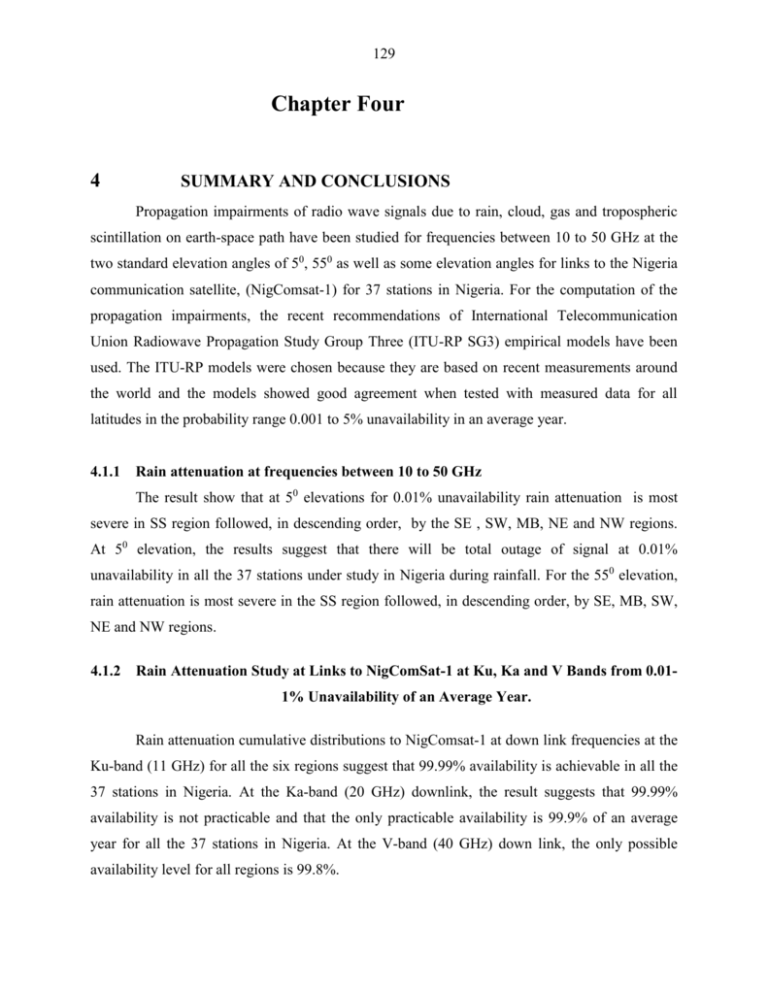
129 Chapter Four 4 SUMMARY AND CONCLUSIONS Propagation impairments of radio wave signals due to rain, cloud, gas and tropospheric scintillation on earth-space path have been studied for frequencies between 10 to 50 GHz at the two standard elevation angles of 50, 550 as well as some elevation angles for links to the Nigeria communication satellite, (NigComsat-1) for 37 stations in Nigeria. For the computation of the propagation impairments, the recent recommendations of International Telecommunication Union Radiowave Propagation Study Group Three (ITU-RP SG3) empirical models have been used. The ITU-RP models were chosen because they are based on recent measurements around the world and the models showed good agreement when tested with measured data for all latitudes in the probability range 0.001 to 5% unavailability in an average year. 4.1.1 Rain attenuation at frequencies between 10 to 50 GHz The result show that at 50 elevations for 0.01% unavailability rain attenuation is most severe in SS region followed, in descending order, by the SE , SW, MB, NE and NW regions. At 50 elevation, the results suggest that there will be total outage of signal at 0.01% unavailability in all the 37 stations under study in Nigeria during rainfall. For the 550 elevation, rain attenuation is most severe in the SS region followed, in descending order, by SE, MB, SW, NE and NW regions. 4.1.2 Rain Attenuation Study at Links to NigComSat-1 at Ku, Ka and V Bands from 0.011% Unavailability of an Average Year. Rain attenuation cumulative distributions to NigComsat-1 at down link frequencies at the Ku-band (11 GHz) for all the six regions suggest that 99.99% availability is achievable in all the 37 stations in Nigeria. At the Ka-band (20 GHz) downlink, the result suggests that 99.99% availability is not practicable and that the only practicable availability is 99.9% of an average year for all the 37 stations in Nigeria. At the V-band (40 GHz) down link, the only possible availability level for all regions is 99.8%. 130 4.2 Cloud Attenuation at Frequencies Between 10 to 50 GHz At 50 and 550 elevation angles the results suggest that cloud attenuation will be more severe in SE region followed, in descending order, by the MB, NE, NW, SW, and SS regions. 4.2.1 Cloud Attenuation Study at links to NigComSat-1 at Ku and Ka from 0.011% Unavailability of an average year. The results of cloud attenuations for 0.01% to 10% unavailability at links to NigComsat-1 at Ku (11 GHz), Ka (20 GHz), and V-band (40 GHz) down link frequencies show that 99.99% availability will be possible in all the 37 stations in Nigeria. These results show consistently that cloud attenuation is generally higher in the SW region and very low in the NW region of Nigeria and that at V-band cloud attenuation will become a concern on earth-space path in the SW region. 4.3 Gaseous Attenuation Study at 1% Unavailability for Frequencies Between 10 to 50 GHz The results of gaseous attenuations at 1% unavailability of an average year at the 37 stations shows that at 50 and 550 elevations, gaseous attenuation was highest in the SS region followed, in descending order, by the SW, SE, MB, NE and NW regions. 4.3.1 Gaseous Attenuation Study at links to NigComSat-1 at Ku, Ka and V Bands for 1% Unavailability of an Average Year at the 37 Stations. The results of gaseous attenuation for 1% unavailability of an average year at Ku, Ka, and V bands for links to NigComsat-1 at the 37 stations suggests that 99% availability is possible and that gaseous attenuation are negligible at Ku, Ka (uplink and downlink) and at V band downlink frequencies in all the 37 stations. At V-bands uplink gaseous attenuation became very significant as gaseous attenuation is between 1.69 and 2.14 dB. For link to NigComsat-1 the results also revealed that gaseous attenuation is highest in Ikeja (the SW region) followed, in descending order, by Calabar (SS), and Enugu (SE), Ilorin (MB), Kano (NW) and Damaturu (NE) regions. 4.4 Tropospheric Scintillation Study at 0.01% Unavailability in an Average Year at Frequencies between 10 to 50 GHz The results of tropospheric scintillation fade depth at 0.01% unavailability of an average year at 50 and 550 elevation angles show that scintillation fade depth will be most severe in Calabar (the SS region) followed, in descending order, by Ikeja (SW), Abakaliki (SE), Abuja (MB), Dutse (NE) and Katsina (NW) regions. 131 4.4.1 Scintillation Fade Depth Study at links to NigComSat-1 at Ku, Ka and V Bands for 0.01 to 10% Unavailability of an Average at 37 Stations in Nigeria. Scintillation fade depth for downlink from NigComsat-1 at Ku, Ka and V-bands show that tropospheric scintillation will not be a serious concern and that 99.99% availability of signal is possible at all the 37 stations. The results for downlink to NigComsat-1 at all the three bands show that scintillation fade depth is highest in Ikeja (the SW region) followed, in descending order, by Calabar (SS region), Enugu (SE region), Jos and Abuja (MB), Damaturu and Bauchi (NE) and Sokoto (NW) regions. 4.5 Combined Attenuation Study at 0.01% Unavailability of an Average Year for Frequencies Between 10 to 50 GHz The result of combined attenuation for 50 elevation suggests that 99.99% availability is most unlikely, and there will be a total fade out of signals at very low elevation angles. At 550 elevation angle the results suggest that at frequencies between 10 to 14 GHz, 99.99% availability is possible in all the 37 stations. At both elevation angles the results show that combined propagation impairments along earth-space path is very high in Abakaliki (the SE region) followed, in descending order, by Uyo (SS), Ikeja (SW), Markudi (MB), Maiduguri (NE) and Katsina (NW) regions. 4.5.1 Results of Combined Attenuation Study at Ku, Ka and V-bands for Downlinks from NigComsat-1 at 0.01 to 10% Unavailability in an Average Year at the 37 stations At the Ku downlink from NigComsat-1, the results suggest that 99.99% availability of signals is possible at all the 37 stations. At the Ka downlink the only possible availability for all the 37 stations is 99.9% of an average year. For the V-band downlink the results suggest that 99.7% availability might be unrealistic and that the most reliable availability for all the 37 locations will be 99.6% in an average year. The combined propagation impairment on earthspace path for downlink from NigComsat-1 at the 37 stations show that combined attenuation is highly severe in Calabar and Yenagoa (the SS region) followed, in descending order, by Owerri (SE) , Ibadan (SW), Jos (MB), Damaturu (NE) and Katsina (NW) regions. Table 4.1 summaries the results of all propagation impairments for all the six regions in Nigeria. 132 Table 4.1: Summary of all Propagation Impairments in Nigeria by Region from 10-50GHz. Regions Rain South-West South-East South-South Middle-Belt North-West North-East 4.6 Impairments Levels Cloud Gases Scintillations Combined High Low Very High Very High High Very High Highest High High Highest Highest Lowest Highest Highest Very High Medium Very High Medium Medium Medium Lowest Medium Lowest Lowest Lowest Low High Low Low Low Conclusion and Recommendations The knowledge of various propagation impairments such as rain, cloud, gas and tropospheric scintillation and the combined effects is of ultimate importance for fixed satellite communication service at frequencies above 10 GHz for planning, budgeting and predicting the transmission and reception of radio waves signals on earth-space path. The present studies indicate the significance of the influence local and regional climatic factor on microwave signals on earth-space path. The predicted attenuations show the various effects of local weather on propagation of radiowave signals for major cities in Nigeria. The results suggest that the southern part of Nigeria experience the highest propagation impairment while the Northern part experience less impairment. Overall, Sokoto and Katsina appear as good locations to site fixed satellite earth stations (operating at Ku band and above) for deep space exploration as the results obtained showed consistently that the two locations are less affected by all propagation impairments investigated. Secondly, for a complete understanding and local modeling of various propagation parameters relevant to the study of impairments of radio waves signals in the earth-space path at the 37 stations, it is recommended that an Agency be set up to fund propagation research by providing necessary instrumentation such as: satellite beacons (receivers), radiometers, distrometers and Automatic weather station for radio scientists at each of the 37 stations to 133 measure propagation impairments on earth-space path monitored from the recently launched Nigeria communication satellite (NigComsat-1). NigComsat-1 has a life span of 15-year, a period long enough for the accumulation of propagation data for the country to produce its own local propagation models. This will help in quick integration and expansion of telecommunication services in Nigeria. It will also help in the assessment of the standards of telecommunication equipment shipped into the country. 134 REFERENCES Adejuwon, J.O., Balogun E.E., and Adejuwon S.A., (1990), On the Annual and Seasonal Patterns of rainfall fluctuations in sub-saharan West Africa. Int. J. Climatology. 10:839848. Adejuwon, J.O. (2005), Food crop production in Nigeria: I. Present effects of climate variability, Clim.Res. 30:53-60 Adeyewa, Z.Debo, and Kenji Nakamura (2003), Validation of TRMM Radar Data Over Major Climatic Regions in Africa, J. App Met, , America Metrological Society. Adimula, I.A., Ajayi, G.O. (1996), Variation in raindrop size distribution and specific attenuation due to rain in Nigeria, Ann. Telecom., Vol. 51, No.1-2, 87-93. Ajayi G. O and R. L Olsen, (1985), Modeling of a raindrop size distribution for microwave and millimeter wave applications Radio Sci., vol. 20, No. 2, pp. 193-202. Ajayi, G.O. (1989), Physics of the Tropospheric Radio propagation, International Centre for Theoretical Physics, Miramare Trieste, Italy Internal Report IC/89/23. Ajayi, G.O., (1993), Rain intensity and raindrop size measurements in Nigeria, International Centre for Theoretical Physics, Miramare Trieste, Italy. Ajayi, G.O., Ezekpo, S.U.B (1988), Development of climatic maps of rainfall rate and attenuation for microwave applications in Nigeria, The Nigerian Engineering 23, No.4, pp. 13-30, Ajayi G. O., Feng, S., Radicella, S. M, Reddy B. M, (1996), Hand Book on Radio propagation Related to satellite communications in Tropical and Subtropical countries UNESCO and ICTP, U. R. S. I Standing committee on developing countries. Ajewole, M.O (1997), Scatering and attenuation of centimeter and millimeter radio signals by tropical rainfall. Ph. D thesis, Federal University of Technology Akure Nigeria (Unpublished) Ajewole M.O, L.B Kolawole and G.O Ajayi (1999), Cross polarization on Line – of – sight Links in a Tropical location: Effect of the Variation in canting Angle and Rain drop size 135 distribution. IEEE transaction on antennas and propagation. Vol 47, No 8. pp 12541259 Allnutt, J.A, (1989), Satellite – to – ground Radiowave Propagation Theory, Practice and System Impact above 1GHz, IEE Electromagnetic wave series 29. Altshuler, E.A, (1984), A simple expression for estimating attenuation by fog at millimeter Wavelengths, IEEE Trans. Ant. Prop., AP-32 (7). Asoka, D., Jeremy, A., and Fatim, H., (2002), A Prediction Model that Combines Rain Attenuation and Other Propagation Impairments along Earth-Satellite paths, Journal of Space Communication Issue No. 2. Battan, L. J. (1973), Radar observation of the atmosphere Univ. of Chicago press Chicago, IL. Bowman, M. R., Eastment, J. D., and Hall, M. P. M. (1997), Results from clear-air propagation studies on Franco-UK paths at 1.3 and 11 GHz, IEE Proc. Part H, Microwave Antennas Propag., 144(4), 267–273. Brussaard, G., Dijk, J. and Wijdemans, L. (1993), 11 GHz satellite Beacon Data in the Western Pasific Basin, final report INTELSAT 770-B, Eindoven University of Technology and Surabaya Institute of Technology. Castanet, L., (2001), Comparison of Various Methods for Combining Propagation Effects and Predicting Loss in Low-Availability Systems in the 20-50 GHz Frequency range, Int. J. Satell. Commun, vol 19, 2001, pp 317-334 César Amaya, (2002), Impact of Clouds and Gases on SATCOM Links at Ka and EHF Bands, American Institute of Aeronautics and Astronautics Report AIAA-2002-1953. Chandrasekhar, S. (1960), Radiative Transfer, Dover Publications, New York. Chieko Ito and Yoshio Hosoya, (2002), The Thunderstorm ratio as a regional Climatic parameter: Its effects on different-integration-time rain rate conversion, rain attenuation, site-diversity and rain depolarization. The proceedings of URSI 2002, GA02 paper P0181. Dicke, R.H., (1946), The measurements of thermal radiation at microwave frequencies, Rev. Sci. Instr., Vol. 17, 268-275. Dicke, R.H., Beringer, R., Kuhl, R. L. and Vane, A. B. (1946), Atmospheric Absorption Measurements with a Microwave Radiometer, Phys. Rev. Vol. 70, 340-348. 136 Dissanayake, A.W., Allnutt, J. E Haidara, F. A., (1997), Prediction Model that Combines Rain Attenuation and Other Propagation Impairments along Earth-Satellite Paths, IEEE Trans. Ant Prop., 45, 1546-1558. Edward, E.A., and Richard, A.M., (1988), A Comparison of Experimental and Theoretical values of Atmospheric Absorption at the Longer Millimeter Wavelengths, IEEE Trans. Ant Prop.,Vol. 36, No, 10. Edward, E.A., and Richard, A.M. (1989), Cloud Attenuation at Millimeter Wavelengths, IEEE Trans. Ant Prop.,Vol. 37, No, 11 November. Feldhake G., (1997), Estimating the attenuation due to combined atmospheric effects on modern Earth-space paths, IEEE Antennas and Propagation Magazine, Vol. 39, No. 4. Gibson J. D. (ed) (2002), The Communication Handbook, second edition, CRC Press, LCC, 59-1 to 59-16, 2002. Gloaguen, C., and Lavergnat, J., (1996), Attenuation due to hydrometeors at 94 GHz: Experimental results and comparison with theory, IEE Proc. Part H, Microwaves Antennas Propag., 143(1), 79–86. Goldhirsh, J., Krichevsky, V. and Gebo, N. E., (1992), Rain rate statistics and fade distributions at 20 and 30 GHz derived from a network of rain gauges in the mid-Atlantic coast over a five-year period, IEEE Trans. Antennas Propag., 40(11), 1408–1415. Green .J.L, Winkler, R.H., Warnock, J.M., Clark, W.L., Gage, K.S., and Van Zandt T.E., (1978), Observation of enhanced clear air turbulence associated with convective clouds, Proc. 18th Conf. Radar Meet. Gunn, R. and Kinzer, G.D., (1949), The terminal velocity of fall for water droplets in stagnant air, J. of Meteorolgy, Vol. 6. P 243-248. Haddon, J., Vilar, E., (1986), Scattering Induced Microwave Scintillation from Clear Air and Rain on Earth-Space Paths and the Influence of the Antenna Aperture, IEEE Trans. Ant. Prop., Vol.34, No.5, 646-657. Harris, R.A. (editor in chief, 2002), COST Action 255, Radiowaves propagation modeling for SATCOM services at Ku-Band and above, European Space Agency publication Division Noordwijk, Netherlands. Huffman.G.J., Alder, R.F., Rudolf, B., Schneider, U., and Keehn, P.R., (1995), Global 137 precipitation estimates based on a technique for combining satellite-based estimates, rain gauge analysis, and NWP model information, J. Climate, 8, 1284-1295. Ippolito, L.J, (1986), Propagation Effect Handbook for Satellite Systems Design, A Summary of Propagation impairments on 10 – 100GHz Satellite links with techniques for system design, NASA Reference Publication 1082(04). Ishimaru, A., (1978), Wave Propagation and Scattering in Random Media, Vol. 1, 2, Academic Press, New York. ITU-R; Recommendation P.840 (1999), Attenuation due to Clouds and Fogs. ITU-R; Recommendation P.839 (2001), Rain height Model for Prediction methods. ITU-R; Recommendation P.453 (2003), The radio refractive index: its formula and refractivity data ITU-R; Recommendation P.618 (2003), Propagation data and prediction methods required for the design of Earth-space telecommunication system. ITU-R; Recommendation P.837 (2003), Characteristics of Precipitation for propagation Modeling. ITU-R; Recommendation P.676 (2005), Attenuation by atmospheric gases. ITU-R; Recommendation P.838 (2005), Specific attenuation model for rain used in prediction methods. Joseph, J.H, Wiscombe, W.J. and Weinman, J.G. (1976), The Delta-Eddington Approximation for radiative flux transfer, J. Atmosph. Sci. 33, 2452-2459. Joss, J., Thams, J.C and Waldvogel, A., (1968), The variation of raindrop size distribution at Lorcano, Switzerland, Proc. Int. Conf, on cloud Physics Toronto, Canada, 369-373. Kasarawa, Y., Yamada, M., Allnutt, J.E., (1988), A New Prediction Method for Tropospheric Scintillation on Earth-Space Paths, IEEE Trans. Ant. Prop., Vol 36, No 11, 1608-1614. Kirchhoff G., (1860), Über das Verhältnis zwischen dem Emissionsvermögen und dem Absorptionsvermögen der Körper für Wärme und Licht, Poggendorfs Annalen der Physik und Chemie, Bd. 109, S. 275-301. Konefal, T., Watson, P.A., Shikla, A.K. and Akram, A., (2000), Prediction of Monthly and Annual Availabilities on 10-50 GHz Satellite to Earth and Aircraft to Aircraft links, Proc. IEE – Microwaves, Antennas and Propagation, 147, 122-1277. Laws, J.O and Parsons, D.A., (1943), The Relation of Raindrop sizes to Intensity, Trans Amer. 138 Geophys. Union, Vol. 24, 432-460. Li, L.W, Kooi, P.S., Leong, M.S., Yeo, T.S., and Gao, M.Z., (1995), Microwave Attenuation by realistically distorted raindrops, part II, Predictions, IEEE Trans. Ant. Prop., 43(8), 823-828 Liebe, H. J., (1981), Modeling attenuation and phase of radio waves in air at frequencies below 1000GHz, Radio Science 16(6) 1183 -1199. Liebe, H. J., (1985), An updated model for milllimetre wave propagation in moist air, Radio Science, 20(5), 1069-1089. Liebe, H. J., MPM (1989), An atmospheric millimeter-wave propagation model, Int. Journal of Infrared and Millimetre Waves, Nr 10, 631-650. Liebe, H. J., Hufford, G. A., and Cotton, M. G., (1993), Propagation modeling of moist air and suspended water/ice particles at frequencies below 1000 GHz, AGARD 52nd Specialists’ Meeting of The EM Wave Propagation Panel, Palma de Mallorca, Spain, 17-21 May. Lorenz, L. V., (1890), Lysbevaegelsen i og uden for en af plane Lysbolger belyst Kugle (Upon the light reflected and refracted by a transparent sphere), Kongelige Danske Vidensk. Selskabs Shrifter 6, 1-62. Lutengs, F.K and Parbuck, E.J., (1992), The Atmosphere, prentice hall, Englewood Cliff, New Jersey, 113-143. Maciel, L.R. and Assis, M.S., (1990), Tropical rainfall dropsize distribution. Int.J. of Sat.Comm. Vol.8, p 181-186 Maitra, A. and Gibbins, C.G., (1995), Inference of raindrop size distribution from measurement of rainfall rate and attenuation at infrared wavelength, Radio Sci. Vol. 30, No 4, p 931941. Marshall, J. S and Palmer, W. M. K. (1948), The distribution of raindrops with size. J. of Meteorology, Vol. 5, p 165-166 Marzano, F.S., and D’Auria, G., (1994), Estimation of Intermittent Scintillation on Microwave Links from Meteorological Data, Alta Frequenza, vol. 6, 94-97. McCarthy, D.K., Allnutt, J.E., Salazar, W.E., Omeata, E.C., Owolabi, B.R., Oladiran, T., Ojeba, E.B., Ajayi, G.O., Raji, T.I., and Zaks, C., (1994), Results of 11.6GHz radiometric experiment in Nigeria: Second year, Electronics Letters Vol.30 N0.17. 139 McCarthy , D.K., Allnutt J.E, Salazar W.E, Sitati R.w., Okoth M, Mutungi M.J, Odhiambo C.D. .Zaks. C 1994(b), Results of an 11.6 GHz radiometric experiment in Kenya, second year Electronics Letters; 30(17) 1450-1452. McCartney, E.J., (1976), Optics of the Atmosphere: Scattering by Molecules and Particles, Willey Publication, New York. Mc Ilveen, R., (1991), Fundamentals of Weather and Climate, Chapman and Hall. Meador, W.E. and Weaver, W.R., (1980), Two-stream approximations to radiative transfer in planetary atmospheres: A unified description of existing methods and a new improvement, J. Atmosph. Sci. Vol. 37, 630-643. Mie, G., (1908), Beiträge zur Optik trüber Medien, speziell kolloidaler Metallösungen (Considerations on the optics of turbid media, especially colloidal metal solutions), Ann. Phys. 25, 377-442. Migliora, C.G.S., Pontes M.S. and Silva Mello, L.A.R. (1990), Rain rate and attenuation measurements in Brazil, Preprint of URSI Comm. F, Open symposium on regional factors in predicting radiowave attenuation due to rain, Rio de Janeiro, Brazil, pp. 8– 13. Moupfouma, F., (1987), Etude des precipitations et de leurs effects sur les liaisons hertziennes en visibility et par satellite dans les regions tropicales, These de Doctorat d Etat essciences physiques, CMET u Universite Paris Nord Moupfouma, F., Martin, M., spanjaard, N., and Hughes, K. (1990), Rainfall rate characteristics for microwave system in tropical and equatorial areas, Int. J. of Satellite Comm., Vol. 8, pp. 151-161. Olonio, R., and Riva, C. (1998), ITALSAT propagation experiment at 18.7, 39.6, and 49.5 GHz at Spino D’Adda: Three years of CPA statistics, IEEE Trans. Antennas Propag., 46(5), 631–635. Olsen, R. L., Rogers, D. V. and Hodge, D. B. (1978), The aRb relation in the calculation of rain attenuation, IEEE Trans. Antennas Propag., 26(2), 318–329. Ortgies, G., (1993), Prediction of Slant-Path Amplitude Scintillations from Meteorological Parameters, Proc. 1993 Int. Symp. Radio Propagation, Beijing, 218-221. 140 Otung, I. E., (1996), Prediction of Tropospheric Amplitude Scintillation on a Satellite Link, IEEE Trans.Ant. Prop., vol. 44, No.12, 1600-1608. Otung, I.E., and Evans, B.G., (1995), Short Term Distribution of Amplitude Scintillation on a Satellite Link, Elec. Lett..l 31 No. 16 1328-1329. Rice, P.L., and Holmberg, N.R., (1973), Cumulative time Statistics of Surface-point 13 Rainfall rates, IEEE Tran, Com-21 pp. 1131-1136. Roberto J.A., (1997), Rain Fade Compensation Alternatives for Ka band Communication Satellite, Third Ka band Utilization Conference Sorrento Italy. Rogers R. and Yau, M. K., (1989), A Short Course in Cloud Physics, Pergamon Press. Salonen E., Karhu S., Jokela P., Zhang W., Uppala S., Aulamo H., Sarkkula S., (1990), Study of propagation phenomena for low availabilities, ESA/ESTEC Contract 8025/88/NL/PR, Final Report. Salonen, E., and Uppala, S., (1991), New prediction method of cloud attenuation, Electr. Lett., vol. 27, 1106-1108. Sandra Cruz Pol, (2001), Scattering from Hydrometeors: Clouds, Snow, Rain, Lecture Note Microwave Remote Sensing INEL 6069 Dept. of Electrical & Computer Engineering, UPRM, Mayagüez, PR. SarKar, S.K., Ahmed, I., Prasad M.V.S.M., Dutta, H.M., and Reddy, B.M. (1992), Rain rate distribution over the Indian subcontinent – reference data manual. SarKar, S.K. (1995), Characterization of rain rate and water vapour for satellite communication, Hand Book on Radio propagation Related to satellite communications in Tropical and Subtropical countries UNESCO and ICTP, U. R. S. I Standing committee on developing countries. Simpson, J., Kummerow, C., Tao, W. K., and Adler, R.F., (1996), On the Tropical Rainfall Measuring Mission (TRMM), Meteor. Atmos. Phys., Vol. 60, p 19-36. Sims, A.L., and Jones, D.M.A. (1973), Climatology of instantaneous precipitation rates – Report AFCRL-TR-73-0171, National Tech. Service (Springfeild, VA) Stutzman, W. L., Pratt, T., Bostian, C. W. and Porter, R. E. (1990) Prediction of slant path rain propagation statistics using dual-polarized radar, IEEE Trans. Antennas Propag, 38(9), 1384–1390. Stutzman, W. L., Pratt, T. Safaai-Jazi, A. Remaklus, P. W., Laster, J., Nelson, B. and Ajaz, H., 141 (1995), Results from the Virginia Tech propagation experiment using the Olympus satellite 12, 20 and 30 GHz beacons, IEEE Trans. Antennas Propag., 43(1), 54–62. Tatarski, V.I., (1971), The effects of the turbulent atmosphere on Wave Propagation, Israel Program for Scientific Translations, Jerusalem. Thomas, G.E., and Stamnes, K., (1999), Radiative Transfer in the Atmosphere and Oceans, Cambridge University Press, Cambridge, UK. Timothy K.I., Ong, J.T., and Choo, E.B.L., (2000), Descriptive fade slope statistics on INTELSAT Ku-band communication link, Electron, Lett., 36(20) 1733-1734. van de Hulst, H.C., (1948), Scattering in a planetary atmosphere, Astrophys. J. Vol. 107, 220246. van de Hulst, H.C., (1957), Light Scattering by Small Particles, Dover Publications, Inc N.Y van de Hulst, H.C., (1980), Multiple Light Scattering: Tables, Formulae and Applications, Academic Press, New York. van de Kamp, M.M.J.L., (1998), Asymmetrical signal level distribution due to tropospheric scintillation, Electr. Lett, vol. 34, 1145-1146. van de Kamp, M.M.J.L., Tervonen, J.K., Salonen, E.T., and Poiares Baptista, J.P.V., (1999b), Improved Models for Long-Term Prediction of Tropospheric Scintillation on Slant Paths, IEEE Trans. Ant. Prop., vol. 47, No.2, 249-260. van de Kamp, M.M.J.L., Riva, C., Tervonen, J., Salonen, E., (1999a), Frequency Dependence of Amplitude Scintillation, IEEE Trans. Ant. Prop., vol. 47, No.1, 77-85. van de Kamp and L. Castanet, (2002), Fade Dynamics Review, 1st International Workshop COST Action 280. Wrench, C.L., Davies, P.G., Ramsden, J., (1999), Global Prediction of Slant Path Attenuation on Earth Space Links at EHF, International Journal of Satellite Communications, Vol. 17, No. 2 and 3, 177 -186. Yoshio, Matsuichi, Y., and Jeremy E.A., (1988), A New Prediction Method for Trorpospheric Scintillation on Earth-Space Paths, IEEE Trans. Antennas Propag Vol. 36 No. 1. Yusof, M.A., Mohd, M. and Hassan, S.I., (1990), Recommended conversion factors for Malaysian based on one year measured rainfall data, Proc. Of URSI Comm. F, open sympt on regional factors in predicting radiowave attenuation due to rain, Rio de Janeiro, Brazil, pp. 47-52,1990. 142 Appendix Tables A1 – A9 A10 - A11, Matlab 7.0 R14 Codes, A12 – A13 TRMM and NigComsat-1 Characteristics
