Release of Eskom Solar and Met Data
advertisement
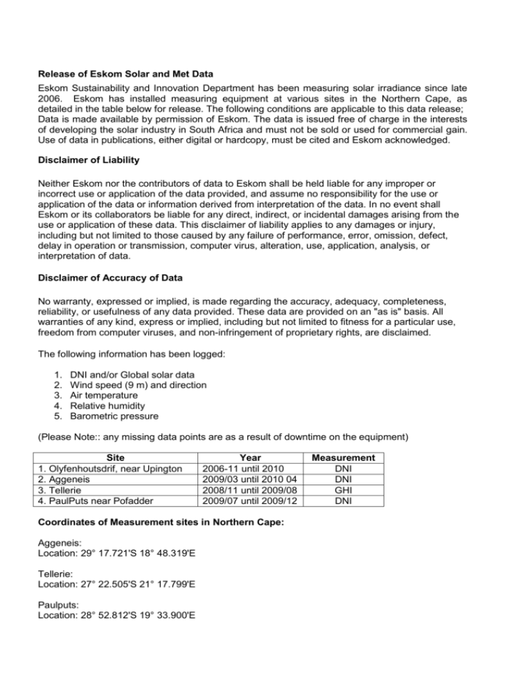
Release of Eskom Solar and Met Data Eskom Sustainability and Innovation Department has been measuring solar irradiance since late 2006. Eskom has installed measuring equipment at various sites in the Northern Cape, as detailed in the table below for release. The following conditions are applicable to this data release; Data is made available by permission of Eskom. The data is issued free of charge in the interests of developing the solar industry in South Africa and must not be sold or used for commercial gain. Use of data in publications, either digital or hardcopy, must be cited and Eskom acknowledged. Disclaimer of Liability Neither Eskom nor the contributors of data to Eskom shall be held liable for any improper or incorrect use or application of the data provided, and assume no responsibility for the use or application of the data or information derived from interpretation of the data. In no event shall Eskom or its collaborators be liable for any direct, indirect, or incidental damages arising from the use or application of these data. This disclaimer of liability applies to any damages or injury, including but not limited to those caused by any failure of performance, error, omission, defect, delay in operation or transmission, computer virus, alteration, use, application, analysis, or interpretation of data. Disclaimer of Accuracy of Data No warranty, expressed or implied, is made regarding the accuracy, adequacy, completeness, reliability, or usefulness of any data provided. These data are provided on an "as is" basis. All warranties of any kind, express or implied, including but not limited to fitness for a particular use, freedom from computer viruses, and non-infringement of proprietary rights, are disclaimed. The following information has been logged: 1. 2. 3. 4. 5. DNI and/or Global solar data Wind speed (9 m) and direction Air temperature Relative humidity Barometric pressure (Please Note:: any missing data points are as a result of downtime on the equipment) Site 1. Olyfenhoutsdrif, near Upington 2. Aggeneis 3. Tellerie 4. PaulPuts near Pofadder Year 2006-11 until 2010 2009/03 until 2010 04 2008/11 until 2009/08 2009/07 until 2009/12 Coordinates of Measurement sites in Northern Cape: Aggeneis: Location: 29° 17.721'S 18° 48.319'E Tellerie: Location: 27° 22.505'S 21° 17.799'E Paulputs: Location: 28° 52.812'S 19° 33.900'E Measurement DNI DNI GHI DNI Upington: Location: 28° 28.095'S 21° 4.291'E Data Format A: Timestamp B: Record no. C: WS_ms_S_WVT D: WindDir_D1_WVT E: AirTC_Avg RH_Avg F: BP_mbar_Avg G: Irrad_Avg : wind speed : wind direction : REL HUMIDITY : B PRESSURE : DNI or global


