Trip 3 am Wissahickon Creek mod 2
advertisement
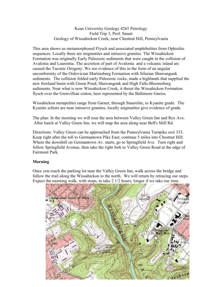
Kean University Geology 4265 Petrology Field Trip 3, Prof. Smart Geology of Wissahickon Creek, near Chestnut Hill, Pennsylvania This area shows us metamorphosed Flysch and associated amphibolites from Ophiolite sequences. Locally there are migmatites and intrusive granites. The Wissahickon Formation was originally Early Paleozoic sediments that were caught in the collision of Avalonia and Laurentia. The accretion of part of Avalonia and a volcanic island arc caused the Taconic Orogeny. We see evidence of this in the form of an angular unconformity of the Ordovician Martinsburg Formation with Silurian Shawangunk sediments. The collision folded early Paleozoic rocks, made a highlands that supplied the new foreland basin with Green Pond, Shawangunk and High Falls-Bloomsburg sediments. Near what is now Wissahickon Creek, it thrust the Wissahickon Formation flysch over the Grenvillian craton, here represented by the Baltimore Gneiss. Wissahickon metapelites range from Garnet, through Staurolite, to Kyanite grade. The Kyanite schists are near intrusive granites, locally migmatites give evidence of grade. The plan: In the morning we will tour the area between Valley Green Inn and Rex Ave. After lunch at Valley Green Inn, we will map the area along near Bell's Mill Rd. Directions: Valley Green can be approached from the Pennsylvania Turnpike exit 333. Keep right after the toll to Germantown Pike East; continue 5 miles into Chestnut Hill. Where the downhill on Germantown Av. starts, go to Springfield Ave. Turn right and follow Springfield Avenue, then take the right fork to Valley Green Road at the edge of Fairmont Park. Morning Once you reach the parking lot near the Valley Green Inn, walk across the bridge and follow the trail along the Wissahickon to the north. We will return by retracing our steps. Expect the morning walk, with stops, to take 2 1/2 hours; longer if we take our time. . STOP #1: Outcrop of Wissahickon Schist. The small outcrop at the shelter is Wissahickon Formation. The schists have visible muscovite crystals showing foliated texture. The mica grains have grown perpendicular to directed pressure during the collisional event. As expected in flysch, also present in the Wissahickon Formation is quartzite, interlayered with the schist. In the outcrop photos below, the quartzite, which is more resistant to weathering, appears as a smoother often raised surface. Mica schists were originally shales deposited in quiet waters; the quartzites were once sandstones from higher energy environments. The sediments were originally tempestites and turbidites in a backarc basin. The alternating sands and shales are termed "Flysch", typical of converging margins. STOP 2: TP conditions for genesis of the abundant garnet schist. The release of water from clay makes mica. Micas grow so that the plates are oriented in the rock to minimize differences in pressure, and they regrow if the direction of pressure changes. This results in foliated layering of micas perpendicular to the directed pressures present in convergent margins. The layers in the Wissahickon Formation's schists are not flat because the rocks have been deformed during and after growth of the mica. Other minerals present include: Almandine Garnet (dark red brown dodecahedra), Staurolite, (dark red brown rectangular laths), and Kyanite (light blue to whitish needles) in order of increasing metamorphic grade. The minerals Garnet + Staurolite + Kyanite imply temperatures higher than 550° C at pressures of 4 kbar (about 4000 atmospheres). High pressures indicate great depths AND/OR great amounts of directed pressure in a collision. STOP 3: Outcrop of Wissahickon showing large recumbent fold. Thrust faulting of thick sequences of sediments results in recumbent folds. These Nappes are typical of fold and thrust terrains such as the Alps. The collision of Laurentias' Grenville coast and Avalonia folded and faulted the layers of sediment from the ocean floor between. Because quartzite does not foliate, it is possible see the structure of the folds better using the quartzite layers. In a collision, rock is under very high pressure, so a local fluctuation in the pressure can cause the rock to fold. Notice that the schist layers are not folded in the same way as the quartzite. The micas responded to the uneven stress by regrowing with its plates aligned perpendicular to the directed pressure. This process is continuous; a constant reorientation of mica occurs in pressurized schist. STOP 4: Outcrop of migmatized Wissahickon Schist. This Wissahickon is a migmatite here. The lighter rock is granite with quartz, feldspar and muscovite; the minerals are not aligned with the layering and are randomly oriented. Chemical analysis of the granite mineral assemblage shows that it is the melted felsic portion of the schist. The phase diagrams of minerals in the schist: biotite, muscovite, garnet, staurolite, and kyanite, indicate that the schist reached temperatures near 600° C, which is the experimental melting point of the granite. In some areas near here, small bodies of granitic magma have coalesced and solidified. Stop 5 Schist and Quartzites showing conformal folding. Here the schist shows the same structure, on the large scale, as the Quartzite.. Stop 6. Around the corner and uphill, the Schist shows more interesting features Augen Gneiss Fold Tubes Small K-spar Pegmatites STOP 7: Layer of amphibolite Near the top of the hill, overlooking the creek is an amphibolite. The dominant mineral is hornblende. Amphibolites are metamorphosed basalt. Are inclusions of Wissahickon Schist within the metamorphosed basalt present? Discussion: How would you decide if the original basaltic rock was a horizontal lava flow, a dike or a sill, part of an ophiolite sequence, etc. Return to Stop 4, then walk back toward the Inn for a short distance. Your instructor will show you to the lower path. STOP 8: The migmatites of stop 4 seen again closer to the stream. Note the stop 4 outcrop above us. This layer continues across the stream. You look to the northeast from here to find the layer at stop 4, so the rocks strike to the NE, and dip 60° to the NW. Continue north along the lower path, keeping an eye on the minerals in the schist. You are checking to see if the highest grade mineral is almandine garnet, staurolite, or Kyanite. Wherever a higher grade mineral appears, note the latitude and longitude. STOP 9. Larger granitic layers crosscutting foliation in the Wissahickon Schist. Layers of the Wissahickon are broken by the granite, so the granite is younger than the metamorphism and deformation Wissahickon Schist ~430 my. STOP 10: A faulted fold. Using PENCIL, sketch this faulted fold in your notebook. Then try to reconstruct the original fold with a second sketch, showing the fault plane and directions of offset. Return to our vehicle, put your field equipment away, and wash up for lunch at Valley Green Inn.
