dam 78
advertisement
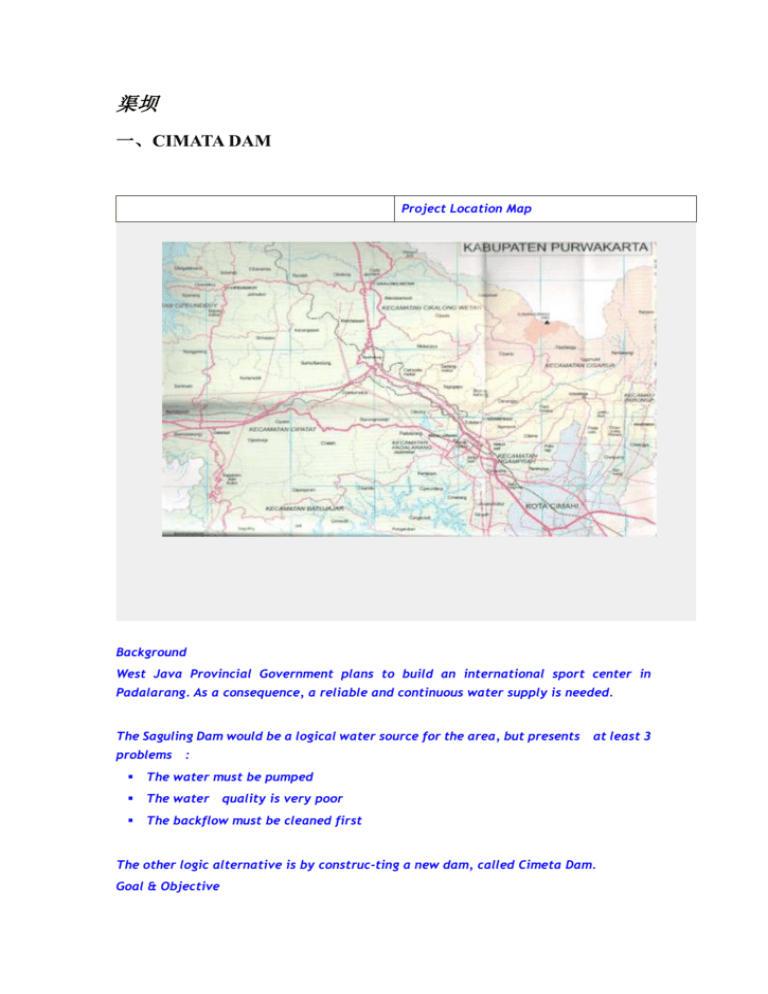
渠坝 一、CIMATA DAM Project Location Map Background West Java Provincial Government plans to build an international sport center in Padalarang. As a consequence, a reliable and continuous water supply is needed. The Saguling Dam would be a logical water source for the area, but presents problems at least 3 : The water must be pumped The water quality is very poor The backflow must be cleaned first The other logic alternative is by construc-ting a new dam, called Cimeta Dam. Goal & Objective To supply water for industrial activi-ities, irrigation and domestic activities in Padalarang and Ngamprah. To supply water for International Sport Centre in Padalarang To improve the health level of people in those area To create a new tourism object Existing Condition Location Administratively, the location of Cimeta Dam is in Cisarua and Ngamprah District, Bandung Regency General Description The topographical area of the location is hilly. The Cimeta River flows along 39.5 km from Mount Burangrang to Citarum River, with the watershed area of some 182 km2.The water of Cimeta River is used mainly for irrigation of 931 ha paddy fields. 二、CIPANAS DAM Project Location Map Background The Cipanas Dam is planned to fulfil the needs for water for irrigation, domestic consumption etc., inSumedang and Indramayu regencies. The estimated water demand in those regencies by 2009 will be 32,700,582.84 liter/day. It is expected to further increase to 36,059,427.27 liter/day in 2015, and 45,300,733.7 liter/d Goal & Objective The Cipanas Dam will be constructed in order to fulfil the demand of irrigation for 7,351 hectares of paddy fields in Sumedang and Indramayu regencies.ay in 2029. Technical Analysis Water source Location : Sungai Cipanas - Sub District : Cibuluh - District : Ujungjaya - Regency : Sumedang Hydrology - Catchment area : 63,31 km2 - Flow of main river : 6,2 m3/sec Dam - Maximum elevation : +130,50 m dpl - Effective capacity : 120 million m3 - Storage capacity : 14,80 million m3 : 7,95 km2 - Water area Dam construction - Type : zone earth fill, central core - Volume : 0,714525 million m3 Spillway - Location : right abutment - Type - Peak elevation : 132 m : Gated concrete gravity crest, chute and flop bucket Service Intake - Type - : concrete pipe Capacity : 6,519 m3/sec Service Gate - Width :6m - Length : 7 m Channel - Location - : Right abutment Type - Capacity : 405,89 m3/sec - Diameter : 5,00 m - Length : 226,00 m : circular, concrete lined Invert level : 90,00 m Financial Analysis The estimated revenue tariffs are : Water : 5.6 USD//m3 Irrigation : 55.6 USD/hectares/year Estimated cost of construction is : 6.8 M USD The resume of financial analysis : - B/C Ratio : 1,43 - IRR : 16,69% - NPV : 2.4 M USD 三、SADAWARNA DAM Project Location Map Background The Sadawarna dam will be built to fulfil the needs of water for the Subang and Indrama-yu Regencies. The location of dam will cover Cipunegara river basin, at the borderline of Subang and Indramayu Regenc Goal & Objective To supply raw water for industrial, commercial and domestic activities in Subang, with 0.767 m3/sec of flow. To supply water for irration, which will cover 8,210 hectares of paddy fields. Electricity Power Plant Tourism activity To construct water conservation area Technical Analysis Water source : The Cipunegara River Location - Sub District : Sadawarna - District - Regency : Cibogo : Subang Hydrology : 347,13 km2 - Catchment area - Flow of main river : 18,832 m3/sec Dam - Maximum elevation : +80,50 m - Normal elevation : +78,50 m dpl - Minimum elevation : +60,00 m dpl - Effective capacity (at 78,50 m of elev.) : 53,50 million m3 - Area of water (at 93,00 m dpl) : 4,10 km2 Dam construction - Type : Earth dam - Length : 185,00 m - Width : 8 m - Peak elevation : +98 m dpl Spillway - Location : left abutment - Type : Gated concrete gravity crest, chute and flop bucket - Capacity : 358,00 m3/sec - Peak elevation : 78,50 m - Length : 50,00 m Service Intake - Type : Concrete pipe - Capacity : 8,947 m3/sec Service Gate - Width : 2,00 m - Length : 2,00 m Channel - Location : Left Abutment - Type : circular, concrete lined - Capacity : 314,70 m3/sec - Quantity : 2 - Diameter : 2,00 m - Length : 300,00m - invert leve) : 75,50 m dpl ies. Service Area of Sadawarna Dam No. 1. 2. Lokasi/Location Luas/Area (Ha) Areal kiri S. Cipunegara Left Side of Cipunegara River Areal kanan S. Cipunegara Right Side of Cipunegara River Total Analisis Finansial Estimasi Sadawarna biaya Debit/Flow (Liter/Detik)/(L/sec) 13.535 16.242 16.241 19.490 29.776 35.731 Financial Analysis pembangunan adalah Waduk sebesar Rp. Estimated Cost of the construction: 9.7 M USD 86.854.013.846,-. Hasil analisis finansial dari pembangunan Waduk Sadawarna ditunjukkan oleh tabel berikut. Resume of Financial Analysis Tingkat Suku Bunga/ Interest rate IRR Net Present Value (NPV) 16% 12% 21,37% 17,21% Rp. 62.338.062.636,- Rp. 68.999.564.587,- 6.9 M USD 7.7 M USD B/C Ratio 1,77 1,84 四、SUKAHURIP DAM Project Location Map Background In order to fulfil the needs of water for irrigation, domestic consumption etc. in Ciamis regency, river as an important water source needs to be managed and used. The Sukahurip Dam will be constructed as a solution to obtain an optimal water use. The supply of water for The Sukahurip Dam will come from Ciputrapinggan River which lies in Pangandaran District, Ciamis regency. The river has several tributaries for example Cimulih River and flows to Indonesian Ocea Goal & Objective To supply irrigation water for 40,000 hectares of paddy fields in Pangandaran, industrial activities, domestic activities, electicity, touris Technical Analysis The technical information of the dam construction : The water source : Ciputrapinggan River Location - Sub District : Sukahurip - District : Pangandara - Regency : Ciamis Hydrology Catchment Area : 39.1 km2 Flow of the main river : 2.34 m3/sec Dam Maximum elevation : 95.06 m Normal elevation : 93.00 m Minimum elevation : 75 m Normal capacity : 4.426 million m3 Efective capacity : 3 million m3 Area of water : 155.4 thousand m2 Dam Construction Type : Earth dam Length : 125 m Width : 8 m Peak elevation : + 98 m Volume : 155.4 thousand m3 Spillway Location : Left abutment Type gated concrete gravity crest, chute and flop bucket Capacity : 222.24 m3/sec Peak elevation : 93 m Length : 21 m Service Intake Type : concrete pipe Capacity : 0.854 m3/sec Service Gate Length : 2 m m and conservation n - Width : 2 m Channel Location : Left Abutment Type : circular, concrete lined Capacity : 179.39 m3/sec Quantity : 2 Diameter : 2 m Length : 300 m Invert level : 75.5 m Financial Analysis Estimation of revenues /year : Clean water supply : 778.151 USD Irrigation : 245.653 USD Estimation of cost : 5.1 M USD Resume of financial analysis No. Condition I Discount rate 12% A Biaya tetap, benefit tetap NPV Biaya naik 20%, benefit tetap 7.213.362,65 801 USD C Biaya naik 20%, benefit turun 10% IRR 1.41 17,45% 1.18 14,20% 1.06 12,77% 1,73 17,45% 1,44 14,20% 1,30 12,77% 14.041.805,89/ 1,560 USD B B/C Ratio 2.394.960,45 266 M USD II Discount rate 10% A Biaya tetap, benefit tetap 26.217.405,92 2,913 USD B Biaya naik 20%, benefit tetap 19.048.510,05 2,116 USD C Biaya naik 20%, benefit turun 10% 12.842.312,52 1,427 USD


