Lithosphere
advertisement
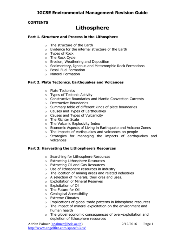
IGCSE Environmental Management Revision Guide CONTENTS Lithosphere Part 1. Structure and Process in the Lithosphere o o o o o o o o The structure of the Earth Evidence for the internal structure of the Earth Types of Rock The Rock Cycle Erosion, Weathering and Deposition Sedimentary, Igneous and Metamorphic Rock Formations Fossil Fuel Formation Mineral Formation Part 2. Plate Tectonics, Earthquakes and Volcanoes o o o o o o o o o o o o Plate Tectonics Types of Tectonic Activity Constructive Boundaries and Mantle Convection Currents Destructive Boundaries Summary table of different kinds of plate boundaries Causes and Types of Earthquakes Causes and Types of Vulcanicity The Richter Scale The Volcanic Explosivity Index Economic Aspects of Living in Earthquake and Volcano Zones The impacts of earthquakes and volcanoes on people Strategies for managing the impacts of earthquakes and volcanoes Part 3: Harvesting the Lithosphere’s Resources Searching for Lithosphere Resources Extracting Lithosphere Resources Extracting Oil and Gas Resources Use of lithosphere resources in industry The location of mining areas and related industries A selection of minerals, their ores and uses. Exploitation of Mineral Reserves Exploitation of Oil The Future for Oil Geological Accessibility Extreme Climates Implications of global trade patterns in lithosphere resources The impact of mineral exploitation on the environment and human health o The global economic consequences of over-exploitation and depletion of lithosphere resources o o o o o o o o o o o o o Adrian Palmer (apalmer@bcis.ac.th) http://www.angelfire.com/space/oikos/ 2/12/2016 Page 1 IGCSE Environmental Management Revision Guide The Lithosphere Part 1: Structure and Processes in the Lithosphere The Structure of the Earth Crust A thin layer, 60km thick in some continental crusts and down to 5km thick at the oceanic crust. Made of Silicon, Aluminuium and Magnesium. Core Very high temperature over 3,000OC and high pressure, the inner core is solid and probably made of iron and nickel. The centre is 6,900km below the earth’s surface. Mantle Most (80%) of the lithosphere is found here, made from molten magma at temperatures over 1,000OC. It extends down to 2,900km deep. Evidence for the internal structure of the Earth In the 1960’s there was a project to drill down into the mantle through the earth’s crust. This project was abandoned although now experimental drilling has gone over 14km into continental crust this has not entered the mantle. Therefore anything deeper than this has not been directly observed, except that some of the rocks from the upper mantle which have risen to the surface. The rest of the Earth’s structure comes from looking at the patterns in earthquake shockwaves, along with predictions made from rock density and patterns of magnetism over the whole planet. Adrian Palmer (apalmer@bcis.ac.th) http://www.angelfire.com/space/oikos/ 2/12/2016 Page 2 IGCSE Environmental Management Revision Guide Types of Rock Sedimentary – These rocks are formed from fragments or particles, not crystals. They are formed from the deposition of hard minerals (for example quartz.) when the agents of erosion drop them e.g. sandstone or chalk. Igneous – These rocks form from cooling magma underground, or lava at the earth’s surface. They are crystalline rocks that are normally hard e.g. granite or basalt. Metamorphic – These rocks are formed when sudden changes in temperature happen, for example when molten magma “cooks” a sedimentary rock. They are also formed under high pressure conditions. Examples include marble or schist. The Rock Cycle The rocks are linked in a very slow moving cycle called the rock cycle, connected by tectonic forces and the processes of weathering, erosion and deposition. The rock cycle takes millions of years to transform one type of rock to another. It is possible for rocks to skip steps in the cycle, for example a sedimentary rock can be weathered, eroded and deposited to become a new sedimentary rock. Sedimentary Rocks Erosion and weathering and deposition Heating, pressure and recrysalistation Igneous Rocks Metamorphic Rocks Adrian Palmer (apalmer@bcis.ac.th) http://www.angelfire.com/space/oikos/ Melting and Solidification Of Magma 2/12/2016 Page 3 IGCSE Environmental Management Revision Guide Erosion, Weathering and Deposition Weathering is the breaking down of rocks without movement; mainly due to the forces of weather. Chemical weathering is the dissolving of rocks by natural acidity in rain; physical weathering is the breaking up of rocks due to changes in temperature and biotic weathering is the break down or rocks by living organisms. Erosion is the movement of the products of weathering, and may involve breaking the rock further. The main agents of erosion are rivers and streams, wind, glaciers and gravity. Deposition occurs when the agents of erosion drop the particles as they no longer have the energy to move them. The compression of these particles over time will result in a sedimentary rock forming. Sedimentary, Igneous and Metamorphic Rock Formations Sedimentary rocks are normally found in layers that can be folded, faulted, heated or pressurized. Igneous rocks are formed when molten magma rises up through lines of weakness in the rocks and cools at or under the surface forming crystals. Metamorphic rocks form where the sedimentary rocks come into contact with the igneous rocks. This type of igneous intrusion is later weathered and eroded to form granite upland areas such as Dartmoor in the UK or islands such as Koh Samui, Thailand. Mineral resources are often found in these metamorphic regions. Adrian Palmer (apalmer@bcis.ac.th) http://www.angelfire.com/space/oikos/ 2/12/2016 Page 4 IGCSE Environmental Management Revision Guide Fossil Fuel Formation Fossil fuels are made from the fossilized remains of plants or animals from millions of years ago. Different types of fossil fuel are formed from different environments of formation. These rocks are fuels as the organic material in the organisms did not decompose fully due to low oxygen conditions in the environment. They are therefore rich in organic hydrocarbons that contain stored energy originating in plant photosynthesis. Petroleum oil is formed under the sea from dead bodies of small plankton; natural gas and tar are formed along with these deposits. Coal is formed in a swampy environment from the bodies of trees and swamp animals. Mineral Formation Ore minerals are rocks that have valuable minerals deposited in them. These minerals are often formed from the metamorphosis around an underground igneous intrusion. In other words rock is cooked by the bubbling of molten magma through the rocks. Many crystals are likely to form and a number of valuable metals may be found. For example the mining of tin is often associated with large granite intrusions such as are found in SW England and Phuket. Both areas supported large tin mining industries in the past, until the tin ran out or became economically not worth mining. Other examples of ore minerals include iron ores (e.g. magnetite or haematite). Part 2: Plate Tectonics, Earthquakes and Volcanoes Plate Tectonics It was suggested by a number of people that the earth’s crust is not stable since at least the 16th century when it was noticed that the continents of South America and Africa interlocked. This theory of moving land was known as called “Continental Drift Theory” and not accepted by many Geographers until the 1960’s when the full theory of plate tectonics was introduced. The basis of plate tectonics is to understand that the world is made of a number of crustal plates, rather like the surface of an egg cracked slowly by rolling it over a table. These plates are moving due to the convection cycles of magma in the mantle below, that are rising under mid ocean ridges and falling at subduction zones. Types of tectonic activity Folding occurs where pressure on rocks in the crust causes them to bend. Faulting occurs where the pressure on rocks in the crust causes them to break and move apart. Adrian Palmer (apalmer@bcis.ac.th) http://www.angelfire.com/space/oikos/ 2/12/2016 Page 5 IGCSE Environmental Management Revision Guide Constructive Boundaries and Mantle Convection Currents New crustal plate is formed at the ridge pushing away in both directions to form new oceanic plate Convection currents of molten magma rise up in the mantle under the ridge. Ridges are found in the centre of all major oceans around 5km under the sea. Low grade volcanic activity and earthquakes are associated with them. Destructive boundaries Subduction Zones Oceanic Plate pushes towards the continental plate Continental Plate pushes towards Oceanic Plate Continental Crust Mantle Rocks Mountain building occurs here, where the rocks in the crust are pushed up higher by plate collisions to form high mountain ranges. When oceanic crust is subducted under oceanic crust then Island Arcs form from volcanic activity e.g. Sumatra and Java, Indonesia. NOTE – In the top diagram the convection current is rising and the bottom diagram it is falling. Adrian Palmer (apalmer@bcis.ac.th) http://www.angelfire.com/space/oikos/ 2/12/2016 Page 6 IGCSE Environmental Management Revision Guide Continental Collision Zone Mountains Pushed Upwards Continental Crust Pushes this way Continental Crust Pushes this way Mountain “roots” pushed down Mantle Rocks The Himalayan Mountain range is a good example of this kind of boundary. Continental Crust collisions produce the highest mountains and the thickest locations for Crustal Rock. Here the crust can reach 70km deep. These boundaries are marked by intense earthquake activity and mountain building, but no volcanic activity. Transform Fault Boundary Crust Mantle Rocks In transform fault boundaries the plates do not move directly together, but slide past each other. This kind of boundary generates a lot of earthquakes. The most famous example is the San Andreas Fault in California, USA. Adrian Palmer (apalmer@bcis.ac.th) http://www.angelfire.com/space/oikos/ 2/12/2016 Page 7 IGCSE Environmental Management Revision Guide Summary table of different Type of Examples Boundary Mid-Ocean Constructive Ridges e.g. or Divergent MidBoundaries Atlantic Ridge Destructive or Convergent Boundaries kinds of plate boundaries Activity Characteristics Low grade earthquake and volcanic activity under the ocean, only on land in a few locations such as Iceland. Forms new plate and may new land or whole islands e.g. Surtsey Island in Iceland Subduction Associated with Zones – mountain e.g. Rocky building, Island Mountains, Arc formation and North high grade America. earthquakes and explosive volcanic eruptions including the December 2004 earthquake and tsunami, and Mt. St. Helens in 1984 Continental Form large Collisions mountain ranges and the deepest continental crusts such as the Himalayas. No volcanic activity. Conservative Lateral or Boundaries transform boundaries A great deal of plate movement is found causing frequent earthquakes. For example the San Andreas Fault. Adrian Palmer (apalmer@bcis.ac.th) http://www.angelfire.com/space/oikos/ These plate boundaries are the only places where new crust is made, that is why they are called constructive. They are found deep down in the middle of the major oceans and always push away from the boundary on both sides (diverge). It is thought they form where mantle convection currents rise. These plate margins have a higher density oceanic plate pushed under lighter continental crusts or oceanic crust. One plate is subducted or pushed under the other. They create many spectacular geographic features such as oceanic trenches (the deepest oceans) and high mountains such as the Rocky Mountains in the USA. Continental crusts are the same density, so one plate does not go under the other. Instead the plates crumple, pushing both up into the atmosphere and down in to the mantle. The Himalayas were formed by the Indian plate crashing into the Eurasian plate and is still rising today. The plates do not directly collide, but push past each other. 2/12/2016 Page 8 IGCSE Environmental Management Revision Guide Causes and Types of Earthquakes Earthquakes are the sudden repeated movements of the earth’s crust caused by shock waves from plate boundaries. Three forms of shock wave occur; 1. Primary “P” Push/Pull waves (fastest) 2. Secondary “S” or Shake waves 3. Long “L” Surface waves (slowest) The slow moving surface waves causing the most damage. Earthquakes are measured in intensity using the Richter scale. Earthquakes are extremely common tectonic events, occurring every day under the ocean. Even large earthquakes of over 7 on the Richter scale occur every month. Plates move continuously at plate boundaries against a lot of friction. When the friction is too great the plate stops moving, this is called a seismic gap. Seismic gaps lead to a build up of pressure and when this is released an earthquake occurs. The type of plate boundary influences the type of earthquake found there, with transform boundaries generating the largest quakes. Causes and Types of Vulcanicity Vulcanicity is the activity associated with the movement of molten magma from the earth’s mantle forming volcanoes and other features such as “magma bubbles” under the ground. Volcanoes are formed when magma is forces up through either continental or oceanic crusts. Magma may rise due to differences in density or the movement of crustal plates, particularly in subduction zones. Volcanic eruptions can be measured on the volcanic explosivity scale. Mid ocean ridges produce low grade volcanoes and subduction zones high grade, the other kinds of boundaries do not produce volcanoes. Volcanoes can produce earthquakes. Volcanic eruptions are far less frequent than earthquakes – compare the threat frequencies on the two diagrams. Adrian Palmer (apalmer@bcis.ac.th) http://www.angelfire.com/space/oikos/ 2/12/2016 Page 9 IGCSE Environmental Management Revision Guide Examples Richter Scale 1 Global Frequency Of Threat 2 3 4 Every Minute Richter 1 -2 - Detected by Seismographs 6.4 India1993 6.9 San Francisco 1989 7.2 Kobe, Japan 1995 7.8 Mexico City 1985 8.2 San Francisco 1906 5 6 7 8 Every Hour Every Week Every Month Every Year Richter 5-6 Distinct shaking, Structural Damage occurs, poorly built houses collapse. Richter 3-4 Faint Tremors Felt – Little Physical Damage The Richter Scale Richter 7-8 Major Earthquake with violent shaking destroying buildings and infrastructure. 8.8 Lisbon, Portugal 1755 9.1 Sumatra, Indonesia 2004 9.5 Chile, 1960 9 Richter 9 Rare and extreme earthquakes, surface cracks open up. Massive faults and folds occur. This is a measure of the size of earthquake shock waves; it is not linear, but logarithmic. This means that each level is approximately ten times greater in force than the previous point on the scale. A large nuclear weapon explodes equivalent to 32 million tons of TNT, this would create shock waves of around 7 on the scale. Around 32 billion tons of TNT would be needed to generate an equivalent shock to level 9. Adrian Palmer (apalmer@bcis.ac.th) http://www.angelfire.com/space/oikos/ 2/12/2016 Page 10 IGCSE Environmental Management Revision Guide Examples Regular, slow flow “Pa Hoe Hoe” Lavas in Iceland VEI 0 1 2 1997 Plymouth, Montserrat Caribbean 1994 Rabaul Papua New Guinea 1980 Mt. St. Helens, USA 1991 Mt. Pinatabu, Phillipines. Global cooling effects on climate recorded 1815 Tambora Sumawa, Indonesia 50 km3 of ash blown into the atmosphere 73,500 Years ago Toba, Sumatra 3000km3 of crust blown in to the atmosphere 3 4 5 6 7 8 Every Year Every Ten years Every 100 years Every Every 1,000 years 50,000 years Global Frequency Of Threat VEI 0-1 Low and frequent eruptions that are typical of mid-ocean ridges or hot spots VEI 2-3 small to moderate eruptions that can cause extensive local damage The Volcanic Explosivity Index VEI 4-5 Large to major eruptions that cause regional effects, local devastation VEI 8 Super-eruptions Rare and regionally devastating eruptions with massive global climatic effects -“volcanic winter” VEI 6-7 Massive eruptions causing regional devastation, may last for a long time. Global climate influenced causing crop failures. This scale was developed in the 1980’s to allow comparisons of eruptions. It is also a logarithmic scale like the Richter. The VEI scale combines measures of how much material is sent up into the atmosphere, along with how fast the volcano erupts. Adrian Palmer (apalmer@bcis.ac.th) http://www.angelfire.com/space/oikos/ 2/12/2016 Page 11 IGCSE Environmental Management Revision Guide Economic Aspects of Living in Earthquake and Volcano Zones There are some benefits to life near the plate boundaries. Geothermal energy supplies may be exploited to heat water or generate electricity. This happens in Iceland and Japan. Volcanic eruptions produce very fertile soils and these attract farmers to the slopes of the volcanoes – such as rice farmers in Sumatra and Java, Indonesia. On the other hand economic damage caused by these events is huge. Despite these limitations some of the most developed cities in the world are found in areas that are at great risk from Earthquake damage e.g. San Franciso or Tokyo. Here a considerable amount of extra money is put into the design and construction of buildings to make them more resistant to damage. The impacts of earthquakes and volcanoes on people Damage to property and loss of life from earthquakes is far greater than that of volcanoes. This is due to the fact that they occur more frequently and cause destruction in a wider area. It is often said that earthquakes don’t kill people, buildings kill people. In many earthquakes it is the collapse of buildings on top of people that kills, not the earthquake itself. Fires breaking out due to the earthquake can also lead to massive increases in the death toll. Additional deaths are caused by broken power lines and the panic responses of crowds of people. Tsunamis caused by earthquakes can take the death toll up massively spreading the disaster over much wider areas. Volcanic eruptions may cause deaths due to the eruption of lava, ash or volcanic bombs. But the pyroclastic flows - “glowing clouds” of dust and ash, with temperatures exceeding 300 to 800 degrees OC, that move at speeds of over 100 km per hour from the eruption sites cause many more deaths. Volcanic mudflows are also one of the biggest killers from eruption sites; mixtures of water and ash can move at tremendous speeds down the side of a volcano. Tsunamis may be triggered by volcanic eruptions or earthquakes. The effects of an eruption or earthquake may be greater in the aftermath if relief efforts are not able to help. Crops may have been destroyed and a lack of food can lead to malnutrition and famine. Water related diseases can also spread quickly in disaster struck areas due to poor sanitation and a lack of clean water. The economic damage to a disaster area may continue for some time after the event itself. Industries may be directly damaged and take some time for development to return. Workers and markets may relocate to other area, such as the tourist trade in Phuket following the 2004 tsunami. Adrian Palmer (apalmer@bcis.ac.th) http://www.angelfire.com/space/oikos/ 2/12/2016 Page 12 IGCSE Environmental Management Revision Guide Comparison of Some of the Worst Disasters. Date Place Event 1976 Tangshan, China Gansu, China Tokyo Yokohama, Japan Xining China Chile and Pacific Ocean Sumatra and Indian Ocean Armero, Columbia 7.8 Earthquake 8.6 Earthquake 8.3 Earthquake 1920 1923 1927 1960 2004 1985 1883 1815 1902 Krakatoa, Indoesia Tambora, Indonesia Martinique, Caribbean No of Casualties 242,000650,000 200,000 Main Cause of Death 143,000 Fire Collapse of Buildings Landslides 7.9 Earthquake 9.5 Earthquake 200,000 6,00010,000 Tsunami 9.1 Earthquake 155,000250,000 Tsunami Nevado del Ruiz Volcano Erupts Volcanic Eruption Volcanic Eruption Mt. Pelee Eruption 25,000 Mudslides 36,000 Tsunami 92,000 Famine (80,000) Glowing Clouds (12,000) Glowing Clouds 35,000 Strategies for managing the impacts of earthquakes and volcanoes Many earthquakes occur away from human settlements and cause no damage, but as population increases there are more people found living in earthquake zones. Volcanoes may actually attract people due to the good farming found on the slopes. Although it is not possible to actually predict either event it is clear that monitoring can help give some warning of volcanic eruption and indicate the likely location of earthquakes along a plate boundary. In some situations such as Mexico City fast response to a quake event can actually give an opportunity to evacuate to shelters (Mexico City is a long way from the fault lines). In the case of tsunamis it is also possible to give accurate early warnings if monitoring buoys are in position. Planning for the design of settlements in earthquake zones can save many lives, through the zoning of land uses. If hazardous industrial areas or refineries are positioned near to domestic areas then the risk of dangerous fires or explosion is likely to threaten more lives. Key routes into areas for evacuation and relief efforts can be designed so that they are unlikely to be Adrian Palmer (apalmer@bcis.ac.th) http://www.angelfire.com/space/oikos/ 2/12/2016 Page 13 IGCSE Environmental Management Revision Guide blocked by damage to structures such as bridge. The design of buildings can make considerable difference. Tall buildings are designed to swing with the earthquake, otherwise they break. Part 3: Harvesting the Lithosphere’s Resources Searching for Lithosphere Resources A variety of techniques are used to determine the location of lithosphere resources. Geologists map the strata of rocks found at the surface and try to determine the positions of these rocks under the ground, this is known as stratigraphy. They will also examine and predict the quality and purity of any resources to try and determine if it will be economic to extract them. If geologists predict valuable resources are likely to be present then seismic surveys are carried out to work out underground structures by using controlled explosions or other impacts and listening to patterns in the reflected sound using a series of geophones. Surveys of magnetic fields or gravity can also help determine under ground structures indicated by variations in the density of rocks. These geophysical techniques are also carried out at sea, particularly in the search for oil (see below for exploratory drilling). Extracting Lithosphere Resources Solid resources found at the surface or nearly at the surface can be mined directly by digging into the ground. This technique is called open-cast mining; coal, copper, bauxite and china clay are sometimes extracted this way. Open-cast mining can be carried out on a massive scale, creating huge holes in the ground, such as the Morenci copper mine in Arizona, USA that is 3km across and 500m deep. Deeper resources are mined by using underground mining. Drift mining is carried out where the useful beds of rock are found on the side of a hill or mountain and the miners simply cut in from the edge of the hill. Deep mines may involve accessing the mineral resources deep under the ground using lifts down long shafts. The deepest mine shaft changes each year as the mines get deeper, but it is normally one of the South African Gold Mines. Some of these currently go deeper than 3.5km into the crust e.g. the East Rand mine at 3,585 meters deep in 2003. Adrian Palmer (apalmer@bcis.ac.th) http://www.angelfire.com/space/oikos/ 2/12/2016 Page 14 IGCSE Environmental Management Revision Guide Extracting Oil and Gas Resources Oil is a liquid mineral that is formed in source rocks (see earlier), but may later move through spaces of certain sedimentary rocks called reservoir rocks. Natural gas may be found with oil, in the rocks above it, or on its own. Gas is piped directly from the gas fields, which may be under the sea. It is rare to find any evidence of oil at the surface so geophysical techniques (see above) along with exploration drilling are carried out, the sequence of rocks that come through the drill (the mud log) giving further evidence for the presence of oil. At sea the exploration drilling takes place on jack-up platforms in depths of water less than 50m, or in deeper water semi-submersible rigs. Very deep drilling takes place from specialized drilling ships. If oil is found during exploration then massive production oil rigs are put into place to extract the oil. The oil extracted is crude oil which varies in quality and impurities. This crude oil is taken into oil refineries and it is used to produce a large range of different grades of oil for different purposes from rocket fuel to diesel. Additionally there is a large range of oil by-products that are made in refineries such as some plastics. Use of lithosphere resources in industry Most industrial processes are still dependent on fossil fuel energy supplies of either coal or oil. Additionally most machinery is dependent on iron or steel and bulk resources such as clay (for cement), sand and gravel are used for the buildings and other constructions using concrete. Limestone (calcium carbonate) has a large variety of uses including the purification or iron during smelting, neutralizing acids from fossil fuel burning in power stations, making lime (calcium oxide) for agriculture, glass making or baking with clay to make cement. Uranium and plutonium are found in mineral ores, these are important fuels for nuclear power stations (see energy section in Biosphere II) The location of mining areas and related industries Lithosphere resources occur where geological processes form them, so they are found only in some restricted locations. Mineral ores for example are found mainly around areas where tectonic activity has or is taking place near plate boundaries. Other kinds of rocks are associated with the conditions found in the centre of plates. Kimberlite, that yields diamonds, is found only Adrian Palmer (apalmer@bcis.ac.th) http://www.angelfire.com/space/oikos/ 2/12/2016 Page 15 IGCSE Environmental Management Revision Guide where rocks from deep in the mantle arise through volcanic plugs. So resources are mined where they are found, with one exception that is natural gas which is piped from under the ocean to the land. Mining takes place where the resource is, but where processing and related industry take place will depend on the type of resource. Crude oil is easy to transport by tanker and refineries may be located a long way from the fields. Coal on the other hand is an extremely bulky fuel and can yield relatively small amounts of energy for its weight. Coal power stations are generally built closer to coal fields due to this. Transport by water – rivers, canals or sea – can be a good deal cheaper so coal may be moved longer distances like this. Uranium yields the equivalent of around 50,000 tonnes of coal and so can be moved large distances to make energy, which is why the UK can import it from Australia. Some industries that require specific resources or large amounts of cheap energy will still have to locate near to those resources. Modern “footloose” industries are rarely dependant on such specifics, but the industrial revolution in the United Kingdom was centered on regions that had abundant coal and limestone for steel manufacture. Mines or manufacturing industries that require large labour forces may need to move close to large population centres or encourage the labour to move closer to the mines and factories. A selection of minerals, their ores and uses. Mineral Resource Mineral Ore Use of the Ore Iron Haematite To make steel for construction work or used directly. Tin Aluminium Cassiterite Bauxite Used for food cans etc. Bottle tops, cans for food an drinks, aeroplane parts, cooking foil etc. Copper Chalcopyrite Good electrical conductor. Lead Galena Used to make batteries Zinc Sphalerite Used to coat iron to protect it from rust. Diamonds Kimberlite Cutting tools and valuable gemstones Uranium Pitchblende Used to produce in nuclear reactions for power generation and weapons. Exploitation of Mineral Reserves Minerals resources are not always mined until they are completely exhausted. It may become economically unviable to take out the materials if the price changes. For example production in the coalfields of the UK fell as a result of a reduction in demand and a political decision to switch to oil. Improved Adrian Palmer (apalmer@bcis.ac.th) http://www.angelfire.com/space/oikos/ 2/12/2016 Page 16 IGCSE Environmental Management Revision Guide technologies and changes in prices may combine to allow resources to be mined in the future that are not at present. Exploitation of Oil Oil has been the most important of all mineral resources during the 20th century. The discovery of oil fields peaked in the 1960’s and it has been harder to discover new oil over the last 50 years, although the techniques for survey and extraction have improved with technological development. The amount of oil discovered in the 20th century can be estimated at around 1,800 billion barrels as shown by the area below the dashed line in the graph. The amount consumed during the same period can be estimated in the same way as around 1,115 billion barrels. Over 90% of the oil discovered has been found in large fields of a minimum 100 million barrels of oil or gas equivalent The Future for Oil The demand for oil is increasing at a rate faster than population growth rate, with massive increases coming from the development of car markets in the Asian region. This increase demand will continue to push the prices higher in the future, particularly as supply cannot increase indefinitely. although it is unlikely to physically years. However the rising price is going to make it economically inaccessible, particularly for LECD’s, in the near future. It is thought by many working in the industry that peak production of oil is likely to happen in the near future. Changes in Accessibility with Market Price Adrian Palmer (apalmer@bcis.ac.th) http://www.angelfire.com/space/oikos/ 2/12/2016 Page 17 IGCSE Environmental Management Revision Guide Oil not being extracted today may be recoverable in some locations in the future, although it is inaccessible at the current market price Mostly oil fields are not completely drained, even older fields. Higher prices will allow more money for investment in enhanced recovery techniques. Lower grade reserves such as oil tars may also be exploited and oil fields that are closed now may be reopened. Extreme Climates influence extraction Future oil supplies are likely to be exploited increasingly in more extreme environments such as in the Alaskan oil fields of North America. The extreme polar climate here will add further costs to the extraction and these will be passed on to the consumer. There are conflicts of interest with conservationists working to protect these environments in both the Arctic and the Antarctic regions. Implications of global trade patterns in lithosphere resources The global trade in these resources is of great significance to the economic development of countries, creating a situation where all the world’s economies are interdependent on each other. A developed country cannot supply all of its needs from within its own boundaries. The global markets are also of military and strategical significance, for example the need for oil to power armed forces and uranium or plutonium to produce nuclear weapons. The impact of mineral exploitation on the environment and human health In some LEDC’s the cheapness of human labour is exploited to bring valuable minerals to the surface, particularly gemstones such as diamonds or valuable metals like silver. In the silver mines of Cerro Rico, Potosi, Bolivia children as young as ten spend up to 12 hours a day mining for silver. Respiratory diseases, such as bronchitis, bring down the life expectancies of many miners from inhaling the particles of rock dust in the air underground. Rock falls may cause more immediate damage to health, death or loss of limbs. In very deep mines the conditions may be very hazardous. Tremendous temperatures and pressures exist at this depth and rock bursts from the side of the tunnels occur, accounting for at least some of the 250 deaths a year in South African mines. Up on the surface of the mines tunneling may lead to landslides; these can be devastating for the surrounding villages if the mines are not dug safely. The processing of rocks to remove ore minerals can cause further problems to the people living in the area including noise, water and air pollution. Adrian Palmer (apalmer@bcis.ac.th) http://www.angelfire.com/space/oikos/ 2/12/2016 Page 18 IGCSE Environmental Management Revision Guide Water pollution from mines can be a major environmental problem; mines flooding after they are abandoned can lead to toxic compounds such as cyanide or heavy metals flooding out of the mines. Overflow water from abandoned mines that reaches rivers or lakes can kill large quantities of fish. The global economic consequences of over-exploitation and depletion of lithosphere resources Mining can not be a sustainable activity in principle, as the resource is nonrenewable on a human time scale. However some resources are so abundant in the lithosphere that they are not going to run out for a very long time. Clearly oil is going to run out in the near future and this will lead to far ranging changes to the way that we supply and use energy in the world. Coal has a longer life span, but in half a century will also be finished. Other mineral resources will have more specific concerns related to the industries they support. Adrian Palmer (apalmer@bcis.ac.th) http://www.angelfire.com/space/oikos/ 2/12/2016 Page 19
