Storm Water Detention Regulations
advertisement
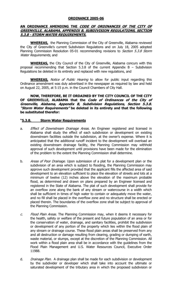
ORDINANCE 2005-06 AN ORDINANCE AMENDING THE CODE OF ORDINANCES OF THE CITY OF GREENVILLE, ALABAMA, APPENDIX B, SUBDIVISION REGULATIONS, SECTION 5.3.8 - STORM WATER REQUIREMENTS. WHEREAS, the Planning Commission of the City of Greenville, Alabama reviewed the City of Greenville’s current Subdivision Regulations and on July 18, 2005 adopted Planning Commission Resolution 05-01 recommending revisions to Section 5.3.8 Storm Water Requirements, and WHEREAS, the City Council of the City of Greenville, Alabama concurs with this proposal recommending that Section 5.3.8 of the current Appendix B – Subdivision Regulations be deleted in its entirety and replaced with new regulations, and WHEREAS, Notice of Public Hearing to allow for public input regarding this Ordinance amendment was duly advertised in the newspaper as required by law and held on August 22, 2005, at 5:15 p.m. in the Council Chambers of City Hall. NOW, THEREFORE, BE IT ORDAINED BY THE CITY COUNCIL OF THE CITY OF GREENVILLE, ALABAMA that the Code of Ordinances of the City of Greenville, Alabama, Appendix B, Subdivision Regulations, Section 5.3.8. “Storm Water Requirements” be deleted in its entirety and that the following be substituted therefor: “5.3.8. a. Storm Water Requirements Effect of Downstream Drainage Areas. An Engineer registered and licensed in Alabama shall study the effect of each subdivision or development on existing downstream facilities outside the subdivision, at the owner’s expense. Where it is anticipated that the additional runoff incident to the development will overload an existing downstream drainage facility, the Planning Commission may withhold approval of such development until provisions have been made for the elimination of the problem to the extent the Planning Commission shall determine. b. Areas of Poor Drainage. Upon submission of a plat for a development plan or the c. Flood Plain Areas. The Planning Commission may, when it deems it necessary for d. Drainage Plan. A drainage plan shall be made for each subdivision or development subdivision of an area which is subject to flooding, the Planning Commission may approve such development provided that the applicant fills the affected area of said development to an elevation sufficient to place the elevation of streets and lots at a minimum of twelve (12) inches above the elevation of the maximum probable flood, as determined and drawn on plans prepared by an Engineer licensed and registered in the State of Alabama. The plat of such development shall provide for an overflow zone along the bank of any stream or watercourse in a width which shall be sufficient in times of high water to contain or adequately move the water, and no fill shall be placed in the overflow zone and no structure shall be erected or placed therein. The boundaries of the overflow zone shall be subject to approval of the Planning Commission. the health, safety or welfare of the present and future population of an area or for the conservation of water, drainage, and sanitary facilities, prohibit the subdivision or development of any portion of the property which lies within the flood plain of any stream or drainage course. These flood plain areas shall be preserved from any and all destruction or damage resulting from clearing, grading or dumping of earth, waste material, or stumps, except at the discretion of the Planning Commission. All work within a flood plain area shall be in accordance with the guidelines from the Flood Plain Management and U.S. Water Resources Council, Executive Order 11988. by the subdivider or developer which shall take into account the ultimate or saturated development of the tributary area in which the proposed subdivision or development is located. Adequate provisions shall be made within each subdivision or development to provide drainage facilities needed within the subdivision or development, taking into account saturated development of the tributary area. The storm and sanitary sewer plan shall be made prior to other utility plans. Engineering considerations in subdivisions and other developments shall give preferential treatment to gravity-flow improvements as opposed to other utilities and improvements. e. Run-off Easements. Off-premises drainage easements and improvements shall be required to handle the runoff of subdivisions into a natural drainage channel as determined by an Engineer registered and licensed in Alabama. Easements shall not be less than ten (10) feet in width, except in case of double-tiered lots where a width of five (5) feet from each other will be permitted. Where a storm water ditch, creek or other such water course exists, the easement shall be of sufficient width to insure that such water course may be installed and maintained efficiently. Low areas subject to periodic inundation shall neither be developed nor subdivided unless and until an Engineer registered and licensed in Alabama has determined and certified that: (1)The nature of the land use (i.e., recreational areas) will not lend itself to damage by water to an appreciable extent. (2) The area may be filled or improved in such a manner as to prevent such periodic inundation. (3) Minimum flood elevations may be established to prevent damage to buildings and other structures. f. Additional Requirements. The Building Inspector or the Planning Commission may g. Water Bodies. Lakes, ponds and similar areas will be accepted for maintenance require whatever additional engineering information they determine to be necessary to make a decision regarding the proposed subdivision of land or any other development in an area of questionable drainage. only if sufficient land is dedicated to the City of Greenville as a public recreational area or park or if such area constitutes a necessary part of the surface drainage control system of the City of Greenville as determined by an Engineer registered and certified by the State of Alabama. h. Storm Water Runoff Control. Where street construction changes from curb and gutter or valley gutter section to ditch section or where street construction changes from ditch section to curb and gutter or valley gutter section, then inlets, storm sewers, and side drains shall be provided and constructed in order to adequately handle storm water in accordance with the requirements of the City Public Works Superintendent. i. The Storm Drainage System Plan shall contain the following: a United States Geological Survey map (1:24,000 scale) highlighting the drainage basin from the Subdivision to the nearest major river tributary and shall include: 1. A contour map of the entire subdivision or development, drawn with a contour interval of twenty (20) feet, showing the direction of drainage and the acreage of each drainage area. 2. The location, size and invert elevation of existing and proposed drainage structures including culverts, bridges, curbs and gutters, valley gutters, drain pipes, ditches, inlets, flumes, catch basins, junction boxes, dry wells, riprap, holding ponds, head walls and any other storm drainage control feature. 3. The amount of water in acres estimated to flow through each drainage control feature. 4. A scale of drawing of masonry and/or concrete drainage structures such as catch basins, flumes, inlets, junction boxes as well as curb and gutter and valley gutter. 5. The location and dimensions of easements and rights-of-way for drainage and for the maintenance of drainage system. 6. A STORM DRAINAGE SYSTEM CERTIFICATE I, _______________________________ the Building Official and/or Public Works Superintendent of the City of Greenville, Alabama, concur in the design of the Storm Drainage Systems as shown on this drawing. ____________ Date j. ________________________________________ Building Official and/or Public Works Supt. Easement requirements are set forth as follows: 1. Location: Easements shall be located on rear, front, or side lot lines, as required and to the width specified by the Planning Commission. Drainage easements shall be placed as required by the Building Official and/or Public Works Superintendent. 2. Major Drainage: Where a subdivision or development is traversed by a water course, drainage way, channel or stream or if such a proposed drainage way is shown on an adopted drainage plan, there shall be provided a storm water drainage easement or right-of-way conforming substantially with the lines of such existing or planned drainage way. The width of such drainage easement shall be sufficient to contain the ultimate channel and maintenance way for the tributary area upstream. 3. Alignment: Lots and easements shall be arranged in such a manner as to eliminate unnecessary easement jogs or offsets and to facilitate the use of easements for power distribution, telephone service, drainage, water, and sewer services. 4. Storm Drainage: Storm drainage systems shall be installed so that all storm water is channeled into and confined in natural drainage channels without causing erosion. No storm drainage shall empty into a sanitary sewer. 5. Storm Sewer Connections: If a development lies within the City of Greenville and a public storm water sewer system is reasonably accessible, the developer shall connect with such system at such point which will adequately carry water to locations which are acceptable to the City of Greenville. k. GENERAL CRITERIA for storm drainage system design and for selection of design storm event are set as follows: 1. Storm drainage systems shall be designed in such a way so that the natural drainage patterns of an area are not significantly altered, erosion is not accelerated, accumulation of eroded soil particles in the storm water system is avoided, and the design storm event is accommodated. The criteria for selecting this design storm event shall be as follows: TYPE OF DRAINAGE SYSTEM DESIGN STORM RETURN PERIOD I. Systems for areas less than 10-year storm for confined conveyance 40,000 square feet less capacity, with provisions made to route the 25-year storm when the conveyance capacity is exceeded. II. Systems that receive drainage from basins whose total size is greater than 40,000 sq. ft. but less than 25 acres. III. Systems that received drainage from basins greater than 25 acres. 25-year storm for confined conveyance capacity, with provisions made to route the 100 year storm when the conveyance capacity is exceeded. 100-year storm for confined conveyance capacity. 2. No land shall be subdivided or developed in the police jurisdiction of the City of Greenville without first considering the effects of this design storm event. If, in the opinion of the Building Official and/or Public Works Superintendent, drainage from the design storm event will adversely affect the proposed subdivision or development, confined conveyance of the drainage will be required. If it is determined that this drainage should be conveyed by pipe 42 inches in diameter or less, then an underground structure will be returned to transport this flow. For greater flows, properly designed open flumed ditches may be used at the option of the Building Official and/or Public Works Superintendent. However, an underground structure will be required on buildable lots between road(s) rights-of-way and the building line. Drainage parallel to an uncurbed roadway and drainage that flows through parks or lots greater than one (1) acre may be excepted from this requirement if it can be shown that utilizing a drainage ditch will not adversely affect the subdivision, development or adjoining lands. 3. Special consideration shall be given to innovative drainage designs that would not adversely affect the quality of a subdivision or development in a particular area. 4. If it is determined that drainage ditches are required to convey the storm drainage and it is necessary that these ditches be constructed at a slope of greater than four (4) percent, then such ditches shall be paved as required by the Planning Commission. 5. Retention ponds and/or similar structures shall be required at the option of the Planning Commission or if recommended by the Building Inspector, Director of Public Works or an Engineer registered and licensed in Alabama. 6. Drainage structures shall be constructed at street intersections or where changes in vertical or horizontal alignment occur. The maximum length of storm sewer pipe between such structures shall be four hundred (400) feet unless otherwise directed by the Building Inspector, Director of Public Works or an Engineer registered and licensed in Alabama. 7. Silt fence shall be installed as required by the Building Official and/or Public Works Superintendent. 8. Rip-rap and cloth shall be installed as required by the Building Official and/or Public Works Superintendent. The class and area to receive cloth and rip-rap will be determined by an Engineer registered and licensed in Alabama, the Building Official and/or Public Works Superintendent or the project Engineer, who must be registered and licensed by the State of Alabama.” ORDAINED this 22nd day of August, 2005, this Ordinance shall take effect immediately upon its adoption and subsequent publication as provided by law. ____________________________ ATTEST: DEXTER MCLENDON, Mayor _____________________________________________ Linda L. VandenBosch, City Clerk-Treasurer


