Name: ESTOC, European Station for Time
advertisement
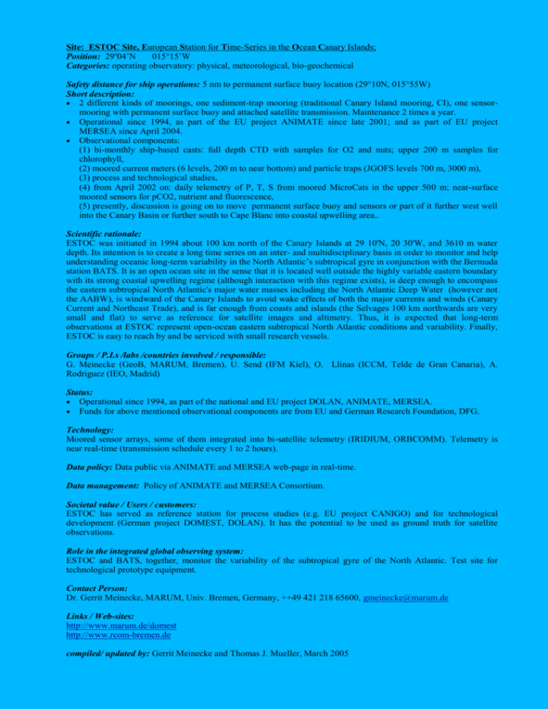
Site: ESTOC Site, European Station for Time-Series in the Ocean Canary Islands; Position: 29º04’N 015°15’W Categories: operating observatory: physical, meteorological, bio-geochemical Safety distance for ship operations: 5 nm to permanent surface buoy location (29°10N, 015°55W) Short description: 2 different kinds of moorings, one sediment-trap mooring (traditional Canary Island mooring, CI), one sensormooring with permanent surface buoy and attached satellite transmission. Maintenance 2 times a year. Operational since 1994, as part of the EU project ANIMATE since late 2001; and as part of EU project MERSEA since April 2004. Observational components: (1) bi-monthly ship-based casts: full depth CTD with samples for O2 and nuts; upper 200 m samples for chlorophyll, (2) moored current meters (6 levels, 200 m to near bottom) and particle traps (JGOFS levels 700 m, 3000 m), (3) process and technological studies, (4) from April 2002 on: daily telemetry of P, T, S from moored MicroCats in the upper 500 m; near-surface moored sensors for pCO2, nutrient and fluorescence, (5) presently, discussion is going on to move permanent surface buoy and sensors or part of it further west well into the Canary Basin or further south to Cape Blanc into coastal upwelling area.. Scientific rationale: ESTOC was initiated in 1994 about 100 km north of the Canary Islands at 29 10'N, 20 30'W, and 3610 m water depth. Its intention is to create a long time series on an inter- and multidisciplinary basis in order to monitor and help understanding oceanic long-term variability in the North Atlantic’s subtropical gyre in conjunction with the Bermuda station BATS. It is an open ocean site in the sense that it is located well outside the highly variable eastern boundary with its strong coastal upwelling regime (although interaction with this regime exists), is deep enough to encompass the eastern subtropical North Atlantic's major water masses including the North Atlantic Deep Water (however not the AABW), is windward of the Canary Islands to avoid wake effects of both the major currents and winds (Canary Current and Northeast Trade), and is far enough from coasts and islands (the Selvages 100 km northwards are very small and flat) to serve as reference for satellite images and altimetry. Thus, it is expected that long-term observations at ESTOC represent open-ocean eastern subtropical North Atlantic conditions and variability. Finally, ESTOC is easy to reach by and be serviced with small research vessels. Groups / P.I.s /labs /countries involved / responsible: G. Meinecke (GeoB, MARUM, Bremen), U. Send (IFM Kiel), O. Llinas (ICCM, Telde de Gran Canaria), A. Rodriguez (IEO, Madrid) Status: Operational since 1994, as part of the national and EU project DOLAN, ANIMATE, MERSEA. Funds for above mentioned observational components are from EU and German Research Foundation, DFG. Technology: Moored sensor arrays, some of them integrated into bi-satellite telemetry (IRIDIUM, ORBCOMM). Telemetry is near real-time (transmission schedule every 1 to 2 hours). Data policy: Data public via ANIMATE and MERSEA web-page in real-time. Data management: Policy of ANIMATE and MERSEA Consortium. Societal value / Users / customers: ESTOC has served as reference station for process studies (e.g. EU project CANIGO) and for technological development (German project DOMEST, DOLAN). It has the potential to be used as ground truth for satellite observations. Role in the integrated global observing system: ESTOC and BATS, together, monitor the variability of the subtropical gyre of the North Atlantic. Test site for technological prototype equipment. Contact Person: Dr. Gerrit Meinecke, MARUM, Univ. Bremen, Germany, ++49 421 218 65600, gmeinecke@marum.de Links / Web-sites: http://www.marum.de/domest http://www.rcom-bremen.de compiled/ updated by: Gerrit Meinecke and Thomas J. Mueller, March 2005 Figure measurement structure at ESTOC; permanent partners are the ICCM, IEO, GeoB and IFMK
