Sleeps Hill Quarries Student Worksheet
advertisement
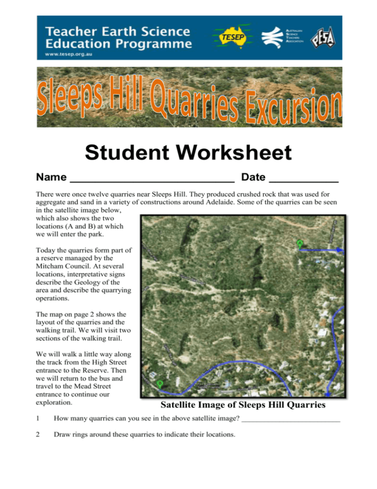
Student Worksheet Name __________________________ Date ___________ There were once twelve quarries near Sleeps Hill. They produced crushed rock that was used for aggregate and sand in a variety of constructions around Adelaide. Some of the quarries can be seen in the satellite image below, which also shows the two locations (A and B) at which we will enter the park. Today the quarries form part of a reserve managed by the Mitcham Council. At several locations, interpretative signs describe the Geology of the area and describe the quarrying operations. The map on page 2 shows the layout of the quarries and the walking trail. We will visit two sections of the walking trail. We will walk a little way along the track from the High Street entrance to the Reserve. Then we will return to the bus and travel to the Mead Street entrance to continue our exploration. Satellite Image of Sleeps Hill Quarries 1 How many quarries can you see in the above satellite image? __________________________ 2 Draw rings around these quarries to indicate their locations. 2 Safety Rules Wear a hat and sturdy shoes and apply sunscreen even during winter months. Carry food and drinking water. Weather conditions can change quickly. Ensure that you wear and bring appropriate clothing. Keep to the paths and stay with the group, or you may get lost. Do not climb the quarry faces. They contain loose boulders that may fall on you! Note that there are no toilets at the site. Our Two Walks in Sleeps Hill Quarries TESEP Sleeps Hill Quarries Excursion, May 2013 Student Worksheet 3 Refer to the above map for the locations of features numbered 1, 2, 3 etc. TESEP Sleeps Hill Quarries Excursion, May 2013 Student Worksheet 4 Walk I (From High St.) From the entrance to the reserve we will walk along the trail to the lookouts at locations 1, 2 and 3 on the map on p2. These lookouts give excellent views of the whole quarry area. Location 1 From this location we can see across the valley to the quarries on the far side. Some of these quarry faces are shown on the photograph below. 1 Add lines to the photograph to show the bedding planes that are visible on the quarry face. 2 Use the map on p2 to identify the quarries that are: 3 a. Immediately below us ____________________________________________________ b. Facing us on the far side of the valley ________________________________________ What probably formed the valley that lies between our present position and the quarries we can see from here? ___________________________________________________________________________ 4 Explain why this steep valley provides a very good location for developing stone quarries. ___________________________________________________________________________ ___________________________________________________________________________ 5 How do you think the tight folding of the rocks might affect the profitability of the quarries? ___________________________________________________________________________ __________________________________________________________________________ TESEP Sleeps Hill Quarries Excursion, May 2013 Student Worksheet 5 Location 1a The boulder shown in the adjacent photograph has been placed here. 1 a. In what year was the boulder placed here? ______________________ b. What event does it commemorate? ______________________ 2 What Mitcham Council activity is probably also commemorated by this boulder? ___________________________________________________________________________ 3 Describe the boulder’s rock type in terms of: a. Texture _______________________________________________________________ ___________________________________________________________________________ b. Minerals it consists of ___________________________________________________ c. Weathering that is occurring _______________________________________________ d. Process of formation (igneous/sedimentary/metamorphic).________________________ Location 2 1. Use the map on p2 to identify: a. the quarry immediately below us. _______________________________________________ b. the quarry opposite us on the other side of the valley. ________________________________ c. the quarry further along the path from where we are standing. _________________________ TESEP Sleeps Hill Quarries Excursion, May 2013 Student Worksheet 6 Location 3 As the photograph below shows, this location provides an excellent panoramic view of the overall fold patterns of the rocks in the quarries. 1 Look for any anticlines or synclines in the rocks opposite you. Mark and label their positions on the above photograph. 2 On the photograph, trace the location of a part of the single overturned fold illustrated in the diagram below. 3 a. Describe one way in which the quarry faces you are looking at differ from the faces of modern quarries. ___________________________________________________________________________ ___________________________________________________________________________ ___________________________________________________________________________ TESEP Sleeps Hill Quarries Excursion, May 2013 Student Worksheet 7 b. Suggest a reason why quarrying processes have changed from those used when these quarries were working. ___________________________________________________________________________ ___________________________________________________________________________ ___________________________________________________________________________ c. Explain why modern quarrying methods are more destructive to the environment than those that were used at Sleeps Hill. ___________________________________________________________________________ ___________________________________________________________________________ ___________________________________________________________________________ Location 4 (Quarry J) The quarry face to your left contains both quartzite and slate, showing that the quarrymen were forced to extract rock that was no use to them, as well as the rock they wanted. 1 Complete the blank face of the above photograph by marking and labelling areas of quartzite and likely areas of slate on the quarry faces to your left and right. 2 Mark and label another quarry face on the photograph. 3 Use the map on p2 to suggest which quarry or quarries this face may belong to. ___________________________________________________________________________ 4 On the photograph, mark and label the position of a fault that shows up in the quarry face We will now return to our transport and drive to another part of the quarry. TESEP Sleeps Hill Quarries Excursion, May 2013 Student Worksheet 8 Walk 2 (From Mead St.) The first part of this walk is around the tops of the quarries on the far side of the valley from the walking trail from where we have just been. We will then walk down to the valley floor and a little way along it. Location 15 1 Name the quarry we are looking at from this point. _________________________ 2 Name the structure that is exposed in this quarry. _________________________ 3 On the photograph, mark and label the axis of this structure. Location 16 1 Name the features seen on the far side of the steeply dipping beds on the far side of the quarry. _________________________ 2 What information do these features provide about the conditions under which the original sediments were deposited? _________________________ ___________________________ 3 What do you think is the approximate distance between the crests of the ripple marks? ___________________________________________________________________________ 4 Add a scale to the photograph to indicate the approximate size of the area covered by the photograph. We will walk along to location 17, to see some more structures, then retrace our steps to location 13 and walk down to the valley. TESEP Sleeps Hill Quarries Excursion, May 2013 Student Worksheet 9 Location 11 — Quarry A Look around near the entrance to quarry A, for a rock outcrop that looks like the photograph below. 1 State, giving reasons, whether this rock is the quartzite that was extracted from the quarries. ___________________________________________________________________________ ___________________________________________________________________________ 2 Describe the following features of this rock: a. Its Colour _________________________ b. Its grain size __________________ c. Is it a hard rock or a soft rock? _____________________________________________ d. Describe as much evidence as possible that indicates whether or not strong pressure has acted on this rock. ___________________________________________________________________________ ___________________________________________________________________________ 3 State, giving reasons, whether this rock would be a useful stone for building or any other purposes. ___________________________________________________________________________ ___________________________________________________________________________ Just inside quarry A, there are some ripple-marked rocks that have fallen down the quarry face. 4 Sketch a ripple-marked boulder in the space provided on the next page. The width of this page is 20cm. Label your diagram to show the approximate size of the boulder and the distance between the crests of the ripples (their wavelength). TESEP Sleeps Hill Quarries Excursion, May 2013 Student Worksheet 10 The Incline Railway 1 Suggest the purpose of the incline railway whose track is shown in the adjacent photograph. ______________________________ ______________________________ ______________________________ _______________________________ 2 Name some energy sources that may have been used to provide power for the railway. ______________________________ ______________________________ ______________________________ _______________________________ TESEP Sleeps Hill Quarries Excursion, May 2013 Student Worksheet 11 Location 23 — Quarry D The adjacent photograph shows an outcrop of slate by the path that leads into quarry D. 1 Describe the changes to the flat face of the rock that have occurred since it has been exposed to the air. 2 What do these changes tell you about the usefulness of this rock as a building stone? _______________________________________________________________________________ 3 Examine some of the powdered material that was originally below the hard outer surface of the rock. Describe it, and suggest what it might be. ___________________________________________________________________________ ___________________________________________________________________________ ___________________________________________________________________________ Walk into the quarry and look at the rock face that is visible above the trees. 4 a. What feature do you notice on one part of this rock face that is just above the trees? ___________________________________________________________________________ ___________________________________________________________________________ TESEP Sleeps Hill Quarries Excursion, May 2013 Student Worksheet 12 b. Fill in the blank area in the photograph below to show the pattern formed by the rock layers inside this area. c. What is this feature called? ________________________________________________ d. Mark on the photograph the boundary between two rock types you can see on the quarry face. e. Write on the photograph the names of the two rock types. f. Compare the hardnesses and resistance to weathering of the two rock types. ___________________________________________________________________________ ___________________________________________________________________________ Start walking back along the path. Take the right turn to location 8. As you walk along, look for evidence that the slate was an unwanted by product of the quarrying activities. ________________________________________________________________________________ TESEP Sleeps Hill Quarries Excursion, May 2013 Student Worksheet 13 Location 8 — Ruins of Crushing Plant The photograph above shows the crushing plant as it was in its heyday. Below are two photograph showing all that is left of these extensive treatment plants. 1 Suggest reasons why this location was selected for the treatment plants. ___________________________________________________________________________ ___________________________________________________________________________ ___________________________________________________________________________ ___________________________________________________________________________ TESEP Sleeps Hill Quarries Excursion, May 2013 Student Worksheet 14 2 Why were such strong foundations needed for these plants? ___________________________________________________________________________ ___________________________________________________________________________ 3 Why is there no longer any evidence of the other buildings and facilities/ ___________________________________________________________________________ ___________________________________________________________________________ That is the end of the excursion. Walk back up the hill to meet the bus on Mead Road. What Do You Think? 1 Write about a paragraph describing an aspect of the geology and/or mining history you saw that you found interesting. Your paragraph should include the reasons why you found it interesting. Add any diagrams that would improve your answer. ___________________________________________________________________________ ___________________________________________________________________________ ___________________________________________________________________________ ___________________________________________________________________________ ___________________________________________________________________________ ___________________________________________________________________________ ___________________________________________________________________________ 2 Suggest some ways in which you think the excursion could be improved. ___________________________________________________________________________ ___________________________________________________________________________ ___________________________________________________________________________ ___________________________________________________________________________ ___________________________________________________________________________ ___________________________________________________________________________ ___________________________________________________________________________ TESEP Sleeps Hill Quarries Excursion, May 2013 Student Worksheet
