Rare Night Tornadoes This Week Fueled By Warm Winter
advertisement
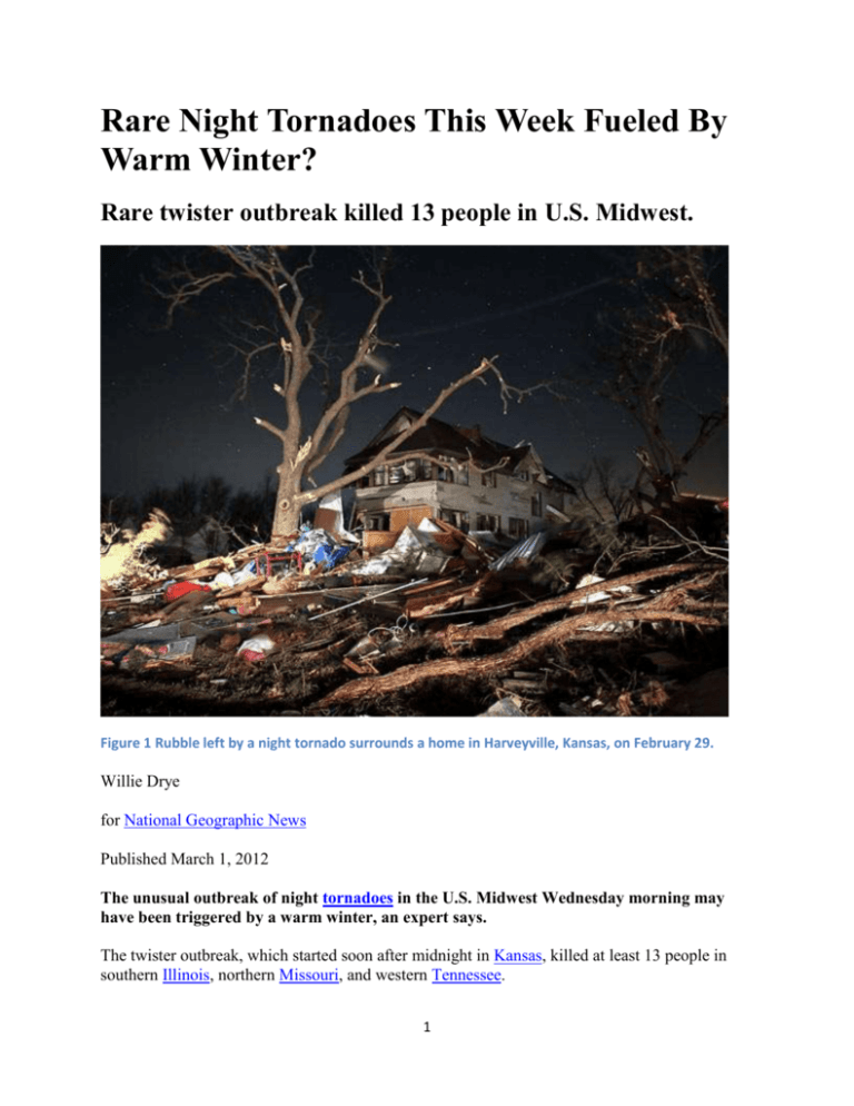
Rare Night Tornadoes This Week Fueled By Warm Winter? Rare twister outbreak killed 13 people in U.S. Midwest. Figure 1 Rubble left by a night tornado surrounds a home in Harveyville, Kansas, on February 29. Willie Drye for National Geographic News Published March 1, 2012 The unusual outbreak of night tornadoes in the U.S. Midwest Wednesday morning may have been triggered by a warm winter, an expert says. The twister outbreak, which started soon after midnight in Kansas, killed at least 13 people in southern Illinois, northern Missouri, and western Tennessee. 1 The most powerful tornado touched down in Harrisburg, Illinois, with winds of about 180 miles (289 kilometers) an hour. (Learn what happens inside a twister.) "It'd be fair to say an unusually warm winter was probably a major factor [in causing the tornadoes]," said Jeff Masters, director of the meteorological website Weather Underground. "You get far fewer tornadoes in February during cold winters." (See "Monster Alabama Tornado Spawned by Rare 'Perfect Storm'" [2011].) Warm Winter Fueled Night Tornadoes Tornadoes are formed from rotating thunderstorms that are set in motion by upper-level winds known as the jet stream. Only about 12 percent of tornadoes form between midnight and 6 a.m., according to the National Oceanic and Atmospheric Administration. That's because temperatures start falling after sunset—depriving potential tornadoes of their primary ingredient: warm, moist air, which rises and creates atmospheric instability that spawns tornadoes. But the current Northern Hemisphere winter has been the warmest since 1890, and is the fourth warmest on record—meaning there was enough warm air to fuel Wednesday's tornadoes, Masters said. (Also see "Why Tornadoes Take the Weekends Off in Summer.") Night Tornadoes Rare but Deadly Although nighttime tornadoes don't occur often, the phenomena can be deadly because they strike when most people are asleep. The spectacular tornado outbreak of April 1974, which killed more than 300 people in 13 U.S. states, included twisters that formed after dark. (See tornado pictures.) What's more, the threat isn't over for the Midwest: The combination of conditions in place before Wednesday night's outbreak will occur again Friday, Masters said. That could prompt tornado warnings for Kentucky and Tennessee, he said. Monster Alabama Tornado Spawned by Rare "Perfect Storm" 2 Clash of warm, cold air encouraged "history making" tornadoes. Figure 2 Buildings in Tuscaloosa, Alabama, lie in ruins on April 28, a day after a tornado demolished the city. Willie Drye for National Geographic News Published April 28, 2011 ON TV: Witness: Tornado Swarm 2011 airs Sunday, May 29, 9 p.m. ET/PT >> The monster tornado that devastated Tuscaloosa, Alabama, (see map) on April 27 was spawned by unusual "perfect storm" conditions, experts say. (See pictures of the Alabama tornado.) Those conditions—which stretched across Mississippi, Alabama, and Georgia—included warm, moist air rising and mixing with colder, dry air at higher altitudes. 3 Unfortunately for those living in the tornadoes' path, "weather conditions came together perfectly," said Tim Samaras, a Denver, Colorado-based tornado expert and producer of the tornado-research website TWISTEX. "Mississippi, Alabama, and Georgia had that down to a T. It was a very, very rare day for everything to come together for this type of event," said Samaras, also a National Geographic Society Emerging Explorer. (The Society owns National Geographic News.) Upper-level winds known as the jet stream also caused the storm system to rotate, according to meteorologist Jeff Masters, director of the website Weather Underground. Rotating thunderstorms—known as super cells—spawn tornadoes. In the South on Wednesday, such storms spawned an outburst of a hundred or more twisters, which barreled through six states and killed at least 283 people. "This is a history-making tornado outbreak," Masters said. "You don't see many like this." Tuscaloosa Tornado Shattered Record? The mile-wide (1.6-kilometer-wide) Tuscaloosa tornado may have had winds exceeding 260 miles an hour (418 kilometers an hour), which would make it an F5 storm on the Fujita scale. The scale ranks tornadoes from F1 to F5 based on wind speeds and destructive potential. (Learn what happens inside a twister.) Investigators are trying to determine how long the tornado, which originated just southwest of Tuscaloosa, stayed on the ground. Tornadoes usually touch the ground for only a few miles before they dissipate. But favorable meteorological conditions may have sustained the Tuscaloosa twister for a record-breaking trek of 300 miles (482 kilometers) across Alabama and Georgia. (See more tornado pictures.) "There were no limitations," said tornado chaser Samaras. "It went absolutely crazy. It had nothing but hundreds of miles to grow and develop." The current record for a tornado's ground time is three and a half hours, set in 1925 by a twister that killed 747 people as it moved 219 miles (352 kilometers) across Missouri and Illinois before falling apart in Indiana. Wednesday night's tornado outburst was the worst since April 3, 1974, when 330 people were killed from Alabama to Indiana (see map), experts say. (Also see pictures: "Tornadoes Ravage U.S. South" [2008].) The outbreak was also the second to strike the South in fewer than two weeks. On April 16, a similar system of violent thunderstorms spawned about 140 tornadoes, killing 22 people in North Carolina. Stormy Spring Still a Mystery 4 Some meteorologists think La Niña conditions—which have existed since summer 2010—could be a factor in the South's stormy spring. For instance, Russell Schneider, director of the U.S. Storm Prediction Center, told msnbc.com that La Niña can create more thunderstorms. Such cyclical conditions are caused by cooler sea-surface temperatures in the equatorial region of the eastern Pacific Ocean, which can affect weather patterns in the U.S. But neither Masters nor Samaras is willing to attribute this year's tornado outburst to La Niña. "We don't have enough statistics to discuss this and decide what's causing it," Samaras said. "I don't know why [there's been a tornado outburst]. It's hard to tell why this year is so violent." While tornadoes form in other parts of the world, the U.S. by far has the most, experiencing about 1,200 each year. (Watch: "Tornadoes, Lightning in Rare Video.") And some unique weather conditions in an area known as Tornado Alley can spark powerful, tornado-producing storms. This alley, which extends from the Dakotas south to the Gulf of Mexico, is bordered by the Rocky Mountains to the west and the Appalachian Mountains to the east. Here, dry air comes off the Rockies and collides with warm, moist air from the Gulf and cold Arctic air from the north—producing energy for powerful storms. (Read about tornado chasers.) Tornado Season Just Starting This year's stormy April marks only the beginning of the tornado season, which continues through June, experts say. Samaras noted that twisters usually move northward as the season progresses. Oklahoma, Kansas, and Nebraska typically see tornadoes in May, while in June the funnels form in Minnesota and parts of the Dakotas. "We still have two very busy months left," Weather Underground's Masters cautioned. "Hang on to your hats." Inside Tornadoes By Karen E. Lange Republished from the pages of National Geographic magazine Last June 11 Tim Samaras and two colleagues did the near impossible—they chased down a tornado and placed a probe with video cameras directly in its path. Beginning at precisely 2:23 p.m. the team caught images that have—in a breakthrough—made it possible to calculate wind speeds close to the ground, where tornadoes rip through human lives. 5 Figure 3 A rare, mother ship cloud formation hovers over Childress, Texas. Tornado-chasers there covered seven hours and 150 miles (241 kilometers) tracking the supercell thunderstorm that produced this cloud formation. Supercell thunderstorms are known to spawn tornadoes with winds exceeding 200 mph (322 kph). Even after his team found the tornado and drove along a dirt road in Iowa to a place they were fairly certain lay in its path. Samaras remained unsure of where exactly he should leave the probe. He stood watching the tornado boil toward him, then, at the last second, he jogged over, hefted the 80-pound (36-kilogram) probe, and shifted it 40 feet (12 meters) to the north. Samaras guessed right: The eye passed just 10 feet (3 meters) from the probe, giving the cameras the closest ever view of the fierce winds turning just off the ground around a tornado's center. Wind speeds within tornadoes are so difficult to measure directly that scientists must rate tornadoes by the damage they cause. The one Samaras caught plucked up a steel bridge and threw it down in a twisted heap, severe damage that earned it an F3 rating, with estimated maximum wind speeds of 158 miles (254 kilometers) to 206 miles (331 kilometers) an hour. Scientists can measure wind speeds with mobile Doppler radar, but only from a safe distance. Samaras's cameras looked into a part of the tornado long hidden from scientists using Doppler: the bottom 30 feet (9 meters). Winds at this level flatten houses and hurl cars. Understanding these winds—the tornado's strongest and most erratic—may enable engineers to design better tornado-resistant structures. 6 7 8
