Aurora Service Area - Physical Environment
advertisement

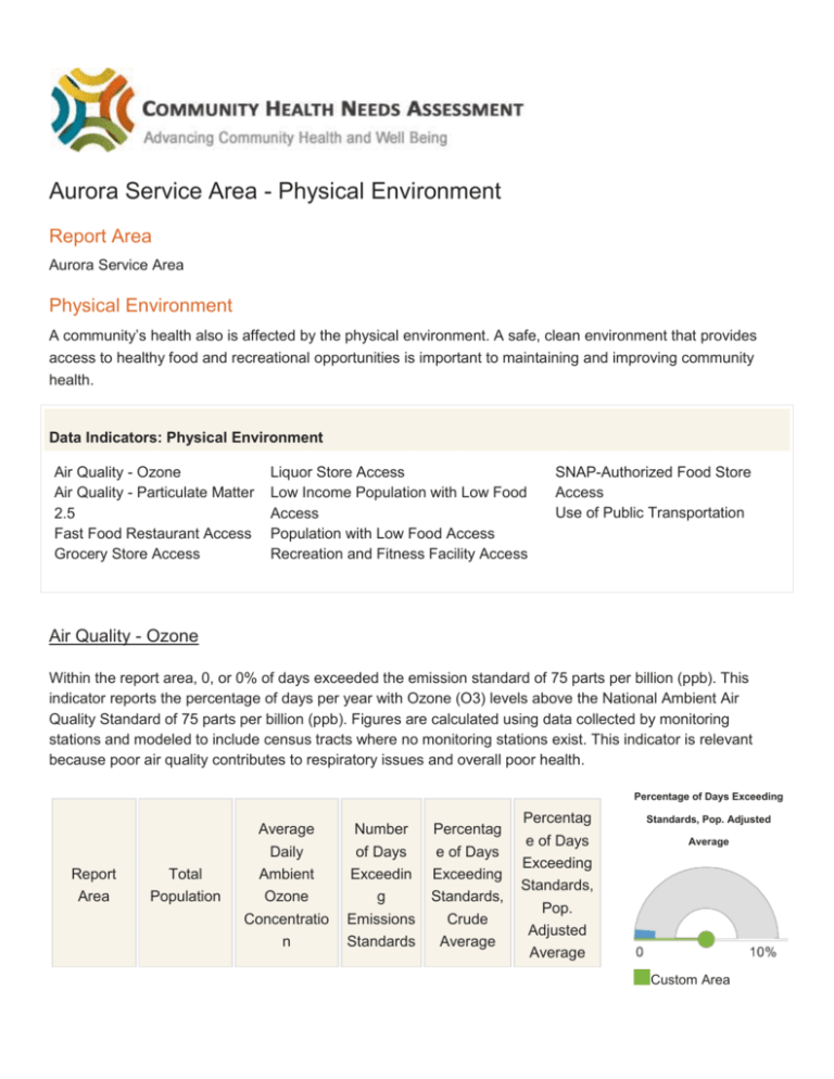
Aurora Service Area - Physical Environment Report Area Aurora Service Area Physical Environment A community’s health also is affected by the physical environment. A safe, clean environment that provides access to healthy food and recreational opportunities is important to maintaining and improving community health. Data Indicators: Physical Environment Air Quality - Ozone Air Quality - Particulate Matter 2.5 Fast Food Restaurant Access Grocery Store Access Liquor Store Access Low Income Population with Low Food Access Population with Low Food Access Recreation and Fitness Facility Access SNAP-Authorized Food Store Access Use of Public Transportation Air Quality - Ozone Within the report area, 0, or 0% of days exceeded the emission standard of 75 parts per billion (ppb). This indicator reports the percentage of days per year with Ozone (O3) levels above the National Ambient Air Quality Standard of 75 parts per billion (ppb). Figures are calculated using data collected by monitoring stations and modeled to include census tracts where no monitoring stations exist. This indicator is relevant because poor air quality contributes to respiratory issues and overall poor health. Percentage of Days Exceeding Report Area Total Population Average Daily Number of Days Percentag e of Days Ambient Ozone Exceedin g Exceeding Standards, Concentratio n Emissions Standards Crude Average Percentag Standards, Pop. Adjusted e of Days Exceeding Average Standards, Pop. Adjusted Average Custom Area 167,505 28.96 0 0% 0% DuPage County, IL 916,924 33.62 0 0% 0% Kane County, IL 515,269 34.84 0 0% 0% Kendall 114,736 35.60 0 0% 0% Illinois 12,830,632 35.28 0.03 0.01% 0.01% United States 312,471,32 7 38.98 1.59 0.44% 0.47% Custom Area Estimates Estimates* (0%) Illinois (0.01%) United States (0.47%) * County, IL Note: This indicator is compared with the state average. Data Source: Centers for Disease Control and Prevention, National Environmental Public Health Tracking Network: 2008. Additional data analysis by CARES. Source geography: Tract Ozone Levels (O3), Percent Days Above NAAQ Standards by Tract, NEPHTN 2008 Over 6.0% 1.1 - 6.0% 0.51 - 1.0% Under 0.51% No Days Above NAAQS Standards No Data or Data Suppressed Report Area Air Quality - Particulate Matter 2.5 This indicator reports the percentage of days with particulate matter 2.5 levels above the National Ambient Air Quality Standard (35 micrograms per cubic meter) per year, calculated using data collected by monitoring stations and modeled to include counties where no monitoring stations occur. This indicator is relevant because poor air quality contributes to respiratory issues and overall poor health. Percentage of Days Exceeding Report Area Total Population Average Daily Ambient Particulate Matter 2.5 Number of Days Exceeding Emissions Standards Percentage of Days Exceeding Standards, Crude Average Percentage of Days Exceeding Standards, Pop. Adjusted Average Custom Area Estimates* 167,505 10.12 2.9 0.79% 0.90% DuPage County, IL 916,924 13.05 3.43 0.94% 0.94% Kane County, IL 515,269 11.95 2.51 0.69% 0.69% Kendall County, IL 114,736 11.89 4 1.10% 1.10% Illinois 12,830,632 12.46 4.15 1.14% 1.08% United States 312,471,327 10.65 4.17 1.14% 1.19% Standards, Pop. Adjusted Average Custom Area Estimates* (0.90%) Illinois (1.08%) United States (1.19%) Note: This indicator is compared with the state average. Data Source: Centers for Disease Control and Prevention, National Environmental Public Health Tracking Network: 2008. Additional data analysis by CARES. Source geography: Tract Fine Particulate Matter Levels (PM 2.5), Percent Days Above NAAQ Standards by Tract, NEPHTN 2008 Over 6.0% 1.1 - 6.0% 0.51 - 1.0% Under 0.51% No Days Above NAAQS Standards No Data or Data Suppressed Report Area Fast Food Restaurant Access This indicator reports the number of fast food restaurants per 100,000 population. Fast food restaurants are defined as limited-service establishments primarily engaged in providing food services (except snack and nonalcoholic beverage bars) where patrons generally order or select items and pay before eating. This indicator is relevant because it provides a measure of healthy food access and environmental influences on dietary behaviors. Fast Food Restaurants, Rate Report Area Total Population Number of Establishments Establishments, Rate per 100,000 Population Custom Area Estimates* 167,504 157 93.79 DuPage County, IL 916,924 860 93.79 Kane County, IL 515,269 322 62.49 Kendall County, IL 114,736 69 60.14 12,830,632 9,591 74.75 312,471,327 224,877 71.97 Illinois United States (Per 100,000 Population) Custom Area Estimates* (93.79) Illinois (74.75) United States (71.97) Note: This indicator is compared with the state average. Data Source: US Census Bureau, County Business Patterns: 2012. Additional data analysis by CARES. Source geography: County Fast Food Restaurants, Rate (Per 100,000 Pop.) by County, CBP 2012 Over 100.0 75.1 - 100.0 50.1 - 75.0 Under 50.1 No Fast Food Restaurants Report Area Grocery Store Access This indicator reports the number of grocery stores per 100,000 population. Grocery stores are defined as supermarkets and smaller grocery stores primarily engaged in retailing a general line of food, such as canned and frozen foods; fresh fruits and vegetables; and fresh and prepared meats, fish, and poultry. Included are delicatessen-type establishments. Convenience stores and large general merchandise stores that also retail food, such as supercenters and warehouse club stores are excluded. This indicator is relevant because it provides a measure of healthy food access and environmental influences on dietary behaviors. Grocery Stores, Rate Report Area Total Population Number of Establishments Establishments, Rate per 100,000 Population Custom Area Estimates* 167,504 33 19.96 DuPage County, IL 916,924 183 19.96 Kane County, IL 515,269 76 14.75 Kendall County, IL 114,736 13 11.33 12,830,632 2,887 22.5 312,471,327 66,047 21.14 Illinois United States (Per 100,000 Population) Custom Area Estimates* (19.96) Illinois (22.5) United States (21.14) Note: This indicator is compared with the state average. Data Source: US Census Bureau, County Business Patterns: 2012. Additional data analysis by CARES. Source geography: County Grocery Stores and Supermarkets, Rate (Per 100,000 Pop.) by County, CBP 2012 Over 35.0 25.1 - 35.0 15.1 - 25.0 Under 15.1 No Grocery Stores FOOTNOTES Air Quality - Ozone Data Background The National Environmental Public Health Tracking Network (Tracking Network) is a system of integrated health, exposure, and hazard information and data from a variety of national, state, and city sources. Methodology Indicator data are acquired from the Centers for Disease Control and Prevention (CDC) and Environmental Protection Agency (EPA) National Environmental Public Health Tracking Network (NEPHTN) Air Quality Data web page. Utilized data includes the EPA’s daily Ozone concentration estimates, a Hierarchical Bayesian Space Time Modeling System (HBM) coverage for the contiguous U.S., presented as centroid-coordinates representing a 12 x 12 km grid. Data was extracted for each coordinate, including: Average Ozone Concentration = SUM [ Concentration ] / 365 Number of Days Above Regulatory Standard* = COUNT [ Days Where Ozone > 75 ] Coordinates were converted to raster and all data was summarized by US census tracts (2010). Final data includes the average annual Ozone concentration, as well as the number and percentage of days where Ozone concentrations exceed air quality standards. For more information about the data used in these estimates, please visit the EPA's Air Quality Data resource page. Notes Race and Ethnicity Statistics by race and ethnicity are not provided for this indicator. *Custom Area Estimates Custom area estimates are generated for this indicator using population weighted allocations. These estimates are aggregates of every census tract which falls within the custom area, based on the proportion of the population from the tract which also falls within the area. Population proportions are determined for each census tract by dividing the sum of each census block’s population by the total census tract population. In this way, when a custom area contains 50% of the area of a census tract, but contains 90% of that census tract’s population, the figure for that census tract is weighted at 90% in the custom area tabulation. These estimates are weighted based on the total population (numerator and denominator) as reported in the 2010 Decennial Census. The base geography for these calculations is the 2010 census tract. See population-weighted small area estimate diagram for an illustration of how data are summarized for custom report areas. Air Quality - Particulate Matter 2.5 Data Background The National Environmental Public Health Tracking Network (Tracking Network) is a system of integrated health, exposure, and hazard information and data from a variety of national, state, and city sources. Methodology Indicator data are acquired from the Centers for Disease Control and Prevention (CDC) and Environmental Protection Agency (EPA) National Environmental Public Health Tracking Network (NEPHTN) Air Quality Data web page. Utilized data includes the EPA’s daily Ozone concentration estimates, a Hierarchical Bayesian Space Time Modeling System (HBM) coverage for the contiguous U.S., presented as centroid-coordinates representing a 12 x 12 km grid. Data was extracted for each coordinate, including: Average Ozone Concentration = SUM [ Concentration ] / 365 Number of Days Above Regulatory Standard* = COUNT [ Days Where Ozone > 75 ] Coordinates were converted to raster and all data was summarized by US census tracts (2010). Final data includes the average annual Ozone concentration, as well as the number and percentage of days where Ozone concentrations exceed air quality standards. For more information about the data used in these estimates, please visit the EPA's Air Quality Data resource page. Notes Race and Ethnicity Statistics by race and ethnicity are not provided for this indicator. *Custom Area Estimates Custom area estimates are generated for this indicator using population weighted allocations. These estimates are aggregates of every census tract which falls within the custom area, based on the proportion of the population from the tract which also falls within the area. Population proportions are determined for each census tract by dividing the sum of each census block’s population by the total census tract population. In this way, when a custom area contains 50% of the area of a census tract, but contains 90% of that census tract’s population, the figure for that census tract is weighted at 90% in the custom area tabulation. These estimates are weighted based on the total population (numerator and denominator) as reported in the 2010 Decennial Census. The base geography for these calculations is the 2010 census tract. See population-weighted small area estimate diagram for an illustration of how data are summarized for custom report areas. Fast Food Restaurant Access Data Background County Business Patterns (CBP) is an annual series that provides sub-national economic data by industry. Data for establishments are presented by geographic area, 6-digit NAICS industry, legal form of organization (U.S. and state only), and employment size class. Information is available on the number of establishments, employment during the week of March 12, first quarter payroll, and annual payroll. ZIP Code Business Patterns data are available shortly after the release of County Business Patterns. It provides the number of establishments by employment-size classes by detailed industry in the U.S. County Business Patterns basic data items are extracted from the Business Register (BR), a database of all known single and multi-establishment employer companies maintained and updated by the U.S. Census Bureau. The BR contains the most complete, current, and consistent data for business establishments. The annual Company Organization Survey provides individual establishment data for multi-establishment companies. Data for single-establishment companies are obtained from various Census Bureau programs, such as the Economic Census, Annual Survey of Manufactures and Current Business Surveys, as well as from administrative record sources. Citation: U.S. Census Bureau: County Business Patterns (2012). For more information about this source, including data collection methodology and definitions, refer to the County Business Patterns website. Methodology Population figures are acquired for this indicator from the U.S. Census Bureau, 2010 Decennial Census, Summary File 1. Industry counts are acquired from the U.S. Census Bureau, County Business Patterns data file. Industries are stratified based on the 2012 North American Industry Classification System (NAICS) a coding system used by Federal statistical agencies in classifying business establishments for the purpose of collecting, analyzing, and publishing statistical data related to the U.S. business economy. Establishment rates for each county are derived using the following formula: Rate = [Establishment Count] / [Population] * 100,000 The specific NAICS codes used to identify establishment categories within the County Business Patterns (CBP) are listed below. Grocery stores and supermarkets: 445110 Grocery stores are establishments engaged in selling a "general line of food, such as canned and frozen foods; fresh fruits and vegetables; and fresh and prepared meats, fish, and poultry". Examples include supermarkets, commissaries and food stores. Convenience stores are excluded. Fast food restaurants: 722513 (formerly 722211) Any “limited service” establishments where the customer typically orders or selects items and pay before eating. Establishments may include carryout restaurants, delicatessens, drive-ins, pizza delivery shops, sandwich shops, and other fast food restaurants Alcoholic beverage retailers: 445310 Establishments engaged in “retailing packaged alcoholic beverages, such as ale, beer, wine, and liquor“. Bars and other venues serving alcoholic beverages intended for immediate consumption on the premises are not included. Recreational Facilities: 713940 Establishments engaged in operating facilities which offer “exercise and other active physical fitness conditioning or recreational sports activities”. Examples include athletic clubs, gymnasiums, dance centers, tennis clubs, and swimming pools. A complete list of NAICS codes and definitions is available using the NAICS Association’s free lookup service . Notes Data Limitations 1. Data are reported based on the primary NAICS code of the establishment. By definition, the primary NAICS code should reflect 50% or more of the establihsment's activity. This definition may exclude some establishments from a particular industry classification. For example, a convenience store which also sells liquor may be classified only as a convenience store (445120) and not a beer, wine and liquor store (445310). Race and Ethnicity Statistics by race and ethnicity are not provided for this indicator. Data Limitations Reported data represent summaries limited by county boundaries. When comparing rates, consider the following: 1) Rates assume uniform distribution of both establishments and populations throughout the county and may not detect disparities in access for rural or minority populations. 2) Summaries may over-represent or under-represent county rates when populations or establishments are highly concentrated on county border lines. 3) Rates do not describe quality of the establishment or utilization frequency. *Custom Area Estimates Custom area estimates are generated for this indicator using population weighted allocations. These estimates are aggregates of each county which falls within the custom area, based on the proportion of the population from the county which also falls in the area. Population proportions are determined for each county using 2010 census block centroids. This is accomplished by dividing the summed population of the census blocks (associated with each county) which fall within the custom area by the total population of each county that intersects the custom area. In this way, when a custom area contains 50% of the area of a county, but contains 90% of its population, the figure for that county is weighted at 90% in the custom area tabulation. This approach assumes spatial uniformity of the reported figure throughout the county. These estimates are weighted based on the total population (numerator and denominator) as reported in the 2010 Decennial Census. The base geography for these calculations is the county. See population-weighted small area estimate diagram for an illustration of how data are summarized for custom report areas. Grocery Store Access Data Background County Business Patterns (CBP) is an annual series that provides sub-national economic data by industry. Data for establishments are presented by geographic area, 6-digit NAICS industry, legal form of organization (U.S. and state only), and employment size class. Information is available on the number of establishments, employment during the week of March 12, first quarter payroll, and annual payroll. ZIP Code Business Patterns data are available shortly after the release of County Business Patterns. It provides the number of establishments by employment-size classes by detailed industry in the U.S. County Business Patterns basic data items are extracted from the Business Register (BR), a database of all known single and multi-establishment employer companies maintained and updated by the U.S. Census Bureau. The BR contains the most complete, current, and consistent data for business establishments. The annual Company Organization Survey provides individual establishment data for multi-establishment companies. Data for single-establishment companies are obtained from various Census Bureau programs, such as the Economic Census, Annual Survey of Manufactures and Current Business Surveys, as well as from administrative record sources. Citation: U.S. Census Bureau: County Business Patterns (2012). For more information about this source, including data collection methodology and definitions, refer to the County Business Patterns website. Methodology Population figures are acquired for this indicator from the U.S. Census Bureau, 2010 Decennial Census, Summary File 1. Industry counts are acquired from the U.S. Census Bureau, County Business Patterns data file. Industries are stratified based on the 2012 North American Industry Classification System (NAICS) a coding system used by Federal statistical agencies in classifying business establishments for the purpose of collecting, analyzing, and publishing statistical data related to the U.S. business economy. Establishment rates for each county are derived using the following formula: Rate = [Establishment Count] / [Population] * 100,000 The specific NAICS codes used to identify establishment categories within the County Business Patterns (CBP) are listed below. Grocery stores and supermarkets: 445110 Grocery stores are establishments engaged in selling a "general line of food, such as canned and frozen foods; fresh fruits and vegetables; and fresh and prepared meats, fish, and poultry". Examples include supermarkets, commissaries and food stores. Convenience stores are excluded. Fast food restaurants: 722513 (formerly 722211) Any “limited service” establishments where the customer typically orders or selects items and pay before eating. Establishments may include carryout restaurants, delicatessens, drive-ins, pizza delivery shops, sandwich shops, and other fast food restaurants Alcoholic beverage retailers: 445310 Establishments engaged in “retailing packaged alcoholic beverages, such as ale, beer, wine, and liquor“. Bars and other venues serving alcoholic beverages intended for immediate consumption on the premises are not included. Recreational Facilities: 713940 Establishments engaged in operating facilities which offer “exercise and other active physical fitness conditioning or recreational sports activities”. Examples include athletic clubs, gymnasiums, dance centers, tennis clubs, and swimming pools. A complete list of NAICS codes and definitions is available using the NAICS Association’s free lookup service . Notes Data Limitations 1. Data are reported based on the primary NAICS code of the establishment. By definition, the primary NAICS code should reflect 50% or more of the establihsment's activity. This definition may exclude some establishments from a particular industry classification. For example, a convenience store which also sells liquor may be classified only as a convenience store (445120) and not a beer, wine and liquor store (445310). Race and Ethnicity Statistics by race and ethnicity are not provided for this indicator. Data Limitations Reported data represent summaries limited by county boundaries. When comparing rates, consider the following: 1) Rates assume uniform distribution of both establishments and populations throughout the county and may not detect disparities in access for rural or minority populations. 2) Summaries may over-represent or under-represent county rates when populations or establishments are highly concentrated on county border lines. 3) Rates do not describe quality of the establishment or utilization frequency. *Custom Area Estimates Custom area estimates are generated for this indicator using population weighted allocations. These estimates are aggregates of each county which falls within the custom area, based on the proportion of the population from the county which also falls in the area. Population proportions are determined for each county using 2010 census block centroids. This is accomplished by dividing the summed population of the census blocks (associated with each county) which fall within the custom area by the total population of each county that intersects the custom area. In this way, when a custom area contains 50% of the area of a county, but contains 90% of its population, the figure for that county is weighted at 90% in the custom area tabulation. This approach assumes spatial uniformity of the reported figure throughout the county. These estimates are weighted based on the total population (numerator and denominator) as reported in the 2010 Decennial Census. The base geography for these calculations is the county. See population-weighted small area estimate diagram for an illustration of how data are summarized for custom report areas. Report prepared by Community Commons, November 07, 2014.


