where the currents are on the globe.
advertisement
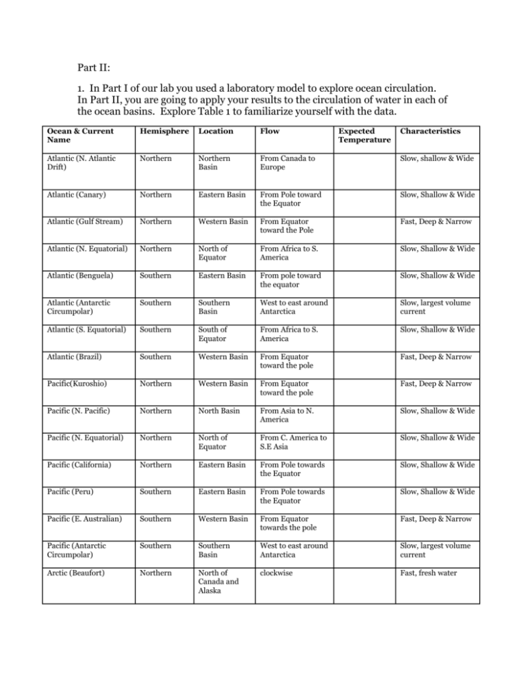
Part II: 1. In Part I of our lab you used a laboratory model to explore ocean circulation. In Part II, you are going to apply your results to the circulation of water in each of the ocean basins. Explore Table 1 to familiarize yourself with the data. Ocean & Current Name Hemisphere Location Flow Expected Temperature Characteristics Atlantic (N. Atlantic Drift) Northern Northern Basin From Canada to Europe Slow, shallow & Wide Atlantic (Canary) Northern Eastern Basin From Pole toward the Equator Slow, Shallow & Wide Atlantic (Gulf Stream) Northern Western Basin From Equator toward the Pole Fast, Deep & Narrow Atlantic (N. Equatorial) Northern North of Equator From Africa to S. America Slow, Shallow & Wide Atlantic (Benguela) Southern Eastern Basin From pole toward the equator Slow, Shallow & Wide Atlantic (Antarctic Circumpolar) Southern Southern Basin West to east around Antarctica Slow, largest volume current Atlantic (S. Equatorial) Southern South of Equator From Africa to S. America Slow, Shallow & Wide Atlantic (Brazil) Southern Western Basin From Equator toward the pole Fast, Deep & Narrow Pacific(Kuroshio) Northern Western Basin From Equator toward the pole Fast, Deep & Narrow Pacific (N. Pacific) Northern North Basin From Asia to N. America Slow, Shallow & Wide Pacific (N. Equatorial) Northern North of Equator From C. America to S.E Asia Slow, Shallow & Wide Pacific (California) Northern Eastern Basin From Pole towards the Equator Slow, Shallow & Wide Pacific (Peru) Southern Eastern Basin From Pole towards the Equator Slow, Shallow & Wide Pacific (E. Australian) Southern Western Basin From Equator towards the pole Fast, Deep & Narrow Pacific (Antarctic Circumpolar) Southern Southern Basin West to east around Antarctica Slow, largest volume current Arctic (Beaufort) Northern North of Canada and Alaska clockwise Fast, fresh water 2. Note that the "Expected Temperature" column of the data table has been left blank. Fill in what you would expect the general temperature of the water making up that part of the gyre to be like. Use the terms warm, cold, warming, cooling to describe the temperature of this ocean water. 3. On your world map, use the red and blue colored pencils to draw arrows at the positions of these currents. Use the red colored pencil for warm and warming currents, and the blue colored pencil for cool and cooling currents. 4. Results: Describe the motion as well as the water temperatures of each gyre found in each ocean basin using the chart below: Gyre location Direction of motion and temperatures around the gyre North Atlantic South Atlantic North Pacific South Pacific Antarctic Arctic 5. Write a general statement about the flow and temperature of currents in the northern hemisphere.
