Curiosities in Lancaster - Lancaster Civic Society
advertisement

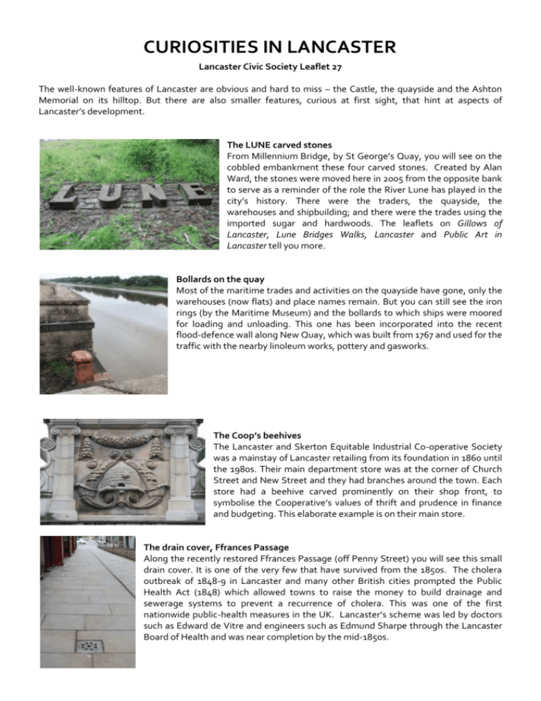
CURIOSITIES IN LANCASTER Lancaster Civic Society Leaflet 27 The well-known features of Lancaster are obvious and hard to miss – the Castle, the quayside and the Ashton Memorial on its hilltop. But there are also smaller features, curious at first sight, that hint at aspects of Lancaster’s development. The LUNE carved stones From Millennium Bridge, by St George’s Quay, you will see on the cobbled embankment these four carved stones. Created by Alan Ward, the stones were moved here in 2005 from the opposite bank to serve as a reminder of the role the River Lune has played in the city’s history. There were the traders, the quayside, the warehouses and shipbuilding; and there were the trades using the imported sugar and hardwoods. The leaflets on Gillows of Lancaster, Lune Bridges Walks, Lancaster and Public Art in Lancaster tell you more. Bollards on the quay Most of the maritime trades and activities on the quayside have gone, only the warehouses (now flats) and place names remain. But you can still see the iron rings (by the Maritime Museum) and the bollards to which ships were moored for loading and unloading. This one has been incorporated into the recent flood-defence wall along New Quay, which was built from 1767 and used for the traffic with the nearby linoleum works, pottery and gasworks. The Coop’s beehives The Lancaster and Skerton Equitable Industrial Co-operative Society was a mainstay of Lancaster retailing from its foundation in 1860 until the 1980s. Their main department store was at the corner of Church Street and New Street and they had branches around the town. Each store had a beehive carved prominently on their shop front, to symbolise the Cooperative’s values of thrift and prudence in finance and budgeting. This elaborate example is on their main store. The drain cover, Ffrances Passage Along the recently restored Ffrances Passage (off Penny Street) you will see this small drain cover. It is one of the very few that have survived from the 1850s. The cholera outbreak of 1848-9 in Lancaster and many other British cities prompted the Public Health Act (1848) which allowed towns to raise the money to build drainage and sewerage systems to prevent a recurrence of cholera. This was one of the first nationwide public-health measures in the UK. Lancaster’s scheme was led by doctors such as Edward de Vitre and engineers such as Edmund Sharpe through the Lancaster Board of Health and was near completion by the mid-1850s. Roving bridges, Lancaster Canal Lancaster Canal from Preston was opened in 1797 and the boats were originally pulled by horses walking along the towpath – now a paved walking and cycling route. The towpath is usually on the west side of the canal but in central Lancaster it switches to the east side. The problem was how to get the horses to the other side without wasting time in unhitching and then rehitching them to the boat. A roving (or turnover) bridge was the solution – it has both ramps facing in the same direction. Lancaster Canal’s bridges 98 (at Aldcliffe) and 100 (at Quarry Road) are examples of roving bridges. The canal was the location for eight mills that were an important part of the textile industry in Lancaster in the 19th and much of the 20th centuries. The companion leaflet on Lancaster’s Canalside Mills describes them. Municipal enterprise Photographed in 1898 soon after its completion, this was the office of Lancaster Borough’s Gas Department. It is in the corner of Market Square next to the Blue Anchor pub. The coat of arms of Lancaster is high up at the roofline. The gas works were by New Quay. The Borough also had its own water works, and an electricity-generating station near the Lune Aqueduct, off Caton Road. Since then the supply of utilities here and throughout the country has been nationalised (after 1945) and then privatised (in the 1980s and 1990s). Ginnels Most old towns have ginnels – alleyways and narrow passages between buildings, linking streets. In Lancaster some were lost during redevelopment from the Victorian period onwards. But many remain, often with distinctive names – Ffrances Passage, Sir Simon’s Arcade, Bashful Alley, Slip Inn Lane, Blue Anchor Lane, Treu Ginnel, Calkeld Lane, Sugar House Lane, Chancery Lane, Anchor Lane, Music Room Passage, Golden Ball Lane and Nip Hill (photographed here). Once, houses lined many of the ginnels; now they usually separate commercial premises. And finally... ...a house number in topiary in Blade Street. Text – Gordon Clark. Photographs – The Gas Office from S.H.Penny Lancaster in Old Picture Postcards. Zaltbommel (The Netherlands) European Library, 1983; Topiary – Winnie Clark; Other photographs – Gordon Clark. Published by Lancaster Civic Society (©2014) www.lancastercivicsociety.org www.citycoastcountryside.co.uk


