the adaptable Word resource
advertisement
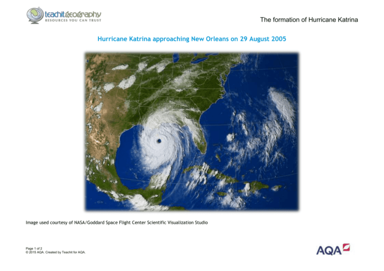
The formation of Hurricane Katrina Hurricane Katrina approaching New Orleans on 29 August 2005 Image used courtesy of NASA/Goddard Space Flight Center Scientific Visualization Studio Page 1 of 2 © 2015 AQA. Created by Teachit for AQA. The formation of Hurricane Katrina Student tasks 1. Watch the two NASA videos, Our World: What is a hurricane? at http://pmm.nasa.gov/education/videos/nasa-our-world-what-hurricane and Towers in the tempest, at http://pmm.nasa.gov/education/videos/towers-tempest. 2. Using the information from the video clips, number the boxes below in the correct order, for the formation of Hurricane Katrina. 3. Cut the boxes from this page, glue them around the image and arrow them to their correct position on the satellite image of Hurricane Katrina approaching New Orleans in August 2005. Number: Number: Number: Surrounding the eye are bands of heavy rain and very high winds. Warm, humid air rises, cools and condenses to form clouds. More air spirals in to fill the gap left from the rising air. Air descends at the centre of the hurricane. The eye is an area of calm conditions with a ring of clouds surrounding it. Number: Number: Number: All tropical storms take their distinctive, anticlockwise spiralling shape because of the Coriolis Force, generated by the rotation of the Earth. The warm air continues to rise and sucks in more air. Hurricane Katrina travelled westwards across the Gulf of Mexico; it gained more moisture and its speed increased. Page 2 of 2 © 2015 AQA. Created by Teachit for AQA.
