Sudan Road Assessment Additional Information
advertisement
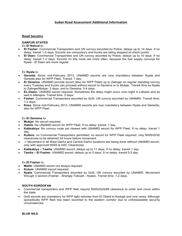
Sudan Road Assessment Additional Information Road Secutiry DARFUR STATES Ex El Nahud to: El Fasher: Commercial Transporters and UN convoy escorted by Police; delays up to 14 days. If no delay: transit 1-2 days. Escorts are compulsory and trucks are being stopped at check points. El Daen: Commercial Transporters and UN convoy escorted by Police; delays up to 10 days. If no delay: transit 1-2 days. Escorts on this route are more often, because the fuel supply convoys for Nyala - El Daen are more regular. Ex Nyala to: Gereida: Since mid-February 2013, UNAMID escorts are now mandatory between Nyala and Gereida also for WFP Fleet. Transit: 1 day. El Geneina: UNAMID provide escort (also for WFP Fleet) up to Zalingei on regular standing convoy every Tuesday and trucks can proceed without escort to Geneina or to Mukjar. Transit time ex Nyala to Zalingei/Mukjar: 2 days; and to Geneina: 3-4 days. EL-Daein: UNAMID escort required. Sometimes the delay might occur over-night in Labado and as well in Mahajria. Transit time: 2 days. Fasher: Commercial Transporters escorted by GoS; UN convoy escorted by UNAMID. Transit time: 1-2 days. Kass: Since mid-February 2013, UNAMID escorts are now mandatory between Nyala and Geireida, also for WFP Fleet. Ex El Geneina to: Mukjar: No escort required. Habila: No UNAMID escort for WFP Fleet. If no delay: transit: 1 day. Kabkabiya: No convoy route yet cleared with UNAMID escort for WFP Fleet. If no delay: transit 1 day. Kulbus: no Commercial Transporters permitted; no escort for WFP Fleet required, only NISS/GOS clearances to be obtained 24 hours before movement. -> Movement in all West Darfur and Central Darfur locations are being done without UNAMID escort, only with approved NISS & HAC Clearances. Kabkabiya – Tawlia: UNAMID escort; delays up to 11 days. If no delay: transit 1 day. Tawlia – El Fasher: UNAMID escort; delays up to 5 days. If no delay: transit 0.5 day. Ex El Fasher to: Mellit: UNAMID escort not always required. Kutum: UNAMID escort required. Nyala: Commercial Transporters escorted by GoS, UN convoy escorted by UNAMID. Movement through 3 sectors (Fasher - Shangly Tobiyah - Nyala). Transit time: 1-2 days. SOUTH KORDOFAN Commercial transporters and WFP fleet require NISS/GoS/MI clearance to enter and move within the state. GoS escorts are mandatory for WFP light vehicles from El Obeid to Kadugli and vice versa. Although sporadically WFP fleet has been escorted to the eastern corridor due to unforeseeable security circumstances. BLUE NILE GoS security escorts for UN convoys are required to the following locations: Geissan town, Yara, Doya, Gambarda, Keli, and Kurmuk town. Commercial transporters are not always willing to serve these locations. There is no access to Chali and Wadega, both in Kurmuk locality, SPLM-area. Bridges There are not many bridges or viaducts in Sudan. The exception being the bridges that cross the Nile into Khartoum at: Khartoum to Khartoum North Mac Nimir Bridge Blue Nile Road and Rail Bridge Elmansheya Bridge Sobia Bridge White Nile to connect with Khartoum and Omdurman White Nile Bridge Fitayhab Bridge Omdurman to Khartoum North Shambat Bridge Hafia Bridge Khartoum States to Tuti. Khartoum and Tuti Bridge Culverts and causeways that span the wadis and rivers may be flooded and become impassable during the rains, for example the cause way that leads to the El Geneina airport in Western Darfur. Transport Corridors Please see below (next chapter). International Corridors Leading to the Country The significant international corridor for transit traffic is through the gateway seaport of Port Sudan, a multi-faceted port that is able to receive and dispatch traffic by road, rail, linking to barges and combinations there of Port Sudan to Chad. Port Sudan to Ethiopia. Port Sudan to the Republic of South Sudan, through combinations of Rail, Road and River barges. There are no ‘cost’ or ‘time’ effective corridors at this juncture into Sudan from the neighbouring countries. Main Corridors within the Country (leading to main towns / hubs) Please see below (next chapter): Road Corridor Assessment DARFUR STATES: the main supply routes linking El Obeid - El Fasher and El Obeid - Nyala via El Nahud in North Kordofan remain open for all traffic with mandatory security escorts starting at El Nahud. Southern /Eastern Corridor: The movement of armed groups from the South increased, which might cause again delays for convoys ex El Daen and ex El Nahud, due to the lack of available security escorts. Northern Corridor: the route El Fasher - Kutum - Kabkabiya - Saraf Umra - Geneina requires security clearance and armed escorts provided by UNAMID or GoS. Tribal conflict in a few northern localities (Kebkebyia, Saraf Umra, El Sireaf) increased end February 2013. UNAMID established a Temporary Operations Base (TOB) in El Sireaf in order to secure humanitarian operations in the area. Commercial Transporters without the ability to use the Northern corridor are moving via Nyala - El Geneina, for which escorts remain mandatory, both for loaded and empty trucks. Insecurity in this area is well known and only some transporters are able to cross this route. NORTH KORDOFAN STATE: El Obeid remains the main hub for humanitarian logistics. SOUTH KORDOFAN STATE: Restriction of movement to and into South Kordofan State remains. The road El Obeid - Kadugli is tarmac and physically accessible for all traffic, but subject to clearances from concerned Government Authorities. IDP locations in Southern Kordofan are being served from El Obeid directly. During the dry season the roads to many IDP locations are accessible for all types of traffic. However, landmines and UXOs have posed some threat in some locations with mine incidents reported. Another corridor is El Obeid - Abu Jebeeha - Kalogi - Talodi. During the rainy season the roads are passable for short dry periods and only for tractors and high clearance -6x6 trucks equipped with offroad-mud tires, which are currently only possessed by the WFP truck fleet. This route is often not accessible for commercial transporters. Of importance is also that this corridor is affected by armed clashes in various localities. BLUE NILE STATE STATE: No access difficulties are reported for Khartoum – Kosti – Damazin, but subject to the usual clearances. A logistics assessment mission was undertaken by WFP in May 2013, to look at storage augmentation and to monitor prepositioning and advanced distribution before the rainy season. The corridor Damazin – Kurmuk requires security escorts for UN convoys. Commercial Transporters are not always willing to serve locations along this route. Last update: May 2013 Main domestic road corridors General Informations Total distance Total travel time Road classification Security Main towns/hubs 30,000 km Dependant on road, traffic flows, security, etc All types Marginal, frequent checks with Agency's Security Focal Points. Port Sudan, Khartoum, El Obeid, Kosti, El Geneina, El Fasher, Nyala, Kadugli and Damazin. Road functional class Tertiary Comments Highway/Primary (asphalt): 7,000km Secondary (gravel): 4,300km Tertiary/Trail (gravel and dirt): 20,000km Local/Urban: 1,000km Comments Paved (asphalt or concrete): 7,000km Gravel or murram: 4,300km Dirt or sand: 20,000km The surface condition of paved roads is consistent, corrugation/ruts on gradients, intersections and turn offs to laybys caused by heavily laden freighters. Potholes and wash a ways on the primary roads are evident in areas in close proximity to rivers. Road condition Comments Compacted smooth (>40kph): 4,300km Compacted rough (<40kph): - Uncompacted smooth (>40kph): - Uncompacted rough (<40kph): 20,000km Mud: seasonal Seasonal variations for transport: 25mt load for the dry season on primary and paved roads, 20mt load for unpaved, tracks and off road. During the rainy season however, only 12mt load of trucks feasible. Passable by what traffic: dry season Passable by what traffic: rainy season Comments All types of vehicles are able to move on the roads, the norm is that vehicles with a payload of 70 mt transport from Port Sudan through to El Obeid and Khartoum, then transship to 30 mt trucks for distribution to the hubs, and to small road vehicles (includes utilities) for distribution to deep field locations.The tracks are in the desert, thus vehicles may get stuck in sand or wadis during the wet. Roads are passable for all vehicle types (dry season): Heavy trucks (15 – 23 mt) (6x6 or 6x4) with trailer Heavy trucks (15 – 23 mt) (6x6 or 6x4) without trailer Light trucks (8 – 12 mt) (6x6) with trailer Light trucks (8 – 12 mt) (6x6) without trailer Light trucks (3 – 8 mt) (4x4) Tractors (< 40 mt) Light vehicles passengers Light vehicles pick-up Motorbike Non-motorised traffic Seasonal variations for transport: 25mt load for the dry season on primary and paved roads, 20mt load for unpaved, tracks and off road. During the rainy season however, only 12mt load of trucks feasible. Obstacles and bridges Comments Mines/UXOs Road blocks Check point - official Check point - unoffcial Debris/wreckage Downed electrical lines Avalanche, snow, ice Landslide/Mudslide Floods Wet crossing Road damage Bridges Traffic restriction Other Under review and reporting by UNMAS, UNAMID and UNISFA. Gateways to major cities, town and main road junctions Gateways to major cities, town and main road junctions They are set and removed without notice. Nil permanent debris/wreckage that impede movement Nil, and lines in the rural areas are generally away from roads Nil Occur during the rainy season (May-October) Occur during the rainy season (May-October). Flooded wadis cause the movement on secondary and tertiary roads to become impassable for periods of time. Causeways and culverts may be submerged during the rains; rivers and wadis may encroach over the low bridges, culverts and roads. Sections of roads may be eroded during the rains, and on the main arterial roads, potholes are evident, on gradients and intersections, and the roads tend to 'corrugate' due to the traction of heavily laden commercial carriers. Commercial vehicles have restricted times that they are permitted to cross the bridges into Khartoum, this is to reduce traffic congestion. Commercial vehicles have restricted times that they are permitted to cross the bridges into Khartoum, this is to reduce traffic congestion. All road movement are subject to security clearance from internal UN procedures and HAC, NIS and MI (see paragraph about Road Security). Towns and hubs El Obeid Overview El Obeid is the primary transhipment hub in the country, for onward transport to Darfur, as well as to South Kordofan (and Abyei). Contacts El Obeid Title: WFP Head of Sub-Office Name: Lemma Bayissa Address: WFP El Obeid Tel: +249 912 179 394 Email: lemma.bayissa@wfp.org Website: http://www.wfp.org Location El Obeid Connection with other means of transport Road, Air Storage capacity Please see Storage Assessment chapter for a breakdown of storage capacity by organisation. Other comments There is a good asphalt runway capable of receiving C130s. Sudan Railway has a marshalling yard in the town centre. Port Sudan Overview Port Sudan is an important entry point into the country. Contacts Port Sudan Title: WFP Sudan Head of Logistics Name: Anthony Freeman Address: WFP Khartoum Tel: +249 912 167 969 Email: anthony.freeman@wfp.org Website: http://www.wfp.org Location Connection with other means of transport Road, Air Storage capacity Please see Storage Assessment chapter for a breakdown of storage capacity by organisation. Other comments A seaport that is able to receive and dispatch all types of cargo by rail and road; a gateway for transit cargo consigned to Ethiopia, Chad and South Sudan; has an international airport. Khartoum Overview The country's capital has an international airport is a main entry point. Contacts Khartoum Title: WFP Sudan Head of Logistics Name: Anthony Freeman Address: WFP Khartoum Head Office Tel: +249 912 167 969 Email: anthony.freeman@wfp.org Website: http://www.wfp.org Location Khartoum Connection with other means of transport Road, Air Storage capacity Please see Storage Assessment chapter for a breakdown of storage capacity by organisation. Other comments El Fasher Overview El Fasher is the state capital of North Darfur, and located on the main route from El Obeid; an ideal transit point for destinations within the Northern sectors of Darfur. Contacts El Fasher Title: Logistics Officer Name: Habtamu Biru Address: WFP Area Office Tel: +249 912 167 922 Email: habtamu.biru@wfp.org Website: http://www.wfp.org Location El Fasher Connection with other means of transport Road, Air Storage capacity Please see Storage Assessment chapter for a breakdown of storage capacity by organisation. Other comments El Fasher has an asphalt runway able to receive C130s and similar type of aircraft. El Geneina Overview El Geneina is the state capital of West Darfur, and transit point for traffic consigned through to Chad. Contacts El Geneina Title: Logistics Officer Name: Kebede Seifu Address: WFP Area Office Tel: +249 192 160 301 Email: kebede.seifu@wfp.org Website: http://www.wfp.org Location Connection with other means of transport Road, Air Storage capacity Please see Storage Assessment chapter for a breakdown of storage capacity by organisation. Other comments Nyala Overview Nyala is the state capital of South Darfur and the main distribution hub in the area as well as deeper field locations in the state. Relative short-haul distances to locations within 100km radius of Nyala city centre. Contacts Nyala Title: Logistics Officer Name: Armand Ndimurukundo Address: WFP Area Office Tel: +249 912 178 822 Email: armand.ndimurukundo@wfp.org Website: http://www.wfp.org Location Nyala Connection with other means of transport Road, Air Storage capacity Please see Storage Assessment chapter for a breakdown of storage capacity by organisation. Other comments Future plans for the construction of a 100,000 litre fuel tank farm to be positioned within the 'OTASH' warehouse & workshop compound. An asphalt surface runway that is able to receive C130s and similar aircraft. Kosti Overview Kosti is a River Nile gateway to the South Sudan. Contacts Kosti Title: WFP Sudan Head of Logistics Name: Anthony Freeman Address: WFP Khartoum Tel: +249 912 167 969 Email: anthony.freeman@wfp.org Website: http://www.wfp.org Location Kosti Connection with other means of transport Road, Waterway, Air Storage capacity Please see Storage Assessment chapter for a breakdown of storage capacity by organisation Other comments Kadugli Overview Kadugli is state capital of South Kordofan, situated about 320km south from El Obeid. Contacts Kadugli Title: Head of Sub-Office El Obeid Name: Lemma Bayissa Address: WFP Sub-Office El Obeid Tel: +249 912 179 394 Email: lemma.bayissa@wfp.org Website: http://www.wfp.org Location Kadugli Connection with other means of transport Road, Air Storage capacity Please see Storage Assessment chapter for a breakdown of storage capacity by organisation. Damazin Overview Damazin is the state capital of Blue Nile. For over 18 months, the Government of Sudan denied humanitarian organisations access to this state, until April 2013, when the security situation allowed to re-launch humanitarian interventions in this state. Damazin Title: WFP Sudan Head of Logistics Name: Anthony Freeman Address: WFP Khartoum Tel: +249 912 167969 Email: anthony.freeman@wfp.org Website: http://www.wfp.org Location Damazin Connection with other means of transport Road, Air Storage capacity Please see Storage Assessment chapter for a breakdown of storage capacity by organisation.
