A Possible Solution: The Ike Dike - Texas A&M University at Galveston
advertisement
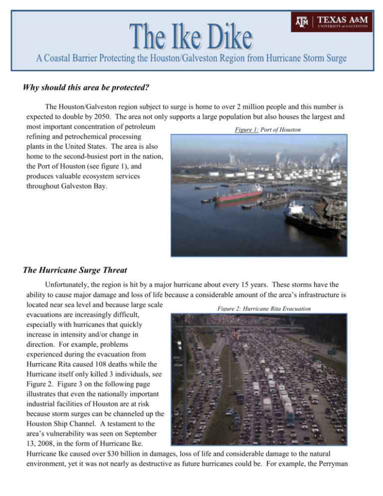
Why should this area be protected? The Houston/Galveston region subject to surge is home to over 2 million people and this number is expected to double by 2050. The area not only supports a large population but also houses the largest and most important concentration of petroleum Figure 1: Port of Houston refining and petrochemical processing plants in the United States. The area is also home to the second-busiest port in the nation, the Port of Houston (see figure 1), and produces valuable ecosystem services throughout Galveston Bay. The Hurricane Surge Threat Unfortunately, the region is hit by a major hurricane about every 15 years. These storms have the ability to cause major damage and loss of life because a considerable amount of the area’s infrastructure is located near sea level and because large scale Figure 2: Hurricane Rita Evacuation evacuations are increasingly difficult, especially with hurricanes that quickly increase in intensity and/or change in direction. For example, problems experienced during the evacuation from Hurricane Rita caused 108 deaths while the Hurricane itself only killed 3 individuals, see Figure 2. Figure 3 on the following page illustrates that even the nationally important industrial facilities of Houston are at risk because storm surges can be channeled up the Houston Ship Channel. A testament to the area’s vulnerability was seen on September 13, 2008, in the form of Hurricane Ike. Hurricane Ike caused over $30 billion in damages, loss of life and considerable damage to the natural environment, yet it was not nearly as destructive as future hurricanes could be. For example, the Perryman Report estimates that a “Katrina-like” storm would cause aggregate losses to the Texas economy of $73 billion in gross product, $61.3 billion in income and 863,000 jobs. Figure 3: Coastal Flood Hazard Areas during Hurricane Storm Events Category 3 Category 4 Map Courtesy of the Houston-Galveston Regional Council Hazard Mitigation Plan-2011 Update A Possible Solution: The Ike Dike The Ike Dike is a coastal barrier that would protect the Houston-Galveston region including Galveston Bay from Hurricane storm surge. It Figure 4: First Component of the Ike Dike is modeled after the Dutch Delta Works that protects the Netherlands Category 5 from North Sea storm surges. The Ike Dike consists of three components. The first of these components is the Galveston Seawall, see Figure 4. The Galveston Seawall has done its job of preventing catastrophic Gulf overflow, but fails to prevent back surge from the Bay. Figure 3: Man-Made Revetment made to Look Natural The second component of the project would be to extend the protection afforded by the existing Seawall along the rest of Galveston Island and along the Bolivar Peninsula. This can be done by creating a 17 foot high revetment near the beach Figure 5: Second Component of the Ike Dike or by raising the coastal highways, see Figure 5. Revetments can be made to natural in order to blend seamlessly with the surrounding environment. The coastal highways are already at an elevation of 5 feet and would need to be raised 12 feet to afford the overall 17 foot surge protection. The third and final component of the project would be the addition of flood gates at Bolivar Roads, the entrance to the Houston, Texas City and Galveston ship channels, and at San Luis pass, see Figure 6. This component would be the costliest Figure 6: Third Component of the Ike Dike aspect of the project and would also be its biggest tourist attraction. The gates would be designed using existing technology from the Dutch Delta Works Project to prevent interference with navigation, to allow circulation into the bay under normal conditions, and to close quickly when a hurricane approaches in order to provide a 17 foot higher-than-sea-level barrier across Bolivar Roads. When combined, these components would create a coastal spine that would provide a barrier against all Gulf surges into the Bay, see Figure 7. Figure 7: Coastal Spine Formed by the Ike Dike The Ike Dike is one method for providing comprehensive protection from storm surge for the people, properties, and industrial base of a nationally important region. The Dike would not only reduce the area’s vulnerability but would also encourage Figure 8: Simulation of Hurricane Ike’s Surge without the Ike Dike economic development through investment in and commitment to the region. Although a structure of this size would be costly, it could be built with existing technology that has proven to be very successful for the Netherlands, would cost much less than a single hurricane recovery, and would also cost less and be more environmentally sound than individually armoring the entire Bay complex. Addition studies are needed, but preliminary studies confirm that the Ike Dike would have indeed suppressed Ike’s storm surge, as demonstrated by Figures 8-10. Figure 9: Simulation of Hurricane Ike’s Surge with the Ike Dike Figure 10: Difference of Hurricane Ike’s Surge with and without the Ike Dike Simulations courtesy of the University of Texas: Gordon Wells, Jennifer Profit, Clint Dawson Next Steps The Governor’s Commission on Recovery and Renewal, recognizing that the vulnerability of the Houston/Galveston area could cause serious economic damage to the United States, reviewed the Ike Dike concept and recommended that a six county public corporation be formed on the upper Texas coast to deal with storm surge and regional recovery strategies. That corporation, the Gulf Coast Community Protection and Recovery District, is now in place and is currently coordinating approaches to compressive regional protection from storm surge. For more information on the Ike Dike please visit: www.tamug.edu/ikedike
