July 2011 White Paper
advertisement

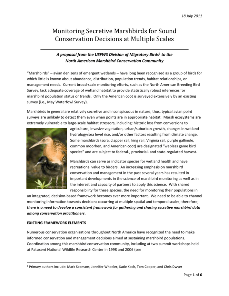
18 July 2011 Monitoring Secretive Marshbirds for Sound Conservation Decisions at Multiple Scales A proposal from the USFWS Division of Migratory Birds1 to the North American Marshbird Conservation Community “Marshbirds” – avian denizens of emergent wetlands – have long been recognized as a group of birds for which little is known about abundance, distribution, population trends, habitat relationships, or management needs. Current broad-scale monitoring efforts, such as the North American Breeding Bird Survey, lack adequate coverage of wetland habitat to provide statistically robust inferences for marshbird population status or trends. Only the American coot is surveyed extensively by an existing survey (i.e., May Waterfowl Survey). Marshbirds in general are relatively secretive and inconspicuous in nature; thus, typical avian point surveys are unlikely to detect them even when points are in appropriate habitat. Marsh ecosystems are extremely vulnerable to large-scale habitat stressors, including: historic loss from conversions to agriculture, invasive vegetation, urban/suburban growth, changes in wetland hydrology/sea level rise, and/or other factors resulting from climate change. Some marshbirds (sora, clapper rail, king rail, Virginia rail, purple gallinule, common moorhen, and American coot) are designated “webless game bird species” and are subject to federal-, provincial- and state-regulated harvest. Marshbirds can serve as indicator species for wetland health and have recreational value to birders. An increasing emphasis on marshbird conservation and management in the past several years has resulted in important developments in the science of marshbird monitoring as well as in the interest and capacity of partners to apply this science. With shared responsibility for these species, the need for monitoring their populations in an integrated, decision-based framework becomes ever more important. We need to be able to channel monitoring information towards decisions occurring at multiple spatial and temporal scales; therefore, there is a need to develop a consistent framework for gathering and sharing secretive marshbird data among conservation practitioners. EXISTING FRAMEWORK ELEMENTS Numerous conservation organizations throughout North America have recognized the need to make informed conservation and management decisions aimed at sustaining marshbird populations. Coordination among this marshbird conservation community, including at two summit workshops held at Patuxent National Wildlife Research Center in 1998 and 2006 (see 1 Primary authors include: Mark Seamans, Jennifer Wheeler, Katie Koch, Tom Cooper, and Chris Dwyer Page 1 of 6 18 July 2011 http://www.waterbirdconservation.org/marshmonitoring.html), has resulted in the development of several framework elements over the past decade. Standardized Protocol Dr. Courtney Conway of the USGS Arizona Cooperative Fish and Wildlife Research Unit has spearheaded development and testing of standardized survey protocols for monitoring secretive marshbirds for the last decade. Much of this work took place on National Wildlife Refuges and involved over 200 participants. Standardized monitoring protocols were deemed an essential part of the effort to determine continental, regional, and local trends in marshbird abundance. Protocols involve broadcast vocalizations of target species to improve detection probability. These protocols may not work well for some target species (such as yellow and black rails). Additionally, protocols for collection of habitat information need to be formalized once decision frameworks are identified. Sampling Design Our recommended approach for selection of sampling points allows for inference at multiple scales including regions, flyways, and continent-wide. Depending on sampling intensity, inference at finer scales may also be possible. A pilot study to assess the sampling framework recommended by Johnson et al. (2009) is currently being conducted in several states. The framework is flexible and allows for more intensive surveys within pre-determined strata such as states, wildlife management areas, or bird conservation regions. Primary sampling units (40 km2 hexagons) are randomly drawn from a uniform hexagonal grid that covers the United States. Once a hexagon is selected, secondary sampling units (survey points) are randomly placed in wetlands within the hexagon. Wetlands within hexagons are delineated using available maps such as the National Wetland Inventory. During the piloting some changes to the design recommended by Johnson et al. (2009) have been made. Johnson et al. (2009) recommended that secondary sampling be stratified among small versus large wetlands. Maintaining the recommended distribution of sample units among small and large wetlands (Johnson et al. 2009 Table 1) was logistically difficult in the field due to access and natural limitations of available wetlands within selected primary sampling units. Therefore this stratification was ignored for some states during the piloting phase. During the piloting phase in each state various stratifications were tried. Due to access issues a public versus private stratification was tried in about half of the states. Logistically this proved very useful; however, objectives concerning inference to private lands versus public lands need to developed. Another stratification test during piloting was that of a “high intensity” stratum versus other areas. This high intensity stratum included National Wildlife Refuges and State Wildlife Management Areas that had extensive areas of marsh, and also included other lands such as private duck clubs. The intent was to stratify sampling based on expected density of marshbirds and therefore reduce variation among sampling units within strata. There appear to be logistical and statistical advantages to such stratification, yet such stratification will likely reduce sampling in areas due to logistical constraints, thus increasing uncertainty in these areas and possibly limiting inferences. Page 2 of 6 18 July 2011 Data Management In cooperation with the National Wildlife Refuge System, USGS Patuxent has developed and currently maintains a survey database specific to the target species and the protocol, with a remote, web-based data entry capability (http://www.pwrc.usgs.gov/point/mb). Support will be needed with operationalization of a program. In addition, full implementation will require additional databases that store data related to ground-truthing of survey locations and habitat. Preliminary Findings from Pilot Efforts Seven states (Florida, Idaho, Kentucky, Michigan, New York, Ohio, and Wisconsin) and the District of Columbia have participated in the piloting phase of the survey. Survey effort varied widely among states: from <6 primary sampling units to approximately 50 per year. Field work for piloting the design and protocol began in 2008 in Wisconsin. Preliminary abundance estimates (N) and their coefficients of variation (CV) for Wisconsin include the following: Sora N(2009)=104,700 (CV=11%), N(2010)=61,820 (CV=15%); Virginia Rail N(2009)=36,870 (CV=16%), N(2010)=27,860 (CV=13%); American Bittern N(2009)=23,340 (CV=25%), N(2010)=15,960 (CV=17%). Approximately 45 primary sampling units (i.e. 40 km2 hexagons; with an average of 7.3 secondary sampling units in each) were sampled each year in Wisconsin. These sampling units were randomly selected throughout the entire state. Field work during piloting was accomplished in each participating state using various means. For example, Wisconsin used a mixture of paid staff and volunteers to affect the survey. Idaho used various state personnel, not all of whom were biologists (e.g., state game wardens). Florida and New York used only a small number of state personnel to affect the survey. To initiate surveys some states required no federal money, some seed money ($5,000-$10,000), and some required enough money to hire all surveyors and a part-time coordinator. Before surveys begin in any state there is an initial expense of ground truthing the randomly selected survey locations. It can take 0.5 to 2 person days to ground truth a single primary sampling unit depending on access and available aerial photographs. Once surveys begin it takes approximately 1.5 person days to fully survey a selected primary sampling unit in a single year. GOAL: INTEGRATED, DECISION-BASED FRAMEWORKS FOR OPERATIONAL MONITORING With a standardized protocol, sampling design approach, and data management system in place, the USFWS Division of Migratory Birds is seeking to operationalize marshbird monitoring focusing on population level management and conservation needs. We recognize that any framework for marshbird monitoring must be driven by the management or policy objectives of stakeholders. These objectives must be explicit, in order that monitoring programs designed at the appropriate scale, scope, and intensity to address them. The following examples illustrate some of the explicit monitoring objectives we expect to address with a marshbird monitoring program. Page 3 of 6 18 July 2011 Informing Harvest Regulations Population information is needed for ensuring sustainable harvest of marshbirds that are hunted. Current regulatory decision frameworks for these birds are not explicitly tied to any population information. The highest priority identified by the Rail and Snipe Strategy is to initiate a national secretive marshbird monitoring program under the leadership of the Flyway Councils and respective Technical Committees, beginning with the Atlantic and Mississippi Flyways, since this is where a majority of marshbird hunting occurs. A general objective is to provide regional, flyway, or population level status information to guide sustainable harvest management practices of hunted marshbird species, but as yet, specific objectives and their spatial scope have yet to be determined. Draft Objective: Maintain current abundance and distribution of marshbird game species while allowing harvest. A potential process for moving forward with developing an operational marsh bird monitoring program is to provide the current document for discussion and feedback at the Atlantic and Mississippi Flyway Technical Section meetings in July, 2011, with similar encouragement for the Central and Pacific Flyways. Tech Sections may identify representatives from both the game and non-game committees to assist in soliciting feedback from state agencies on the questions identified in the following section. The proposal includes compiling information from each state in advance of a winter 2011 meeting, which will be used to develop specific monitoring objectives, sampling considerations, thresholds for detecting changes, costs associated with conducting surveys, a potential timeline for implementation and/or participation. Recommendations generated during the winter meeting will be communicated back to flyway technical sections at their winter 2012 meetings for consideration, and any further recommendations that are deemed appropriate by the technical committees could be forwarded to Councils for their consideration to determine the final steps toward implementation. Informing Management and Conservation Decisions (other than harvest) Our position is that monitoring should be used to track progress towards meeting conservation and management needs for marshbirds and for evaluating population-scale effectiveness of the management actions delivered in the field. The following examples using Clapper Rail (CLRA) illustrate how monitoring could inform and evaluate management decisions. The examples are listed in what we believe is the order of desirability based on strength of inference and integration of objectives, starting with the most simple and least informative and ending with the more complex and informative design. Note that although the designs become increasingly more complex it does not follow that there is an increased burden on field personnel. However, estimating the needed field effort and comparing among approaches can only be done after the objectives, alternatives, and designs have been refined. 1. Omnibus/BBS style design: The intent is to estimate status and trend of target species (e.g., Clapper Rail) in estuarine marsh in the southeastern US. The design follows that of the pilot study: delineate sampling frame using National Wetlands Inventory (NWI) data, Page 4 of 6 18 July 2011 randomly place points in marsh, survey, and make inference to population status. Ancillary habitat data can be collected and correlated with observations. 2. Ecological hypothesis type design: The intent is to estimate the effect climate change has on CLRA in the southeastern US. A potential design might be: use state of the art climate change modeling to predict the spatially explicit effect sea level rise has on estuarine marshes and the CLRA population in the southeastern US. We would sample areas of predicted high, medium, and low impact and collect ancillary habitat data to assess effect of sea level rise. We can also use habitat data to correlate with marshbird observations. We will be able to make inference regarding effect of climate change on CLRA populations, and effect of climate change on estuarine marshes (this will likely require collaboration with marsh experts and/or existing programs examining sea level rise). We can also make inference to status and trends because all estuarine marsh is in the sampling frame and will be randomly sampled within respective strata (strata based on effect of climate change on marsh). Thus, we would get complete inferential strength of #1 above plus added insights into effect of climate change on CLRA. 3. Management Monitoring design: The intent is to estimate: (1) effect of climate change on CLRA in the southeastern US; and (2) efficacy of management actions in combating effects of climate change. A potential design might be: define all areas where management is or may occur to alter the effect of sea level rise on coastal marsh (e.g., coastal NWR actions in southeastern US to dike areas, create new marsh, etc.); categorize management actions. Sample within categories to estimate effect of actions on marsh and CLRA. Sample outside managed areas for comparison. Collect explicit habitat data at each sample site to determine efficacy of management action, and we can correlate this with CLRA population change. We will be able to estimate effect of management actions on CLRA and marsh habitat. We will also be able to infer effect of climate change on CLRA and predict how we might alter this effect with various management actions. Because all estuarine marsh is in the sampling frame (either for managed areas or for comparison), we can make inference to status and trends. NEXT STEPS: REQUEST FOR INPUT ON DECISION-BASED FRAMEWORKS We are actively seeking review of this proposal and input from the larger marshbird conservation community in summer 2011. The achievement of an integrated, decision-based framework requires that we tap into existing or potential natural resource management structures --partnerships based around goals for a specified area, biological population, or activity, such as harvest, that is able to make decisions and take action to effect change. We are also initiating planning for an invite-only summit workshop in winter 2011 to include representatives from the stakeholder groups to integrate objectives and recommendations received in response to this proposal in order to develop an operational marshbird monitoring program. Page 5 of 6 18 July 2011 Integral to successful outcomes from the winter 2011 summit will be summarizing and incorporating your answers to the following key questions during the next few months. Specifically, we request your assistance in gathering and further developing explicit objectives for marshbird monitoring within your respective sphere: 1. Perspectives and Lessons Learned: Are you presently involved in an existing multi-site marshbird monitoring program (e.g., as a pilot state for this program, using the Conway protocol for studies outside of the pilot effort, working under a regional project effort etc.)? If so, please summarize your objectives, successes and lessons learned to be communicated to the larger marshbird conservation community. 2. Objectives: To integrate explicit objectives and to ensure monitoring programs are initiated strategically at appropriate scales and geographic locations, please describe the decisions you are making that are informed by a marshbird monitoring program. Or describe the questions and uncertainties that are limiting your success in conservation and management of marshbirds. 3. Protocol Considerations: Describe any needs or anticipated research to refine marshbird protocols for targeted studies (e.g., very rare species) or to expand the utility of the standardized protocol. 4. Coordination: Please describe your vision for the coordination structure to deliver a consistent framework for monitoring secretive marshbirds to inform conservation and management decisions at multiple scales. What staff support and funding do you envision contributing? If you are implementing a program now, what logistical or budgetary needs or challenges have you overcome? 5. Paramount to the success of this program will be our ability to apply effective, modern data management and analysis techniques to address management questions. What suggestions do you have to ensure acquisition and retention of the financial and administrative support for data management? Please Submit Responses to the authors (see contact info below) by September 30, 2011. Mark Seamans: mark_seamans@fws.gov, 301-497-5866 Jennifer Wheeler: jennifer_wheeler@fws.gov, 703-358-1931 Katie Koch: katie_koch@fws.gov, 906-226-1249 Tom Cooper: tom_cooper@fws.gov, 612-713-5338 Chris Dwyer: chris_dwyer@fws.gov, 413-253-8706 LITERATURE CITED Johnson, D.H., J.P. Gibbs, M. Herzog, S. Lor, N.D. Niemuth, C.A. Ribic, M. Seamans, T.L. Shaffer, W.G. Shriver, S.V. Stehman, and W.L. Thompson. 2009. A sampling design framework for monitoring secretive marshbirds. Waterbirds 32: 230-215. Page 6 of 6


