3rd Grade Geography Lesson Plan: Where We Are
advertisement
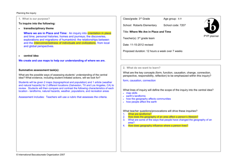
Planning the inquiry 1. What is our purpose? To inquire into the following: Class/grade: 3rd Grade Age group: 8-9 School: Roberts Elementary School code: 7207 transdisciplinary theme Where we are in Place and Time: An inquiry into orientation in place and time; personal histories; homes and journeys; the discoveries, explorations and migrations of humankind; the relationships between and the interconnectedness of individuals and civilizations, from local and global perspectives. Title: Where We Are in Place and Time Teacher(s): 3rd grade team PYP planner Date: 11-15-2012 revised Proposed duration: 12 hours a week over 7 weeks central idea We create and use maps to help our understanding of where we are. Summative assessment task(s): What are the possible ways of assessing students’ understanding of the central idea? What evidence, including student-initiated actions, will we look for? Students will be given 2 maps (topographical and population) and 1 article (weather and natural hazards) for 2 different locations (Galveston, TX and Los Angeles, CA) to review. Students will then compare and contrast the following characteristics of each location - landforms, natural hazards, weather, populations, and recreation areas Assessment includes: Teachers will use a rubric that assesses the criteria. 2. What do we want to learn? What are the key concepts (form, function, causation, change, connection, perspective, responsibility, reflection) to be emphasized within this inquiry? form, causation, connection What lines of inquiry will define the scope of the inquiry into the central idea? map skills earth’s landforms how the geography affects communities how people affect the earth What teacher questions/provocations will drive these inquiries? 1. 2. 3. 4. © International Baccalaureate Organization 2007 What are landforms? How does the geography of an area affect a person’s lifestyle? What are some of the ways that people have changed the geography of an area? How does geography influence where a person lives? Planning the inquiry 3. How might we know what we have learned? 4. How best might we learn? This column should be used in conjunction with “How best might we learn?” What are the learning experiences suggested by the teacher and/or students to encourage the students to engage with the inquiries and address the driving questions? What are the possible ways of assessing students’ prior knowledge and skills? What evidence will we look for? The class will dissect the central idea and discuss the meaning of the words. Students will given a variety of maps, such as amusement parks, zoos, museum, weather, Olympic Village, and various cities to observe and list their noticings. What am I noticing? What am I learning? How is it helpful? What is the purpose? Who uses this type of map? Is a title helpful? The class will read a description of the travels of Lewis and Clark discussing how they made the maps. What are the possible ways of assessing student learning in the context of the lines of inquiry? What evidence will we look for? 1. 2. 3. 4. 5. After researching landforms, participating in science labs on the earth’s crust and weathering/erosion, students will choose landform(s) and describe how it is formed through a poster/brochure or student/teacher selected method. Students will draw a realistic map of their choosing in order to develop map skills. Students will pick a landform or community that they would want to live in and write about why they would chose to live there. Students will examine population maps and then determine possible geographic reasons for the greatest/least populations. Maps from the world, Australia, and Texas will be used. After reading The Little House, students will create a visual project (mural, shoebox, diorama, mosaics) illustrating how humans affect geography, why people live where they do, and how geography affects lifestyle. 1. 2. 3. 4. 5. 6. 7. 8. 9. 10. 11. 12. 13. 14. TSW inquire about the variety of places they have lived throughout the world and what types of landforms are present. C, I, RF TSW explore landforms through pictures, facts, and books to learn about the vocabulary and features. R, S, C, I, K TSW complete a vocabulary landform activity (matrix) including: What is it? Can you describe it? What does it look like? R, C, K Throughout the unit, anchor charts will be created identifying the characteristics (landforms, population, weather, natural hazards, etc) of Galveston, TX and Los Angeles, TX. R, C, K, RF Science Labs: S, T, SM, C, I, K Landform-shaving cream models; Weathering/erosion; Hurricanes/Tornadoes/Volcanoes TSW use maps and globes, cardinal and intermediate directions to locate places, use a map scale to determine distance, identify and use a compass rose, grid system (latitude and longitude), map symbols, locate places such as Rocky Mountains/Mississippi River, map titles, map legends. R, T, K TSW view different kinds of maps such as population/density, political, physical, etc… R, T, I TSW define population and give reasons why some areas are more populated than others. R, T, C, I, RF TSW explore and inquire through virtual field trips (Google Earth) important landforms such as Grand Canyon, Mt. Everest, Pompeii, Hawaii’s volcanoes etc…. R, T, C, I TSW explore slow changes such as erosion and weathering. R, K, I TSW look at natural hazards such as hurricanes, landslides, droughts, tornado, tsunamis, floods, and blizzards to look for fast changes to the Earth. Students will research using notefacts and a variety of resources. R, S, SM, T, C; I TSW will view videos about the tectonic plates and the layers of the earth. R, K TSW define and describe the differences between urban, suburban, and rural communities. R, T, K To learn about how people affect the Earth, students will read The Little House and then create a before and after project (shoebox) about how the Earth changed. R, SM, C, T; RF What opportunities will occur for transdisciplinary skills development and for the development of the attributes of the learner profile? S –Social, R-Research, T-thinking, SM- Self-management, C- Communication I – Inquirer, RF-Reflective, C – Communicator, K - Knowledgeable 5. What resources need to be gathered? What people, places, audio-visual materials, related literature, music, art, computer software, etc, will be available? www.brainpop.com (soil/rock, changes, natural disasters, erosion, and layers of the earth) www.united streaming.com (maps, symbols, geographical features, landforms and living patterns, earth’s physical features, how mountains affect life, Magic School Bus Volcano) http://news.bbc.co.uk./2/hi/science/nature/4588149.stm - small video on fast changes Science and Social Studies textbook, The Little House, Google Earth, variety of maps, Time for Kids articles, Fun Maps, Scholastic books on Natural Hazards How will the classroom environment, local environment, and/or the community be used to facilitate the inquiry? Field trip to Galveston © International Baccalaureate Organization 2007 Reflecting on the inquiry 6. To what extent did we achieve our purpose? 7. To what extent did we include the elements of the PYP? Assess the outcome of the inquiry by providing evidence of students’ understanding of the central idea. The reflections of all teachers involved in the planning and teaching of the inquiry should be included. What were the learning experiences that enabled students to: The students really have a strong understanding of how to use maps and the purposes of various maps. They could predict why different maps were made. They were able to use the maps to tell about the landforms of a locations and what the lifestyle of the inhabitants would like. Students were able to predict what types of natural hazards might occur in various locations. How you could improve on the assessment task(s) so that you would have a more accurate picture of each student’s understanding of the central idea. We decided that the summative assessment needed to be more cohesive and simplified. We need to do more preparation and learning activities throughout the unit in order to make sure that the students are anchoring the characteristics of maps and locations of various places in the world throughout the entire unit. What was the evidence that connections were made between the central idea and the transdisciplinary theme? When we discuss population and where people choose to live, the students make connections to past and present and why people make different choices now. They really start to see how geography and lifestyle are connected. develop an understanding of the concepts identified in “What do we want to learn?” demonstrate the learning and application of particular transdisciplinary skills? develop particular attributes of the learner profile and/or attitudes? In each case, explain your selection. Concepts Form – Students researched various landforms and created them with shaving cream and their bodies. Causation – After viewing maps, class discussions, and science experiments students were able to see how landforms are created, slow and fast changes in the science lab and classroom discussion. Connection – Students viewed physical and population density maps to identify why people chose to live in various locations. Transdisciplinary Skills Social – worked in groups while making the collage and while acting out the landforms, students also presented in groups Research - investigated the answers to their questions, using internet, virtual field trips, library books, atlases, and each other Communication – writing and drawing, presenting research Learner Profile and Attitudes Students showed curiosity, especially during the frontloading activities. They showed caring and cooperation while they were working in collaborative groups. Many of the students really showed their independence through researching their wonderings and then bringing the information back to the group. The kids were really excited about their own learning. © International Baccalaureate Organization 2007 Reflecting on the inquiry 8. What student-initiated inquiries arose from the learning? 9. Teacher notes Record a range of student-initiated inquiries and student questions and highlight any that were incorporated into the teaching and learning. Do landforms grow? I wonder how many landforms there are. Are landforms everywhere? Can landforms be in metropolitan areas such as New York or LA? Is a landform surrounded by water? Can landforms form in water? Why is the Earth separating? Why do landforms come in different shapes? Who made the first map? Are there really treasure maps in the world? How are maps made? How do tectonic plates move? Why aren’t people in Antarctica upside down? When was the first map made? When did they find out the world is round? How do people know where they are? How do they come up with the scale? How do they know the measurements? Is the whole world mapped? Why do they call maps maps? If you are in a park, how do you know which way is north? Why doe the compass point north? Does the universe go on forever? How do maps change? Who makes the changes? At this point teachers should go back to box 2 “What do we want to learn?” and highlight the teacher questions/provocations that were most effective in driving the inquiries. What student-initiated actions arose from the learning? Record student-initiated actions taken by individuals or groups showing their ability to reflect, to choose and to act. While on a field trip to the Museum of Fine Arts students made connections between the landscapes in the pictures and the landforms they were inquiring about. They were better able to identify locations on the map and how locations are connected. A student brought in pictures from her trip to the Grand Canyon. Students brought in maps from their trips. © International Baccalaureate Organization 2007 We need more resource books on landforms and population; buy more atlases, globes, maps look for more leveled readers – especially Pearson online, Time for Kids Houston – why did the Allen Brothers decide to start a community in this area (what landforms caused the population development) why do families live here TSW read and answer questions for chapters 9 and 10 in the science textbook. TSW read and answer questions for chapters 1 and 2 in the social studies textbook. Me on the Map (Me in the city, state, country, continent, hemisphere, planet) Walking tour of the school using the school map The idea of change is essential – the earth has been changing for millions of years, Pangaea – we are still moving.

