Unit 5 Prework - Cloudfront.net
Living on the Edge, Unit 5 Prework Name:
Prework: Monitoring and Eruptions of Mount St. Helens, Washington
Please submit this assignment on:
This work addresses the following learning objectives:
1.
Students will interpret authentic data from multiple sources to develop hypotheses and forecast the potential impacts of increasingly frequent geologic activity prior to an eruption.
2.
Students will inform non-scientists of the impacts of potential hazards and make recommendations for future mitigation.
Videos: a. Please watch a video of interviews with USGS geologists who helped monitor Mount St. Helens prior to and during the 1980 eruption: http://pubs.usgs.gov/fs/2013/3014/videos/May_18_1980.mp4
(6:30 min) b. Next watch an update to the state of Mount St. Helens’ eruptive activity: http://youtu.be/sC9JnuDuBsU or http://gallery.usgs.gov/videos/235#.UtWnnr7Tmt8
(6 min) c. Read about the hazards associated with eruptions at Mount St. Helens on the USGS Web site: http://volcanoes.usgs.gov/volcanoes/st_helens/st_helens_hazard_75.html
(check out the hazards map on this page as well as the specific hazards like Lava Flow and Domes, Ash, Pyroclastic deposits, Lahars and
Sedimentation using the navigation bar on the left side of the Web site).
Questions:
1. Toward the end of the first video about May 18, 1980 (at about 5:48), Norm Banks (USGS) indicates that volcanologists learned a lot scientifically and about society’s needs. Based on the video and your own knowledge of hazards and risk, what kinds of things do you think scientists learned from the 1980 eruption in terms of monitoring volcanoes?
2. What are some of the more modern methods for monitoring volcanoes that have been developed since the
1980 eruption? How do those help geoscientists understand a volcano’s activity? Are the monitoring techniques used in 1980 obsolete?
3.
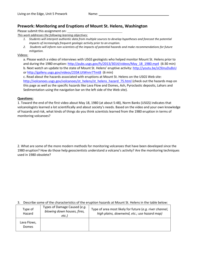
Describe some of the characteristics of the eruption hazards at Mount St. Helens in the table below:
Type of
Hazard
Types of Damage Caused (e.g. blowing down houses, fires, etc.)
Type of area most likely for future (e.g. river channel, high plains, downwind, etc.; use hazard map)
Lava Flows,
Domes
Living on the Edge, Unit 5 Prework Name:
Type of
Hazard
Ash/Tephra
Fall
Pyroclastic
Flows/Surges
Types of Damage Caused (e.g. blowing down houses, fires, etc.)
Type of area most likely for future (e.g. river channel, high plains, downwind, etc.; use hazard map)
Lahars
Flooding &
Sedimentation
4.
Examine the seismograph below, which represents seismic data recorded at Mount St. Helens on May 18,
1980. Note that each horizontal line represents a time interval (usually labeled on the seismogram, approximately 15 minutes or 4 lines per hour). The labeled activity is a low frequency event, which is typically a shallow earthquake below the volcano, associated with magma moving
(rather than an earthquake associated with plate tectonic stresses).
Capitol Peak, WA (CPW) seismic station data (data from USGS).
Describe what you expect a seismogram to look like just before an eruption like that of Mount St. Helens.
Consider the number and size of earthquakes as well as the time intervals between earthquakes and explain your hypothesis.
5. Based on your knowledge of volcano monitoring and the interviews with USGS volcanologists from the
Mount St. Helens 1980 eruption, describe 2-3 specific ways in which society benefits from monitoring volcanoes.
What is the role of local citizens during a volcanic crisis? (Each answer must be supported logically).
