PowerPoint format - City of Gulf Breeze
advertisement
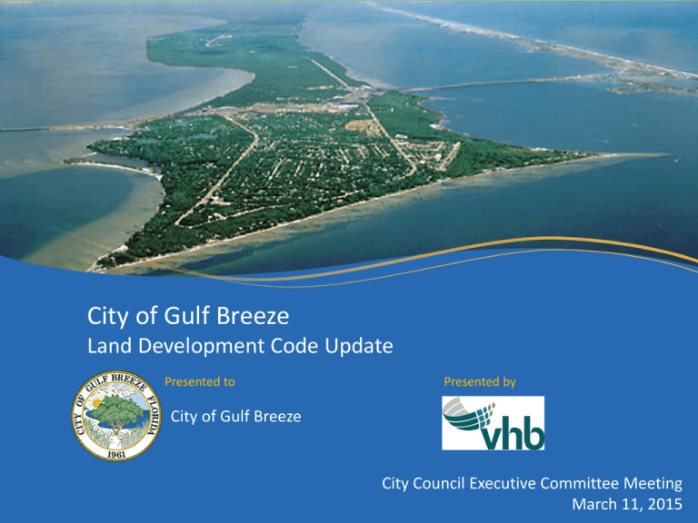
City of Gulf Breeze Land Development Code Update Presented to Presented by City of Gulf Breeze City Council Executive Committee Meeting March 11, 2015 Agenda Overview of Process Building Heights • Steering Committee Discussion • Public Comments • Steering Committee Recommendation Other Discussion LDC Update Process Two Stakeholder Meetings (June and August, 2014) Steering Committee Meeting (September 30, 2014) Public Meeting (October 8, 2014) Steering Committee Meeting (October 20, 2014) Final Steering Committee Meeting and Recommendations (December 16, 2014) Memorandum of Recommendations (February 10, 2015) Reasons for LDC Updates To implement the City’s adopted Master Plan and Comprehensive Plan To determine appropriate locations and standards for increased heights To determine appropriate policies and standards to mitigate impacts on residential neighborhoods To balance changing desires, increased opportunities for growth, and maintaining Gulf Breeze’s quality of life Previous Future Land Use Map Existing Future Lane Use Map Adopted Future Land Use Map FROM TO ACRES C MXD 19.76 P/I MXD 18.75 MDR MXD 5.38 HDR MXD 1.04 Total Change 44.93 New Zoning District: MXD-1 Summary Adopted Comprehensive Plan now allows for Mixed Development (MXD) future land use • 11-40 DU/ac • 0.25 – 3.0 Floor Area Ratio Recommended LDC Change: MXD-1 Mixed Use Zoning District Allows for consistency with new FLU classification Must meet City of Gulf Breeze CRA and Central Business District Design Guidelines," adopted June 11, 2006 No changes are being proposed to the City’s existing Zoning Map. New Zoning District: MXD-1 Sec. 21-246. – Intent. The MXD-1 district is intended to implement the City’s Most Livable City Plan and Comprehensive Plan 2035, by providing for medium to high-density development with a mix of uses within an appropriate area. These uses will be mixed throughout the district, as well as in individual developments. Residential, retail and office uses may be mixed either vertically or horizontally in a building within the MXD-1 district. Sec. 21-247. - Permitted uses. (a) Permitted Uses. Land and buildings within the MXD-1 mixed use district shall be used only for the following purposes: (1) Restaurants, cafes, and other food and beverage providers. (2) Business and professional offices, and any other uses allowed in the C-2 district. (3) Hotels, motels and other lodging facilities. (4) Educational uses. (4) Medical clinics (including nursing homes as defined in section 21-191) (5) Churches, religious institutions, private or parochial schools and fraternal organizations. (6) Municipal, county, state, federal and public buildings. (7) Retail shops. (8) Multi-family residential, including townhouses, condominiums and apartments, and accessory uses. (b) Prohibited Uses. Any use that is prohibited in the CDB Overlay district, section 21-243(b), shall be prohibited in any MXD-1 district. (c) Uses allowed as a special exception. A single-use development on a parcel of 2 ½ or fewer acres shall require a special exception, as described in Article II, Division 5 Special exception and variances, of this Code. New Zoning District: MXD-1 Sec. 21-248. - Height of buildings. In the MXD-1 district building height shall not exceed a total height of 35 feet, unless provided for in section 21-274 – Target Height Zones. Sec. 21-249. - Setback requirements . (a) In the MXD-1 zoning district, no building or any portion thereof shall be erected further than two and one-half feet (2 ½’) from any street right-of-way. (b) A building may be located a maximum of 20 feet (for no more than 50 percent of the building frontage) if pedestrian courtyards, plazas, cafes, fountains or other public gathering places are provided within the setback. (c) The maximum side and rear yard setbacks within the MXD-1 district shall be ten feet (10’). In no instance, shall a proposed building be located less than 10 feet (10’) from an existing building. (d) When abutting land is zoned R-ES, R-1, R-1-A, R-1-AA, P, M or TH: (1) The building setbacks shall be no less than 30 feet. (2) A landscaped buffer of not less than ten feet in width shall be established along the entire length of and contiguous to the property line. (e) For additional setback requirements in the CRA and CBD areas, see respective Design Guidelines. New Zoning District: MXD-1 Sec. 21-250. – Service roads . All roads serving developments in the MXD-1 district shall have a minimum pavement width of 24 feet and a minimum right-of-way of 40 feet, and shall never be accepted by the city unless the streets and buildings meet the subdivision, zoning, and all applicable land development code requirements, and are constructed to standards approved by the city for public roads. Sec. 21-251. – Parking. The total required parking for a mixed-use development shall be the total of the required parking for each separate use in such a development, according to the requirements in Chapter 24, division 3 of this Code., unless the developer provides a shared parking study during the development review process. Sec. 21-252. - Density. (a) The minimum density for residential uses in the MXD-1 district shall be 11 dwelling units per acre. The maximum density for residential uses in the MXD-1 district shall be 40 dwelling units per acre. (b) The minimum intensity for non-residential uses in the MXD-1 district shall be 0.25 F.A.R. The maximum intensity for non-residential uses in the MXD-1 district shall be 3.0 F.A.R. Sec. 21-253. – Areas of dwelling units. The minimum floor area of any individual dwelling unit in the MXD-1 district shall be 500 square feet. The overall average floor area for a dwelling unit, for an entire development, shall not be less than 750 square feet. Sec. 21-254. – Design review process. Developments in the MXD-1 district shall adhere to the review process specified in section 21-244 of this Code. Sec. 21-255. – Design guidelines. Developments in the MXD-1 district shall adhere to the design guidelines specified in section 21-245 of this Code. Gulf Breeze Target Height Zones Increased height (over 35 feet) is a special exception within the Target Height Zones Target height zones are designated areas within the City that were identified by the Master Plan Steering Committee as locations for potential height increases. These zones do not permit a building greater than 35 feet by right, but they provide for the option to request it as a special exception. Building height special exceptions to be reviewed by the Architectural Review Board and decided by City Council Proposed Overlay District Map Special Exception Process – Section 21-274 and Chapter 20 PRELIMINARY PLAT PRE-APPLICATION MEETING - Early meeting with City Staff to review proposed special exception and discuss potential issues and questions ARCHITECTURAL REVIEW BOARD - ARB to hear proposed special exception and make recommendation to City Council REQUIREMENTS CITY STAFF REVIEW - Conditions and safeguards (Special Exception) - - Evidence of mitigative measures in site design - Compatibility with adjacent and surrounding uses City Staff to provide review, recommendations and conditions to ARB NEIGHBORHOOD MEETING CITY COUNCIL HEARING - - Address concerns of neighbors before City Council Special Exception hearing(s) City Council hearing(s) Gulf Breeze Target Height Zones Additional building setbacks to apply when adjacent to residential property outside of the target height zones Additional building setbacks determined based on slope (setback vs height) • Recommended: 1.25 feet of additional setback for every 1 foot of additional height Building setbacks may include landscaping, parking, stormwater, or building that does not exceed the permitted maximum height. Applicant must provide visual studies or elevations/renderings to demonstrate visual impact and propose methods of mitigation • Landscaping • Buffers or screening • Building/Architectural design • Other studies as required by City Council 1.25:1 slope Based on Most Livable City Plan, previous consensus at meetings, and second Stakeholder Meeting attendees. Building Height Setback for Maximum Height Slope (run over rise) 35 feet (currently permitted) 30 feet (currently permitted) 0.85 : 1 45 feet 56 feet 1.25 : 1 1.25:1 slope Based on Most Livable City Plan, previous consensus at meetings, and second Stakeholder Meeting attendees. Building Height Setback for Maximum Height Slope (run over rise) 35 feet (currently permitted) 30 feet (currently permitted) 0.85 : 1 45 feet 56 feet 1.25 : 1 50 feet 63 feet 1.25 : 1 60 feet 75 feet 1.25 : 1 35’ Building Height 30’ Building Setback 45’ Building Height 56’ Building Setback 60’ Building Height 35’ Building Height 30’ Building Setback 75’ Building Setback Proposed Apartment Complex • Located within 45 foot Target Height Zone • 43 feet high • 75 foot rear setback from adjacent residential property Buffering Location of Buffer: The buffer shall be located at the perimeter of the zoning lot where required. Buffer shall extend to the zoning lot line or the right-of-way line, except where easements, covenants, or natural features may require the buffer to be set back from the property line. Required Buffer: A 40’ vegetated buffers shall be provided for proposed mixed use multistory development adjacent to existing single family residential development. The buffer shall be planted to create a one hundred percent (100%) screen and will include a 6’ high masonry wall with cap. Vegetation shall consist of a minimum of three (3) canopy trees, four (4) understory trees, and 33 shrubs/100 linear feet. Plant Sizes at installation • Canopy Trees • Understory Trees • Shrub Screen 2” caliper, 12’ overall height, 30 gallon container 1 ½” – 2” caliper, 7’ overall height, 15 gallon container 24” minimum at installation to create 36” – 42” high by 36” wide hedge or continuous screen with 90 percent opacity with one year of planting. 3 gallon container City of Gulf Breeze Land Development Code Update Presented to Presented by City of Gulf Breeze City Council Executive Committee Meeting March 11, 2015
