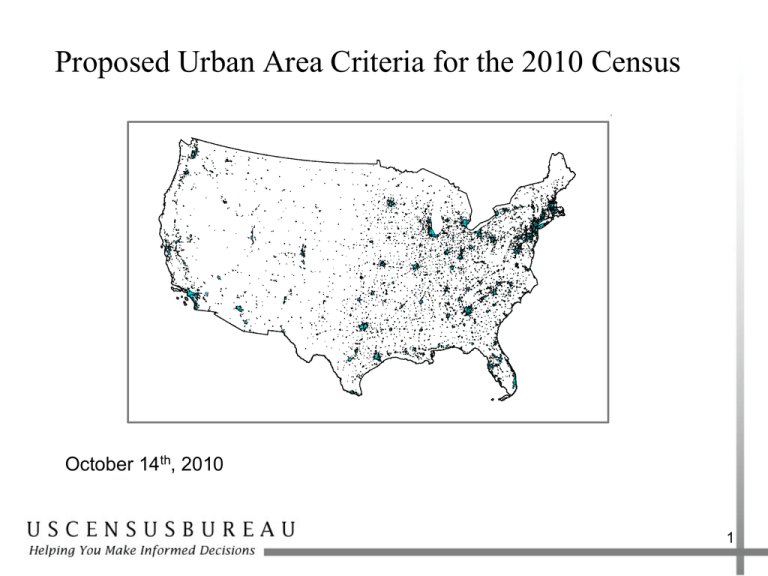
Proposed Urban Area Criteria for the 2010 Census
advertisement

Proposed Urban Area Criteria for the 2010 Census October 14th, 2010 1 Urban and Rural Classification • The Census Bureau identifies and classifies urban and rural areas after each decennial census. • Urban areas of at least 2,500 people have been identified since 1906. • Urbanized areas of 50,000 or more people were first defined for the 1950 Census. Urban places of at least 2,500 people were identified outside urbanized areas. Urban clusters of 2,500 - 49,999 were first defined after Census 2000. • The Census Bureau identifies urban and rural areas solely for the purpose of tabulating and presenting statistical data. 2 Urban Area Definitions • Represent densely developed territory, encompassing residential, commercial, and other non-residential urban land uses in which social and economic interactions occur. • Represent the “Urban Footprint” • Structure has been explicitly defined through measures based primarily on population counts and residential population density • Criteria have also accounted for non-residential urban land uses that are functionally part of the urban landscape 3 Census 2000 Urban Areas • For Census 2000, an urban area consists of a densely settled core created from census block groups, census blocks, and the adjacent densely settled surrounding territory that together have a minimum population of 2,500 people • There are two types of urban areas: urbanized areas of 50,000 or more population and urban clusters of 2,500 – 49,999. 4 Census 2000 Basic Urban Core Delineation 5 Census 2000 Basic Urban Core Delineation 6 2010 Urban Area Program • Remain committed to an objective, equitable, and consistent nationwide urban area delineation. • Retain decennial comparability by building upon 2000 criteria. • All potential modifications are refinements, or supplements to address deficiencies encountered for Census 2000. 7 Initial Core Using Census Tract Analysis Units Qualifying census tract ≥ 1,000 ppsm 560 ppsm 800 ppsm Qualifying census tract ≥ 500 ppsm contiguous to initial core Census tract not contiguous to an initial core census tract ≥ 1,000 ppsm 550 ppsm Census tract > 3 sq. miles 1,600 ppsm 1,300 ppsm 700 ppsm 750 ppsm Initial Census Tract Core Based on Population and Size Criteria Boundary Using Proposed Impervious Criteria Urban Area Boundary Using Impervious Land Cover 2000 Urban Area Impervious Land Cover Census Blocks ´ 0 0.1 0.2 0.4 Miles 9 Initial Core Test Delineation Regions Tract as Analysis Unit Population 42,384,952 Land Area (sq. miles) 14,525 Block Group as Analysis Unit Number of Initial Urban Cores 924 Population 42,213,521 Land Area (sq. miles) 15,027 Number of Initial Urban Cores 904 Wetlands as an Additional Exempted Territory Noncontiguous qualifying territory Jump census block Urban Core Road connection Distance from core to wetlands is 0.7 mile Distance over wetlands is 0.5 mile Distance over river is 0.6 mile Distance over wetlands is 0.7 mile Distance from wetlands to noncontiguous qualifying area is 0.7 mile Total exempted distance is 1.8 miles Total jump distance is 3.2 miles Hop and Jump Corridor Examples Grand Junction, CO "Sawtooth" Grants Pass, OR "Fingers" Jump Blocks Hop Blocks Urban Area 12 Splitting Large Urban Agglomerations Census 2000 San Francisco-Oakland and San Jose Split 13 Figure 4: Splitting Large Urban Agglomerations Urbanized Area A after split Urban agglomeration prior to split Incorporated or Census Designated Place Metropolitan Statistical Area Boundary Boundary splitting the agglomeration Urbanized Area B after split 14 URBAN AREA DELINEATION REGION 65 Enclave block Hop block Jump block 25 Oct 2010 NOTE: These cores were generated using proposed 2010 urban area criteria with 2000 population and geography 15 0 5 10 20 30 Miles 16 17 18 19 Qualification of Airports for Inclusion in Urban Areas Merced Municipal/MacCready Field, Merced CA Prison Urban Clusters Abilene North (Robertson Unit), TX Population: 4,650 Urban: 4,650 Group Quarters: 4,650 Institutional: 4,650 Correctional: 4,650 21 Density: 94,589 ppsm Central Places The Woodlands, TX 2000 Population: 89445 • • Central places are not necessary for UA or UC delineation Principal cities defined within CBSAs: • • • Shenandoah, TX 2000 Population: 1503 Oak Ridge North, TX 2000 Population: 2991 capture same concept classification based on different criteria Lack of consideration of place boundaries in delineation process results in central places split between urban and rural portions. The Woodlands CDP, TX 2000 Population: 55649 Accokeek CDP, MD 2000 Population: 5057 St. Charles, MD 2000 Population: 74765 Waldorf CDP, MD 2000 Population: 22266 Indian Head, MD 2000 Population: 3422 Bryans Road CDP, MD 2000 Population: 4912 Largest CDP Incorporated Place CDP UA Bennsville CDP, MD 2000 Population: 6207 St. Charles CDP, MD 2000 Population: 33379 22 A Reminder!!! We are currently seeking input… Any comments, suggestions, or recommendations concerning the criteria proposed should be submitted in writing no later than NOVEMBER 22, 2010 Please submit written comments on the proposed criteria to: Timothy Trainor Chief, Geography Division U.S. Census Bureau Washington, DC 20233-7400 www.census.gov/geo/www/ua/2010urbanruralclass.html 23 Questions? Comments? Vincent Osier Chief Geographic Standards and Criteria Branch Geography Division U.S. Census Bureau Vincent.osier@census.gov (301) 763-9039 Chris Henrie Geographic Standards and Criteria Branch Geography Division U.S. Census Bureau christopher.j.henrie@census.gov (301) 763-9086 24


