10. Atmospheric Disturbances, Storms and Natural Hazards
advertisement
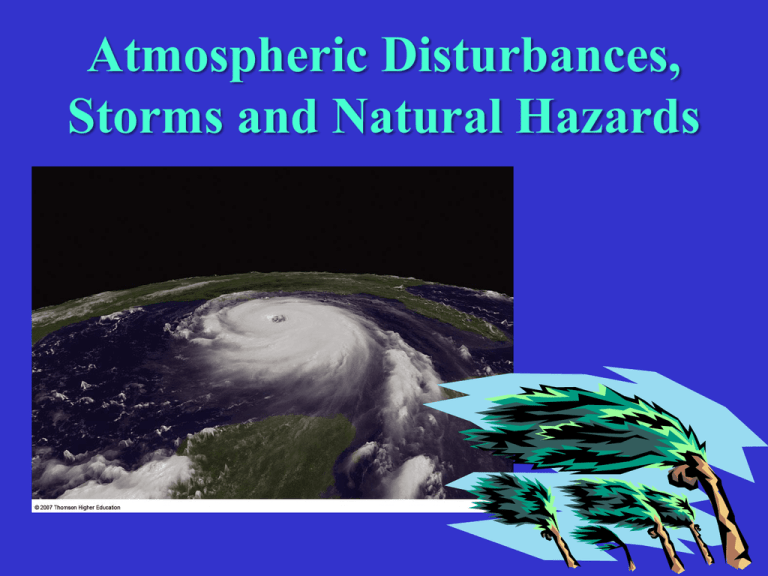
Atmospheric Disturbances, Storms and Natural Hazards Storms and Atmospheric Disturbances Embedded within the wind belts of the general atmospheric circulation are secondary circulations, which are made up of storms and other atmospheric disturbances Atmospheric disturbance is a broader and more general term than storms – includes variations in secondary circulation Such Disturbances include: a) Middle Latitude Cyclones b) Cyclones and Anticyclones, and c) Weak Tropical Disturbances (e.g., Easterly Waves, Polar Outbreaks) Well-defined Storms include: Hurricanes, Tornadoes, Thunderstorms, Snowstorms and Blizzards Middle Latitude Cyclones Also called Extra-tropical Cyclones or Mid-latitude Cyclones These migrating “storms” develop at the polar front, and then travel along it With their opposing cold, dry polar air and warm, humid subtropical air, these can cause significant variations in day-to-day weather They evolve as they move, and can last a few days or a even a week Can travel about 40 mph, and can be 800 - 1000 miles wide STRUCTURE OF A MID-LATITUDE CYCLONE Low Pressure at the center of the storm Counterclockwise winds A warm front A cold front A pie-shaped wedge of warm air Surrounded by cold air mass CROSS-SECTION OF A MID-LATITUDE STORM Lighter, warm, moist air rides up over cold air – Warm Front Denser, cold air pushes into warmer air and forces it to rise – Cold Front A Model and Cross Sections of a Mid-latitude Cyclone Stages in the Development of a Mid-latitude Cyclone Fig. 7-7, p. 183 Tracks of Mid-latitude Storms in the U.S. – West to East Hurricanes A hurricane (tropical cyclone) is a large rotating cyclonic system of high wind velocity – with a forward motion of 4-5 mph. [also called typhoons (East Asia), willy-willies (Australia), bagyos (the Philippines), or simply, cyclones (South Asia)]. They are the largest and most destructive storms on earth, often lasting 10-14 days. The devastation by these massive storms are not mainly due to the high winds but because of the associated flooding/storm surges, tornadoes, and lightning. Hurricane Katrina, which struck the Gulf Coast in 2005, wreaking havoc in Louisiana, Mississippi and Alabama, was among the most devastating in U.S. history. Hurricane Tracks → Storm Surge ↓ Hurricane Formation A hurricane develops from a tropical disturbance when sustained winds exceed 74 mph (Category 1), often going to more than 155 mph (Category 5) – Names are assigned once storms reach tropical storm status (39-74 mph) Among the factors leading to hurricane development are: a warm ocean surface of about 77˚F; warm, moist overlying air; and Coriolis effect must be sufficient to support spiraling Therefore, hurricanes do not develop or survive in the equatorial zone (about 10o N or S latitude) as the Coriolis effect is too weak closer to the equator. The "fuel" for a hurricane comes from the enormous amount of latent heat released from the warm ocean water. Hurricane Structure In terms of its structure a hurricane is a warm-core low pressure system with a diameter of 100-400 miles, and extending to heights of 40,000-45,000 feet. The center or eye of the hurricane is an area (12 to 40 miles wide) of nearly cloudless skies, subsiding air, and light winds. At the periphery of the eye is a ring of cumulonimbus clouds that produce torrential rains and extremely strong winds. Surrounding the core are the typical spiraling rain bands. As a hurricane moves over a colder land surface, it loses its source of energy and dissipates. But the system remains an organized storm for several days, flooding the interior with rainfall. Tornadoes often accompany hurricanes as they move ashore. http://www.youtube.com/watch?v=75qAgSuMbzA&eurl=http%3A%2F%2Fwww. uwsp.edu%2Fgeo%2Ffaculty%2Fritter%2Fgeog101%2Ftextbook%2Fweather_syst ems%2Fhurricanes.html&feature=player_embedded Thunderstorms Thunderstorms are local storms in the middle and lower latitudes that are accompanied by thunder and lightning Lightning is an intense discharge of electricity – the charges are generated by the intense friction of the air on moving ice particles within a Cumulonimbus cloud When the difference between the positive and negative charges in the cloud becomes large enough to overcome the natural insulating effect of the air, a lightning flash takes place These discharges (often over 1 million volts) heat up the air around to temperatures of over 45,000˚F – the heated air expands explosively, creating the shock wave – thunder! Being an intense form of precipitation, thunderstorms result from the same uplift mechanisms as in precipitation, especially convectional, orographic and frontal uplift; -- cyclonic/convergence uplift is less effective in triggering severe thunderstorms. As in rainfall, hail is often associated with thunderstorms. Usually covers a small area of a few miles, but sometimes there can be a series of thunderstorms covering a larger region, on or in advance of a cold front, forming a Squall Line. Most thunderstorms last about an hour. Tornadoes • Tornadoes are the most powerful weather phenomenon known – A violently rotating column of air extending from a thunderstorm to the ground (See: Fujita Scale). • Technically, a tornado is an intense, narrow system of low pressure with violent updrafts and converging winds. • Though the mechanisms that actually create tornadoes still elude us, about 80% of all tornadoes are associated with thunderstorms and mid-latitude cyclones; the other 20% are spawned by hurricanes that make landfall. • Conditions for Tornado formation: Cool, dry air (e.g., from the Rockies) colliding with warm, moist air (from the Gulf). • Tornadoes can be on the ground for an instant to several hours, but the average time is 5 minutes. Tornadoes have been documented in most regions of the Earth, though they are most prevalent in the U.S., particularly along the Tornado Alley On average 1000 Tornadoes occur every year in the U.S. Average Annual Number of Tornadoes per 10,000 sq. mi. • Tornadoes are common during Spring, when greatly contrasting air masses collide to produce severe storm systems. • There is also a distinct Seasonal March of Peak Tornado Activity Seasonal March of Peak Tornado Activity Advancements in Weather Forecasting Doppler Radar Image of a Storm showing Squall Lines (in Red) Additional Slides for Reference

