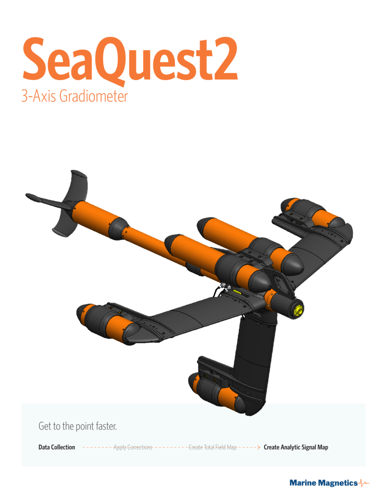
SeaQuest2 3-Axis Gradiometer Get to the point faster. Data Collection Apply Corrections Create Total Field Map Create Analytic Signal Map Need to find small, near surface targets in shallow water? Bring in a specialist. Gradient Data SeaQuest measures the gradients in all three directions simultaneously, and computes the total gradient, which is invariant of heading and orientation. No matter how your heading changes, no information is lost. Horizontal gradiometers, on the other hand, can only measure the gradient in one axis (direction). This means that whenever the heading or tilt of a 1-axis gradiometer changes, so does the direction of the measured gradient, making it more challenging to capture consistent line data. Analytic Signal Mapping Analytic Signal data suppresses geology and enhances small nearby targets, enabling you to see more of what you want to see, while suppressing what you don’t want to see. Single-axis gradiometers and arrays can only do this in one of three possible directions. Since SeaQuest measures the complete 3-dimensional gradient, it enhances signals from small targets uniformly, regardless of their geometry or position in space. BAM software (included with SeaQuest) allows you to visualise SQ data. Highest Absolute Accuracy SeaQuest has the best absolute accuracy of any marine gradiometer: 0.1nT. Stability and Durability Accidents happen. SeaQuest’s robust and rigid frame is ready for them providing strength and rigidity while keeping weight down. All cables are contained within the pressurized sub-housings, or within the hollow free-flooded wings. This, coupled with its sleek, swept design minimizes the risk of snagging foreign objects and debris. The entire structure is designed to deflect impact rather than absorbing it. SeaQuest’s vertical (keel) wing is made heavier than the horizontal wings, which helps improve stability when under tow, keeping pitching and rolling motion to a minimum. The large surface area of the wings ensures that the platform will tow straight and smooth, even in high sea states. All this comes together to produce the highest quality data possible in a towed marine gradiometer. The echosounder/altimeter measures bathymetry with 0.1m precision, which provides a precise distance to seafloor reference for both total field and vertical gradient measurements. The Overhauser Effect Marine Magnetics’ SeaQuest Overhauser sensors measure the ambient magnetic field using a specialized branch of nuclear Magnetic Resonance technology, applied specifically to hydrogen nuclei. Maintenance-free Sensors, No Realignment and No Consumable Parts SeaQuest Overhauser sensors are entirely maintenance-free and most importantly, SeaQuest’s specifications do not degrade over time. As a result, SeaQuest sensors, unlike optically pumped sensors, never have to be realigned or recalibrated in order to meet the manufacturer’s specifications at the time of shipping. Worldwide Operation with No restrictions Adjustable Floats SeaQuest is entirely omnidirectional, meaning you never have to orient your sensor, because it is already optimized to work around the world. As a result, regardless of where you are in the world and no matter what the magnetic field strength is, your SeaQuest sensors will continue to provide a strong signal and accurate data. Floats keep SeaQuest on the surface when the vessel is stopped, so it’s easy to bring closer. On-board Sensors In addition to our Overhauser sensors, accuracy is further improved by the integrated tilt sensor, which continuously monitors the tiniest platform movements caused by rough seas, telling the operator and data analyst exactly how ‘horizontal’ and ‘vertical’ the gradient measurements are. High Sensitivity SeaQuest sensors deliver high-resolution output with a noise level of 0.01nT/√Hz; counter sensitivity is 0.001nT. Right: SeaQuest2 with forward-positioned adjustable floats With the floats moved forward, the nose will point up slightly, and SQ will tend to stay at the surface (good for shallow water work). Conversely, with the floats moved aft, the nose will point slightly downward, making the SQ dive deeper (good for deep water operation). The floats can be adjusted to sit more forward or aft on SeaQuest, presetting its natural pitch in the water. When the floats are forward (fig 1), SeaQuest will remain at the surface at any speed. In aft positions, the SeaQuest wings act as a depressor, causing it to descend to a fixed depth at a fixed speed. The floats are air-filled, and equipped with pressure relief valves. If the floats are damaged and leak under pressure, the valves will allow any internal pressure to dissipate slowly as SeaQuest is brought to the surface. Magnetometer System Comparison SeaSPY2 Explorer v.AUV SeaQuest Ease of use Easiest to run Requires most operator training A little more complicated to run Cost $ Least expensive before additional requirements. See below $ Least expensive before additional requirements. See below $$ More expensive Requirements Sentinel Base Station AUV None (includes BAM) BAM software Sentinel Base Station BAM software Considerations Lowest risk of loss Highest risk of loss Higher risk of loss Can work in choppy weather Can work in very rough weather Needs calm weather Can work at greater depths Process Results Data Collection (Total Field) Data Collection (Total Field) Apply Corrections Apply Corrections Create Total Field Map Create Total Field Map Convert to AS map with BAM software Convert to AS map with BAM software Good data (with skilled boat driver) Best data; self-driving Best data (with skilled boat driver) The SeaSPY2 measures the total magnetic field. The AS map can be computed from a complete total-field map. The Explorer AUV measures the total magnetic field. The AS map can be computed from a complete totalfield map. This SeaQuest map had the same positioning inaccuracies as a single SeaSPY but produced much better data. This SeaSPY map was affected strongly by the usual positioning inaccuracies; additionally, there was no Base Station correction. Above: Analytic Signal Maps These Analytic Signal Maps were created from real data collected over the same area. The targets being detected in this area were as small as 1kg. The Explorer AUV AS data benefits from having the lowest positioning errors, keeping altitude and line spacing very consistent. Also, it can get the sensor closer to the bottom, where the signals are stronger. Ultimately, it produces the best data almost as accurate as a SeaQuest, but without the true gradients. It may yield stronger signals at greater depths due to better altitude control Data Collection (Total Field, Horizontal and Vertical Gradients, Total Gradient [Analytic Signal], platform orientation) Create AS map with BAM software The AS map was measured directly and did not need to be computed from the raw magnetic map (= less processing). The SeaQuest gradient data does not require correction with a Base Station magnetometer, making its data the most accurate of the three. As added benefit you get three true gradient measurements in addition to Analytic Signal map. Features at a Glance • Auxiliary sensors include: 3-axis IMU with gyro, leak detector in E/M, pressure sensor, altimeter • Entirely non magnetic construction. All aluminum and fiberglass • 300m depth rating Seaquest is Ideal for • • • • UXO and mine detection Cable and pipeline tracking Environmental survey Archaeology Specifications Performance Operating Zones Worldwide. SeaQuest2 collects accurate results regardless of how it’s pointed in relation to Earth’s magnetic field. Sensor separation Horizontal transverse: 1.5 m Vertical: 0.75 m Longitudinal: 0.81 m Highest absolute accuracy 0.1 nT High sensitivity 0.01 nT Resolution 0.001 nT Power consumption 13W (4W stand by, +1.5W per sensor, +3W altimeter) Maintenance-free sensors No realignment and no consumable parts No heading bias Eliminates the need to level your data (provided survey altitude is constant across survey lines) No drift A complete lack of 1/f noise (provided a totally flat noise spectrum) No temperature dependence Data accuracy does not change through a temperature range of –40C to +60C Altimeter 0-90m range, 0.1m step Heading + Tilt 3-axis IMU with 3-axis gyro compensation Pressure sensor 300m range, 0.1m step (others optional) 3-Axis Gradiometer Wing Span Overall 1.66 m (65.2”) Length Overall 1.93 m (76.1”) Height overall 1.07 m (42.4”) Keel Depth 0.83 m (32.7 in) Dry Mass 78 kg (167 lbs)

