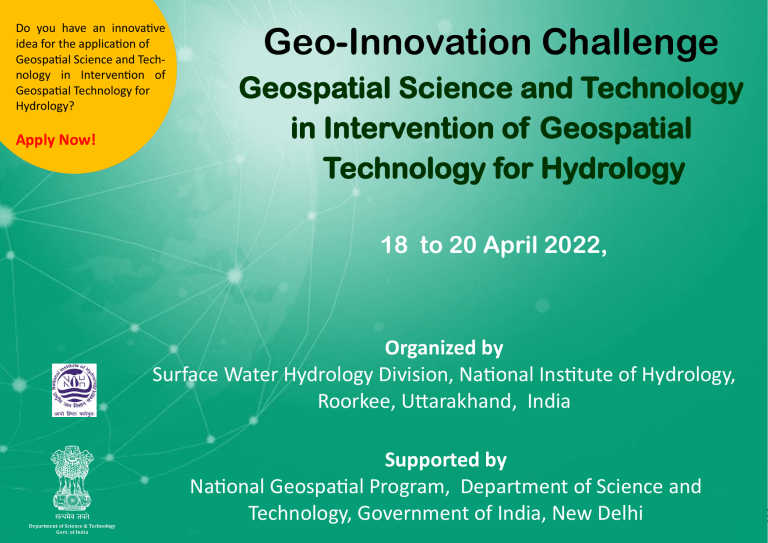
Do you have an innovative idea for the application of Geospatial Science and Technology in Intervention of Geospatial Technology for Hydrology? Apply Now! Geo-Innovation Challenge Geospatial Science and Technology in Intervention of Geospatial Technology for Hydrology 18 to 20 April 2022, Organized by Surface Water Hydrology Division, National Institute of Hydrology, Roorkee, Uttarakhand, India Supported by National Geospatial Program, Department of Science and Technology, Government of India, New Delhi Principal Investigator Dr. L. N. Thakural, Scientist D, Surface Water Hydrology Division, National Institute of Hydrology, Roorkee, Uttarakhand National Institute of Hydrology, Roorkee National Institute of Hydrology (NIH) is a premier Research and Development organization under the Ministry of Water Resources, River Development and Ganga Rejuvenation, Government of India. It was established as an autonomous society in 1978 with its headquarters at Roorkee. The main objectives of NIH are to undertake, aid, promote and coordinate systematic and scientific work in all aspects of hydrology. The Institute was declared as an S&T organization in 1987. Six Regional Centers of the Institute are located in different physiographic regions of the country. The scientific and technical credibility of the Institute in conducting hydrological and water resources research is well recognized both at the national and international level. Visit us on: www.nihroorkee.gov.in Surface Water Hydrology Division The Division is carrying out R&D on various aspects of surface water hydrology. The thrust areas of research of the Division are: (i) hydrological modelling; (ii) water availability analysis, flow duration curve analysis and environmental flow requirement; (iii) design flood estimation; (iv) hydrodynamic modelling of rivers for preparing flood mitigation plans; (v) flood inundation modelling and flood hazard assessment; (vi) snow and glacier melt monitoring and modelling; (vii) urban hydrology; (viii) watershed management studies; (ix) drought mitigation and management; (x) impact of climate change on water resources. The Division is carrying out sponsored and consultancy studies and under technology transfer program, the Division organizes seminars/ symposia/ training courses/ workshops. In pursuance of various R& D activities the Division has made interactions with CWC, CGWB, GFCC, IMD, IITM, NHPC, CPCB, DST, NPCIL, NTPC, NSPCL, THDC, IITs, GMDA, RVNL, VMC, AUD, NEEPCO, NGPC and various other academic as well as R & D institutions and state water resources departments etc. Visit us on: http://nihroorkee.gov.in/scientific-divisions/surface-water-hydrology/vision Fig 1. National Institute of Hydrology, Roorkee 1 What is the Geo-Innovation Challenge? In India’s recent journey of sustainable economic growth, knowledge has been identified as one of the key drivers. In this odyssey, India has adopted a new information regime through its ‘Digital India’ program to support good governance, sustainable development goals and empowerment of its citizens. The challenges of this developmental path are inclusiveness, transparency, efficiency and productivity while balancing economic growth and sustainable development. Over the last three decades, geospatial technologies have proven to be an effective enabler to meet these challenges. Increasing g-governance and efficiency of the system, necessitates innovation in geospatial technologies. While there has been widespread adoption of geospatial technologies into various sectors, innovation brings economic and social value through the combination of geospatial technologies with artificial intelligence, IoT, big data, etc. . Objective of the program The objective of this Geo-Innovation Challenge is to recognize, encourage and nurture geo-innovation in the field of Intervention of Geospatial Technology for Hydrology This call invites young professionals under the age of 40 to submit their innovative ideas in the prescribed format that can address any of the sub- themes bringing in innovative ideas in their approach. The ideas will have to be presented to an eminent jury drawn from the scientific community, industry, academia and premier research institutions. The three top innovative ideas will be awarded cash prizes and a certificate with an opportunity to be mentored in developing the idea into a full proposal/ business proposition. First Prize: Merit Certificate + Rs. 12000/Second Prize: Merit Certificate + Rs. 8000/Third Prize: Merit Certificate + Rs. 5000/- Who can apply? The three-days Geo-Innovation Challenge is targeted at young professionals. We encourage you to apply if you are: • Young professionals under the age of 40 years with a doctoral degree from any recognized University • Young professionals registered for a doctoral program • Young professionals having or studying for a Bachelors/ Masters degree in any field • Individuals with industry or field experience and innovative original ideas without the required degree 2 How to apply? Apply through the portal http://dst-iget.in. Upload the following documents as a single pdf 1.Abstract (not more than 300 words) clearing stating the title, need for the proposed innovation, data, methods and proposed output alongwith keywords and names of team members, email ids/mobile nos. (max. 2 team members) 2.Your identity card /s from the institution where you are currently working. 3.Your published paper/s. What are the theme/ subthemes for submitting abstracts? Theme: Intervention of Geospatial Technology for Hydrology Subtheme 1: Water Resources Mapping (identification and mapping of surface water) Subtheme 2: Integration of geospatial technology in Hydrological Modelling Subtheme 3: Flood Risk Zone Mapping and Damage Assessment Subtheme 4: Drought Monitoring and Management Subtheme 5: Irrigation Water Management Subtheme 6: Impact of Climate/Land Use Change on Water Resources Subtheme 7: Groundwater augmentation under various geologic and agro-climatic conditions Subtheme 8: Water Quality Monitoring and evaluation using geospatial tools. Subtheme 9: Integrated watershed management for sustainable development Subtheme 10: Assessment of reservoir sedimentation using geospatial techniques. Subtheme 11: Site suitability analysis for Rainwater harvesting Subtheme 12: Environmental Impact Assessment of water resource projects Subtheme 13: Integration of Geospatial datasets in water resources Subtheme 14: Estimation of Hydro-Meteorological State Variables (rainfall, snow cover & water equivalent, soil moisture and water quality) 3 Important Information Last date for registration : 30 March 2022 Dates of the program: 5 April 2022 Submission of Full Project proposal: 15 April 2022 Dates of the program: 18-20 April 2022 Mode of conduct: Online ( Offline if possible, as per Government Permissions). Participants will be informed at the time of selection. Boardin g, logging and TA provides as per government norms, only in case of offline mode. No. of seats: 25 Registration Fees: Nil Principal Investigator: Dr. L. N. Thakural, Scientist D, Surface Water Hydrology Division, National Institute of Hydrology, Roorkee, Uttarakhand, Email: thakuralln@gmail.com/ lnt.nihr@gov.in Mobile : 9411152020 (cell)/ 01332-249244 (off) For any queries contact: Dr. L. N. Thakural , (Principal Investigator) thakuralln@gmail.com/ lnt.nihr@gov.in, 9411152020 (cell)/ 01332-249244 (off) Address: Surface Water Hydrology Division, National Institute of Hydrology, Roorkee – 247667 (Uttarakhand), India Note: Participants must ensure that they have a laptop and a strong internet connection Infrastructure and Facility • Labs: Remote Sensing and GIS Labs, Nuclear Hydrology lab, Hydrological Instrumentation Lab, Snow and Glacier Lab, Soil and GW lab • Remote Sensing & GIS Lab Remote sensing and GIS Laboratory carries out studies and research on various aspects of hydrology and water resources using remote sensing and GIS techniques. Software available in the Laboratory include ArcGIS, ERDAS Imagine, ILWIS, ENVI, and R2V (Raster to Vector Conversion software). The laboratory also has A0 Colortrac Smart-F Image Scanner, Laser Colour Printer, A0 size Cannon Colour plotter etc. The laboratory also maintains large number of Survey of India topographic maps and satellite remotely sensed data which are being used in hydrological studies at the Institute. 4 • Snow & Glacier Lab Especially meant for analysis and modelling of snow and glacier melt runoff, the laboratory displays glaciological research exhibition facility viz. Mountaineering and hydrological equipments used in the field, sediment samples collected from different parts of glaciers, display of results related to hydrological aspects of different glaciers, problems of high altitude region of the Himalaya etc. A weather display unit has been installed at the main building for display of current and recorded weather parameters. • Hydro met Observatory SWHD is maintaining an observatory of the Institute at (Gangotri Glacier). It is well equipped with various ground-based equipments e.g. automatic weather station, automatic water level recorder, ORG, SRRG, hygrograph, dry & wet bulb thermometer, thermograph, Evaporimeter, anemometer etc. Lodging: Guest House While preserving the heritage of "Atithi Devo Bhava", we offer our visitors the best facilities in terms of service, ambience or food. Our Institute has two guest houses to provide accommodation to the guests and delegates visiting NIH: • Sindhu Guest House This guest house has 18 double bedrooms and 20 single bedrooms. Each of them has an attached toilet with a hot and cold water facility. All rooms are serviced by an emergency generator set. All rooms are also provided with colour televisions with cable connection. All rooms are also provided with telephones through an EPABX system, with direct inward dialling facility. • Gangotri Guest House It is one of the guest houses present in the Campus. There are 12 suites and 1 VIP Suite in the visitors' hostel. All the rooms and suites are air conditioned and are well furnished. Both the guest houses are \aged by the Maintenance Section of the Institute. The guest houses have the Reception Desk which works 24X7. Auditorium: NIH has an Auditorium of the capacity of around 200 people. This is used for organising various events of NIH. 5 Fig 2. A view of the Remote Sensing and GIS Laboratory Fig 4. Automatic Weather Station Fig 3. Hydrometeorological Observatory Fig 5. Auditorium 6 Fig 6 & 7. Sindhu Guest House Fig 8 Gangotri Guest House 7 FAQs for Geo Innovation Challenge 1. Who can participate in the Geo-Innovation Challenge? Candidates having or pursuing Doctoral / Masters/ Bachelors degree in any field from any recognized university under the age of 40 years with innovative original ideas OR Individuals under the age of 40 years with industry or field experience and innovative original ideas without the above required qualification are eligible to apply. The candidates whose ideas are selected for presentation can participate in the event. 2. Do I need to have studied/ be studying Geospatial Science/ Geoinformatics to be eligible to apply? Not at all! We strongly encourage candidates from all fields of study to apply and bring their innovative ideas on development and use of geospatial science and technology for the socio-economic development of the country. You could also team up with a member from a completely different field or somebody who is into geospatial technologies to develop your idea and apply! 3. Do I have to submit a project proposal? No, you do not have to submit a project or a project proposal. You need to submit idea(s). 4. What is the difference between Idea and Project Proposal? Any project begins with an idea. An idea lays the foundation stone for the starting of a project. In other words, without an idea there can be no project. An idea forms the basis to either solve an impasse or to improve on how things are done. It’s a creative process of coming up with possible solutions that address societal needs and problems. A project further develops the idea, its viability, its structure, its implementation, etc. We strongly encourage participants to submit ideas (introduce something new) and NOT project proposals. For example, the United Nations Sustainable Development Goals provide a good framework and starting point to address poverty, gender equality, environment protection, infrastructure development, etc. All of these can benefit by the spatial perspective that geospatial technologies provide. Don’t worry about how big or the big picture. We need thousands of ideas, both big and small, to ensure that the goals are met and to build a better world! 5. What is Innovation? Innovation is a new idea or a method that is translated into a product or a service that creates value. The real essence of innovation is improvement – the ability to create something better that serves as a source of collective well-being, economic growth and sustainable development. 6. Can I team up when submitting my idea? Yes. However, there can be maximum of two participants in a team. If you are in a team, make sure both the participants apply for the challenge and register for the same if your idea is selected. 8 7. What if only I can be present at the Geo-Innovation Challenge? It should not be a problem for the two of you to attend if the event is online. If it is offline, you could request the Coordinator/ PI to permit you/ your partner to be present online. However, if it is an offline event, at least one person from the team should be present at the Geo-Innovation Challenge at all times. 8. What is the purpose of conducting this Geo-Innovation challenge? The Geo-Innovation challenge will serve as a repository of ideas leading to Call for Proposals by the Department of Science of Technology (DST), Government of India, in future. 9. Are your ideas safe with DST? Yes. All the information collected will be used solely for official purposes, including inviting ‘Call for Proposals’ by DST in future. 10. Who own the ideas after the Geo-Innovation Challenge program is over? We DO NOT own your ideas. Our primary goal is to support viable ideas that have potential to create unique products, services and methods, ultimately enhancing the life of people and contributing to sustainable development. 11. I am a student of B.Tech./M.Tech./ M.Sc./B.Sc./etc. , do I qualify? Yes. 12. What kind of ideas can I submit? The Geo-Innovation Challenge program addresses different broad themes as given below. You could submit an idea related to any of the themes/ subthemes. Kindly check the brochures of the individual institutions for the sub themes. • Geospatial science and technology in hyperspectral data analysis and applications • Geospatial science and technology in health applications • Geospatial applications for rural development 9 • NavIC/IRNSS applications • Innovations in geospatial science • Interventions of geospatial science and technology in water resources management • Geospatial science and technology in defence, security and intelligence • Geospatial science and technology in meteorology and ocean sciences Geospatial science and technology in geo-enabled technological solutions for realizing smart cities • 13. Can I submit an idea even if my area of research is not fully related to Geo spatial technologies? Yes. We suggest you team up with someone from the geospatial background to check the feasibility of realizing your idea. New knowledge can only be generated when we move out of our silos and work with interdisciplinary teams combining different strengths. 14. What is the first step in this process? The first step is to send a 300-words abstract briefly mentioning about your idea, innovation versus current status, and how it can address an existing problem. 15. What happens if my idea is short-listed? The shortlisted participants will have to present their ideas in the Geo-Innovation Challenge. Once shortlisted you will have to submit 1500-2000 words essay covering the following points. You will also use these points as a guide during your presentation. • What problem is your idea addressing? (Remember the problem could be societal, or in technology development, or in the development of a scientific concept, which can have an impact towards sustainable development) • What is the current status? • What is the proposed innovation? • What will be its impact on any aspect of sustainable development or betterment of life of people? Remember: DO NOT submit any research work/ algorithms to be used and/or results associated. We are mainly focusing on new ideas. 16. How the idea will be evaluated? The submitted ideas will be evaluated in two steps: i. The preliminary shortlisting depends on basic rubrics such as, significance of the idea in solving an issue/problem, its innovative component and probable impact on sustainable development in the country and/or impact in the field under consideration. 10 ii. The final evaluation will consider: adequacy in identification, novelty and innovation in the idea, relevance to the theme of the Geo-Innovation Challenge, approaches proposed, feasibility of the idea in producing disruptive technologies and impact in the area under consideration. 17. Do I actually have to create my idea / work through all the details? Remember idea is akin to a concept. A project proposal is a detailed plan. We expect ideas. You can just explain your idea using the guidelines provided. Having visuals in the presentation is encouraged and that may include a sketch, picture or even a prototype, work flow, etc. 18. How will the ideas be awarded? • The three top innovative ideas will be awarded cash prizes and a certificate. Such candidates may also further develop the full project proposal and submit to DST, subject to eligibility, when the ‘Call for Proposals’ is released by DST. • A Compendium with all the innovative ideas will be published by DST, out of which a few selected ideas will be showcased during the Second United Nations World Geospatial Congress to be held during 10-14 October 2022 at Hyderabad. 19. What tips can you give for improving my submission? • Your writing and presentation should be clear, highlighting the problem identification process, current status, need for innovation and the innovation itself. • Highlight the uniqueness. • Clearly explain how the idea is different from what is already available. • Describe your innovation as comprehensively as possible. • Make it easy for the jury to assess your idea. • Remember that the bright ideas should have clearly identified the idea, the market, the problem being solved or business case, the technology needed, and the next steps to develop or commercialize the idea, and submission of facts. Pitch well: how well can you convince the jury of your idea. Identify market/industry potential. Social Impact/ feasibility / sustainability. List out and explain what is needed to move the idea closer to completion, as a product, tool or research project. • • • • 11

