FSX VFR Flying: Small Fields & Vintage Aircraft Navigation
advertisement
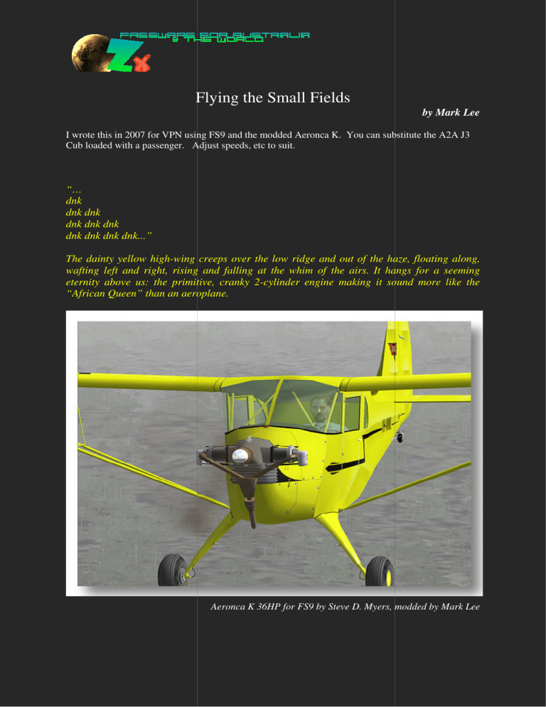
Flying the Small Fields by Mark Lee I wrote this in 2007 for VPN using FS9 and the modded Aeronca K. You can substitute the A2A J3 Cub loaded with a passenger. Adjust speeds, etc to suit. “… dnk dnk dnk dnk dnk dnk dnk dnk dnk dnk...” The dainty yellow high-wing wing creeps over the low ridge and out of the haze, floating along, wafting left and right, rising and falling at the whim of the airs. It hangs for a seeming eternity above us: the primitive, cranky 2-cylinder 2 cylinder engine making it sound more like the “African Queen” than an aeroplane. Aeronca K 36HP for FS9 by Steve D. Myers, modded by Mark Lee Step back in time with me to an era when pilots used a road map, watch, compass and dodgy estimates of wind to find their way, sometimes in bad weather and low visibility, from dot to dot on the map. It’s an intellectual challenge which gives more purpose to an FSX session than just jumpin’ in and goin’ for a fly. Gadgets for VFR low’n’slow in FSX What do I need for old-style style VFR? I recommend purchase, firstly, of the Brisbane-Maroochydore-Gold Gold Coast VTC. VTC If you enjoy VFR flying, you will also want to purchase any available VTCs for your areas of choice. Next, you will want a Whiz Wheel for calculating: 1. TAS (True Air Speed) and GS Ground Speed 2. Heading required to allow for crabbing due to crosswind to give your desired Track across the ground and 3. ETE (Estimated Time Enroute). The whiz wheel is a Circular Slide Rule Calculator which, in addition to the above tasks, can calculate fuel burn. A Plotting lotting Ruler is also handy for measuring distances and true directions on the map. A Stopwatch velcroed to your flying desk is a good idea but you can use the on-panel panel clock, of course. If you don’t want to buy any of these, use a road map, ruler, protractor and an electronic calculator or read the Fields doc in the OZx\User_Docs OZx folder to get a heading and distance from the nearest AFCADed field. Why such small, close-together together fields? About 3½ years ago my imagination was captured by Steve D. Myers’ wonderful Aeronca K. Now, the “Air Knocker” is definitely not a performance bird. With only 36HP from its E113a 2-cylinder single-ignition ignition motor on a cold day at sea level, that’s hardly surprising. In real life, these primitive engines cut out out regularly and you’ll have difficulty dragging 2 people over the fence, let alone the trees, on a hot day. The 60 knot cruise, 250’/min climb and useful ceiling of about 6000’ mean you need to choose your routes carefully….and the demonstrated crosswind capability of less than 12 knots dictates very careful reading of the sock and often a grass- rather than runway landing. So, the “K” is why I decided to build small fields close together – filling in all the private strips I could find in South East Queensland nsland (where I live) and far Northern New South Wales. Why fly VFR with no modern Navigational Nav Aids? In keeping with the vintage “K”, many of these strips are non-AFCADed. non AFCADed. They don’t show in the FSX Airport List, FSX GPS or on the FSX In-Game In Game Map. The “K” had no GPS, radio or nav-aids aids other than the compass. Are you ready? Well let us begin… How about a short flight from Aratula (YAUL), stopping at Boonah (YBOA), Kooralbyn (YKBN), Canungra (YCGA), Kagaru (YKGU) and finishing at Archerfield (YBAF). Be strong: don’t use the in-game game map, flight planner or GPS. Try a “s_l_o_w” aircraft like the “K” or A2A Cub with Heidi and full fuel. YAMB^-YAUL-YBOA*-YKBN YKBN-YCGA-YKGU#-YBAF 1. Pencil in lines on your VTC map connecting the fields (skirt round any mountains). VTC 2. Measure your Distances (NM) and calculate your Tracks (Magnetic0=True0-110 near Brisbane). PLOTTING RULER and Mag Dev Chart from OZx\User_Docs User_Docs\Maps. 3. Note any Landmarks and Waypoints. VTC and FLIGHT PLAN SHEET 4. Calculate Headings required to give desired desired Tracks when Wind is 349010knots and write these down with Ground Speeds you’ve calculated. WHIZ WHEEL 5. Calculate and note ETE (Estimated Time Enroute) to Landmarks/Waypoints/Destinations. 6. Note altitudes to fly – consider Highest Ground in the area area and VFR heights: East=odd thousands+500’, West=even thousands+500’, flying above 500’agl and below 5000’amsl for Recreational Aircraft in G class airspace. See URLs below. 7. To fly VFR you need VMC (Visual Meteorological Conditions). You must be able to fly with a vertical separation of 1000’ and horizontal separation of 1mile from clouds with visibility of 3.2miles. There are more VFR rules of course and you can research correct procedures for flying in Controlled Airspace if you like. 8. Calculate fuel required if you know burn-rate burn rate for the aircraft. Allow a reserve of 45mins45mins cruise after an alternate destination. You will have to land and re-fuel re fuel before you start using your 45 mins reserve. 9. Set Wind 349010knots and Visibility 5miles, 6/8 cloud at 3500’. 3500’. Fly from Amberley S to YAUL, QLD. Fuel up appropriately and carry a passenger. Pencil YCGA Canungra International on your VTC using the coordinates: S27056.17’ E153006.89’ (the Canungra field shown on the VTC is something else). Flight Planning Table: Aircraft: Aeronca K VH-MWL MWL TAS: 55knots inc climb Fuel: ~3 gal/hr? Capacity 10gal Wind: 349010knots Cloud: 6/8@3500’ Visibility: 5miles Refuel: @YCGA Looking at the table BELOW, note: 1. We have to creep around high ground due to our poor performance and lowish cloud. 2. Even a 10knot wind affects our Headings and Ground Speed greatly. 3. YKBN will be difficult due to crosswind. 4. Our cruise height changes when our track swaps from E to W and vice versa 5. We must remember to commence descent descent in time to keep the rate 500’/min or less Magnetic Heading required is calculated on the back of the Whiz Wheel using desired Track0 and TAS, Magnetic Wind Direction0 and Speed. This also gives Ground Speed which is then entered on the front of the Whiz Wheel to calculate ETE. You modify Headings Headi and ETEs enroute to adjust for inaccuracies/mistakes. Comparing landmarks with the VTC hopefully hope will give you an idea of where you really are …and keep your eyes peeled! For example, look out for the green strip and hotel of YKBN; large greenhouses just over the road from YCGA; a rail bridge just near YKGU;; roads and rails leading to towns; creeks flowing out of valleys; the shape of mountains, etc. And in conclusion… Hope you’re curious enough to try the above flight. It’s best attempted offline so you don’t just follow the leader, although it can be fun with a pair of planes flying loose formation. formation There is a lot more to flying VFR than I’ve touched on here. Check out the Navigation link and download the “K” if you’re interested. Unfortunately it has some issues in FSX so realistically the A2A Cub is probably the best choice. The aim of this article is of course to get more more sim pilots flying low and slow where OZx and ORBX FTX excel. Calculate plans yourself, share them around… and HAVE FUN while you learn! The pauses between each cylinder’s concussion fill us with suspense. Will this stroke be the little motor’s last? There’s a wave from the window and a wide grin as, perched on the stall with smoke streaming from the exhaust, the battle for height commences – there’s a taller ridge ahead! Where had it come from and where was it going? The answer to both these questionss must be “Not far”. But what an adventure! The antique Airknocker gradually fades ...out of sight “… dnk dnk dnk dnk dnk dnk dnk dnk dnk dnk …” ...out of earshot ...out of mind? Links: Navigation http://www.navfltsm.addr.com/index.htm Aeronca K http://www.4shared.com/file/22351596/4ce2d20d/aeronca_k.html http://www.4shared.com/file/22351596/4ce2d20d/aeronca_k.html check webpage in Aeronca download folder too ^no directions on Plan for first leg to YAUL (YAMB189021) *YBOA coming soon in Ant’s fields # Erratum: YKGU called YKAG in table
