IRJET- Landslide Prone Areas in Asangaon, Thane, Maharashtra
advertisement
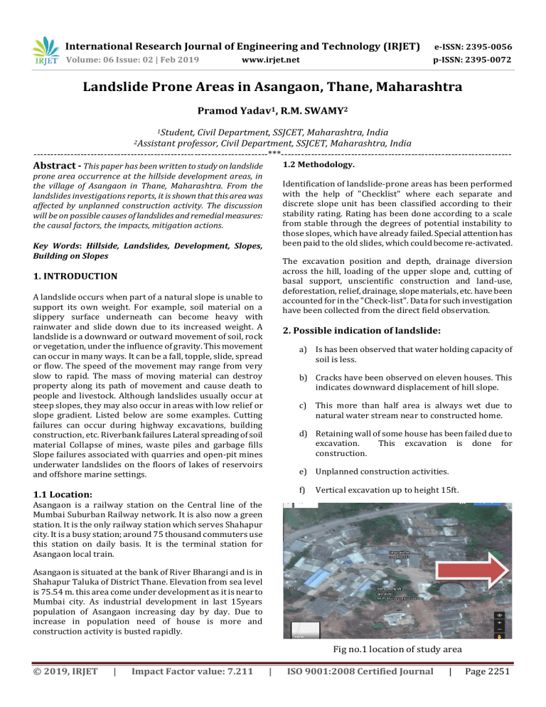
International Research Journal of Engineering and Technology (IRJET) e-ISSN: 2395-0056 Volume: 06 Issue: 02 | Feb 2019 p-ISSN: 2395-0072 www.irjet.net Landslide Prone Areas in Asangaon, Thane, Maharashtra Pramod Yadav1, R.M. SWAMY2 1Student, Civil Department, SSJCET, Maharashtra, India professor, Civil Department, SSJCET, Maharashtra, India ----------------------------------------------------------------------***--------------------------------------------------------------------2Assistant Abstract - This paper has been written to study on landslide 1.2 Methodology. prone area occurrence at the hillside development areas, in the village of Asangaon in Thane, Maharashtra. From the landslides investigations reports, it is shown that this area was affected by unplanned construction activity. The discussion will be on possible causes of landslides and remedial measures: the causal factors, the impacts, mitigation actions. Identification of landslide-prone areas has been performed with the help of "Checklist" where each separate and discrete slope unit has been classified according to their stability rating. Rating has been done according to a scale from stable through the degrees of potential instability to those slopes, which have already failed. Special attention has been paid to the old slides, which could become re-activated. Key Words: Hillside, Landslides, Development, Slopes, Building on Slopes The excavation position and depth, drainage diversion across the hill, loading of the upper slope and, cutting of basal support, unscientific construction and land-use, deforestation, relief, drainage, slope materials, etc. have been accounted for in the "Check-list". Data for such investigation have been collected from the direct field observation. 1. INTRODUCTION A landslide occurs when part of a natural slope is unable to support its own weight. For example, soil material on a slippery surface underneath can become heavy with rainwater and slide down due to its increased weight. A landslide is a downward or outward movement of soil, rock or vegetation, under the influence of gravity. This movement can occur in many ways. It can be a fall, topple, slide, spread or flow. The speed of the movement may range from very slow to rapid. The mass of moving material can destroy property along its path of movement and cause death to people and livestock. Although landslides usually occur at steep slopes, they may also occur in areas with low relief or slope gradient. Listed below are some examples. Cutting failures can occur during highway excavations, building construction, etc. Riverbank failures Lateral spreading of soil material Collapse of mines, waste piles and garbage fills Slope failures associated with quarries and open-pit mines underwater landslides on the floors of lakes of reservoirs and offshore marine settings. 2. Possible indication of landslide: a) Is has been observed that water holding capacity of soil is less. b) Cracks have been observed on eleven houses. This indicates downward displacement of hill slope. c) This more than half area is always wet due to natural water stream near to constructed home. d) Retaining wall of some house has been failed due to excavation. This excavation is done for construction. e) Unplanned construction activities. f) 1.1 Location: Vertical excavation up to height 15ft. Asangaon is a railway station on the Central line of the Mumbai Suburban Railway network. It is also now a green station. It is the only railway station which serves Shahapur city. It is a busy station; around 75 thousand commuters use this station on daily basis. It is the terminal station for Asangaon local train. Asangaon is situated at the bank of River Bharangi and is in Shahapur Taluka of District Thane. Elevation from sea level is 75.54 m. this area come under development as it is near to Mumbai city. As industrial development in last 15years population of Asangaon increasing day by day. Due to increase in population need of house is more and construction activity is busted rapidly. Fig no.1 location of study area © 2019, IRJET | Impact Factor value: 7.211 | ISO 9001:2008 Certified Journal | Page 2251 International Research Journal of Engineering and Technology (IRJET) e-ISSN: 2395-0056 Volume: 06 Issue: 02 | Feb 2019 p-ISSN: 2395-0072 www.irjet.net 2.1 Natural Causes of landslides Buttressing beams are placed at an angle downs lope of the piles to prevent the piles from toppling or tilting. Retaining walls also are constructed of concrete, cinder blocks, rock, railroad ties, or logs, but these may not be strong enough to resist landslide movement and could topple. a) This area comes under heavy rainfall that indicates possibility of land slide. b) The environmental destruction is more since Diagram of a retaining wall with tiebacks and buttress beams. Tiebacks are metal rods that extend from the piles to a competent rock layer below the ground surface. Buttress beams are metal beams that are inclined down slope from the piles that prevent the piles from toppling. Lagging consists of wooden, metal, or concrete beams placed upslope and between the piles to fill in the gaps. c) Slope of hilly area. d) Natural stream of water alongside of slope. 2.2 Artificial Causes of landslides 1. Deforestation in the area for development purpose. 2. Construction of houses since 201, which required leveling of steep areas, which contributed to instability of the hills. 3. The construction of the houses without proper soil testing and stability analysis. 4. The instability of the hillsides was due to the construction activities, which are often done without careful analysis of environmental consequences 3. PREVENTION METHODS OF LANDSLIDES: Many methods are used to remedy landslide problems. The best solution, of course, is to avoid landslide-prone areas altogether. Before purchasing land or an existing structure or building a new structure, the buyer should consult an engineering geologist or a geotechnical engineer to evaluate the potential for landslides and other geology-related problems. Listed below are some common remedial methods used when landslide-prone slopes cannot be avoided. Fig. 2 piles and retaining wall 3.1 PRESERVING VEGETATION: 3.3 Retaining walls Trees, grasses, and vegetation can minimize the amount of water infiltrating into the soil, slow the erosion caused by surface-water flow, and remove water from the soil. Although vegetation alone cannot prevent or stop a landslide, removal of vegetation from landslide-prone slope may initiate a landslide. Retaining walls are relatively rigid walls used for supporting the soil mass laterally so that the soil can be retained at different levels on the two sides. Retaining walls are structures designed to restrain soil to a slope that it would not naturally keep to (typically a steep, near-vertical or vertical slope). They are used to bound soils between two different elevations often in areas of terrain possessing undesirable slopes or in areas where the landscape needs to be shaped severely and engineered for more specific purposes like hillside farming or roadway overpasses. Following are types of wall can be used to retain over loading. 3.2 CONSTRUCTING PILES AND RETAININGWALLS: Piles are metal beams that are either driven into the soil or placed in drill holes. Properly placed piles should extend into a competent rock layer below the landslide. Wooden beams and telephone poles are not recommended for use as piles because they lack strength and can rot. 4. CONCLUSION Because landslides can ooze through the gaps between the piles, retaining walls are often constructed. Retaining walls can be constructed by adding lagging (metal, concrete, or wooden beams) horizontally between the piles. Such walls can be further strengthened by adding tiebacks and buttressing beams. Tiebacks are long rods that attach to the piles and to a competent rock layer below the ground surface. © 2019, IRJET | Impact Factor value: 7.211 In conclusion, a detailed study must be elaborated in any environment transformation to avoid an accident that could cause a high number of fatalities and economic impact. It’s important to observe possible causes as Asangaon east area is prone zone. Proper mitigations techniques should be adopted to prevent future mishaps. | ISO 9001:2008 Certified Journal | Page 2252 International Research Journal of Engineering and Technology (IRJET) e-ISSN: 2395-0056 Volume: 06 Issue: 02 | Feb 2019 p-ISSN: 2395-0072 www.irjet.net 5. REFERENCES 1. F.C. Dai, C.F. Lee b, Y.Y. Ngai, “Landslide risk assessment and management: an overview”, Engineering Geology 64 (2002) pp.65–87 2. Huabin, W., Gangjun, L., Weiya, X., & Gunghui, W. 2005. GIS-based landslide hazard assessment: an overview. Progress in physical geography, 29(4):548-567. 3. Jagadish Kundua, KripamoySarkara, T.N. Singh, “Static and Dynamic Analysis of Rock Slope – a Case Study”, Symposium of the International Society for Rock Mechanics, Procedia Engineering 191 (2017) pp. 744 – 749 4. Jamali, A.A. &Abdolkhani, A. 2009. Preparedness against landslide disaster with mapping of landslide potential by GIS – SMCE (Yazd – Iran). International journal of geoinformatics, 5(4):25–31. 5. K.Y. Choi, Raymond W.M. Cheung, “Landslide disaster prevention and mitigation through works in Hong Kong”, Journal of Rock Mechanics and Geotechnical Engineering 5 (2013) pp.354–365 6. Mohit Kumar, Shruti Rana, Pitamber Dutt Pant, Ramesh Chandra Patel, “Slope stability analysis of BaliaNala landslide, Kumaun Lesser Himalaya, Nainital, Uttarakhand, India”, Journal of Rock Mechanics and Geotechnical Engineering 9 (2017), pp.150-158. 7. N. Casagli et.al, “Landslide mapping and monitoring by using radar and optical remote sensing: Examples from the EC-FP7 project SAFER”, Remote Sensing Applications: Society and Environment4(2016) pp. 92–108. © 2019, IRJET | Impact Factor value: 7.211 | ISO 9001:2008 Certified Journal | Page 2253
