Environmental Assessment Summary
advertisement

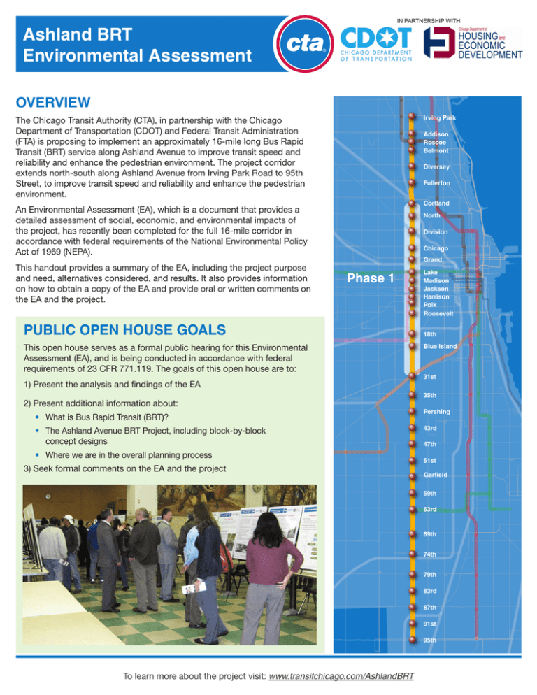
Ashland BRT Environmental Assessment ® OVERVIEW Irving Park The Chicago Transit Authority (CTA), in partnership with the Chicago Department of Transportation (CDOT) and Federal Transit Administration (FTA) is proposing to implement an approximately 16-mile long Bus Rapid Transit (BRT) service along Ashland Avenue to improve transit speed and reliability and enhance the pedestrian environment. The project corridor extends north-south along Ashland Avenue from Irving Park Road to 95th Street, to improve transit speed and reliability and enhance the pedestrian environment. Addison Roscoe Belmont Diversey Fullerton Cortland An Environmental Assessment (EA), which is a document that provides a detailed assessment of social, economic, and environmental impacts of the project, has recently been completed for the full 16-mile corridor in accordance with federal requirements of the National Environmental Policy Act of 1969 (NEPA). This handout provides a summary of the EA, including the project purpose and need, alternatives considered, and results. It also provides information on how to obtain a copy of the EA and provide oral or written comments on the EA and the project. North Division Chicago Grand Phase 1 PUBLIC OPEN HOUSE GOALS This open house serves as a formal public hearing for this Environmental Assessment (EA), and is being conducted in accordance with federal requirements of 23 CFR 771.119. The goals of this open house are to: 1) Present the analysis and findings of the EA 2) Present additional information about: • What is Bus Rapid Transit (BRT)? • T he Ashland Avenue BRT Project, including block-by-block concept designs • Where we are in the overall planning process 3) Seek formal comments on the EA and the p roject Lake Madison Jackson Harrison Polk Roosevelt 18th Blue Island 31st 35th Pershing 43rd 47th 51st Garfield 59th 63rd 69th 74th 79th 83rd 87th 91st 95th To learn more about the project visit: www.transitchicago.com/AshlandBRT Ashland BRT Environmental Assessment This project is planned as part of a citywide BRT initiative consistent with the goals and objectives outlined in the Chicago Metropolitan Agency for Planning 2040 regional long range transportation plan (GO TO 2040). The project purpose and need were developed through the Alternative Analysis process in coordination with public and agency outreach efforts. PROJECT NEED CTA and CDOT are proposing to implement the Ashland Avenue BRT Project to address the following issues: • • • • • • Regional growth patterns outside of Chicago’s Loop Congestion and a lack of competitive travel options Large number of transit dependent customers Lack of non-downtown, north-south, fast transit alternatives Slow bus speeds, frequent stops, and unreliable bus travel times Street design issues no longer meet corridor needs or land use policy objectives PROJECT PURPOSE The purpose of the Ashland Avenue BRT Project is to expand connectivity to the region’s existing transit system by providing a new and upgraded high quality, high capacity and cost effective premium transit service—a service which provides faster, more reliable, and comfortable passenger experience. The proposed project would address the transportation needs of expansive population and employment growth outside of the Central Business District or “Loop” and support local and regional land use, transportation and economic development initiatives. Specifically, the project will improve accessibility, mobility, transit travel times and reliability, and passenger facilities in this heavily transit reliant corridor. ALTERNATIVES ANALYSIS After technical analysis and input at six public open houses in 2012, the center running configuration was chosen as the “Preferred Alternative” to move through subsequent environmental evaluation and conceptual design. Further details on the Alternatives Analysis process and results are discussed in CTA’s “How We Got Here: Western and Ashland Corridors Bus Rapid Transit Project Alternatives Analysis Summary,” available on CTA’s project website (www.transitchicago.com/AshlandBRT). PROJECT FEATURES AND BENEFITS BRT will offer riders faster, more reliable service and new, amenity-filled stations with enhanced, landscaped medians between stations. Local bus service will remain in addition to the BRT service. This project will provide enhanced regional connectivity to existing transit bus and rail services that intersect with the corridor, and serve 232,000 residents and 133,000 jobs along the corridor. Ashland currently has the highest ridership in the system, with more than 31,000 boardings each weekday. HOW IT WORKS • • • • • • • • • Conceptual Rendering of an Ashland BRT Station Center running bus-only lanes (one in each direction), to keep buses moving fast and on-schedule, out of general traffic Limited stops: approximately every half mile and at CTA ‘L’ stations Transit Signal Priority intersections and longer green lights to keep traffic moving Potential for paying fares at the station before boarding to make boarding faster Wide doors on left side of new, high-capacity vehicles to make boarding easier Improved lighting, ADA ramps and real-time bus arrival information at stations Maintains most existing medians and adds more than 75 blocks of new landscaped medians Approximately 90% of parking and loading zones retained on both sides of the street In order to accommodate BRT, the following adjustments would occur: • Two general travel lanes (one in each direction) dedicated as center running bus-only lanes • Most left turns removed to keep buses and general through-traffic moving IN PARTNERSHIP WITH ® ENVIRONMENTAL ASSESSMENT SUMMARY An Environmental Assessment (EA) was recently completed to evaluate and assess potential impacts to the natural, manmade and community environments that may result from implementation of the 16-mile Ashland Avenue BRT Project. To evaluate impacts, the proposed configuration (“Build Alternative”) was compared to the existing configuration (“No-Build Alternative”). The No-Build Alternative assumed no major transit system improvements or investments within the corridor. Existing Configuration (No-Build Alternative) ENVIRONMENTAL EVALUATION The EA evaluated potential impacts related to various features that may result from a project. These features include: Natural Features – Air quality, water, biological, geology and soils, indirect and cumulative Community Features – Land use and economic development, neighborhood and community, environmental justice, historic and archaeological, park land and recreational, visual quality, noise and vibration, displacement/relocations •Two auto travel lanes in each direction •Parking on both sides •Left turns mid-block and at intersections •15’ sidewalks •Painted and landscaped medians Proposed Configuration (Build Alternative) Vehicular Traffic and Parking Features – Vehicular traffic volumes and speeds, vehicular diversion routes, parking Transit, Bicycle and Pedestrian Features – Transit travel times and reliability, transit ridership and demand, station access, pedestrian space, connectivity to bike-share Construction and Operational Features – Energy, safety and security, temporary construction, hazardous materials EVALUATION RESULTS •One center running bus-only lane in each direction •One auto travel lane in each direction •Approximately 90% of parking and loading zones maintained on both sides of street •Left turns removed, except at interstates •Maintains existing 15’ sidewalks and wider sidewalks (17’ to 28’) provided at station intersections •Most landscaped median widths maintained throughout corridor Based on the results of the EA evaluation, the Ashland Avenue BRT Project is expected to have positive impacts on air quality, land use, economic development, neighborhoods and communities, transit service, and the bicycle and pedestrian environment. Potential negative impacts of the project include noise and vibration, vehicular traffic, parking, energy, and temporary construction impacts. Proposed mitigation measures identified in the EA would render these impacts not adverse. Additional detailed analyses can be found in the full Environmental Assessment. Copies of the full Environmental Assessment are available at this meeting and online at www.transitchicago.com/AshlandBRT. •Over 75 blocks of new landscaped medians provided The Ashland Avenue BRT design is still being developed. CTA and CDOT are considering options and modifications, including the addition of some left-turns to the design, and we want your feedback on the current proposal. Ashland BRT Environmental Assessment HOW CAN I VIEW A COPY OF THE ENVIRONMENTAL ASSESSMENT? Copies of the Environmental Assesment are available at CTA’s website (www.transitchicago.com/AshlandBRT), and at the following locations during the 30-day comment period: Ashland Avenue Bus Rapid Transit Project IN PARTNERSHIP WITH ® ® Next Steps PROJECT SCHEDULE Schedule Alternatives Analysis Alternatives Analysis 2012 2012 We Environmental Analysis and and Environmental Analysis Spring 2013 – Spring2013/Fall2013 Aree CTA Headquarters Conceptual Engineering Conceptual Engineering Fall 2013 er H Next Steps Irving Park • 567 W. Lake Street, Chicago While BRT is planned for 16 miles of Ashland Avenue from Irving Park Road to 95th Street, implementation will be Addison To be determined, Roscoe The first phase is being designed for the central areaDesign from Cortland Avenue to 31st Street. BRT on Hours: Weekdays 8:00 A.M. – 4:30phased. P.M. Tobedetermined,contingentuponfunding Final Belmont Ashland Avenue is moving into its engineering and environmental design phase where the route and configuration will Detailed Design contingent upon available be comprehensively analyzed on a block-by-block basis. Diversey funding Harold Washington Library Center Fullerton • We Heard You... What Happens Next? Comments onpublic the input Environmental Assessment phases public engagement. 400 S. State Street, Chicago During the alternatives analysis process, we heldAll six• open houses toinclude garner and additional meetings were held at the request of stakeholders. Dedicated center running bus lanes with vehicle travel lane removal was chosen as (EA)arebeingtakenatthismeetingandover possibleP.M. configuration to address community concerns. Hours: Weekdays, Sat.: 9:00 A.M.the–best 9:00 a30-dayperiodthatbeganwithpublicationof Increased Speed: BRT will provide riders with a Decreased Congestion: Streets with high-quality Sun: 1:00 P.M. – 5:00 P.M. EA.make room for more people to travel with less transit option about as fast as driving a car on Ashland the transit NEXT STEPS Avenue congestion • Commentswillinformfinaldesign. Enhanced Streetscape: Improves lighting, expands Increased Safety: In New York City, BRT Cortland North Division Chicago Grand Chicago Public Library Branch Locations: • Comments on the Environmental Assessment (EA)Lake are being Madison pedestrian corners, and adds more than 75 blocks of improvements reduced traffic injuries by 21% Jackson • Comments andaresponses will become partbegan of new streetscaping, including medians and sidewalks taken over 30-day period that with publication of Harrison • Lincoln Belmont Phase 1 Polk Parking: Configuration preserves 92% of parking on thefinalEA,whichwillbeavailableonCTA’s Roosevelt the EA. 1659 W. Melrose Street, Chicago both sides of the street website. 18th • Comments • Finaldesignwillbeginonthefirst • West Town And Continue to Hear You.will inform the next phase of design. Blue Island 5.4-milesegment(Phase1).Conceptualplans performed throughout 2013 toand formulate the final design andwill there become part of the final EA, 1625 W. Chicago Avenue, Chicago Thousands of hours of additional analysis will be• Comments responses will be further opportunities for public feedback as this project moves forward. willberefinedbasedonadditionaltechnical 31st which will be available on CTA’s website. • Lozano (Pilsen) analysis and community input. How to Stay Involved 35th 1805 S. Loomis Street, Chicago ••WEB:CTAandCDOTarecommittedtoadditional Detailed design JOIN MAILING/E-LIST To learn more about this project will begin on the first 5.4-mile segment Pershing Email us at visit (Phase 1). Concept designs will be refined based on ashlandbrt@transitchicago.com www.transitchicago.com/ashlandbrt publicmeetingsaspartoffinaldesign. • West Englewood 43rd MAIL: 25 To learn more about Bus Rapid Transit additional technical analysis and community input.47th Chicago Transit Authority 1745 W. 63rd Street, Chicago in Chicago, including other projects and Strategic Planning & Policy, 10th Floor visit 51st as part of Attn.: Joe Iacobucci • events CTA and CDOT will hold additional public meetings www.BRTCHICAGO.com 567 W.– Lake Street P.M. Branch Hours: Mon., Wed.: 10:00 A.M. 6:00 Garfield Chicago, IL 60661-1465 the next phase of design. Tues., Thurs.: 12:00 P.M. – 8:00 P.M. Fri., Sat.: 9:00 A.M. – 5:00 P.M. 59th 63rd Project Partners 69th 74th HOW TO COMMENT/ STAY INVOLVED 79th 83rd With Support From: 87th Comments may be submitted during this open house by either speaking with the court reporter or completing Modernizing Chicago Transit for the 21st Century a comment form. In addition, written comments may be submitted via email to AshlandBRT@transitchicago.com or by mail to: Chicago Transit Authority Strategic Planning & Policy, 10th Floor Attn: Joe Iacobucci 567 W. Lake Street Chicago, IL 60661 To be added to the project contact email or mailing list for future updates, contact CTA by email address at right or U.S. mail at the address above. 91st Project E-mail AshlandBRT@transitchicago.com 95th Modernizing Chicago Transit for the 21st Century Phone 1-888-YOUR-CTA (1-888-968-7282) En español Para información en español, llame al (312) 681-2704 Project Web Site www.transitchicago.com/AshlandBRT/ For more information about other BRT projects and events in Chicago: www.brtchicago.com To learn more about the project visit: www.transitchicago.com/AshlandBRT Prepared by CDM Smith Inc.

