Lolo Motorway Trip - Montana Back Roads 4x4

9-8-12
Bruce Erickson’s Lolo Motorway trip for Montana Back Roads 4x4 Club.
Bruce had five other vehicles meet him at the Conoco gas station at Highways 93 and 12 in Lolo at 8:30 on Saturday morning. Bruce had his buddy Gary Swenson
(from Iowa) with him, Larry Garrison in his TJ
, Willie and Jeanne in the “great pumpkin
’s” first trip, along with guests Mark and Penny Strandberg and their
2012 Rubicon, Chris Tucker in his Toyota, and Don Round and friend in his
Nissan XTerra.
Bruce did a super job in providing both a safety information handout as well as historical information about the Lolo Motorway, which covers part of the Lewis and Clark Trail which they traveled in 1805-06. Lewis and Clark reached the
Bitterroot Valley mid September in 1805, and the weather was beginning to change, with frost at night, and snow on the surrounding mountains.
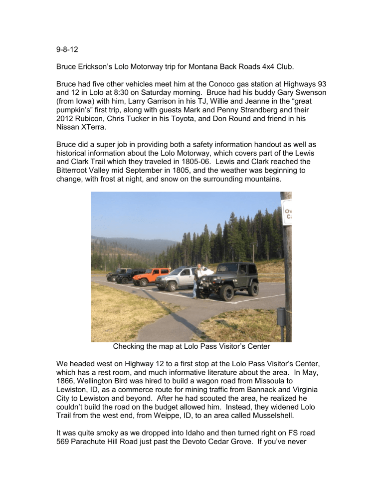
Checking the map at Lolo Pass Visitor
’s Center
We headed west on Highway 12 to a first stop at the Lolo Pass Visitor’s Center, which has a rest room, and much informative literature about the area. In May,
1866, Wellington Bird was hired to build a wagon road from Missoula to
Lewiston, ID, as a commerce route for mining traffic from Bannack and Virginia
City to Lewiston and beyond. After he had scouted the area, he realized he couldn’t build the road on the budget allowed him. Instead, they widened Lolo
Trail from the west end, from Weippe, ID, to an area called Musselshell.
It was quite smoky as we dropped into Idaho and then turned right on FS road
569 Parachute Hill Road just past the Devoto Cedar G rove. If you’ve never
stopped there, make it a point to. It was named for Bernard DeVoto, a conservationist and historian who edited the Lewis and Clark journals. Two short trails loop through the beautiful western red cedar grove . It is magical to see the huge cedars and moss and walk amongst them.
There are many big cedars along Parachute Hill Road also, along with native amur maples already turning yellow, along with quite a bit of mauve fireweed and yellow goldenrod still in bloom. I liked seeing how purply the seed pods of the fireweed were as well as the blossoms, and then the fluffy seed pods as they matured.
Instructions for using the fire ring and how to extinguish the fire
We continued on FS road 569 towards Powell Junction, not turning towards the
Rocky Point Look Out. As we gained elevation we were seeing sub-alpine fir, mountain hemlock with its droopy top, lodgepole, lots of spruce, and mountain ash with bright red berries (drat, I didn’t get a photo of one!!), along with some purple aster still in bloom, and small alder along the road edges.
A fire had burned through here maybe five years ago, good regeneration on all the trees. Much fall color already, mostly from huckleberry and something I haven’t yet identified.
Regrouping on the Lolo Motorway
The trail was very DUSTY!!! All you had to do is follow the dust to stay on the trail! It was neat seeing the sun shining through the dust motes. The best time to do this trail would be after a rain storm or in the spring just after the snow has melted.
The only ones to even use four wheel drive was the “great pumpkin” because
Wi llie didn’t want to air down the stock tires. The Rubicon was quite skittish (or is that “skiddish” as seen in the Missoulian’s classifieds lately) on the loose gravel roads. It was pretty spooky the way the rear of the Jeep would slide around, like on marbles. Could definitely see someone not familiar with a 4x4 vehicle getting in real trouble because of this. Or of them taking the vehicle back to their dealer telling him it handled like …..!
Arrived at Cayuse Junction around noon, made a right turn on FS road 581 down to Cayuse Creek to eat lunch. Had a perfect log to sit on while we ate and gabbed.
Lunch spot at Cayuse Creek
We then continued straight on FS road 500 towards Saddle Camp, while a left turn would return you to Highway 12 in 10 miles. The trail is rockier through here, so not quite as dusty.
Interpretive sign at Indian Post Office
Penny showing the size of the rock piles at Indian Post Office
Stopped at Indian Post Office where there is a commemorative marker stating how this trail has been used by Native American Indians for hundreds of years, and that this was a sacred place to leave messages and make “medicine”. There is also a quote from Captain William Clark, September 16, 1805 talking of how much snow there was and how wet and cold his party was upon arrival at
Lonesome Cove Camp.
Indian Post Office Lake
Shortly after that is Lake View Point, with, of course, a view of the lake! Then on to Devil’s Chair, an impressive granite boulder area.
Devil ’s Chair
There are also several white bark pines here (Pinus albicaulis) that are marked with “tree improvement” plaques so foresters can gather their cones. Again, the fall colors were spectacular, along with the smoky haze from all the Idaho fires.
Fall Colors
Smoke
Whitebark Pine and Spruce
We did not turn right at Saddle Camp towards Horseshoe Lake and Howard
Camp, 6160 feet elevation, but instead made a hard left turn on FS road 107 to return the 9 miles to Highway 12.


