Passive Microwave (Rainfall) Algorithms
advertisement
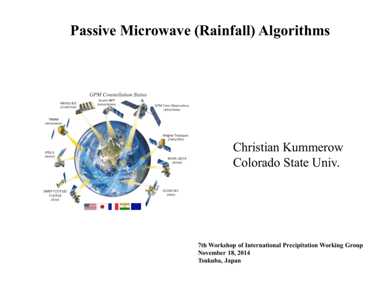
Passive Microwave (Rainfall) Algorithms
Christian Kummerow
Colorado State Univ.
7th Workshop of International Precipitation Working Group
November 18, 2014
Tsukuba, Japan
Passive Microwave Remote Sensing
http://nsidc.org/data/amsre/data_summaries
Microwave Radiation
Plank Function:
Rayleigh-Jeans Approximation:
Observed Radiance:
Observed Brightness Temperature:
Microwave Radiation
Water is a strong absorber/emitter in microwave regime
Snow/ice crystals do not absorb, but scatter radiation
Absorption & scattering increase with frequency
Microwave Radiation
10.65 V
19.35 V
21.3 V
TMI Tb
37.0 V
85.5 V
Gas Absorption
5 mm/hr rain at 37 Ghz
Physical retrievals - Oceans
Water Vapor
Cloud Water
Wind
Absorption, Emission, & Scattering
Mie scattering by frozen
hydrometeors
Melting layer
Absorption by cloud water
Atmospheric absorption by
Oxygen and water vapor
Mie scattering and absorption
by liquid hydrometeors
Surface emissivity: Salinity, SST, wind speed, foam
Soil type, soil moisture, vegetation
GPI
MSU
SSM/I
Satellite Rainfall Biases
Mean DJF Rainfall (1987 – 1996)
Relationship between Tb and Rainfall
MSU
SSM/I
Real Clouds are Complicated
Relative humidity, temperature, snow,
snow density, snow DSD, snow shape,
melting?
Relative humidity,
temperature, rain, rain
DSD, cloud water, cloud
DSD, snow, snow density,
snow DSD, snow shape,
graupel, graupel DSD,
graupel density, melting?
Relative humidity, temperature, rain, rain DSD,
cloud water, cloud DSD, hail, hail DSD, melting?
Passive Microwave Signatures (Ocean vs Land)
Rainfall Algorithms
Under-constrained Solutions
Ocean
vs
Land
(Emission vs Scattering)
Mixed Lognormal PDF of Rain (Rain – NoRain)
Inter-satellite Consistency
Types of Algorithms - Regression
Ø Need to construct a cloud w. various rain rates
Ø Need to decide what to vary with rain and what
to vary independently (co-variance)
Ø Generally need to decide if raining or not
raining before applying regression.
Ø Because of poor knowledge of land background,
use only high frequency scattering signal. Mask
cold surfaces.
Types of Algorithms - Regression
Minimum Variance Framework
Goal: Minimize F (e.g. find x that yields forward computed
Tbs which agree with observed Tbs
Optimal Estimation Framework
Goal: Find
that yields forward computed TBs which agree
with observed TBs within allotted error range
Optimal Estimation
Minimize cost function:
Minimize Differences between
Observed and Simulated TBs
*No Off-Diagonal Elements
*1-2% Error for Each TB
Channel
Minimize Differences between
a priori and retrieved states
*No Off-Diagonal Elements
*50-100% Error for a priori
TPW, WIND and LWP
Minimization
ØEquate Gradient
of Cost Function
to zero.
ØSolution is found in an iterative manner using
Framework analogous to Newton’s Method.
in
where
Solution
Retrieval Error (
)
**Details on Optimal Estimation Methodology Can Be Found Rodg
MIRS Concept
Variational Assimilation
Retrieval (1DVAR)
CRTM as forward
operator, validity->
clear, cloudy and precip
conditions
Emissivity spectrum
is part of the
retrieved state
vector
Algorithm valid in all-weather conditions, over all-surface types
Cloud & Precip profiles retrieval (no cloud
top, thickness, etc)
EOF
decomposition
Sensor-independent
Highly Modular
Design
Flexibility and Robustness
Selection of Channels to use,
parameters to retrieve
Modeling & Instrumental
Errors are input to algorithm
Cost Function Minimization
• Cost Function to Minimize:
T
ù
é1
ù é1 m
T
-1
J( X) = ê (X - X 0 ) ´ B ´ (X - X 0 )ú + ê Y - Y( X) ´ E -1 ´ Y m - Y( X) ú
ë2
û ë2
û
(
)
(
)
• To find the optimal solution, solve for: ¶J( X) = J(' X) = 0
¶X
é
• Assuming Linearity y( x) = y( x )+ K êx - x ùú
êë
0
0 úû
• This leads to iterative solution:
ü
-1
ï
ù
Δ
= B-1+ KnTE-1Kn KnTE-1ïýéêæç Ym - Y( X n )ö÷ + KΔ
ú
n
n
è
ø
n
1
+
ë
ï
X
X û
ïþ
ì
ïïæ
íçç
ïè
ïî
Δ
X
More efficient
(1 inversion)
ö
÷
÷
ø
ì
-1ü
æ
ö
ï
T çK BK T + E ÷ ïýéæç Ym - Y(
= íBK n
ç
÷
ê
n
n+1 ï
è n
ø ïëè
î
þ
X n )÷ö + KΔ
n
ø
X
ù
n úû
Preferred when nChan << nParams (MW)
Microwave TPW Extended over Land
snow-covered surfaces
need better handling
GDAS Analysis
Retrieval over sea-ice and
most land areas
capturing same features as GDAS
26
MIRS Retrieval
TPW Retrieval over Land
Bias: -1.13 mm
Corr. Factor: 0.86
Optimal Estimation
Minimize cost function:
Minimize Differences between
Observed and Simulated TBs
*No Off-Diagonal Elements
*1-2% Error for Each TB
Channel
Minimize Differences between
a priori and retrieved states
*No Off-Diagonal Elements
*50-100% Error for a priori
TPW, WIND and LWP
Bayesian Retrieval Retrieval
Simplified Bayesian retrieval with assumption that pdf’s of both hydrometeor
profiles and observations are realistic and representative:
Expexted value
hydrometeor
profile
Expected value
of errors
Cost-function
Observed
TB-vector
Simulated
TB-vector
Observation &
modelling error
covariance matrix
Quality control:
1)
2)
3)
Only take profiles with |tbo – tb (wi)| < 20 K;
Assume uncorrelated errors (2-5 K);
Perform bias-correction using TB-pdf medians/modes.
The GPM radiometer algorithm
Step 1: Use TRMM/GPM Satellite to derive
set of “Observed” profiles that define an apriori database of possible rain structures.
Step2: Compare observed Tb to
Database Tb. Select and average
matching pairs
TB database profile #1
TB observed
TB database profile #2
~10 km
TB database profile #3
GPROF 2010 w. ideal database
GPROF 2010 w. ideal database
South Africa
GMI Rainfall
Snow over the United States
GPROF - GMI V01D (PPS)
Hurricane Arthur
GPROF 2014 V1- V4
Ocean –
Same as TRMM. GMI and other sensor databses
were computed from physically consistent
database of TRMM PR and TMI. Colder regions
extended by artificially lowering the freezing level
of TRMM observed profiles. Tested for SSMI and
AMSR-E before GMI. (Sarah Ringerud, Dave Randel)
Land –
Fundamentally changed algorithms from TRMM.
Used surface radar over US (NMQ) to construct
databases of observed surface rain and sensor
Tb for each radiometer. GMI currently running
with SSMIS database. (Pierre Kirstetter, Nai-Yu Wang/Ralph Ferraro)
Cold Sfc – Used AMSR2/MHS with CloudSat rain & MMF for
physically consistent database. All sensors use
AMSR2+MHS channels (Mark Kulie, Karen Mohr, Toshio Matsui)
PR/TMI Rainfall Differences
5-year mean Radar (2A25) - Radiometer (2A12)
Surface
types
The Retrieval Algorithm
Retrievals to search only subset of database with similar ancillary values
Input + Ancillary
Data
e?
no
S0
A channel
combination that
is insensitive to
the surface is
compared to apriori database
profiles
.
S1
Retrieval
searches profiles
of self-similar
emissivity
classes
Ancillary data will add
Surface Temp., Water
Vapor, Topography,
and Emissivity Class to
each profile.
yes
S1
Retrieval
searches profiles
of self-similar
emissivity
classes
S2
Retrieval
searches apriori database
with same
surface
properties
Ancillary Data - Topography
Elevation
1 km global elevation from GLOBE, Sampled to 1/10 of a degree (12 km).
Includes standard deviation of elevation within the sampled 10X10 footprint.
