check list - solar photovoltaic system permit
advertisement

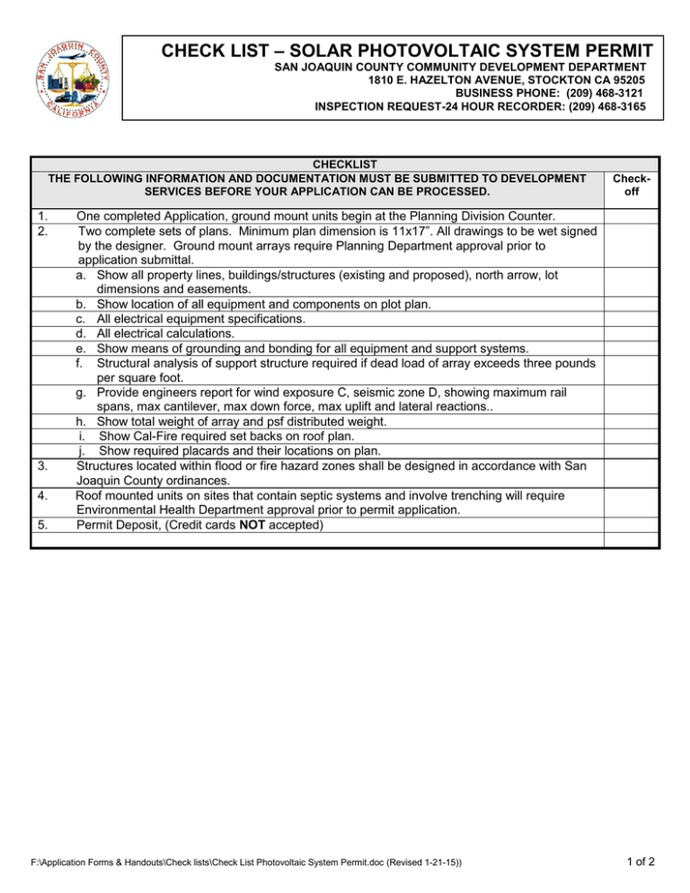
CHECK LIST – SOLAR PHOTOVOLTAIC SYSTEM PERMIT SAN JOAQUIN COUNTY COMMUNITY DEVELOPMENT DEPARTMENT 1810 E. HAZELTON AVENUE, STOCKTON CA 95205 BUSINESS PHONE: (209) 468-3121 INSPECTION REQUEST-24 HOUR RECORDER: (209) 468-3165 CHECKLIST THE FOLLOWING INFORMATION AND DOCUMENTATION MUST BE SUBMITTED TO DEVELOPMENT SERVICES BEFORE YOUR APPLICATION CAN BE PROCESSED. 1. 2. 3. 4. 5. Checkoff One completed Application, ground mount units begin at the Planning Division Counter. Two complete sets of plans. Minimum plan dimension is 11x17”. All drawings to be wet signed by the designer. Ground mount arrays require Planning Department approval prior to application submittal. a. Show all property lines, buildings/structures (existing and proposed), north arrow, lot dimensions and easements. b. Show location of all equipment and components on plot plan. c. All electrical equipment specifications. d. All electrical calculations. e. Show means of grounding and bonding for all equipment and support systems. f. Structural analysis of support structure required if dead load of array exceeds three pounds per square foot. g. Provide engineers report for wind exposure C, seismic zone D, showing maximum rail spans, max cantilever, max down force, max uplift and lateral reactions.. h. Show total weight of array and psf distributed weight. i. Show Cal-Fire required set backs on roof plan. j. Show required placards and their locations on plan. Structures located within flood or fire hazard zones shall be designed in accordance with San Joaquin County ordinances. Roof mounted units on sites that contain septic systems and involve trenching will require Environmental Health Department approval prior to permit application. Permit Deposit, (Credit cards NOT accepted) F:\Application Forms & Handouts\Check lists\Check List Photovoltaic System Permit.doc (Revised 1-21-15)) 1 of 2 SITE PLAN CHECKLIST The following information must be shown on your site plan before our department can begin processing your application. INFORMATION NEEDED FOR COMPLETE MAP ITEM COMPLETE ITEM NEEDED ITEM NOT REQUIRED Size: The Site Plan must be drawn on minimum 11”x17" material.” North Arrow, Date and Scale: Use an engineer's scale (i.e., 1" to 20' or 1" to 40', preferred). The direction of "north" should be pointing towards the top of the page. Streets and Easements: Location and names of all streets and easements bordering on the property with access details. Property Lines: All property lines or boundary lines of the parcel with dimensions. Vicinity Map: A vicinity map showing the location of the property in relation to surrounding streets. Existing and Proposed Development: All existing structures (labeled 'existing') and any proposed structures (labeled 'proposed') with dimensions, square footage and distances from other structures and property lines. Any existing structures planned for removal should be shown with dashed lines. The use and number of floors should be labeled on each structure. Parking and Driveways: The location, dimensions and surface material of all existing and proposed parking and driveways. Calculations indicating the number of required spaces must be shown. (Refer to 'County Parking Lot Standards'). Water Wells: The location of existing and proposed water wells on-site and any off-site wells within 150' of the proposed development. Wells must be meet the following setbacks: 5' from structures; 50' from septic tanks; 100' from leach lines; 150' from sumps or seepage pits; and 10' from property lines. If public water will be utilized, a "will-serve" letter must be submitted from the service provider Sewers and Septic Tanks: The location of the sewer outlet, public sewer hook-up, or existing and proposed sewage disposal systems and any off-site sewage disposal systems within 150' of the property. Septic tanks must meet the following setbacks: 5' from property lines, structures, driveways and swimming pools; 50' from water wells. Leach lines must meet the following setbacks: 10' from structures, driveways and swimming pools; 100' from wells, streams and waterways. 5' to 75' from property lines depending on zoning or the location of septic systems on adjoining Properties (this requirement also applies to seepage pits). If public sewage disposal will be utilized, a "will-serve" letter must be submitted from the service provider. Storm Drainage: The location of existing and proposed storm drainage facilities(check with Engineering staff regarding design criteria). If subject to flooding, the 100-year flood elevations must be shown. Indicate any unusual topographic features of the site (e.g. steep slopes, or drainage courses). Landscaping: The location of existing and proposed landscaping and trees 6" or greater in diameter (note any trees to be removed). Calculation indicating the percentage of the net site area to be landscaped must be shown. (Refer to County Landscaping Standards). Signs, Fences, Storage and Trash Enclosures: The location of and height of all existing and proposed signs and fences and the location and dimensions of all open and/or enclosed storage and trash receptacles. Grading and Contours need to be shown. SITE PLANS MUST BE COMPLETE AND LEGIBLE Before applying, check your Site Plan to make sure that it contains all of the information cited above. You are encouraged to have one of our counter staff review your draft Site Plan prior to having copies run. Faint prints and light blue lines cannot be accepted because they cannot be reproduced or microfilmed F:\Application Forms & Handouts\Check lists\Check List Photovoltaic System Permit.doc (Revised 1-21-15)) 2 of 2


