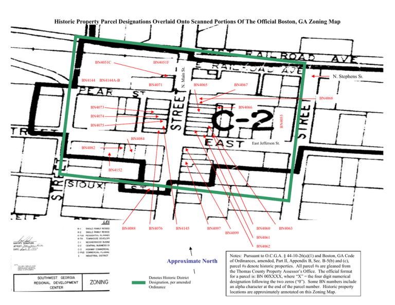
Boston HP Overlay Onto Zoning Map
advertisement

Historic Property Parcel Designations Overlaid Onto Scanned Portions Of The Official Boston, GA Zoning Map BN4144 BN4051F BN4144A-B BN4071 N. Main St. BN4051C N. Stephens St. BN4065 BN4067 BN4068 BN4066 BN4055 BN4073 BN4074 BN4075 BN4084 East Jefferson St. BN4082 BN4152 BN4088 BN4076 BN4145 BN4097 BN4060 BN4063 BN4099 BN4061 BN4062 Approximate North Denotes Historic District Designation, per amended Ordinance Notes: Pursuant to O.C.G.A. § 44-10-26(a)(1) and Boston, GA Code of Ordinances, amended, Part II, Appendix B, Sec. B-5(b) and (c), parcel #s denote historic properties. All parcel #s are gleaned from the Thomas County Property Assessor’s Office. The official format for a parcel is: BN 00XXXX, where “X” = the four digit numerical designation following the two zeros (“0”). Some BN numbers include an alpha character at the end of the parcel number. Historic property locations are approximately annotated on this Zoning Map.

