Field Mapping Geologic Structures: GEOL 429 Handout
INTRODUCTION TO FIELD MAPPING OF
GEOLOGIC STRUCTURES
GEOL 429 – Field Geology
Department of Earth Sciences
Montana State University
Dr. David R. Lageson
Professor of Structural Geology
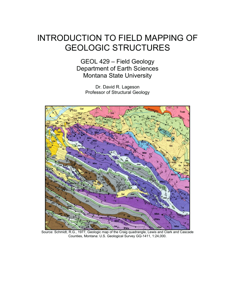
Source: Schmidt, R.G., 1977, Geologic map of the Craig quadrangle, Lewis and Clark and Cascade
Counties, Montana: U.S. Geological Survey GQ-1411, 1:24,000.
CONTENTS
Topic
Procedure
Introduction
Deliverables
Constructing a geologic map in the field
Common symbols used on geologic maps
Surficial deposits
The scale
The importance of thinking
Map and cross-section key (explanation)
Written report
Page
3
4
4
5
7
8
9
10
10
10
12
14 to 15
Ethics in field work 17
The author respectfully acknowledges Professor Gray Thompson’s unpublished paper entitled
“Geologic Mapping” (University of Montana), which was revised and used extensively in the compilation of this handout.
2
3
INTRODUCTION
Structural analysis proceeds through three linear stages: 1) description of the structural geometry of a deformed field area (bedding attitudes, planar fabrics, linear fabrics, folds, faults, joints, etc.); 2) kinematic analysis (movements responsible for the development of structures [translation, rotation, distortion, and dilation] and relative timing); and 3) dynamic analysis (interpretation of forces and stresses responsible for the deformation). Stage 1, descriptive structural analysis, is the product of careful field mapping.
Although maps are two-dimensional sheets of paper, they portray the geology in three-dimensions. This is because most structures tend to dip or plunge and, therefore, one can infer the direction and degree of dip or plunge through outcrop patterns. Also, we use special geologic symbols to indicate 3-dimensionality on our maps. Therefore, a geologic map is nothing more than the representation of
3-d structures on an arbitrary 2-d horizontal plane. Put another way, a geologic map is a cross-section of dipping and plunging structures projected on a horizontal plane. Clearly, it is necessary to carefully map out this 2-d view before one can visualize the 3-d geometry of deformed rocks. A well-done geologic map can provide a powerful down-plunge view of the 3-d structural geometry in a
“true” cross-section view that is
to plunge.
Field mapping can be physically and mentally challenging. Hundreds of questions arise, dictating that hundreds of decisions must be made during the course of a single day. Where should I go? What unit is this? Why does this bed abruptly end? Thus, field mapping is the ultimate application of the scientific method – a good field mapper is constantly testing predictions about the next outcrop and evaluating multiple hypotheses about the structure. In the midst of this mental workout, it is important to maintain your focus and purpose by remembering the goals of your project or research. Try to maintain a good sense of humor and enjoy the day. After all, didn’t most of us decide to go into geology because we like being outdoors and we like thinking about the Earth?
To get started with structural field mapping, here are some tips:
Eat a good breakfast
Drink plenty of water throughout the day
It is humanly impossible to take “too many” strike-and-dips
In structural geology, accuracy and neatness count heavily!
Force your mind to think in 3-d; with time and experience, this will come naturally
Use your time in the field efficiently - always have a plan in the field!
4
DELIVERABLES
Each mapping/structural field project in GEOL 423 requires the following deliverables (i.e., products to be turned in), typically at a designated time/place on the evening of the last day of the project:
Geologic map – lightly colored and burnished
Structural
Key or explanation that describes all rock units and explains structural symbols, etc.
Written report, usually based on a set of questions posed at the onset of
the project; some reports may require accompanying stereonets notebook
In order to accomplish this (on time), it is essential to work during each and every evening during the course of a multi-day project. An evening work plan might be the following:
Evening 1 – construct your topo-profiles and “boxes” for your crosssection(s) lines; begin work on the key; start to ink your field map; plan your next day (perhaps following a cross-section line)
Evening 2 – continue to ink your field map; start to make cross-section sketches; continue work on the key; plan your next day
Evening 3 – continue to ink your field map; finish one of your crosssections (assuming you have more than one cross-section); make an initial outline of your report; plan your next day
Evening 4 – continue to ink your field map; finish your second crosssection; spend some more time thinking about your report, particularly how you are going to answer the questions (compile strike-dip data on stereonets); plan your final day to maximize in-filling of your map in critical areas
Evening 5 – finish inking and coloring your map and key; finalize your report (deadline = mid-evening)
This suggested work schedule would obviously be compressed with mapping projects that span less than five days, so plan accordingly.
CONSTRUCTING A GEOLOGIC MAP IN THE FIELD
The art and science of geologic mapping involves the accurate depiction of contacts between rock units on a base map of some sort. This is what it’s all about – being able to draw a contact on a topo-map or air photo! Obviously, this task is best done in the field where you can visually verify the location of contacts
(don’t try to “dry lab” a geo-map back in camp). Your ability to construct a reasonable geologic map in the field fundamentally depends on two things.
First , you must know exactly where you are on a topo-sheet or aerial photo at all times – being lost is simply not an option! Second , you must know where you
5 are in the stratigraphic section, which sometimes requires a little scrambling around (this obviously becomes easier with experience in an area). Unless you know where you are and what you’re standing on, it is impossible to draw a contact. Therefore, the overriding goal is accurate mapping of contacts and related geologic features (faults, etc.); it is not good enough to depict the “general idea” – we insist on accurately mapped contacts.
Procedure:
1. Keep track of your location on the map or aerial photo continuously as you traverse an area; typically, you will want to plan your traverses perpendicular to strike, thus crossing as many units as possible.
2. Orient the map in the direction that you are traversing: if you are walking east, then you should be looking eastward on the map. Always look ahead to where you want to go next on the topographic map, so when you get there you have already anticipated the topography - have a plan!
3. When you encounter a contact between two mappable units, stick a pin through the map at your location, turn the map over, circle the pinhole, and assign a station number to it; then, enter the station number in your field notebook as the heading for entries relating to that map station.
4. A typical station number might be abbreviated in the following manner:
DL1-06
(Personal initials, station 1, 2006)
Back of map
Circled pin-hole (exaggerated size)
5. Typical notebook entries for a given station might include:
Rock
Identification of formations (or other mappable units) at the contact
Nature of the contact (disconformity; gradational; fault; igneous; etc.)
Strike-and-dip,
Estimates of formation thickness
Observations on topographic expression of rock units
Structural cross-section sketch
Stereonet sketch (to help visualize structural data)
Sketch of complex outcrop relationships
(Be sure to distinguish facts/observations from interpretations)
Good field notes are richly illustrated with clean, clear sketches; one good picture is worth a thousand words!
6. Next, draw the contact on your map as far as you can confidently see it, either on the ground or the air photo (use a thin/sharp pencil with a soft touch, in case you need to erase it). Do not forget the Rule of V’s, but
6 don’t exaggerate the contact migration in valleys. The contact location on your map should be accurate not generalized or theoretical. Your map IS data.
7. Then move on quickly to the next contact. Remember, try to cover as much ground as possible each day and NEVER plan to return to the same outcrop later – chances are, you never will.
Also, don’t stash your daypack expecting to return to it later. Once you get to a new spot, you may see something that dictates a different route than you planned on. Carry all your gear with you, all the time (this is a basic USGS rule of mapping).
8. To save time and energy, plan your traverse so it crosses the structural grain at a high angle (perpendicular to strike). Work back and forth over an area in a series of traverses, spaced according to the topography and complexity of the geology.
9. Take advantage of hilltops to check your mapping, refine your contacts, refine your traverse route, and predict contacts on the next leg of your traverse. Sometimes in rugged, high mountains, the view from a peak may be your only way to map cliffs, cirque headwalls, and other inaccessible places. In such instances, a good pair of lightweight field binoculars may be your best friend (the so-called “Swiss rock hammer”).
10. On your geologic map, depict the hinge lines of folds at the point of maximum curvature and be sure that your strike-and-dip data support the interpretation. Use medium-weight blue lines for fold hinges .
11. Use heavyweight red lines for faults and apply the appropriate design for different fault types (e.g., barbs in the hanging wall of thrust faults).
7
TYPES OF CONTACTS
There are many different types of contacts between mappable units (refer to geologic map and structure symbols). However, for this field course, three types of contacts will be used to express your level of confidence:
Solid line = definite contact (you are sure you have located the contact within the line width on your map); sometimes you can show the dip direction and amount with an arrow, as below (intrusive igneous contacts can sometimes dip inwards):
Ki
70
Kk
3
Figure 1. Contact position known well (50 ft on a 1:24,000 map)
Dashed contact = the contact is reasonably well located, but possibly not within a line width on the map
Kk
3
Kk
2
Figure 2. Contact known with less precision
Dotted contact = concealed contact (i.e., beneath Quaternary alluvium)
Kk
1
Jm
Qaf – alluvial fan
Figure 3. Contact concealed below a surficial unit.
If the rocks are well exposed (as they generally are in field camp), you should be able to draw solid contacts with confidence in most cases. Dotted contacts are certainly permissible where you need to extrapolate a contact beneath
Quaternary cover. Dashed contacts should be used rarely in this class because, again, you are mapping some incredibly well exposed areas!
8
Air photos:
When available, air photos can be a great help in locating contacts. Even with black-and-white air photos, contacts can sometimes be clearly seen as tonal boundaries. Just be sure (through ground truthing) that a change in tone corresponds to a mappable contact (formational boundary) and not simply a change in vegetation; if the tone change does correspond to a contact, then you may be able to extrapolate the contact well beyond the area of your traverse and then transfer these data back to your topographic base map. Color air photos work even better for this application! Of course, working with stereo-pairs can assist in visualizing the 3-d relationship of contacts to topography. Be aware that distortion increases on an air photo from the center to its margins, thus affecting the shape of outcrops near the margins of the photo.
When traversing about a field area, pay attention to the plant cover that grows on different rock units. This will assist in your interpretation of air photos.
COMMON SYMBOLS USED ON GEOLOGIC MAPS
9
Figure 4. Common symbols on a geologic map (from Rowland et al., 2007, appendix F)
10
SURFICIAL DEPOSITS
Do not get carried away with mapping Quaternary alluvium in every little creek and arroyo; reserve the mapping of Qal for big creeks and rivers with broad, deep floodplains. If bedrock mapping is your goal, then map surficial deposits only where they hopelessly obscure bedrock; alternatively, if your goal is to map surficial deposits, then do not let the bedrock detain you. Do not map surficial deposits as “undifferentiated cover” and do not invent some meaningless designation, such as Quaternary hill wash.
Here is a short-list of some commonly encountered Quaternary deposits that you might need to map:
Qal – alluvium
Qaf or Qf – alluvial fan, typically at the base of a range
Qls – landslide
Qt – talus (particularly a talus apron at the base of a cliff)
Qm - moraine
THE ISSUE OF SCALE
The amount of detail you can show on your map depends on its scale – basically on what you have room to draw. You can generally show more detail by resorting to a larger scale, depending of course on the size of the structures in your field area. When selecting a map scale for your field project (something you don’t have to worry about in field camp), consider the following:
What is the goal or purpose of my mapping?
What scale of structures do I want to “capture” through mapping?
How much time do I have (is this a reconnaissance project, or can I go slow and map in great detail)?
The typical scale for USGS mapping projects is 1:24,000. At this scale, the
USGS rule-of-thumb pace of mapping is one mile
2
per day. For projects involving detailed structural analysis, a better scale may be 1:12,000 and a pace of ~0.5 mile
2
per day.
THE IMPORTANCE OF THINKING
People who wander aimlessly from one outcrop to the next, with no traverse plan, are probably wasting their time. You should always have in mind one or more working hypotheses that predicts what rocks you will find at the next outcrop or ridge, based on an overall hypothesis about the structure. Geologic field mapping is the ultimate application of continuous hypothesis testing and juggling multiple hypotheses in your mind – the essence of scientific methodology! Every outcrop you visit should test one or more hypotheses.
11
For this reason, good field mappers are generally very good scientists. The
Classic paper The Method of Multiple Working Hypotheses by T.C. Chamberlain
(1890) explains the benefits of this method in eloquent 19 th
century scientific prose. The paper is included in this tome for your edification. If you find that you do not have a working hypothesis, it is important to stop and think until you have one. Alternatively, if you find that you are able to consistently predict the next outcrop with ease, don’t become too confident and allow your model to dictate the mapping, for Mother Nature has a way of throwing curve balls that can humble even the most experienced field mappers!
STRUCTURAL MEASUREMENTS
Every student in field camp is required to have successfully completed structural geology (GEOL 315 or equivalent from another university). Here are some points to keep in mind:
Make sure the magnetic declination on your compass is set correctly
(based on up-to-date information)
There are a variety of ways to measure dip and strike with a compass:
1. Observe an outcrop exposed in three dimensions (most accurate
(Compton, 1962, p. 29)): o Step back from outcrop 10 feet or so. o Move until the bedding surface just disappears. o Sight a level line and read the azimuth (Fig. 2A) o Maintain position and measure the dip looking along the azimuth line (Fig. 2B).
Figure 5. Dip and strike from outcrop 10 feet away (from Compton, 1962, p. 29)
2. On an outcrop (beware of surface irregularities)
12
Figure 6. Measurement of dip and strike on outcrop (from Compton, 1962,
3. On an outcrop with low dip angle splash water on surface and measure dip parallel to water flow and strike perpendicular to that
(Compton, 1962, p. 31)
4. Visually sight a strike-and-dip across an outcrop or across a ravine; these are generally more accurate than measuring directly on an outcrop surface (especially an irregular bedding surface) unless there is a fault in the ravine that offsets the contact.
For a given outcrop, you and your partner should both take a structural measurement. This provides a quick double-check of your measurement and allows you to take a numerical average, thus accounting for Mother
Nature’s variability. Your measurements should be within 5 o
of one another; if not, then find out why.
With accurate mapping of contacts across topography, you can also determine strike-and-dip through the application of the three-point method (three points in space define a plane); this is especially useful for measuring the dip of thrust faults.
Record a strike-and-dip as: S = 305, 45 SW (always indicate dip direction!)
Alternatively, record dip and dip direction as: 45, 215
Record plunge and trend as: 35, 045 (i.e., 35 o
in the direction 045 o
)
Never record a bunch of numbers without knowing exactly what they mean; take thorough field notes with lots of structure sketches and stereonet sketches
Remember, if the trace of a contact (or dike) crosses irregular topography in a straight line, it is vertical or nearly so. If the map trace of a contact follows topographic contours, it must be horizontal. If the map trace of a contact wanders across irregular topography, then it dips!
13
One can measure plunge and trend of the hinge line of a fold in one of two ways: o Stand on the nose of a fold and take a direct measurement of plunge angle and plunge direction at the point of maximum curvature, or o Simply plot strike-and-dip measurements on a stereonet from the limbs of a fold and determine the
-point or
-point (S-pole diagram) – this is the preferred method
Structure sections should be drawn according to the MSU cross-section formatting rules, with no vertical exaggeration.
Don’t forget Occam’s Razor: use the simplest explanation that fits your observed and measured field data.
MAP AND CROSS-SECTION KEY (EXPLANATION)
You will typically be asked to create one key for both the geologic map and cross-section(s). The key should provide the basic information needed to read the map, leaving nothing to guess about. It should be complete, yet concise and very clear. The key should include the following elements:
The key should be on a separate piece of paper
Every mapped rock unit should be identified by a colored box that matches the color on the map and cross-section(s), pattern (if used), symbol, and age
Units should be vertically stacked from youngest at the top to oldest at the bottom
Show igneous rocks in a separate section of the key (not lumped with sedimentary rocks)
In some cases, you may be asked to represent stratigraphy as a columnar section instead of colored boxes – but you will receive specific instructions on this
Each mapped unit should have a brief description adjacent to it, such as color (weathered versus fresh), texture, composition, thickness, outcrop expression, etc. – this information should be gathered by you in the field and recorded in your field notebook
All structure and contact symbols must have an explanation (faults, folds, strike-and-dip of bedding and foliation, lineations, fold hinges, mine adits and trenches, etc.)
The key should be specific to the project – it should not include units that do not appear on the map or cross-section
14
APPEARANCE
Geologic maps, cross-sections, keys, and field notes should please the eye and inform the mind. Always present your work as attractively and professionally as possible.
Smooth, even, finely drawn ink lines inspire confidence; wavering and uncertain lines inspire doubt. Thick, sloppy lines virtually guarantee a very poor grade on the mapping project.
Dashed and dotted lines should make smooth, continuous curves, not wayward chicken tracks.
Lettering should be neat, precise, and easily readable.
Letter your formation symbols on the map so they read the same way; don’t have some upside-down, some sideways, and some right-side-up.
If you do not have room within the contacts of a unit, place the symbol outside with a thin line connecting it to the unit.
Be sure the cross section contact location matches the position on the map.
WRITTEN REPORT
We normally require a written report of a page or more on the important geologic aspects of the field area. The written report should be based solely on your own interpretations, not those of your instructors or fellow students. Furthermore, it is unethical to copy and/or slightly modify another student’s field report.
Field reports should address the questions posed in the project handout.
Reports should not rehash rock descriptions and stratigraphy, unless you are so instructed.
Reports should not rehash “Laramide history” or some other aspect of regional geology – keep the report focused on the geology of your map area and the leading questions.
Spelling counts! Use dictionaries (geological and English language)
The written report should be carefully phrased for the same reason your map and cross-section should be carefully drawn. No one wishes to struggle through a mess of superfluous verbiage and tortured syntax.
Nothing makes you look worse than a written report that conveys the impression that you do not comprehend your own map!
FIELD NOTES
Field notes should be neat, clear, well organized, and richly illustrated. They should be written in such a manner that another geologist could easily comprehend what you wrote down. You should be able to pick up your notebook in 20 years and not guess about what your columns of numbers meant (like strike-and-dip). Many agencies (USGS) and companies catalog all field
15 notebooks as archival records of your work. Your notebooks are part of your legacy, part of your professional reputation. Someone may read your notebook and form an impression of you long after you are gone, or worse, long before you are gone! Therefore, as always in your geologic work, strive for high-quality professionalism!
Use a bound notebook; two will be required for field camp.
Use permanent ink or a hard pencil lead that will not smear; it is useful to have two separate pencils, a soft thin pencil for mapping and a harderlead pencil for notes.
You should start each day’s notes with the date, location, identity of the map and/or air photos you are using, and other pertinent information about the field project (project number, land ownership, township-range-section,
GPS coordinates, etc.)
Basically, organize your notes by station number and GPS coordinates (if you are recording GPS).
Enter your observations in an orderly manner. Try to be consistent in the order that you write down field data and observations.
For structural data, it may be useful to place the appropriate structural symbol along the left margin, and then enter the numbers next to it (as a way to keep track of what the numbers represent).
Consider making a “running” structural section along your line of traverse.
Make numerous sketches!
Many students resist sketching in their notebooks on the grounds that they are not artists and therefore cannot draw; if that logic were to prevail, then most could easily resist taking written notes on grounds that they are not published authors. Even a poorly executed sketch depicts ideas with clarity difficult to attain verbally.
Many noted geologists recommend organizing notes with the left page reserved for writing and the right page for sketching, cross-sections, or columnar sections.
Keep facts and interpretations physically separate and clearly identifiable.
If you invent your own abbreviations (as we all tend to do), it is imperative to explain them with a “key” in the back of the notebook. An example might be “RBS” – rocks badly shattered – no one would have the foggiest idea what RBS meant without an explanation.
GRADING CRITERIA
Goals to strive for-
Map: accuracy, neatness, all map units present on the map, proper symbols and use of colors, logical field relationships, sufficient number of stations, and sufficient number of structural measurements.
16
Key: all units and symbols on map and cross-section are also on the key, mapping units in proper sequence (oldest on the bottom), accurate lithologic descriptions, and neatness.
Cross-section(s): consistent with your map, logical structural relationships
(admissible), consistent bed thickness, properly formatted, and neatness.
Written report: addresses questions, succinct, correct sentence structure, correct spelling, and overall flow.
Stereonets: neat and clearly labeled, good explanation for each sheet, color or symbol coded if multiple fabrics are plotted on one sheet.
Field notes: organization, orderly presentation of data and interpretations, lots of clear sketches, running cross-sections, columnar sections where applicable, neatness, and overall readability.
PITFALLS
Common criticisms of geologic maps:
1. Inaccurately located contacts
2. Incorrect map symbol
3. Illogical contacts or other map relations (including missing mappable units
– mostly commonly Jm)
4. Insufficient number of stations (strike-and-dips); in most field areas, you should easily be able to make at least 20 stations per day
5. Missing or inaccurately located fold hinge line, or the hinge is not drawn through the entire fold at all stratigraphic levels
6. Coloring so dark and streaky that it obscures the map
7. Inked lines too thick and/or not neatly drawn
Common criticisms of keys:
1. Map units or structure symbols missing
2. Poor lithologic descriptions
3. Improper sequence in the stratigraphic column
4. Sloppy lettering
Common criticisms of cross-sections:
1. Inconsistent with the geologic map
2. Inconsistent bed thickness (especially for competent units)
3. Illogical relationships – weak structural interpretation
4. Symbols missing
5. Formatting errors
17
Common criticisms of written reports:
1. Poor writing or spelling
2. Report does not address the salient questions posed at the onset of the project
Common criticisms of field notes:
1. Weak organization and/or lack of neatness
2. Using a pencil that is too soft, resulting in smudges and smears
3. Missing or inadequate sketches of structures and other relevant geologic features
4. Not enough structural data and/or poor organization of measurement data in the notebook
5. Inadequate lithologic descriptions
6. Overall inability to clearly follow what was written down
ETHICS IN FIELD WORK (King, 1977)
You will be required to work with a mapping partner, for the sake of field safety.
That does not give you license to copy and plagiarize data. It is fine to discuss where a contact might be, or to compare strike-and-dip measurements to achieve a mean value, or to discuss rock descriptions, or to discuss and debate field relations, but it is not fine to blatantly copy from another student.
Draw your own contacts on your own map – don’t copy someone else’s map
Write your own field notes and do not “dry lab” them from another student in the evening
Draw your own cross-sections and make your own interpretations
Treat the land with respect and tread lightly, don’t litter, don’t carve your initials in rock, and don’t break down fences (step through or crawl under when possible)
Be honest and set high standards for yourself, in geology field camp and in daily life! Take the ethical high road – it’s a better view!
18
REFERENCES CITED
Compton, R.R., 1962, Manual of Field Geology : New York, John Wiley and Sons,
378 p.
King, P.B., 1977, The Evolution of North America (revised edition): Princeton
University Press, Princeton, N.J., 197 p.
Rowland, S.M., Duebendorfer,E.M., and Schiefelbein, I.M., 2007, Structural
Analysis and Synthesis. A Laboratory Course in Structural Geology (3 rd edition): Oxford, Blackwell Publishing, 300 p.
Chamberlain, T.C., 1890, The method of multiple working hypotheses: Science , v. 15, p. 92-97. Reprinted in Science , v. 148, p. 754-759 (1965).
