Administrator Lesson Guide: ELECTIVE LET 2 Unit 5: Chapter 1:
advertisement

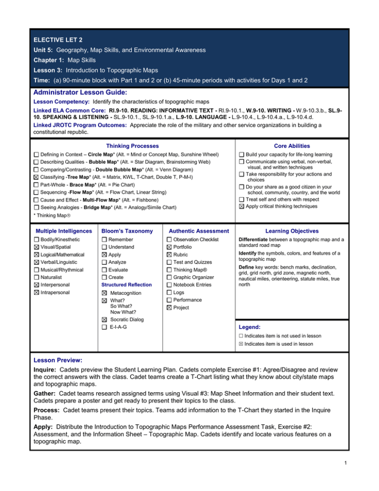
ELECTIVE LET 2 Unit 5: Geography, Map Skills, and Environmental Awareness Chapter 1: Map Skills Lesson 3: Introduction to Topographic Maps Time: (a) 90-minute block with Part 1 and 2 or (b) 45-minute periods with activities for Days 1 and 2 Administrator Lesson Guide: Lesson Competency: Identify the characteristics of topographic maps Linked ELA Common Core: RI.9-10. READING: INFORMATIVE TEXT - RI.9-10.1., W.9-10. WRITING - W.9-10.3.b., SL.910. SPEAKING & LISTENING - SL.9-10.1., SL.9-10.1.a., L.9-10. LANGUAGE - L.9-10.4., L.9-10.4.a., L.9-10.4.d. Linked JROTC Program Outcomes: Appreciate the role of the military and other service organizations in building a constitutional republic. Thinking Processes Core Abilities Defining in Context – Circle Map* (Alt. = Mind or Concept Map, Sunshine Wheel) Describing Qualities - Bubble Map* (Alt. = Star Diagram, Brainstorming Web) Comparing/Contrasting - Double Bubble Map* (Alt. = Venn Diagram) Classifying -Tree Map* (Alt. = Matrix, KWL, T-Chart, Double T, P-M-I) Part-Whole - Brace Map* (Alt. = Pie Chart) Sequencing -Flow Map* (Alt. = Flow Chart, Linear String) Cause and Effect - Multi-Flow Map* (Alt. = Fishbone) Seeing Analogies - Bridge Map* (Alt. = Analogy/Simile Chart) Build your capacity for life-long learning Communicate using verbal, non-verbal, visual, and written techniques Take responsibility for your actions and choices Do your share as a good citizen in your school, community, country, and the world Treat self and others with respect Apply critical thinking techniques * Thinking Map Multiple Intelligences Bloom’s Taxonomy Authentic Assessment Bodily/Kinesthetic Remember Observation Checklist Visual/Spatial Understand Portfolio Logical/Mathematical Apply Rubric Verbal/Linguistic Analyze Test and Quizzes Musical/Rhythmical Evaluate Thinking Map® Create Graphic Organizer Naturalist Interpersonal Structured Reflection Intrapersonal Metacognition Logs What? So What? Now What? Performance Notebook Entries Learning Objectives Differentiate between a topographic map and a standard road map Identify the symbols, colors, and features of a topographic map Define key words: bench marks, declination, grid, grid north, grid zone, magnetic north, nautical miles, orienteering, statute miles, true north Project Socratic Dialog E-I-A-G Legend: Indicates item is not used in lesson Indicates item is used in lesson Lesson Preview: Inquire: Cadets preview the Student Learning Plan. Cadets complete Exercise #1: Agree/Disagree and review the correct answers with the class. Cadet teams create a T-Chart listing what they know about city/state maps and topographic maps. Gather: Cadet teams research assigned terms using Visual #3: Map Sheet Information and their student text. Cadets prepare a poster and get ready to present their topics to the class. Process: Cadet teams present their topics. Teams add information to the T-Chart they started in the Inquire Phase. Apply: Distribute the Introduction to Topographic Maps Performance Assessment Task, Exercise #2: Assessment, and the Information Sheet – Topographic Map. Cadets identify and locate various features on a topographic map. 1 Chapter 1: Map Skills Lesson 3: Introduction to Topographic Maps ELECTIVE LET 2 Unit 5: Geography, Map Skills, and Environmental Awareness Chapter 1: Map Skills Lesson 3: Introduction to Topographic Maps Time: (a) 90-minute block with Part 1 and 2 or (b) 45-minute periods with activities for Days 1 and 2 Instructor Lesson Plan: Why is this lesson important? Road maps and topographic maps have many of the same characteristics, such as map legends, scales, grids, and symbols. But topographic maps add unique characteristics and show detail about terrain, elevation, and relief. This learning plan presents an overview of topographic maps, describing their characteristics, marginal information, symbols, and colors. This will prepare you for future practical exercises that require your interpretation of topographic maps. Future lessons within this chapter will deal specifically with topographic maps. Lesson Question What are the distinguishing differences between a city/state map and a topographic map? What will Cadets accomplish in this lesson? Lesson Competency Identify the characteristics of a topographic map What will Cadets learn in this lesson? Learning Objectives a. Differentiate between a topographic map and a standard road map b. Identify the symbols, colors, and features of a topographic map c. Define key words: bench marks, declination, grid, grid north, grid zone, magnetic north, nautical miles, orienteering, statute miles, true north When will your Cadets have successfully met this lesson’s purpose? Performance Standards by identifying various features on a topographic map when the Cadets identify the sheet name and the name of an adjacent map when the Cadets identify the city, state, largest river, and highway on the map when the Cadets identify the highest region on the map and its approximate elevation when the Cadets locate other features by grid lines NOTES: Unit 5: Geography, Map Skills, and Environmental Awareness 2 Chapter 1: Map Skills Lesson 3: Introduction to Topographic Maps Part 1: 45 minutes Phase 1 -- Inquire: Lesson Delivery Setup: 1. Make sure Curriculum Manager is installed and the clicker receiver is plugged in. Distribute clickers to Cadets. 2. Ensure that Cadets have access to the Student Learning Plan. 3. Prepare to show all Inquire Phase slides from the Lesson PowerPoint Presentation and start with the Focusing Question. 4. Prepare to display the Learning Objectives. 5. Prepare to distribute Exercise #1: Agree/Disagree. The answers to the exercise are in the Exercise #1: Agree/Disagree Answer Key. 6. Provide chart paper and markers for team use. 7. Ensure Cadets have their Cadet Notebooks for use throughout this lesson. Student Learning Activity Teaching Notes Direct Cadet Focus: Ask Cadets to think about what they know about topographic maps. The Inquire Phase of the lesson is to set Cadets up to begin thinking about what they already know about this subject area. 1. THINK ABOUT what you know about topographic maps. PREPARE for this lesson by discussing What you will accomplish in this lesson; What you will learn in this lesson; Why this lesson is important, and When you will have successfully met this lesson’s purpose. Display the Focusing Question on the PowerPoint Presentation. Allow time for discussion. Review the Student Learning Plan. Ask Cadets to find the answers to the following questions on their plans: What will you accomplish in this lesson; What you will learn in this lesson; Why the lesson is important; When will you have successfully met the lesson’s purpose. Show the learning objectives slide. Remind Cadets that learning objectives tell them ‘what’ they will learn about in this 90-minute lesson. Explain that key words are vocabulary words. They will appear throughout the lesson. Suggest that Cadets write down on paper or circle any words that they are not familiar with. Remind them that you may be checking their comprehension of the words later in the lesson. 2. On your own, COMPLETE Exercise #1: Agree/Disagree. REVIEW the correct answers with your class. Distribute Exercise #1: Agree/Disagree and instruct Cadets to complete it on their own. Review the correct answers with the class. 3. VIEW an example of a topographic map and COMPARE it with a state and city road map. With your team, CREATE a T-Chart that lists what you know about the features of a city/state map and a topographic map. Save your chart for later use. Display the three slides showing a topographic map and the two slides showing a city and state map. Direct Cadets to think about the obvious differences between the two maps. 4. REFLECT on the differences between topographic maps and road maps. Use these Reflection Questions as tools to focus Cadet discussion, reflection on learning, and note taking as you Unit 5: Geography, Map Skills, and Environmental Awareness Divide Cadets into five teams and distribute chart paper. Instruct teams to create a T-Chart listing the features of topographic maps and the other maps. Inform Cadets that they will add to this chart later in the lesson. 3 Chapter 1: Map Skills ANSWER the reflection questions presented by your instructor. Lesson 3: Introduction to Topographic Maps feel appropriate for your Cadet population. What are some of the obvious differences in a topographic map and a city or state map? Can you think of situations where you would want a topographic map? Conclude this phase of learning by summarizing the purpose of the activity and informing them that they will now learn some new information about topographic maps. Total Time: 20 minutes Self-paced Option: Instruct self-paced learning Cadets to complete the Inquire Phase learning activities for this phase of learning. Modify activities as necessary for your Cadet. Phase 2 -- Gather: Lesson Delivery Setup: 1. Prepare to show all Gather Phase slides from the Lesson PowerPoint Presentation. 2. Provide access to a student text: Unit 5: Geography, Map Skills, and Environmental Awareness (hardbound). 3. Provide chart paper and markers for partner or team use. 4. Prepare to distribute copies of Visual #3: Map Sheet Information. Student Learning Activity Teaching Notes Direct Cadet Focus: Ask Cadets to think about the features of a topographic map. The Gather Phase introduces Cadets to the learning objectives by providing new information or content through the activities provided. Cadets begin to build on any previous knowledge or experiences. 1. With your team, use Visual #3: Map Sheet Information and your student text to RESEARCH your assigned topics. CREATE posters that illustrate your topics. BE PREPARED to present your information to the class. Have Cadets work in five teams. Distribute Visual #3: Map Sheet Information and chart paper and markers. Assign each team two key words to illustrate: 1. Bench marks and declination 2. Grid and grid north 3. Grid zone and magnetic north 4. Nautical miles and orienteering 5. Statute miles and true north Instruct teams to research the terms using Visual #3: Map Sheet Information and their student text. Teams should make a poster illustrating their topics and be prepared to explain them to the class. 2. REFLECT on the purpose of topographic maps. ANSWER the reflection questions presented by your instructor. Unit 5: Geography, Map Skills, and Environmental Awareness Use these Reflection Questions as tools to focus Cadet discussion, reflection on learning, and note taking as you feel appropriate for your Cadet population. What is the purpose of a topographic map? How does information you know about city, state, or road maps help you to read a 4 Chapter 1: Map Skills Lesson 3: Introduction to Topographic Maps topographic map? How would it benefit you to know information regarding terrain prior to taking a trip or expedition? Conclude this phase of learning by summarizing the purpose of the activity(ies) and informing them that they will now ‘do’ something with the new information or skill they were introduced to. Total Time: 25 minutes Self-paced Option: Instruct self-paced learning Cadets to complete the Gather Phase learning activities for this phase of learning. Modify activities as necessary for your Cadet. Part 2: 45 minutes Phase 3 -- Process: Lesson Delivery Setup: 1. Prepare to show all Process Phase slides from the Lesson PowerPoint Presentation. 2. Be prepared to launch Reinforcing Questions. Student Learning Activity Teaching Notes Direct Cadet Focus: Ask Cadets to think about specific features of a topographic map. This phase of the lesson allows Cadets to practice using the new skill or knowledge. 1. PRESENT your team topics to the class. TAKE NOTES on other teams’ topics to help learn and remember the different features of topographic maps. Allow teams time to present their topics and encourage them to take notes on other teams’ presentations. 2. With your team, USE what you learned from the presentations to add information to your T-Chart. Keep Cadets in their same teams. Direct them to add to their T-Chart based on what they learned from the class presentations. Display the Reinforcing Question(s). 3. REFLECT on what you have learned so far about different types of maps. ANSWER the reflection questions presented by your instructor. Use these Reflection Questions as tools to focus Cadet discussion, reflection on learning, and note taking as you feel appropriate for your Cadet population. What information regarding terrain can be found on standard road maps? Why is it important to know the details about the topography when traveling? Conclude this phase of learning by summarizing the purpose of the activity and informing Cadets that they will now apply the new knowledge or skill through the assignment or activity outlined in the performance Unit 5: Geography, Map Skills, and Environmental Awareness 5 Chapter 1: Map Skills Lesson 3: Introduction to Topographic Maps assessment task. Total Time: 25 minutes Self-paced Option: Instruct self-paced learning Cadets to complete the Process Phase learning activities for this phase of learning. Modify activities as necessary for your Cadet. Phase 4 -- Apply: Lesson Delivery Setup: 1. Prepare to show all Apply Phase slides from the Lesson PowerPoint Presentation. 2. Distribute the Introduction to Topographic Maps Performance Assessment Task and Exercise #2: Assessment. 3. Print color copies of the Information Sheet: Topographic Map. 4. Determine how you will review the key words from this lesson. 5. Prepare to use the Digital Timer application in your Curriculum Manager. 6. Prepare to assign the performance assessment task as homework as time necessitates. Student Learning Activity Teaching Notes Direct Cadet Focus: Ask Cadets to think about locating different features on a topographic map. This phase of learning will help Cadets transfer past knowledge and experience to new knowledge and skills introduced and practiced during this lesson. Prompt Cadets by asking them how this lesson can be used beyond this classroom experience. 1. COMPLETE the Introduction to Topographic Maps Performance Assessment Task. SUBMIT your completed performance assessment task to your instructor for feedback and a grade. Distribute the Introduction to Topographic Maps Performance Assessment Task and Information Sheet: Topographic Map. The performance assessment task may be completed in class or assigned as homework, depending on the available time. Refer Cadets to the scoring guide for a list of criteria that should be included in their written summary. The same criteria on the scoring guide can be used as a grading checklist, too. Remind Cadets that lesson assessment tasks can be used as evidence of learning and are solid artifacts to add to their Cadet Portfolios. 2. REVIEW the key words of this lesson. Key words connect concepts and principles introduced in the text and learning activities. After activities are complete, Cadets should be able to complete a quick check on each word and define it properly. Remind Cadets that key words were introduced throughout various learning activities and should not be ‘new’ to them. Instruct Cadets that you are going to see how well they remember the key word meanings and launch Unit 5: Geography, Map Skills, and Environmental Awareness 6 Chapter 1: Map Skills Lesson 3: Introduction to Topographic Maps the automated response slides or one of several animated games. Remember to use your digital timer in Curriculum Manager to set a reasonable time limit for this activity. 3. REFLECT on what you have learned in this lesson and how you might use it in the future. Use these Reflection Questions as tools to focus Cadet discussion, reflection on learning, and note taking as you feel appropriate for your Cadet population. What did you locate on the topographic map that would not have been shown on a city/state map? Did you find the topographic map difficult to read? If so, which parts? What does it mean if a topographic map does not have any contour lines? Can Cadets answer the Lesson Question(s) now: What are the distinguishing differences between a city/state map and a topographic map? Allow some time for discussion. Total Time: 20 minutes Self-paced Option: Instruct self-paced learning Cadets to complete the Apply Phase learning activities for this phase of learning. Modify activities as necessary for your Cadet. Homework: Cadets may need time outside of class to complete the Introduction to Topographic Maps Performance Assessment Task. Optional Activities: The following activities are not used within the Student Learning Plan, but you may find them useful for enrichment, extra practice, or as homework assignments. The optional activities for this lesson plan include: Information Sheet: City and State Maps Note on Cadet Portfolios: As Cadets work through the lessons in this chapter, remind them to add completed documents to their Cadet Portfolio. Portfolios can be arranged by topic, chapter, or LET depending on your requirements. Refer to the Cadet Portfolio Assessment Task in your JROTC Instructor’s Desk Reference for ideas on setting up and evaluating Cadet Portfolios. Unit 5: Geography, Map Skills, and Environmental Awareness 7


