4.3.17 MINISTER FOR REGIONAL DEVELOPMENT AND MINISTER FOR RURAL AFFAIRS OVERVIEW
advertisement
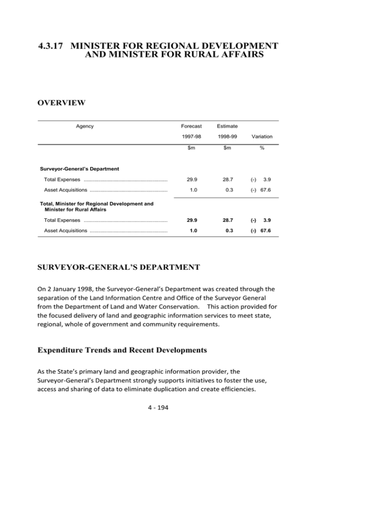
4.3.17 MINISTER FOR REGIONAL DEVELOPMENT AND MINISTER FOR RURAL AFFAIRS OVERVIEW Agency Forecast Estimate 1997-98 1998-99 Variation $m $m % Total Expenses ........................................................ 29.9 28.7 Asset Acquisitions .................................................... 1.0 0.3 Total Expenses ........................................................ 29.9 28.7 Asset Acquisitions .................................................... 1.0 0.3 Surveyor-General’s Department (-) 3.9 (-) 67.6 Total, Minister for Regional Development and Minister for Rural Affairs (-) 3.9 (-) 67.6 SURVEYOR-GENERAL’S DEPARTMENT On 2 January 1998, the Surveyor-General’s Department was created through the separation of the Land Information Centre and Office of the Surveyor General from the Department of Land and Water Conservation. This action provided for the focused delivery of land and geographic information services to meet state, regional, whole of government and community requirements. Expenditure Trends and Recent Developments As the State’s primary land and geographic information provider, the Surveyor-General’s Department strongly supports initiatives to foster the use, access and sharing of data to eliminate duplication and create efficiencies. 4 - 194 The Department is focused on achieving public interest output and outcomes. Recent and ongoing developments include - the construction of a complete roads database of New South Wales with associated address ranges; program support through data exchange and mapping services for the development of land and water management plans for irrigation areas and districts as administered by the Department of Land and Water Conservation; integration and spatial definition of all Crown land in the State with the Digital Cadastral Database; the development and publication of the NSW road directory; continued participation in the Australian Land Cover Change project, a joint State and Commonwealth Government initiative, to map the vegetation coverage and changed coverage for New South Wales; and a NSW Community Mapping Project in cooperation with Rural Fire Services, local and state governments to provide topographic datasets for emergency service applications. Strategic Directions The Surveyor-General’s Department is the State’s mapping and geographic information agency. The Department is developing the information assets of New South Wales through data partnering relationships to optimise the utility of existing investments and minimise duplication across all sectors in the management and application of spatial information. To achieve the most beneficial mix of social, economic and environmental outcomes, the Department’s strategies focus on - 4 - 195 facilitating regional development by establishing distributed data centres; promoting community awareness of the availability and benefits of spatial data; providing equitable access to spatial data through appropriate means; achieving economies through the integration and sharing of data; and ensuring consistent, accurate, reliable and current data services to meet community needs. Priorities for the Department in 1998-99 include - providing access to, and integration of, property databases held within State and local government; delivery of infrastructure datasets for emergency service applications; the revision and publication of NSW topographic map coverage; and implementation of internet based data services and regionally distributed data centres. 1998-99 Budget Total Expenses Total expenses by the Department in 1998-99 are estimated at $28.7 million. This will provide for - revision and publication of topographic map coverage of the State; construction and maintenance of the Topographic Database in line with community and emergency service priorities; maintenance and upgrade of the Digital Cadastral Database, 4 - 196 maintenance of the survey program and the initiation of strategies to migrate existing survey data to be standard compliant; implementation of data management strategies to accommodate data distribution and access priorities including internet applications; and development of whole of government information partnering models. Asset Acquisitions Total asset acquisitions in 1998-99 are estimated at $0.3 million. 4 - 197
