Satellite Data Used to Constrain Cloud Physics Parameterization in Climate Models
advertisement

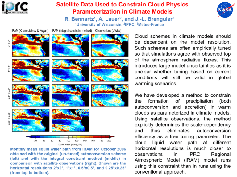
Satellite Data Used to Constrain Cloud Physics Parameterization in Climate Models R. Bennartz1, A. Lauer2, and J.-L. Brenguier3 1University iRAM (Khairoutdinov & Kogan) iRAM (integral constraint method) of Wisconsin, 2IPRC, 3Meteo-France Observations (UWisc) Cloud schemes in climate models should be dependent on the model resolution. Such schemes are often empirically tuned so that simulations agree with observed top of the atmosphere radiative fluxes. This introduces large model uncertainties as it is unclear whether tuning based on current conditions will still be valid in global warming scenarios. Monthly mean liquid water path from iRAM for October 2006 obtained with the original (un-tuned) autoconversion scheme (left) and with the integral constraint method (middle) in comparison with satellite observations (right). Shown are the horizontal resolutions 2°x2°, 1°x1°, 0.5°x0.5°, and 0.25°x0.25° (from top to bottom). We have developed a method to constrain the formation of precipitation (both autoconversion and accretion) in warm clouds as parameterized in climate models. Using satellite observations, the method explicitly determines the scale-dependency and thus eliminates autoconversion efficiency as a free tuning parameter. The cloud liquid water path at different horizontal resolutions is much closer to observations in IPRC Regional Atmospheric Model (iRAM) model runs using this constraint than in runs using the conventional approach.


