Msltalk1
advertisement
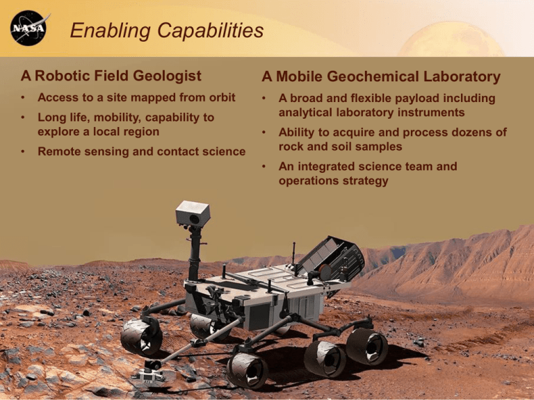
Enabling Capabilities A Robotic Field Geologist A Mobile Geochemical Laboratory • Access to a site mapped from orbit • • Long life, mobility, capability to explore a local region A broad and flexible payload including analytical laboratory instruments • Ability to acquire and process dozens of rock and soil samples • An integrated science team and operations strategy • Remote sensing and contact science Previous and MSL Landing Sites MSL Final Candidate Landing Sites Eberswalde Crater (24°S, 327°E, -1.5 km) contains a clay-bearing delta formed when an ancient river deposited sediment, possibly into a lake. Gale Crater (4.5°S, 137°E, -4.5 km) contains a 5km sequence of layers that vary from clay-rich materials near the bottom to sulfates at higher elevation. Holden Crater (26°S, 325°E, -1.9 km) has alluvial fans, flood deposits, possible lake beds, and clayrich sediment. Mawrth Vallis (24°N, 341°E, -2.2 km) exposes layers within Mars’ surface with differing mineralogy, including at least two kinds of clays. Scientific Objectives for MSL Explore and quantitatively assess a local region on Mars’ surface as a potential habitat for life, past or present. A. B. C. D. Assess the biological potential of at least one target environment. 1. Determine the nature and inventory of organic carbon compounds. 2. Inventory the chemical building blocks of life (C, H, N, O, P, S). 3. Identify features that may represent the effects of biological processes. Characterize the geology and geochemistry of the landing region at all appropriate spatial scales (i.e., ranging from micrometers to meters). 1. Investigate the chemical, isotopic, and mineralogical composition of martian surface and near-surface geological materials. 2. Interpret the processes that have formed and modified rocks and regolith. Investigate planetary processes of relevance to past habitability, including the role of water. 1. Assess long-timescale (i.e., 4-billion-year) atmospheric evolution processes. 2. Determine present state, distribution, and cycling of water and CO2. Characterize the broad spectrum of surface radiation, including galactic cosmic radiation, solar proton events, and secondary neutrons. MSL Mission Overview * ENTRY, DESCENT, LANDING • Guided entry and controlled, powered “sky crane” descent • 20×25-km landing ellipse • 9-10 month cruise • Discovery responsive for landing sites ±30º latitude, <0 km elevation • Spinning cruise stage • ~1000-kg landed mass CRUISE/APPROACH • Arrive N. hemisphere summer SURFACE MISSION • Prime mission is one Mars year LAUNCH • Latitude-independent and long-lived power source • Nov. 2011 • 20-km range • Atlas V (541) • 85 kg of science payload • Acquire and analyze samples of rock, soil, and atmosphere • Large rover, high clearance; greater mobility than MPF, MER * Artist’s Renderings * Mars Rover Family Portrait Power Source Chemistry and Camera (ChemCam) Chemical composition High-res imaging Antennas NOT VISIBLE: Radiation Assessment Detector (RAD) Natural high-energy radiation Dynamic Albedo of Neutrons (DAN) Subsurface hydrogen Mast Cameras (Mastcam) Color imaging and video Medium and high resolution Mars Descent Imager (MARDI) Color high-definition descent movie Rover Environmental Monitoring Station (REMS) Meteorology and UV ON THE TURRET: Mars Hand Lens Imager (MAHLI) Color microscopic imaging Alpha Particle X-Ray Spectrometer (APXS) Chemical composition INSIDE THE ROVER BODY: Sample Inlets Spare Drill Bits Sampling System Arm, powdering drill, brush, scoop, and sieves Sample Analysis at Mars (SAM) Composition and isotopes of rock, soil, and air samples; organics Chemistry and Mineralogy (CheMin) Mineralogy of rock and soil samples Assembled Rover

