1
advertisement
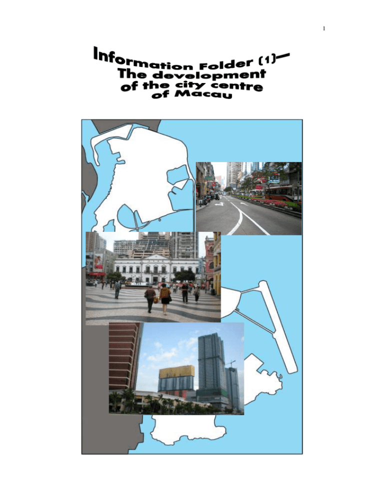
1 2 Senado Square (議事亭前地) has long been treated as the city centre of Macau owing to its commercial and institutional functions. The pedestrian and traffic flow both within the Square and along nearby roads are heavy and the renewed and rehabilitated historical buildings surrounding the Square are one of the major tourism attractions of the city. The Institute of Civic and Municipal Affairs Building (民政總署大 樓), located at the opposite of Senado Square, was once a political centre of Macau. First developed in 1580s, the site was originally occupied by a group of Chinese-style office buildings used for the discussion of political and civic issues in Macau at that time. Moreover, this building block also included a museum, a court house, a prison and a post office. The buildings were pulled down, rebuilt and renovated many times since the 1780s. The present building was erected after a major reconstruction in 1930s. Nowadays, the Institute of Civic and Municipal (民政總署) is responsible for the greening of the city, promotion of civic education and organization of various cultural activities in Macau. 3 Macau is a small city, with a total area of only 12 km² in 1912. To obtain more land for development, reclamation deems necessary. Macau is made up of 3 main parts—Macau Peninsula, Taipa and Coloane. Reclamation work first started at the Macau Peninsula in the 1860s, but reclamation at Taipa and Coloane had not be started until 1920s. The development of the city centre of Macau (the transect mentioned in the worksheets—“Worksheets – Changes and development in the city centre of Macau”) is also related to the history of reclamation in the Macau Peninsula. Some parts of the city centre have been built on reclaimed land. As shown in Figure 1 and Table 1, the total land area of Macau Peninsula has been greatly increased by reclamation. The total land area of Macau Peninsula was about 3 km² in 1912 but it had been increased to about 9 km² in 2006! Year 1912 Total area of the Macau Peninsula (km²) 3.4 1936 5.2 1986 5.8 2004 8.6 2006 9.3 Table 1 The changing area of Macau Peninsula (Source: 1. 地圖繪製暨地籍局(2005)《澳門地圖集(第二版) – 影像地圖版》 ,澳門:澳門特別行 政區政府地圖繪製暨地籍局,第 62 頁。 2. 黃就順(2009)《澳門地理》 ,香港:三聯書店(香港)有限公司,第 56 頁。) 4 Figure 1 History of reclamation in Macau Peninsula 5 Figure 2 Avenida de Almeida Ribeiro (新馬路)—A major road along the ‘Centro (市中心 / 中區)’ of Macau Figure 3 Acerida do Infante D. Henrique (殷皇子大馬路) 6 Before the opening up of Avenida de Almeida Ribeiro in 1918, commercial activities of Macau were concentrated along major roads close to the Inner Harbour (內港). Examples of these roads include Rua de Cinco de Outubro (十月初五街), Rua dos Mercadores (營地大街) and Rua das Estalagens (草堆街). The first two roads are running from north to south while the last one is running from west to east, so Rua das Estalagens was the only main road linking those north-south roads at the Macau city centre before the construction of Avenida de Almeida Ribeiro. After 1918, its importance was replaced by Avenida de Almeida Ribeiro. Most buildings along Avenida de Almeida Ribeiro were built in 1920s and 1930s. These 2-3 storey buildings are usually used for both commercial activities and residential purpose. In most cases, upper floors are used for residential / office / warehouse purposes while the ground floor (with higher land rent) is for retailing activities. One of the most representative buildings along the road is the present “Cultural Club (文化會館)”. The Cultural Club is formerly the Tak Seng On Pawnshop (德成按). The building was constructed in 1917 and the pawnshop was closed in 1993. This historical building was then renovated and turned into a tourist attraction comprising of a museum, a library and a number of shops. Linking the Inner Harbour in the west and the Outer Harbour (外港) in the east, Avenida de Almeida Ribeiro and Avenida do Infante D. Henrique (built on reclaimed land) turned its surrounding areas into the commercial centre of Macau. Lots of commercial buildings can be found here today, including the headquarters of most of the banks in Macau and the Economic Services Bureau of Macau. 7 About 50 years ago, Inner Harbour was a transport hub in Macau. There were a number of piers and transport terminals for both passengers and freight, including the passenger terminal for water transportation between Macau and Hong Kong. Before the relocation of the HK-Macau pier to Outer Harbour of Macau, the Inner Harbour district was once a busy commercial and business area of Macau. Retailing activities were flourishing in nearby streets, such as Rua de Cinco de Outubro (十月初五街). In the 1960s, many gambling facilities were developed at Avenida de Almeida Ribeiro and Rua de Cinco de Outubro, which pushed the development of the area near Inner Harbour to its peak. After that, urban decay has occurred in this area due to the relocation of the HK-Macau pier to Outer Harbour and the abandonment of the area as the transport hub of the city. Most recent development of Macau Peninsula is concentrated around the Outer Harbour and along Acerida do Infante D. Henrique and Avenida de Sagres ( 沙 格 斯 大 馬 路 ). This is especially the case after the 1990s. Lots of new hotels and entertainment facilities were constructed here. Examples of these include MGM Grand Macau (hotel), Wynn (hotel) and Macau Fisherman’s Wharf (theme park). 8 a) Figure 5 b) Abandoned piers at Inner Harbour Figure 6 Freight transport facilities at Inner Harbour Figure 7 New development along Acenida de Sagres in the past ten years. 9 地圖繪製暨地籍局(2005)《澳門地圖集(第二版)–影像地圖版》 ,澳門:澳 門特別行政區政府地圖繪製暨地籍局。 林發欽主編(2005)《澳門街道的故事》,澳門:澳門培道中學歷史學會。 黃就順(2009)《澳門地理》,香港:三聯書店(香港)有限公司。 澳 門 大 學 澳 門 研 究 中 心 (2007) 《 澳 門 現 代 化 進 程 與 城 市 規 劃 / Modernization of Macau and Urban Planning》 ,澳門:澳門大學澳門研究中 心。
