1
advertisement
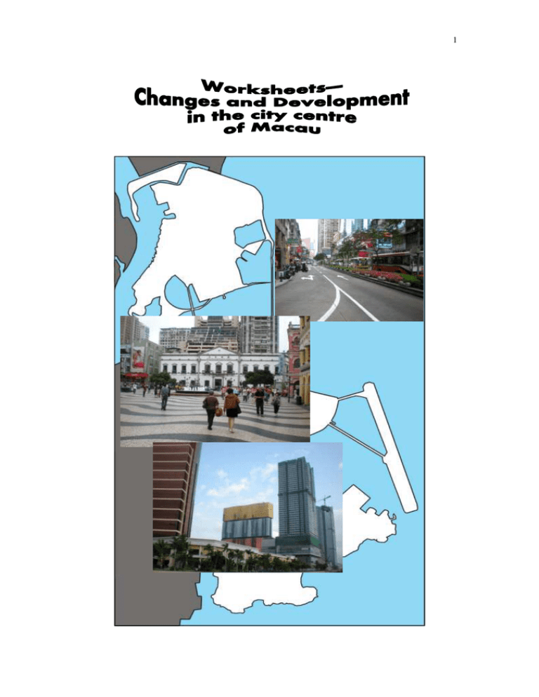
1 2 A. Introduction: Macau (Macao) is one of the two special administrative regions of China. It is made up of 3 main parts—Macau Peninsula, Taipa and Coloane. It is close to Hong Kong and, with its unique history of development, is an ideal site for studying concepts of urban changes and development. For more able students, comparative study between the urban development of Hong Kong and Macau may also be conducted. The scope of this fieldwork investigation is the city centre of Macau, including the Senado Square (議事亭前地) and its neighbourhood. A transect (Figure 1) along three major roads in this area, namely Aveniada de Almeida Ribeiro (亞美打利庇盧 大馬路 / 新馬路), Avenida do Infante D. Henrique (殷皇子大馬路) and Avenida de Sagres (沙格斯大馬路), has been designed for you to conduct your fieldwork investigation. It is a line radiated out from Senado Square, starting at Pier 16 Hotel and ending at MGM Grand Macau. By conducting a land use survey along this transect, you can learn a lot about urban development and changes in Macau. Pier 16 Hotel MGM Grand Macau Figure 1 A transect (red line) for data collection in the city centre of Macau (Source: All the figures on P.1-6 of this set of worksheets are extracted from the website of Macau Yellow Pages [www.yp.mo].) 3 B. Pre-trip activities: Before you start your fieldwork investigation in the city centre of Macau, finish the following pre-trip activities. 1. Using geographic information system (GIS) to know more about the study area: As shown in Figure 1, the main route of this fieldwork investigation is a transect along Aveniada de Almeida Ribeiro (亞美打利庇盧大馬路 / 新馬路), Avenida do Infante D. Henrique (殷皇子大馬路) and Avenida de Sagres (沙格斯大馬路). Follow the steps below to make use of the Macau Yellow Pages (A web-based GIS) to know more about the urban landscape of your area of study. a) Browse the website of Macau Yellow Pages (www.yp.mo). Choose “網上地圖”. b) Minimize the following 3D map by using the icon on the left of the map. 4 c) You can then view the whole study area on your screen. d) At this point, you may use the following functions of the map to know more about your study area: (i) 3D image 2D image 2D / 3D / satellite view of Macau By clicking the icons “立體”, “衛星”, “平面” on the top left corner of the map respectively, you may view the 3D, satellite and 2D images of your areas of interest. Satellite image 5 (ii) Know more about a feature (e.g. a building) in the 3D map by clicking the feature with your mouse An example of MGM Grand Macau is shown below. You may also click the photograph in the information box (red circle) to enlarge the photograph of the feature. (iii) Measure the distance between two points on the 3D map Left click your mouse at any point on the map to mark the starting point and right click another point to mark the end point. The distance in metres will be shown on the screen. 6 (iv) Watch the video clip about a feature by clicking the icon map. on the 3D e) Now, turn your map to the 3D view and browse our designed transect from Pier 16 Hotel to MGM Grand Macau. Describe the appearance of the buildings along the route. f) Mark the location of Senado Square in Figure 1 g) Measure the distance from Senado Square to Pier 16 Hotel (Ponte 16) and to MGM Grand Macau respectively. Explain the importance of Senado Square in terms of its location and history of development. (Hint: You may know more about the history of reclamation in Macau and development of Senado Square from the reference books listed on P.12 or from “Information Folder (1)—The development of city centre of Macau”.) 7 h) Identify areas of urban decay and areas of recent development with the 3D map and satellite images. Then, circle the areas of urban decay in blue and the areas of recent development in yellow on Figure 1. i) With reference to the areas of urban decay being identified in Question (h) above, describe and explain their locational characteristics. j) With reference to areas of recent development being identified in Question (h) above, describe and explain their locational characteristics. k) Describe and explain the urban development processes that can be found along different parts of the transect. (Hint: Reclamation and horizontal expansion, vertical expansion, urban decay and urban renewal) 2. Study the following two photographs (Figure 2) about areas around Pier 16 Hotel at Inner Harbour (內港). Describe the appearance and conditions of the buildings in the photographs. 8 (a) The urban scene at the opposite of Pier 16 Hotel Figure 2 Figure 3 (b) A vacant hotel Pier 16 Hotel (Ponte 16) 3. Contrast the appearance and conditions of the buildings in Figure 2 with Pier 16 Hotel (Figure 3). 9 Figure 4 Vacant land at the opposite of Pier 16 Hotel 4. With the help of Figures 2-4, describe and explain the urban development processes that have taken place in the area close to the Inner Harbour. 5. Study the newspaper clipping about “The Historic Centre of Macau” on P.10. a) Print either Map 1 or Map 2 in the pdf file (mentioned in the newspaper clipping). Mark the transect of this fieldwork investigation in red on the map. b) Based on your printed map, evaluate the possible impact of “The Historic Centre of Macau” and the setting up of related buffer zones on the urban development processes of the city centre of Macau (along the transect). The photographs (Figure 5 and Figure 6) and the poster of Cultural Club (文化會館) (Figure 7) on P.11 may give your some hints. 10 “The Historic Centre of Macau” and the setting up of “buffer zones” “The Historic Centre of Macau” was successfully inscribed as a World Heritage Site in 2005. World Heritage is the designation for places on the Earth that are of outstanding universal value to humanity and should be protected for future generations to appreciate and enjoy. “The Historic Centre of Macau” includes more than 20 monuments and their relevant streets and public piazzas in the historic centre of Macau peninsula. Examples of these are Senado Square (議事亭前地), “Leal Senado” Building (民政總署大樓), Holy House of Mercy (仁慈堂大樓) and St. Dominic’s Church (玫瑰堂). Along the route of “The Historic Centre of Macau”, the rich urban evolutionary processes of the city centre of Macau can also be seen. In order to protect the “The Historic Centre of Macau”, “buffer zones” are also established around the historic centre as a heritage protection mechanism. In these buffer zones, there are complementary legal and / or customary restrictions on their uses and development. They act as an additional layer of protection to “The Historic Centre of Macau”. For the spatial distribution of “The Historic Centre of Macau” and their buffer zones, you may refer to Map 1 and Map 2 (P.5-6) of the following pdf file: http://edocs.icm.gov.mo/Heritage/MWHE3.pdf 11 Figure 5 A notice being found near Pier 16 Hotel Figure 6 A building along the transect (close to Pier 16 Hotel) Cultural Club Address: No.390 & 396, Aveniada de Almeida Ribeiro, Macau Tel: (853) 28921811 Website: www.culturalclub.net The restoration and use of the histocial “Tak Seng On” Pawnshop has been awarded with the Honourable Mention in the UNESCO 2004 Asia-Pacific Heritage Awards for Culture Heritage Conservation. The Cultural Club was selected for “Urban Best Practices Area” showcase at 2010 Shanghai World Expo Figure 7 A poster about Cultural Club 12 6. For more information about the changes and development in the city centre of Macau, you may refer to the following reference books or “Information Folder (1)— The development of the city centre of Macau”: 林發欽主編(2005)《澳門街道的故事》,澳門:澳門培道中學歷史學會。 黃就順(2009)《澳門地理》,香港:三聯書店(香港)有限公司。 澳門大學澳門研究中心(2007)《澳門現代化進程與城市規劃 / Modernization of Macau and Urban Planning》,澳門:澳門大學澳門研究中心。 C. The fieldwork investigation: The Aim: The aim of this fieldwork investigation is to study the changing urban landscape in the city centre of Macau along a selected transect. Through examining the land use pattern and characteristics of the buildings along the transect, the underlying urban development processes can also be identified. You may further predict the further development pattern in the city centre of Macau. Field sites: The main route (the transect) for this fieldwork investigation is shown in Figure 1. You may also design supplementary routes for data collection according to your enquiry title (more suggestions can be found in “Extended Activities” included in this set of worksheets). Field trip: Data collection for this study may take you half a day. During the fieldwork, you should walk along the transect and identify the land use pattern and underlying urban development processes from Pier 16 Hotel to MGM Grand Macau. Stages of fieldwork enquiry: Your fieldwork investigation will be divided into 3 main stages as follows: 13 Stage of fieldwork enquiry Marks 1 Planning and preparation 10 2 Data Collection 20 3 Report Writing Data processing, presentation and analysis Interpretation and conclusion Evaluation 70 Stage 1—Planning and preparation 1. After finishing the pre-trip activities, you now have a preliminary understanding of the changing urban landscape in the city centre of Macau. Based on the information, develop your own enquiry title about changes and development in the city centre of Macau. 2. Prepare for the field trip at the city centre of Macau. Fill in Table 1: Develop the enquiry title / question; Clarify the objectives of the enquiry; Identify the type of information (primary and secondary data) that is required; Decide on the methods and instruments to be used; Prepare for the enquiry, e.g. designing record sheets (see two sample record sheets in “Appendix 1”), preparing a base map of the transect (with buildings) for recording purposes (similar to the one in Appendix 2) and questionnaires; and Develop the enquiry sequences. Enquiry Title: Explanation of the study (scope, objectives, geographical questions / problems / phenomena / focusing questions / hypothesis): 14 Relevant geographical concepts and perspectives (with references): Required information (primary and secondary): Methods of investigation: Instruments for data collection: Enquiry sequences: 1. 2. 3. 4. 5. … Table 1 Planning and preparation for the fieldwork investigation 15 Stage 2—Data Collection Along the transect at the city centre of Macau, collect data for your enquiry. At this stage, you should: use different techniques and instruments to collect data in the field; record and organise field data systematically; and gather supplementary information (secondary data) after the fieldwork. Stage 3—Report writing After data collection, you are required to prepare a fieldwork report in not more than 1,500 words. It should mainly base on primary data but secondary data can also be used as supplementary information. All secondary data used should be acknowledged. The report may include the following parts: Cover page Contents page Introduction (including the objectives, enquiry title(s), site and methodology used for the fieldwork) Presentation of the collected data (See an example of presenting data collected along a transect in Appendix 2) Analysis of the data Interpretation of the findings Conclusions Evaluation (of the whole enquiry) and suggestions Appendices (may include some sample record sheets and other materials that are relevant to the investigation) Bibliography 16 Appendix 1 Sample record sheet (1)— Characteristics of the buildings and urban environment along the transect Distance from the starting point of the transect (i.e. Pier 16 Hotel) (m) 1 0-100 101-200 201-300 301-400 … 1 Average number of floors of the buildings Appearance of the buildings (e.g. concrete / glass / metal) and environmental conditions 2 Main type(s) of land use / functions Urban development process(es) being identified (with reasons) Remarks With the help of the measurement function in the 3D map of Macau Yellow Pages, you can easily divide the transect into a number of zones. Besides, you can also conduct a survey on every building along the road / transect. In this case, you need to prepare a base map with all buildings along the road for recording purposes (similar to the one in Appendix 3). 2 You may also refer to “Sample Record Sheet (2)” on P.17 for details. 17 Sample record sheet (2)— A chart for assessing level of urban decay and environmental conditions Name of the Street: _________________________________ A B C D E F G H I J K [Source : Building Appearance Much Some Little None Deterioration of building surface (e.g. paint peeling, stains 5 3 1 0 and cracks on the walls of building) Broken glass / windows, leaking pipes (e.g. water and 8 4 2 0 sewage pipes) Iron rust or timber rot 7 3 1 0 Unstable building structure (e.g. displaced tiles) 11 6 3 0 Illegal structures are added to the building 3 2 1 0 Main building material (at least more than 50% of the total surface area): Wood: 10 Brick/stone: 5 Concrete: 1 Environmental Conditions Much Some Little None Air pollution and noise pollution 3 2 1 0 Solid waste (e.g. rubbish dump heaps), rats and cockroaches 3 2 1 0 can be found Overcrowding environment (e.g. narrow streets, dense 3 2 1 0 buildings, lack of open space) Amount of sunlight penetration 0 1 2 3 green belt, vegetation 0 1 2 3 Modified from the notes (P.2 of ‘Study of Urban Decay and Environmental Condition’) of Sai Kung Field Studies Centre. http://cd.emb.gov.hk/lwl/saikung/ENG/index_e.htm] 18 Appendix 2 An example of presenting data along a transect Road A Land use 1 Land use 2 Land use 3 Land use 4 Land use 5 Road A 19 Appendix 3 A base map showing all buildings along the transect in the city centre of Macau (from Ponte 16 to Casino Lisboa) for recording purpose a) From Ponte 16 to Senado Square 20 b) From Senado Square to Casino Lisboa 21 Extended Activities In the city centre of Macau, you may also conduct the following urban fieldwork investigations: 1. A survey on the land use pattern from Senado Square to Ruins of St. Paul’s [大三巴牌坊] (or any other routes in the city centre of Macau, e.g. Rua das Estalagens [草堆街] and Rua de Cinco de Outubro [十月初五 街]). 2. A comparative study of urban development between Hong Kong and Macau, e.g. Urban development processes Urban renewal strategies sustainable development Comparative case study of Hong Kong and Macau city centre
