Snapshot Day 10/14/10 Data (Salt Front RM 36.0)
advertisement
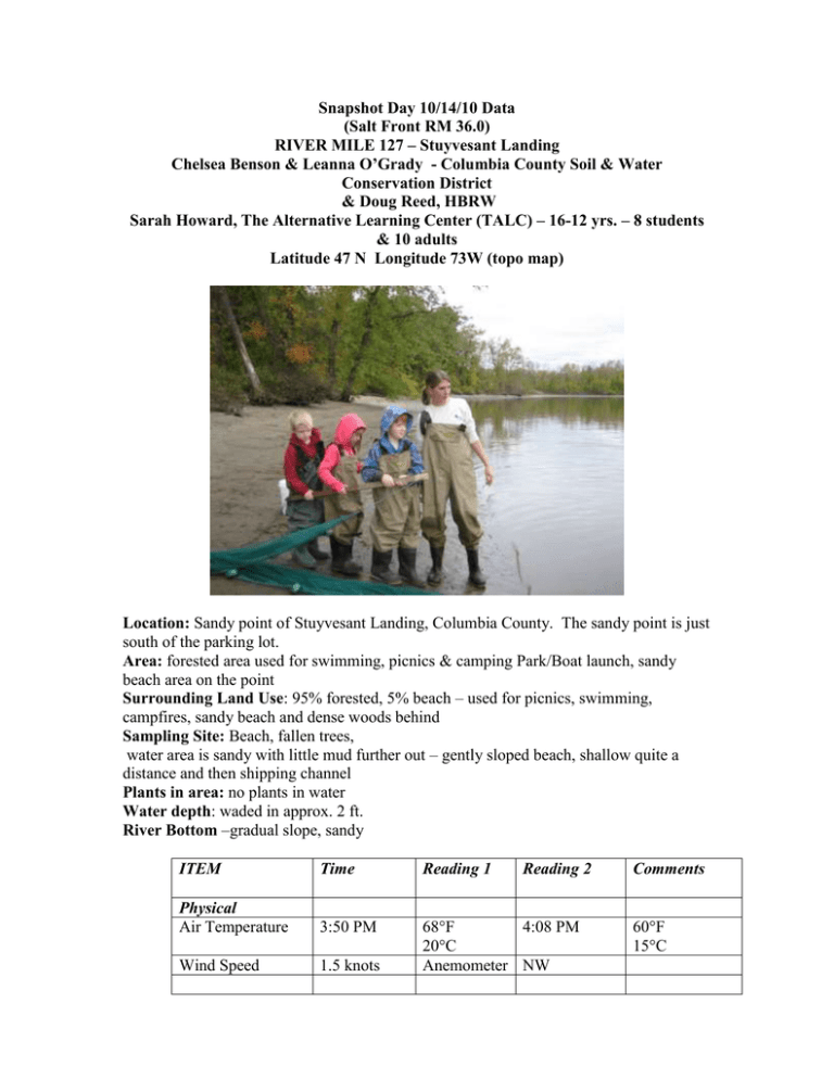
Snapshot Day 10/14/10 Data (Salt Front RM 36.0) RIVER MILE 127 – Stuyvesant Landing Chelsea Benson & Leanna O’Grady - Columbia County Soil & Water Conservation District & Doug Reed, HBRW Sarah Howard, The Alternative Learning Center (TALC) – 16-12 yrs. – 8 students & 10 adults Latitude 47 N Longitude 73W (topo map) Location: Sandy point of Stuyvesant Landing, Columbia County. The sandy point is just south of the parking lot. Area: forested area used for swimming, picnics & camping Park/Boat launch, sandy beach area on the point Surrounding Land Use: 95% forested, 5% beach – used for picnics, swimming, campfires, sandy beach and dense woods behind Sampling Site: Beach, fallen trees, water area is sandy with little mud further out – gently sloped beach, shallow quite a distance and then shipping channel Plants in area: no plants in water Water depth: waded in approx. 2 ft. River Bottom –gradual slope, sandy ITEM Time Reading 1 Reading 2 Physical Air Temperature 3:50 PM Wind Speed 1.5 knots 68°F 4:08 PM 20°C Anemometer NW Comments 60°F 15°C Cloud Cover Weather today Weather last 3 days Water Water Temperature overcast Sprinkles 4:50 PM Started off overcast – by the time we were leaving few sprinkles had developed Daytime sunny 60°F but at night cool in the 30°F range. Some locations near the river had frost. Calm – no waves 3:50 PM 58°F 14°C 4:10 PM Turbidity – short site tube 3:55 PM 58°F 14°C 60 JTU Chlorophyll 3:30 PM 5.0 Had sand in it 3:45 PM 8.6 mg/L 15 C 3:30 PM 7.5 7.4 7.8 0.22 ppm 0.47 ppm 104 ppm 92 ppm 98 ppm 28 ppm / Chloride (0.8 Quantab reading) 35 ppm Salinity 2 seine with fish catch Chemical DO Drop count pH pen 4:15 PM 60 JTU 85% Average 7.56 Nitrates Phosphates Alkalinity 4:10 PM 4:05 PM 3:35 PM Salinity Test strip 3:45 PM Fish Catch – 4:45 PM – 2 pulls Seine 40 ft. X 3 ft. Mesh 0.25 inch 3 minute pullseine #1 Seine #2 Tides Number Caught 3 Species Size of largest Spottail shiner 10 cm 4:20 PM 0 catch 8 yd pull CPUE - 0 4:40 PM 3 catch 10 yd. pull CPUE .86 Currents 3:35 PM Average 98 ppm 35 cm 4:00 PM Falling 33 cm .08 cm/min 4:15 PM 4:30 PM 3:40 PM 4:10 PM Rising Rising North North 35 cm 39 cm Flood Flood .13 cm/min .26 cm/min Beach is set back from the direct current of the river. There is an outcrop of land 1/8 mi south of our sampling location; may cause a swirling current. Other Items Core Description Total Top Layer Second Layer Describe Length 8 inches Gray on Dark tan at All sand but bottom top color layers Shipping 4:05 PM Pleasure Boat Northbound Traffic 4:30 PM Pleasure Boat Southbound Observations We saw a flock of approx 20 birds that we thought were cormorants. They landed near the sampling area, stuck around for 1-2 minutes and then flew south. Doug, Leanna, and I have never seen that many together at once and they flew a slightly higher than cormorants normally do… So, who knows? Great sight though. (Comment from Steve Stanne - Cormorants do migrate in flocks so this would not be unusual behavior, although wonderful to see.) (return of above)
