Snapshot Day 10/8/09 (Salt Front RM 60.3) RIVER MILE 2
advertisement
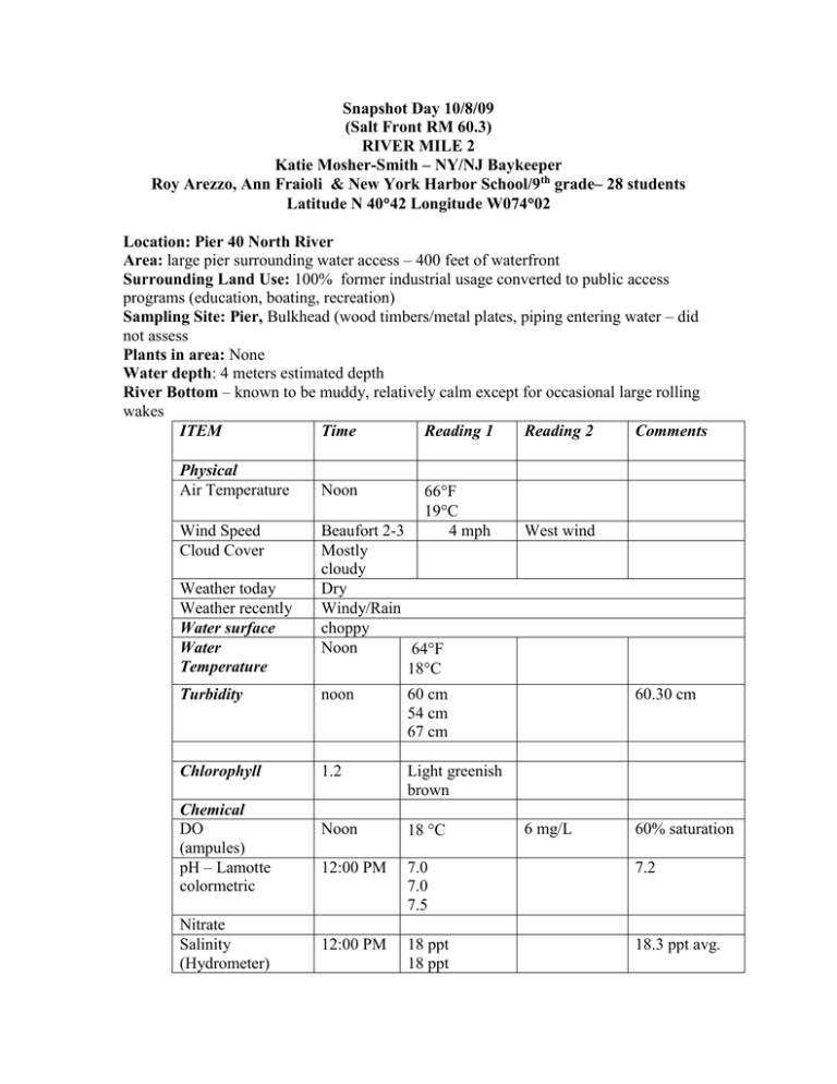
Snapshot Day 10/8/09 (Salt Front RM 60.3) RIVER MILE 2 Katie Mosher-Smith – NY/NJ Baykeeper Roy Arezzo, Ann Fraioli & New York Harbor School/9th grade– 28 students Latitude N 4042 Longitude W07402 Location: Pier 40 North River Area: large pier surrounding water access – 400 feet of waterfront Surrounding Land Use: 100% former industrial usage converted to public access programs (education, boating, recreation) Sampling Site: Pier, Bulkhead (wood timbers/metal plates, piping entering water – did not assess Plants in area: None Water depth: 4 meters estimated depth River Bottom – known to be muddy, relatively calm except for occasional large rolling wakes ITEM Time Reading 1 Reading 2 Comments Physical Air Temperature Wind Speed Cloud Cover Noon F 19C 4 mph Weather today Weather recently Water surface Water Temperature Beaufort 2-3 Mostly cloudy Dry Windy/Rain choppy Noon 64F 18C Turbidity noon 60 cm 54 cm 67 cm Chlorophyll 1.2 Light greenish brown Noon 18 C 12:00 PM 7.0 7.0 7.5 7.2 12:00 PM 18 ppt 18 ppt 18.3 ppt avg. Chemical DO (ampules) pH – Lamotte colormetric Nitrate Salinity (Hydrometer) West wind 60.30 cm 6 mg/L 60% saturation Tides Currents 8:30 AM 2:30 PM 12:00 PM 18 ppt Low High 1.8 kts, North Flood
