Geology 143A: Field Course to Northern Arizona Merguerian, Chairman, Geology
advertisement
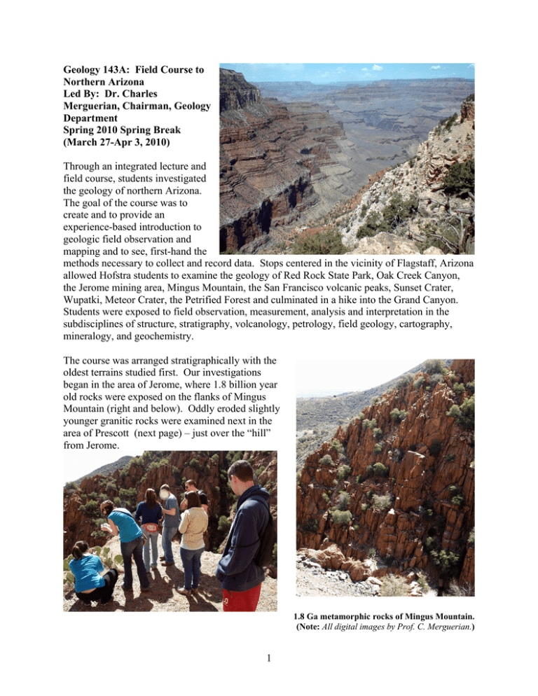
Geology 143A: Field Course to Northern Arizona Led By: Dr. Charles Merguerian, Chairman, Geology Department Spring 2010 Spring Break (March 27-Apr 3, 2010) Through an integrated lecture and field course, students investigated the geology of northern Arizona. The goal of the course was to create and to provide an experience-based introduction to geologic field observation and mapping and to see, first-hand the methods necessary to collect and record data. Stops centered in the vicinity of Flagstaff, Arizona allowed Hofstra students to examine the geology of Red Rock State Park, Oak Creek Canyon, the Jerome mining area, Mingus Mountain, the San Francisco volcanic peaks, Sunset Crater, Wupatki, Meteor Crater, the Petrified Forest and culminated in a hike into the Grand Canyon. Students were exposed to field observation, measurement, analysis and interpretation in the subdisciplines of structure, stratigraphy, volcanology, petrology, field geology, cartography, mineralogy, and geochemistry. The course was arranged stratigraphically with the oldest terrains studied first. Our investigations began in the area of Jerome, where 1.8 billion year old rocks were exposed on the flanks of Mingus Mountain (right and below). Oddly eroded slightly younger granitic rocks were examined next in the area of Prescott (next page) – just over the “hill” from Jerome. 1.8 Ga metamorphic rocks of Mingus Mountain. (Note: All digital images by Prof. C. Merguerian.) 1 Granite “Dells” of Watson lake Park in Prescott, AZ The second day was spent in the area of Sedona, where the structure and stratigraphy of “red rock” country was investigated via a series of short hikes (left). Time for fun was found easily at Slide Rock State Park (below). Students relaxing after a short hike in “Red Rock” country. Recreational exercise at Slide Rock State Park. 2 The San Francisco Peaks (Mt. Elden, Sunset Crater, etc.) were the target for our next day’s excursions where students were exposed to volcanic flow features and structures and were allowed to walk through the Bonita Flow, dating back only 1000 years before present. Bonita lava flow at Sunset Crater. View of highly oxidized vent of Sunset Crater. Later that day, we examined the Indian ruins at Wupatki and learned about the integration of people and geology in the way that the rocks and land were utilized for survival. Wupatki Indian Ruins. 3 The next day we headed east of Flagstaff to Meteor Crater and the Petrified Forest. Here we examined the deformed rim of meteor crater the direct result of a 50,000 year old impact with a hypervelocity iron-nickel meteorite strike. View of Meteor Crater, near Winslow, AZ. One of our students served as a tour guide at the Petrified Forest during an internship with the National Park Service a year earlier sop we were treated to a new lecturer for the day. Mr. Adrian Flores (pictured to left) led the discussions that afternoon where we made numerous stops to examine the unique “badlands” erosion and topography and the petrified logs and wood that have made this park famous. The “Chocolate Hills”, part of the Petrified Forest’s many unusual landforms. 4 Student examining logs at the Petrified Forest, near Holbrook, AZ. Two final days at the Grand Canyon was the capstone experience of our week-long field course. We spent the first day (left and below) examining the canyon from a distance. Here, through a series of integrated stops, we established the stratigraphic relationships of the region in totality by splicing together what we had seen elsewhere into a comprehensive picture. For example (next page) the same 1.8 billion year old rocks exposed in the core of Mingus Mountain were seen in the inner gorge of the canyon, where down cutting of the Colorado River has exposed them for view. View into the Grand Canyon along the Bright Angel fault. Students posing along the south rim of the canyon after their first view. 5 Telephoto view of the inner gorge of the Grand Canyon showing steeply inclined 1.8 Ga metamorphic rocks beveled by near horizontal strata of the Paleozoic Era with 1.2 billion years of time missing at the contact (unconformity). Our second day in the canyon was spent hiking down the Bright Angel trail to examine the details of the rock types, their structure, and fossils. A bit treacherous in early April with snow and ice on the trail, we managed to hike down a few miles into the canyon before heading back out for a photo opportunity in a canyon rim tree (below left) and then later at the gorge of the Little Colorado River (below right). Hikers along the Bright Angel Trail. 6
